



Samarinda, Indonesia
Samarinda is a regional capital of 865,306 people in East Kalimantan, Indonesia, founded in January 21, 1668.
Why visit Samarinda
Townapedia lists 2 museums and landmarks, 7 parks and trails, 180 places to eat, 72 places to stay and 8 attractions in and around town.
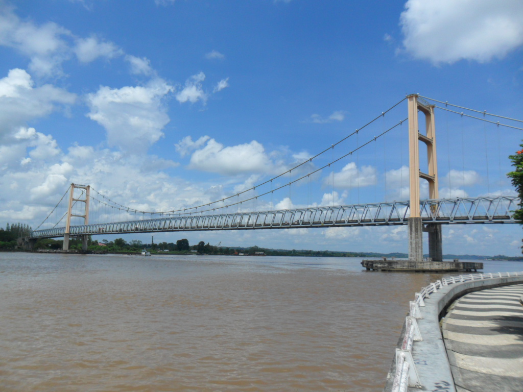
Highlights include Achmad Amins Bridge, Kutai Kartanegara Bridge and Segiri Samarinda Stadium.
Weather in Samarinda
Forecast from MET Norway (CC BY 4.0). Full forecast
About Samarinda
Samarinda (Indonesian pronunciation: [samaˈrɪnda]) is the capital city of the Indonesian province of East Kalimantan. It is situated on the riverbanks of lower Mahakam, and both parts are connected by Mahakam Bridge, Mahakam Ulu Bridge, and Achmad Amins Bridge. It holds title of the seventh largest Indonesian city by area, with a total area of around 718 km2 (277 sq mi). Samarinda is also the most populous city on the entire island of Borneo, with population estimates of 727,500 (2010 Census); 827,994 (2020 Census); and 865,306 (mid 2025).
From the Wikipedia article Samarinda (this version), under CC BY-SA 4.0.
Travel tips from other travellers: Samarinda on Wikivoyage (CC BY-SA 4.0).
Things to do8


Mulawarman University
School · 2.7 km
Public university in Samarinda, East Kalimantan, Indonesia

Trans Studios Samarinda
Monument and historic site
Theme park and hotel in Samarinda, Borneo, Indonesia


Museums and landmarks2

Parks, trails and playgrounds7


Restaurants and cafes180



Ngerujak mangga muda
Cafe · Asian · 1.3 km
Dokter Soetomo, Samarinda


Ikan Goreng Cianjur - Pelabuhan
Restaurant · 1.1 km
Pengeran Diponegoro, Samarinda
168 more on the map.
History
Samarinda, which nowadays has been known as a city, was a part of the Sultanate of Kutai. In the 13th century CE, before it was known as Samarinda, there had been settlements in six locations, namely Pulau Atas, Karang Asan (Karang Asam), Karamumus (Karang Mumus), Luah Bakung (Loa Bakung), Sembuyutan (Sambutan), and Mangkupelas (Mangkupalas). The mentioning of 6 villages above was found at a manuscript of Surat Salasilah Raja dalam Negeri Kutai Kertanegara written by Khatib Muhammad Tahir in 30 Rabi' al-Awwal AH 1265 (24 February 1849).
At the start of the Gowa War, the Dutch under Admiral Speelman's command attacked Makassar from the sea. Meanwhile, the Netherlands' Bugis ally Arung Palakka led a ground attack. The Kingdom of Gowa was forced to surrender and Sultan Hasanuddin was made to sign the Treaty of Bongaja on 19 November 1667.
The treaty did not quell all trouble for the Dutch however, since the Bugis from Gowa continued their struggle using guerilla tactics. Some Buginese moved to other islands close by such as Kalimantan. A few thousand people led by Lamohang Daeng Mangkona or Pua Ado I, moved to East Kalimantan, known then as Kutai, where they were welcomed by the local Sultan.
Samarinda was a small, sleepy town in 1942 with several small oil fields in the vicinity. It was occupied by the Japanese after the Dutch East Indies had fallen.
From the History section of Samarinda on Wikipedia, under CC BY-SA 4.0.
Where to stay72
Ganesa Backpaker
Motel and hotel · 0.9 km
Jalan Wiraswasta gg. haji mustam 1, Samarinda
Churches and places of worship98
Shopping35
Gas and EV charging6
SPBU Pertamina 64.751.03
Gas station · 1.8 km
Jalan Insinyur Haji Juanda, Samarinda
SPBU Pertamina 6475128
Gas station · 2.0 km
Jalan Insinyur Haji Juanda, Samarinda
Schools, colleges and libraries95
Healthcare67
Map of Samarinda
250 places. The map loads OpenStreetMap tiles when you open it.
Getting there and nearby towns
Aji Pangeran Tumenggung Pranoto International Airport (AAP) is the nearest airport with scheduled flights listed in OpenStreetMap, 17 km away.
- Loa Janan 12 km southwest, about 12 min by car
- Muarajawa 23 km southeast, about 23 min by car
- Nusantara 72 km southwest, about 1 h 15 min by car
- Bontang 79 km northeast, about 1 h 15 min by car
Drive times are estimates from straight-line distance, not routes.
Local news
Headlines from INDB.
Reviews, tips and questions
Loading what members have shared...
Sources and licences
- GeoNames (CC BY 4.0): population, coordinates, regions and time zone
- OpenStreetMap contributors (ODbL 1.0): places, airports, map data
- Wikidata (CC0 1.0): elevation, founding date, time zone, website, landmarks and historic places
- Wikimedia Commons (see each image): photos
- Wikipedia (CC BY-SA 4.0): overview and history text
Photo credits
- Samarinda landscape 2, MR Halal, CC BY 3.0
- Jembatan Kutai Kartanegara (4), Ezagren ( bicara / talk ), Attribution
- Mahakam Bridge (1), Ezagren ( bicara / talk ), Attribution
- Gedung Rektorat Universitas Mulawarman, Ezagren ( bicara / talk ), Attribution
- Gereja Katedral Santa Maria Penolong Abadi, Samarinda (3), Fandy Aprianto Rohman, CC BY-SA 4.0
- Stadion Segiri Samarinda (1), Fauzan Noviatmoko, CC BY-SA 4.0
- Nasi ayam, Emado's Shawarma Embong Malang, Surabaya, 2025 (01), Bahnfrend, CC BY-SA 4.0
- Kapal Tongkang Batubara melintas dibawah jembatan Mahkota 2 Samarinda, Herusutimbul, CC BY-SA 4.0
- Stadion Segiri Samarinda, Enzox3012, CC0

Page built November 3, 2026. Spotted a mistake? Tell us or suggest a place.