
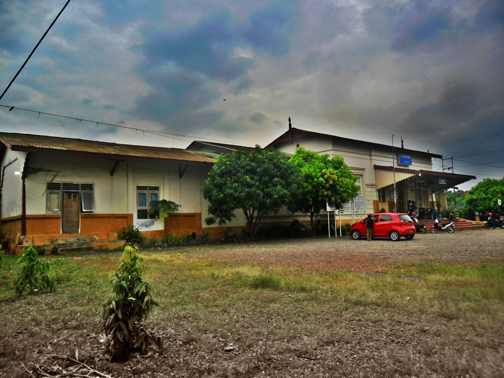


Serang, Indonesia
Serang is a regional capital of 735,651 people in Banten, Indonesia, founded in August 10, 2007.
Why visit Serang
Townapedia lists 41 museums and landmarks, 21 parks and trails, 16 places to eat, 9 places to stay and 23 attractions in and around town.
Highlights include Sultan Ageng Tirtayasa University, University Primagraha, Keraton Surosowan and Museum Literasi KH TB Ahmad Khotib.
Weather in Serang
Forecast from MET Norway (CC BY 4.0). Full forecast
About Serang
Serang (Indonesian: Kota Serang, Indonesian pronunciation: ['seraŋ], Javanese: ꦱꦺꦫꦁ; Sundanese: ᮞᮦᮛᮀ) is a city and the capital of Banten province and was formerly also the administrative center of Serang Regency in Indonesia (the Regency's capital is now at Ciruas). The city is located towards the north of Banten province, on the island of Java; the north part of the city (Kasemen District) contains the coast zone facing onto Banten Bay, and includes the historical site of Old Banten, after which the province is named. Before Banten province was formed in 2000, Serang city was part of West Java province.
From the Wikipedia article Serang (this version), under CC BY-SA 4.0.
Travel tips from other travellers: Serang on Wikivoyage (CC BY-SA 4.0).
Things to do23

Sultan Ageng Tirtayasa University
School · 4.5 km
University in Banten
University Primagraha
School · 3.9 km
Private university primagraha, Indonesia


11 more on the map.
Museums and landmarks41


Museum Literasi KH TB Ahmad Khotib
Museum · 0.8 km
Jalan Kyai Haji Tubagus Ahmad Khotib, Serang
24/7
Museum Literasi Gol A Gong
Museum · 3.2 km
Jalan Hegar Alam, Sumurpecung
Museum Sepeda Pramuka Keliling Dunia
Museum · 4.2 km
Jalan Raya Serang - Pandeglang, Karundang



29 more on the map.
Parks, trails and playgrounds21

Situs Taman Tasikardi
Park · 6.9 km
Tempat sultan Banten menyepi. Awal didirikan oleh Sultan Ageng.



9 more on the map.
Restaurants and cafes16

Cafe Taman Limasan
Cafe · Coffee Shop · 2.7 km
Jl. Bhayangkara No.50, Sumurpecung, Kec. Serang, Kota Serang, Banten 42118, serang
24/7
Dum Dum Original Cafe
Cafe · Coffee, Thai Tea, Snacks · 1.9 km
10 Jalan Ayip Usman, Serang
Mo-Su 10:00-22:00

Restoran Ayam Bakar
Restaurant · Regional
Jalan Raya Serang - Pandeglang, Serang
09:00-21:00
Salawasna Coffee
Cafe · 1.7 km
Jl. Nyimas Anjung, Sumurpecung, Kec. Serang, Kota Serang, Banten, Serang
Mo-Su 07:00-23:00
Ma'em Yuk Cilegon
Restaurant · Regional · 10.9 km
Zona Levante blok L12 no. 12A Taman Krakatau Zona Levante, Kabupaten Serang
4 more on the map.
Where to stay9
Lesemar Hotel
Motel and hotel · 2.7 km
Jl. Bhayangkara No.50, Sumurpecung, Kec. Serang, Kota Serang, Banten 42118, serang
Podjok Kost Serang
Motel and hotel · 6.9 km
Jalan Syekh Mohammad Nawawi Albantani, Serang City
Kontrakan Zona Carmel, Jl. Gg Kenari, Blok C1, No. 6
Motel and hotel · 11.3 km
Kontrakan Zona Carmel, Jl. Gg Kenari, Blok C1, No. 6, Kabupaten Serang
Churches and places of worship71
Masjid Agung Banten
Place of worship · Sunni · 8.8 km
Jalan Masjid Agung Banten, Banten
Masjid Nurul Iman
Place of worship · 6.3 km
C8/14 Komplek Bukit Pelamunan Permai, Kabupaten Serang
Masjid Nurul Islam Ciruas
Place of worship · 8.7 km
Jalan Raya Serang Jakarta, Kabupaten Serang
Shopping7
Gas and EV charging7
Schools, colleges and libraries38
Dinas Perpustakaan dan Kearsipan Provinsi Banten
Library · 4.9 km
Jalan Raya Jakarta, Km. 4, Pakupatan, Panancangan, Serang, Panancangan, Kecamatan Cipocok Jaya, Kota Serang, Banten 42124
Perpustakaan Dan Arsip Daerah Kota Serang
Library · 2.2 km
Jalan Jenderal Sudirman No.25, Sumurpecung, Kecamatan Serang, Kota Serang, Banten 42118
Healthcare17
Klinik Kimia Farma 253 Benggala
Clinic and pharmacy · 0.7 km
114 Jl. Yusuf Martadilaga Serang, Kota Serang
Klinik Kimia Farma Ahmad Yani Serang
Clinic and pharmacy · 1.0 km
57 Jalan Jenderal Ahmad Yani, Kota Serang
Map of Serang
250 places. The map loads OpenStreetMap tiles when you open it.
Getting there and nearby towns
Budiarto Airport (RTO) is the nearest airport with scheduled flights listed in OpenStreetMap, 50 km away.
- VILLA PERMATA HIJAU 11 km northwest, about 11 min by car
- Cilegon 16 km northwest, about 16 min by car
- Pandeglang 22 km south, about 22 min by car
- Kresek 25 km east, about 25 min by car
- Rangkasbitung 29 km south, about 29 min by car
- Pasarkemis 42 km east, about 42 min by car
- Tangerang 53 km east, about 53 min by car
- South Tangerang 65 km east, about 1 h by car
- Jakarta 77 km east, about 1 h 15 min by car
- Bogor 88 km southeast, about 1 h 30 min by car
Drive times are estimates from straight-line distance, not routes.
Local news
Headlines from INDB.
Reviews, tips and questions
Loading what members have shared...
Sources and licences
- GeoNames (CC BY 4.0): population, coordinates, regions and time zone
- OpenStreetMap contributors (ODbL 1.0): places, airports, map data
- Wikidata (CC0 1.0): elevation, founding date, time zone, website, landmarks and historic places
- Wikimedia Commons (see each image): photos
- Wikipedia (CC BY-SA 4.0): overview and history text
Photo credits
- Stasiun Serang, Gupt24, CC BY-SA 3.0
- Masjid agung banten lama, Firdaus31, CC BY-SA 4.0
- Keraton Kaibon-4, Lany pirna, CC BY-SA 4.0
- Keraton Surosowan (3), Mirani Pramitasari, CC BY-SA 4.0
Page built November 3, 2026. Spotted a mistake? Tell us or suggest a place.