



Why visit Sumedang
Townapedia lists 7 museums and landmarks, 2 parks and trails, 13 places to eat and 4 attractions in and around town.
Highlights include Indonesia University of Education, Museum Prabu Geusan Ulun and Sumedang Larang Palace.
Weather in Sumedang
Forecast from MET Norway (CC BY 4.0). Full forecast
About Sumedang
Sumedang (former Dutch spelling: Soemedang) is a town in Western Java, Indonesia, approximately 46 km northeast of Bandung, the provincial capital. It is the capital of Sumedang Regency. The town's two administrative districts (kecamatan) have a combined area of 125.32 km2 and had a population of 184,293 as of mid-2025. The town is just south of the volcanic Mount Tampomas, which is 1,684 m (5,525 ft) high and is usually climbed from Cimalaka District, 7 km from Sumedang.
From the Wikipedia article Sumedang (this version), under CC BY-SA 4.0.
Travel tips from other travellers: Sumedang on Wikivoyage (CC BY-SA 4.0).
Things to do4

Indonesia University of Education
School · 2.7 km
National university in West Java, Indonesia

Museums and landmarks7




Parks, trails and playgrounds2

Restaurants and cafes13


Pusat Jajanan Serba Ada Sawo Polo
Cafe · Tahu Sari Bumi, Soto, Kopi, Dll · 2.4 km
1 more on the map.
Churches and places of worship3
Shopping1
Gas and EV charging2
Schools, colleges and libraries2
Healthcare6
Map of Sumedang
40 places. The map loads OpenStreetMap tiles when you open it.
Getting there and nearby towns
Kertajati International Airport (KJT) is the nearest airport with scheduled flights listed in OpenStreetMap, 36 km away.
- Cileunyi 20 km southwest, about 20 min by car
- Paseh 27 km southwest, about 27 min by car
- Lembang 33 km west, about 33 min by car
- Majalengka 34 km east, about 34 min by car
- Bandung 35 km west, about 35 min by car
- Wanaraja 36 km south, about 36 min by car
- Subang 37 km northwest, about 37 min by car
- Pameungpeuk 39 km southwest, about 39 min by car
- Cimahi 41 km west, about 41 min by car
- Banjaran 42 km southwest, about 42 min by car
Drive times are estimates from straight-line distance, not routes.
Local news
Headlines from INDB.
Reviews, tips and questions
Loading what members have shared...
Sources and licences
- GeoNames (CC BY 4.0): population, coordinates, regions and time zone
- OpenStreetMap contributors (ODbL 1.0): places, airports, map data
- Wikidata (CC0 1.0): elevation, founding date, time zone, website, landmarks and historic places
- Wikimedia Commons (see each image): photos
- Wikipedia (CC BY-SA 4.0): overview and history text
Photo credits
- COLLECTIE TROPENMUSEUM De woning van de assistent-resident in Sumedang TMnr 3728-816, Jhr. J.C. (Josias Cornelis) Rappard (Schilder)., CC BY-SA 3.0
- BRI Kota Sumedang - panoramio, Devitapra, CC BY-SA 3.0
- Objek WisataMistis, Gunung Kunci, Jl. Pangeran Sugih, Sumedang - panoramio, Devitapra, CC BY-SA 3.0
- Makam Soeria Koesoemah Adinata (Pangeran Sugih) di Makam Gunung Puyuh Sumedang 5, Makamindo, CC BY-SA 4.0
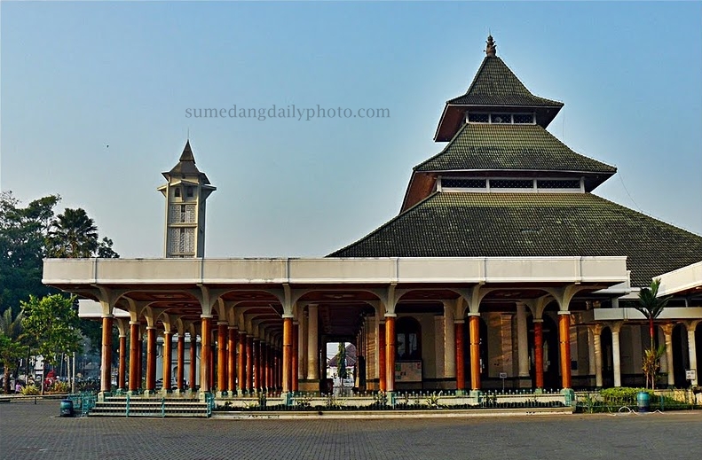
- Mesjid Agung Sumedang - panoramio, Sumedang Daily Photo, CC BY 3.0
- Makam RAA Martanagara di Makam Gunung Puyuh Sumedang, Makamindo, CC BY-SA 4.0
- Makam RAA Martanagara di Makam Gunung Puyuh Sumedang 2, Makamindo, CC BY-SA 4.0
- Ciri Makam Soeria Atmadja (Pangeran Mekkah) di Makam Gunung Puyuh Sumedang, Makamindo, CC BY-SA 4.0
- Makam RAA Martanagara di Makam Gunung Puyuh Sumedang 4, Makamindo, CC BY-SA 4.0
- Makam RAA Martanagara di Makam Gunung Puyuh Sumedang 3, Makamindo, CC BY-SA 4.0
- Makam Soeria Koesoemah Adinata (Pangeran Sugih) di Makam Gunung Puyuh Sumedang 6, Makamindo, CC BY-SA 4.0
- Makam Hadian & Maemoenah Oesman Soeriaadiningrat di Makam Gunung Puyuh Sumedang, Makamindo, CC BY-SA 4.0
- Makam Hadian Soeriaadiningrat di Makam Gunung Puyuh Sumedang, Makamindo, CC BY-SA 4.0
- Makam Hadian Soeriaadiningrat di Makam Gunung Puyuh Sumedang 2, Makamindo, CC BY-SA 4.0
- Makam Hadian Soeriaadiningrat di Makam Gunung Puyuh Sumedang 3, Makamindo, CC BY-SA 4.0
- Makam Soeria Koesoemah Adinata (Pangeran Sugih) di Makam Gunung Puyuh Sumedang 4, Makamindo, CC BY-SA 4.0
- Makam Soeria Koesoemah Adinata (Pangeran Sugih) di Makam Gunung Puyuh Sumedang 2, Makamindo, CC BY-SA 4.0
- Makam Soeria Koesoemah Adinata (Pangeran Sugih) di Makam Gunung Puyuh Sumedang 3, Makamindo, CC BY-SA 4.0
- Makam Soeria Koesoemah Adinata (Pangeran Sugih) di Makam Gunung Puyuh Sumedang, Makamindo, CC BY-SA 4.0
- Makam RA Soeriadikoesoemah di Makam Gunung Puyuh Sumedang, Makamindo, CC BY-SA 4.0
- Makam RA Soeriadikoesoemah di Makam Gunung Puyuh Sumedang 2, Makamindo, CC BY-SA 4.0
- Gedung Isola Universitas Pendidikan Indonesia, OsamaAbdillah, CC BY-SA 4.0
- Jalan Makam Cut Nyak Dien - panoramio, Sumedang Daily Photo, CC BY 3.0
- Nisan RAA Martanagara 2, Makamindo, CC BY-SA 4.0
- Nisan RAA Martanagara, Makamindo, CC BY-SA 4.0
- Ciri Makam Keluarga Soeria Atmadja (Pangeran Mekkah) 4, Makamindo, CC BY-SA 4.0
- Ciri Makam Nisan Pangeran Aria Soeria Atmadja (Pangeran Mekkah), Makamindo, CC BY-SA 4.0
- Ciri Makam Keluarga Soeria Atmadja (Pangeran Mekkah) 3, Makamindo, CC BY-SA 4.0
- Ciri Makam Keluarga Soeria Atmadja (Pangeran Mekkah), Makamindo, CC BY-SA 4.0
- Ciri Makam Nisan Nyi Rd Radja Permana binti Pangeran Aria Soeria Atmadja (Pangeran Mekkah), Makamindo, CC BY-SA 4.0
- Ciri Makam Nisan Nyi Rd Ayoe Radjaningroem (Isteri Pangeran Mekkah), Makamindo, CC BY-SA 4.0
- Ciri Makam Keluarga Soeria Atmadja (Pangeran Mekkah) 2, Makamindo, CC BY-SA 4.0
- Nisan Maemoenah Oesman Soeriaadiningrat, Makamindo, CC BY-SA 4.0
- Nisan Hadian & Maemoenah Oesman Soeriaadiningrat, Makamindo, CC BY-SA 4.0
- Nisan Hadian Soeriaadiningrat, Makamindo, CC BY-SA 4.0
- Nisan Soeria Koesoemah Adinata (Pangeran Sugih), Makamindo, CC BY-SA 4.0
- Nisan Soeria Koesoemah Adinata (Pangeran Sugih ), Makamindo, CC BY-SA 4.0
- Nisan Soeria Koesoemah Adinata (Pangeran Sugih) 3, Makamindo, CC BY-SA 4.0
- Nisan RA Soeriadikoesoemah 2, Makamindo, CC BY-SA 4.0
- Nisan RA Soeriadikoesoemah, Makamindo, CC BY-SA 4.0
- Monumen Lingga Sumedang - panoramio, Sumedang Daily Photo, CC BY 3.0
- Patung Kuda Renggong, Sumedang - panoramio, Devitapra, CC BY-SA 3.0


Page built November 3, 2026. Spotted a mistake? Tell us or suggest a place.