


Why visit Angamāli
Townapedia lists 3 museums and landmarks, 3 parks and trails, 34 places to eat, 12 places to stay and 5 attractions in and around town.
Weather in Angamāli
Forecast from MET Norway (CC BY 4.0). Full forecast
About Angamāli
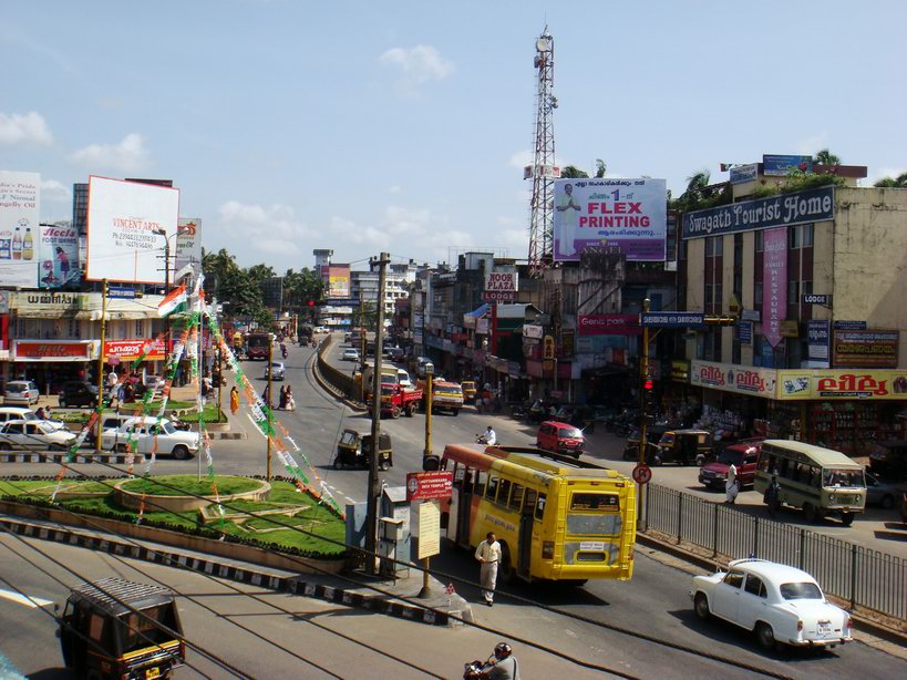
Angamaly (Malayalam pronunciation: [ɐŋgɐmɐːli]) is a municipality in the Ernakulam district of Kerala, India. Angamaly is part of the Kochi metropolitan area and is located northeast of the Kochi city centre. As of the 2011 Indian census, the municipality has a population of 33,465 people and a Population density of 1,633/km2 (4,230/sq mi).
From the Wikipedia article Angamaly (this version), under CC BY-SA 4.0.
Things to do5



Museums and landmarks3


Parks, trails and playgrounds3


Restaurants and cafes34

Poppins Curry Shop
Restaurant · Indian, Chinese · 2.2 km
696M+3C Karayamparambu, Karukutty, Angamaly
Mo-Su 09:00-21:00

Mariya Tea Shop And Bakery
Bakery · 2.3 km
696M+7G Karayamparambu, Karukutty, Angamaly
Mo-Su 09:00-21:00
Orange Bakers
Bakery · 0.6 km
Orange Bakers Salem - Kochi - Kanyakumari Highway, Angamaly
Indian Coffee House
Restaurant · Coffee Shop, Indian · 2.1 km
Salem - Kochi - Kanyakumari Highway, Angamaly
Orange Bakers Restraunt
Restaurant · 0.6 km
Orange Bakers Salem - Kochi - Kanyakumari Highway, Angamaly
Mayoora Laxmi Bhavan
Restaurant · 1.9 km
Salem - Kochi - Kanyakumari Highway, Angamaly
22 more on the map.
History
Several old coins and other artifacts demonstrate that this region was predominantly Buddhist and Jain. Malayatoor Church, an international shrine, is located nearby. Tradition states that Thomas the Apostle visited the region from Kodungaloor port in AD 52. There is evidence of churches in the locality built as early as AD 409 and AD 822. Angamaly was the headquarters of Mar Abraham, the last East Syriac bishop of the Archdiocese of Angamaly.
Originally established as a panchayat in May 1952, Angamaly became a municipality in April 1978 and has been a Ernakulam Assembly constituency since 1965. The area is known for the 1959 Angamaly police firing in which police fired upon protesters who had been demonstrating against Kerala's communist government.
From the History section of Angamaly on Wikipedia, under CC BY-SA 4.0.
Where to stay12
Churches and places of worship49
Infant Jesus Church, Kidangoor
Church · Catholic · 2.2 km
Infant Jesus Church Kidangoor, Kottayam District
Eldho Mor Baselious Jacobite Syrian Orthadox Church
Church · 2.4 km
Kidangoor Angamaly Manjapra Road, Angamaly
Kavalakkattu Mahadeva Temple
Place of worship · 2.1 km
Kidangoor Mookkannoor Connection Road, Ernakulam
Shopping11
Chacko Provisional Stores
Shopping center · 2.3 km
696M+7F Karayamparambu, Karukutty, Angamaly
Gas and EV charging6
Schools, colleges and libraries25
Healthcare12
Little Flower Hospital And Research Centre
Hospital
MC Road, Main Central Road, Opposite Thomson Dental Clinic, Angamaly, angamaly
Dr George's Homoeopathy
Hospital · 2.3 km
Karayamparambu Angamaly Ezhattumukham Road, Ernakulam
Map of Angamāli
160 places. The map loads OpenStreetMap tiles when you open it.
Getting there and nearby towns
Cochin International Airport (COK) is the nearest airport with scheduled flights listed in OpenStreetMap, 4 km away.
- Kizhake Chālakudi 13 km northwest, about 13 min by car
- Elūr 18 km southwest, about 18 min by car
- Kodungallūr 22 km west, about 22 min by car
- Irinjālakuda 26 km northwest, about 26 min by car
- Vypīn 29 km southwest, about 29 min by car
- Kochi 31 km southwest, about 31 min by car
- Kotamangalam 30 km southeast, about 30 min by car
- Arukutti 36 km south, about 36 min by car
- Piravam 38 km south, about 38 min by car
- Thrissur 41 km northwest, about 41 min by car
Drive times are estimates from straight-line distance, not routes.
Local news
Headlines from INDB.
Reviews, tips and questions
Loading what members have shared...
Sources and licences
- GeoNames (CC BY 4.0): population, coordinates, regions and time zone
- OpenStreetMap contributors (ODbL 1.0): places, airports, map data
- Wikidata (CC0 1.0): elevation, founding date, time zone, website, landmarks and historic places
- Wikimedia Commons (see each image): photos
- Wikipedia (CC BY-SA 4.0): overview and history text
Photo credits
- അങ്കമാലി1, Original uploaded by Challiyan (Transfered by sreejithk2000 ), CC BY-SA 3.0
- Mar Hormizd Syro-Malabar Church Angamaly, BVT99 at English Wikipedia, CC BY-SA 3.0
- St Marys jacobite Syrian church angamaly, Ranjithsiji, CC BY-SA 3.0
- St george Basilica church Angamaly, Ranjithsiji, CC BY-SA 3.0
- Angamali - Little Flower Hospital-1, കാക്കര, CC BY-SA 3.0
- Depaul English Medium Higher Secondary School, RanjithSiji, CC BY-SA 3.0
- St. George Bascilica Church, DeltaBot0, CC BY-SA 4.0
- Mar Hormizd at Syro-Malabar Church, Angamaly, Mathen Payyappilly Palakkappilly, CC BY-SA 4.0
- Mar Hormizd at Syro-Malabar Church, Angamaly–2, Mathen Payyappilly Palakkappilly, CC0
- Madbaha of Mar Hormizd Syro-Malabar Church, Angamaly, Mathen Payyappilly Palakkappilly, CC BY-SA 4.0
- Tomb of last East Syrian Metropolitan Mar Abraham at Mar Hormizd Syro-Malabar Church, Angamaly, Mathen Payyappilly Palakkappilly, CC BY-SA 4.0
- Angamaly Junction, Ranjithsiji, CC BY-SA 4.0
- Mar Hormizd Cathedral, unknown author, CC0
- Angamaly Municipal office complex, RanjithSiji, CC BY-SA 3.0
- അങ്കമാലി പട്ടണം - സായാഹ്നക്കാഴ്ച, Edukeralam, CC BY-SA 3.0
- Angamaly Municipality office complex building, Ranjithsiji, CC BY-SA 4.0
- Vanitha Mathil at Angamaly 2019, Navaneeth Krishnan S, CC BY-SA 3.0
- Aerial view of angamaly town, Ranjithsiji, CC BY-SA 4.0
- BJP Harthal Protesting against Sabarimala Women Entry 01, KannanVM, CC BY-SA 4.0
- BJP Harthal Protesting against Sabarimala Women Entry 02, KannanVM, CC BY-SA 4.0
- Angamaly Police station, RanjithSiji, CC BY-SA 3.0
- Vanitha Mathila Angamaly, Navaneeth Krishnan S, CC BY-SA 3.0
- Vanithamathil at Angamaly, Navaneeth Krishnan S, CC BY-SA 3.0
- Aval milk from Angamaly Town, Ranjithsiji, CC BY-SA 4.0
- Westrex 14 film projector from angamaly, Ranjithsiji, CC BY-SA 4.0
- Aval milk from Angamaly, Ranjithsiji, CC BY-SA 4.0
- Clock tower of KSRTC bus terminal angamaly, RanjithSiji, CC BY 3.0
- Angamaly Municipal Bus Stand, RanjithSiji, CC BY-SA 3.0
- Angamaly Church,Ernakulam,Kerala,India. - panoramio (1), Geyo John, CC BY-SA 3.0
- Angamaly KSRTC Bus Station Building with bus, Ranjithsiji, CC BY-SA 4.0
- Angamaly Church,Ernakulam,Kerala,India. - panoramio, Geyo John, CC BY-SA 3.0
- Double decker bus at Angamaly ksrtc bus station, Ranjithsiji, CC BY-SA 4.0
- Arial view of Angamaly KSRTC Bus station taken from the top of the shopping complex building, Ranjithsiji, CC BY-SA 4.0
- After the 2018 Kerala Floods Pazhuvapongu Bridge between Kidangoor and Angamaly, Navaneeth Krishnan S, CC BY-SA 3.0
- Angamaly KSRTC Bus Stand IMG 20250417 162607 627, Ranjithsiji, CC BY-SA 4.0
- Angamaly ksrtc bustation 1305, Rameshng, CC BY-SA 3.0
- Angamaly ksrtc bustation 1303, Rameshng, CC BY-SA 3.0
- Bsnl angamaly 1301, Rameshng, CC BY-SA 3.0
- Angamaly ksrtc bustation 1302, Rameshng, CC BY-SA 3.0
- Angamaly municipal market 1309, Rameshng, CC BY-SA 3.0


Page built November 3, 2026. Spotted a mistake? Tell us or suggest a place.