



Why visit Bārākpur
Townapedia lists 6 museums and landmarks, 30 parks and trails, 29 places to eat and 4 attractions in and around town.
Highlights include Carey Museum, Denmark Tavern and Hotel and Kalyangram Park.
Weather in Bārākpur
Forecast from MET Norway (CC BY 4.0). Full forecast
About Bārākpur
Barrackpore, also spelled as Barrackpur, is a city and a municipality in North 24 Parganas district in the Indian state of West Bengal. It is the headquarters of the Barrackpore subdivision. The city is a part of the area covered by Kolkata Metropolitan Development Authority (KMDA).
From the Wikipedia article Barrackpore (this version), under CC BY-SA 4.0.
Travel tips from other travellers: Bārākpur on Wikivoyage (CC BY-SA 4.0).
Things to do4

Museums and landmarks6



Parks, trails and playgrounds30

Jolkol Park
Park · 2.3 km
Jolkol Park is one the biggest parks of this area. Very popular and a lovely picnic spot.
Mini Jolkol Park
Park · 2.4 km
A smaller park and playground situated beside the jolkol park.
Riverside Park
Park · 2.2 km
A park located just beside the river. provides open access to all.

18 more on the map.
Restaurants and cafes29




17 more on the map.
History
The earliest references to the Barrackpore region are found in the writings of the Greek navigators, geographers, chronicles and historians of the 1st century BC to the 3rd century AD. These authors generally referred to the country of a people variously called the Gangaridai (also Gangaridae or Gandaritai). By the 15th and 16th centuries, Chanak and the other towns in the region had become populous river towns. The Statistical Account of Bengal by W.W.Hunter mentions the towns and villages of this subdivision on the banks of the Hooghly river as chief trading and marketing centres: "On The Hugli- Calcutta, the chief seat of commerce in India. Baranagar, Dakhineswar, Agarpara, Panihati, Sukchar- Khardah, Barrackpur, Nawabganj, Ichapore, Shyam Nagar, Naihati and Halisahar contain large bazaars for sale of miscellaneous goods."
Under the Mughal Empire, Bengal was divided into Circars, or administrative subunits, each of which was ruled over by a Mahal. The name "Barbuckpur", another name for Barrackpore, is associated with a Mahal in the Ain-e-Akbari. From the 17th century, the area was ruled over by a line of Zamindars based in Nona Chandanpukur, Barrackpore.
From the History section of Barrackpore on Wikipedia, under CC BY-SA 4.0.
Churches and places of worship23
Shopping5
Reliance fresh
Grocery · 0.6 km
67/2 Barrackpore, East, Ghoshpara Rd, Titagarh, West Bengal 700120
Gas and EV charging1
Schools, colleges and libraries28
Government College of Engineering And Textile Technology
School · 1.9 km
12 William Carey Sarani, Serampore
Healthcare27
Map of Bārākpur
153 places. The map loads OpenStreetMap tiles when you open it.
Getting there and nearby towns
Netaji Subhash Chandra Bose International Airport (CCU) is the nearest airport with scheduled flights listed in OpenStreetMap, 15 km away.
- Shrīrāmpur 3 km southwest, about 3 min by car
- Rishra 5 km south, about 5 min by car
- Khardah 5 km south, about 5 min by car
- Pānihāti 8 km south, about 8 min by car
- Kāmārhāti 11 km south, about 11 min by car
- Chandannagar 11 km north, about 11 min by car
- Bhātpāra 12 km north, about 12 min by car
- Madhyamgram 12 km southeast, about 12 min by car
- Bārāsat 13 km east, about 13 min by car
- Naihāti 15 km north, about 15 min by car
Drive times are estimates from straight-line distance, not routes.
Local news
Headlines from INDB.
Reviews, tips and questions
Loading what members have shared...
Sources and licences
- GeoNames (CC BY 4.0): population, coordinates, regions and time zone
- OpenStreetMap contributors (ODbL 1.0): places, airports, map data
- Wikidata (CC0 1.0): elevation, founding date, time zone, website, landmarks and historic places
- Wikimedia Commons (see each image): photos
- Wikipedia (CC BY-SA 4.0): overview and history text
Photo credits
- Barrackpore Railway Station - North 24 Parganas 2012-04-11 9670, Biswarup Ganguly, CC BY 3.0
- St Olaf's Church-Serampore-West Bengal-13, Kinjal bose 78, CC BY-SA 4.0
- Serampore College, Serampore, Hooghly, West Bengal, Kanad Sanyal, CC BY-SA 4.0
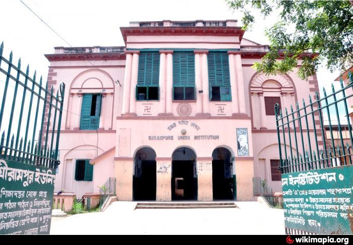
- School union gate, Sarkarsayantan.2241, CC BY-SA 4.0
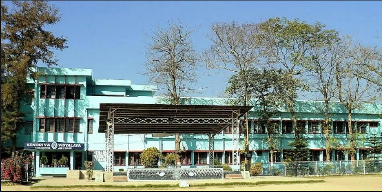
- Kendriya Vidyalaya (AFS), Barrackpore, Doctrosans, CC BY-SA 4.0
- William Carey Museum, Serampore College, Serampore - 1, PIN 712201, CC BY-SA 4.0
- Henry Martin's Pagoda at Serampore in Hooghly district, Mukut Tapadar, CC BY-SA 4.0
- Radhaballav Temple-Serampore-West Bengal-15, Kinjal bose 78, CC BY-SA 4.0
- The Denmark Tavern of Serampore in West Bengal, Dassurojitsd, CC BY-SA 4.0
- Annapurna Temple of Titagarh-Barrackpore in North 24 Parganas 19, Pinakpani, CC BY-SA 4.0
- Annapurna Mandir-Barrackpore-West Bengal-3, Kinjal bose 78, CC BY-SA 4.0
- St Olav's Church, Serampore, SoumilyaDe, CC BY-SA 4.0
- Near Digha, Deepak Kumar Singh, CC BY-SA 4.0
- Keyboard snap, Shubjt, CC BY-SA 4.0
- Assorted Mocktails, Subrata Ghose, CC BY-SA 4.0
- Chicken Bhatiali Kabab, Subrata Ghose, CC BY-SA 4.0
- Ors sachet, Shubjt, CC BY-SA 4.0
- Scarlet-backed Flowerpecker by Tisha Mukherjee 16, Tisha Mukherjee, CC BY-SA 4.0
- Scarlet-backed Flowerpecker by Tisha Mukherjee 09, Tisha Mukherjee, CC BY-SA 4.0
- Scarlet-backed Flowerpecker by Tisha Mukherjee 07, Tisha Mukherjee, CC BY-SA 4.0
- Scarlet-backed Flowerpecker by Tisha Mukherjee 02, Tisha Mukherjee, CC BY-SA 4.0
- Scarlet-backed Flowerpecker by Tisha Mukherjee 04, Tisha Mukherjee, CC BY-SA 4.0
- Scarlet-backed Flowerpecker by Tisha Mukherjee 08, Tisha Mukherjee, CC BY-SA 4.0
- Scarlet-backed Flowerpecker by Tisha Mukherjee 06, Tisha Mukherjee, CC BY-SA 4.0
- Purple Sunbird by Tisha Mukherjee 02, Tisha Mukherjee, CC BY-SA 4.0
- Scarlet-backed Flowerpecker by Tisha Mukherjee 12, Tisha Mukherjee, CC BY-SA 4.0
- Scarlet-backed Flowerpecker by Tisha Mukherjee 15, Tisha Mukherjee, CC BY-SA 4.0
- Scarlet-backed Flowerpecker by Tisha Mukherjee 17, Tisha Mukherjee, CC BY-SA 4.0
- Scarlet-backed Flowerpecker by Tisha Mukherjee 11, Tisha Mukherjee, CC BY-SA 4.0
- Scarlet-backed Flowerpecker by Tisha Mukherjee 10, Tisha Mukherjee, CC BY-SA 4.0
- Scarlet-backed Flowerpecker by Tisha Mukherjee 14, Tisha Mukherjee, CC BY-SA 4.0
- Scarlet-backed Flowerpecker by Tisha Mukherjee 05, Tisha Mukherjee, CC BY-SA 4.0
- Purple Sunbird by Tisha Mukherjee 01, Tisha Mukherjee, CC BY-SA 4.0
- Scarlet-backed Flowerpecker by Tisha Mukherjee 19, Tisha Mukherjee, CC BY-SA 4.0
- Scarlet-backed Flowerpecker by Tisha Mukherjee 13, Tisha Mukherjee, CC BY-SA 4.0
- Scarlet-backed Flowerpecker by Tisha Mukherjee 20, Tisha Mukherjee, CC BY-SA 4.0
- Scarlet-backed Flowerpecker by Tisha Mukherjee 03, Tisha Mukherjee, CC BY-SA 4.0
- Scarlet-backed Flowerpecker by Tisha Mukherjee 18, Tisha Mukherjee, CC BY-SA 4.0
- Scarlet-backed Flowerpecker by Tisha Mukherjee 01, Tisha Mukherjee, CC BY-SA 4.0
- Barrackpore railway station IMG 20200229 175836 02, Sumita Roy Dutta, CC BY-SA 4.0


Page built November 2, 2026. Spotted a mistake? Tell us or suggest a place.