


Why visit Bilaspur
Townapedia lists 1 place to eat and 2 places to stay in and around town.
Weather in Bilaspur
Forecast from MET Norway (CC BY 4.0). Full forecast
About Bilaspur
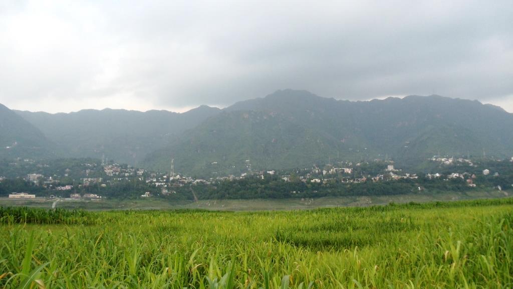
Bilaspur is a town and a municipal council in Bilaspur district in the Indian state of Himachal Pradesh.
From the Wikipedia article Bilaspur, Himachal Pradesh (this version), under CC BY-SA 4.0.
Travel tips from other travellers: Bilaspur on Wikivoyage (CC BY-SA 4.0).
Restaurants and cafes1

Where to stay2

Churches and places of worship1

Gas and EV charging1

History
Bilaspur was the capital of a state of the same name founded in the 7th century, also known as Kahlur. The ruling dynasty were Chandel Rajputs, who claimed descent from the rulers of Chanderi in present-day Madhya Pradesh. The town of Bilaspur was founded in 1663. The state later became a princely state of British India, and was under the authority of the British province of Punjab.
On 13 May 1665, Guru Tegh Bahadur went to Bilaspur to attend the mourning and funeral ceremonies for Raja Dip Chand of Bilaspur. Rani Champa of Bilaspur made an offer to the Guru of a piece of land in her state, which the Guru accepted at the cost of 500 rupees. The land consisted of the villages of Lodipur, Mianpur, and Sahota. Guru Tegh Bahadur broke ground on a new settlement on 19 June 1665, which he named, Nanaki, after his mother.
In 1932, the state became part of the newly created Punjab States Agency, and in 1936 the Punjab Hill States Agency was separated from the Punjab States Agency. On 12 October 1948 the local ruler, Raja Sir Anand Chand, last ruler of Bilaspur [CHANDEL DYNASTY] acceded to the Government of India.
From the History section of Bilaspur, Himachal Pradesh on Wikipedia, under CC BY-SA 4.0.
Healthcare5
Map of Bilaspur
10 places. The map loads OpenStreetMap tiles when you open it.
Getting there and nearby towns
Shimla Airport (SLV) is the nearest airport with scheduled flights listed in OpenStreetMap, 40 km away.
- Ghumārwīn 13 km north, about 13 min by car
- Naina Devi 21 km west, about 21 min by car
- Sundarnagar 27 km northeast, about 27 min by car
- Mandi 46 km north, about 46 min by car
- Shimla 46 km southeast, about 46 min by car
- Chandigarh 66 km south, about 1 h by car
- Mani Mājra 69 km south, about 1 h 15 min by car
- Panchkula 71 km south, about 1 h 15 min by car
- Mohali 72 km south, about 1 h 15 min by car
- Kulu 77 km northeast, about 1 h 15 min by car
Drive times are estimates from straight-line distance, not routes.
Local news
Headlines from INDB.
Reviews, tips and questions
Loading what members have shared...
Sources and licences
- GeoNames (CC BY 4.0): population, coordinates, regions and time zone
- OpenStreetMap contributors (ODbL 1.0): places, airports, map data
- Wikidata (CC0 1.0): elevation, founding date, time zone, website
- Wikimedia Commons (see each image): photos
- Wikipedia (CC BY-SA 4.0): overview and history text
Photo credits
- BilaspurCityHimachal, Jini.ee06b056, CC BY-SA 3.0
- Bilaspur bus station, Gannu03, CC BY-SA 4.0
- Bilaspur bus station (69037), Gannu03, CC BY-SA 4.0
- Bilaspur bus station (36016), Gannu03, CC BY-SA 4.0
- Bilaspur bus station (26125), Gannu03, CC BY-SA 4.0
- Dainis Matisons, Laxmi Narayan Temple, Bilaspur, Dainis Matisons, CC BY 4.0
- Morning time, Yukti2001, CC BY-SA 4.0
- Manali from Delhi vrtmrgmpksk (10), Vinayaraj, CC BY-SA 4.0
- Manali from Delhi vrtmrgmpksk (9), Vinayaraj, CC BY-SA 4.0
- Manali from Delhi vrtmrgmpksk (8), Vinayaraj, CC BY-SA 4.0


Page built November 3, 2026. Spotted a mistake? Tell us or suggest a place.