
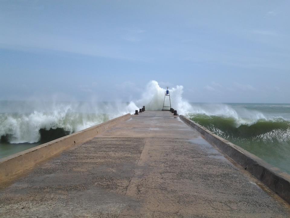


Why visit Colachel
Townapedia lists 1 museum or landmark in and around town.
Weather in Colachel
Forecast from MET Norway (CC BY 4.0). Full forecast
About Colachel
Colachel (Tamil/Malayalam: Kulachal, IPA: [kuɭɐt͡ʃːɐl]) is a Town in the far south of India, located in the Kanyakumari district of Tamil Nadu. It is a natural harbor on the Malabar Coast, located 20 km northwest of Kanyakumari (Cape Comorin), the southernmost tip of India. As of 2011, the municipality had a population of 23,227 and a metropolitan population of 47,007.
From the Wikipedia article Colachel (this version), under CC BY-SA 4.0.
Museums and landmarks1

Churches and places of worship1

Healthcare6

History
Colachel is an ancient port town, that Vasco da Gama called ‘Colachi’. Before the State re-organization in 1956, it was part of the Travancore State. After the defeat of the Dutch by King Anizham Thirunal Marthanda Varma in 1741, a victory pillar had been erected near the beach in commemoration of the victory. The town is bounded on the south by Arabian Sea. It has Pampoori Vaikal in its Western side. Nagercoil the headquarters of Kanyakumari District is 20 km away from this town in the North East Direction.
From the History section of Colachel on Wikipedia, under CC BY-SA 4.0.
Map of Colachel
8 places. The map loads OpenStreetMap tiles when you open it.
Getting there and nearby towns
Thiruvananthapuram International Airport (TRV) is the nearest airport with scheduled flights listed in OpenStreetMap, 50 km away.
- Eraniel 7 km northeast, about 7 min by car
- Tiruvankod 9 km northeast, about 9 min by car
- Padmanābhapuram 10 km northeast, about 10 min by car
- Nāgercoil 19 km east, about 19 min by car
- Neyyāttinkara 31 km northwest, about 31 min by car
- Thiruvananthapuram 48 km northwest, about 48 min by car
- Nedumangād 55 km northwest, about 55 min by car
- Attingal 75 km northwest, about 1 h 15 min by car
- Tirunelveli 77 km northeast, about 1 h 15 min by car
- Kadakkavoor 77 km northwest, about 1 h 15 min by car
Drive times are estimates from straight-line distance, not routes.
Local news
Headlines from INDB.
Reviews, tips and questions
Loading what members have shared...
Sources and licences
- GeoNames (CC BY 4.0): population, coordinates, regions and time zone
- OpenStreetMap contributors (ODbL 1.0): places, airports, map data
- Wikidata (CC0 1.0): elevation, founding date, time zone, website
- Wikimedia Commons (see each image): photos
- Wikipedia (CC BY-SA 4.0): overview and history text
Photo credits
- Colachel harbour, Risvan Mohammed S, CC BY-SA 4.0
- Arabian sea at colachel. tamil nadu. india - panoramio, Suresh Babunair, CC BY 3.0
- Fishing trawlers . colachel port .arabian sea - panoramio, Suresh Babunair, CC BY 3.0
- Colachel town. tamilnadu - panoramio, Suresh Babunair, CC BY 3.0
- Victory Pillar Colachal, SAJEEVJINO, CC BY-SA 4.0
- Kumari Bivin, Bivin pon singh, CC BY-SA 4.0
- Kodimunai Church, Nanjil Bala, CC BY-SA 4.0

Page built November 3, 2026. Spotted a mistake? Tell us or suggest a place.