



Delhi Cantonment, India
Delhi Cantonment is a town of 110,351 people in Delhi, India, founded in 1914.
Why visit Delhi Cantonment
Townapedia lists 28 museums and landmarks, 88 parks and trails, 155 places to eat, 22 places to stay and 18 attractions in and around town.
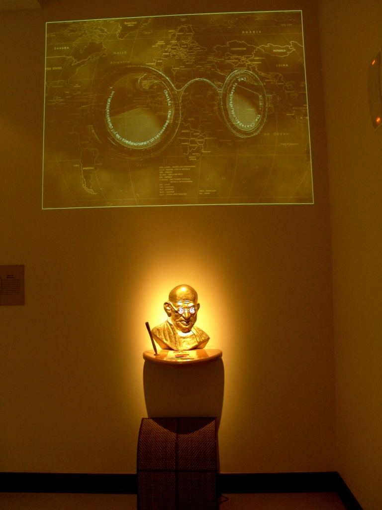
Highlights include Army College of Medical Sciences, All India Institute of Medical Sciences, New Delhi, Sulabh International Museum of Toilets and Mystery Rooms.
Weather in Delhi Cantonment
Forecast from MET Norway (CC BY 4.0). Full forecast
About Delhi Cantonment
Delhi Cantonment (ISO: Dillī Chāvanī; popularly referred to as Delhi Cantt) is a Class I Cantonment Board in New Delhi established in 1914. The area of the Cantonment is 10,452 acres (42.30 km2) and its population, as per the 2011 census, is 110,351.
From the Wikipedia article Delhi Cantonment (this version), under CC BY-SA 4.0.
Things to do18

Army College of Medical Sciences
School · 1.1 km
College in New Delhi, India
All India Institute of Medical Sciences, New Delhi
School · 8.4 km
Indian medical school and hospital in New Delhi
Bhaskraycharya College of Applied Sciences
School · 6.4 km
College of the University of Delhi, India
Delhi Skill and Entrepreneurship University
School · 7.1 km
State public university in South West, Delhi, India
Indian Agricultural Research Institute
School · 4.8 km
Research institute in Delhi

Indian Institute of Technology Delhi
School · 8.6 km
Public research university located in Delhi

Maharaja Surajmal Institute of Technology
School · 4.8 km
College affiliated to the Guru Gobind Singh Indraprastha University
Morarji Desai National Institute of Yoga
School · 7.6 km
College affiliated to the Guru Gobind Singh Indraprastha University
Shri Lal Bahadur Shastri National Sanskrit University
School · 8.1 km
Central university in New Delhi
South Asian University
School · 5.9 km
International university in India
TERI School of Advanced Studies
School · 6.3 km
Sustainability-focused university in Delhi, India

6 more on the map.
Museums and landmarks28




Gandhi Smriti
Museum · 7.9 km
Museum and death place of Mahatma Gandhi, in New Delhi, India


Jaipur Column
Monument and historic site · 6.9 km
Monument in New Delhi

National Museum
Museum · 8.5 km
National and art museum in New Delhi, India

National Philatelic Museum, New Delhi
Museum · 8.2 km
Museum at Dak Bhawan, New Delhi, India

National Rail Museum
Museum · 5.0 km
Rail museum in Chanakyapuri, New Delhi

16 more on the map.
Parks, trails and playgrounds88




Northern Railway Eco Park Club
Golf course · 4.1 km
San Martin Marg
07:00-10:00;Mar-Nov 17:00-20:00;Dec-Feb 16:00-19:00
Bindra Park
Park · 4.8 km
C 70 Major Sudesh Marg, Rajouri Garden
Mo-Su 06:00-23:00
76 more on the map.
Restaurants and cafes155

Talli Station Naraina
Restaurant · Indian, Chinese · 3.3 km
C-127 Girdhari Lal Goswami Marg, Delhi Cantonment
Mo-Su 11:00-23:00
Om Sweets
Restaurant · Pizza, Indian · 4.5 km
GL - 23,SHAHEED BHAGAT SINGH MARG Jail Road Hari Nagar, New Delhi
08:00-2300
Raju Chur Chur Naan
Restaurant · Indian · 5.2 km
B-1 Community Centre Dharam Marg, New Delhi
11:00-17:00,19:00-23:00

Maharaj Surajmal College Canteen
Restaurant · Burger, Chinese, Coffee Shop, Sandwich, Ice Cream, Indian · 4.6 km
Mo-Sa 08:30-17:00

Rajyogi Kulfi Bhandar
Ice cream · 5.2 km
B-1 Community Centre Arya Samaj Road,Janak Puri, New Delhi,
18:00-12:30

thrid wave coffee
Cafe · 3.7 km
121 ground floor satya niketan, New Delhi
10:00-22:00
Giani Ice cream
Ice cream · 5.1 km
B-3/66 Opposie B-2 Mar Gregorios Church,Janak Puri, New Delhi,
143 more on the map.
History
Cantonments in Delhi and Ahmedabad were originally established during the British Raj. The Delhi Cantonment was constructed by acquiring parts of the land of the Naraina Village and houses the headquarters of the Indian Army Headquarters, the Army Golf Course; the Defence Services Officers Institute; military housing; Air Force and Army Public Schools; and various other defence-related installations. The cantonment also houses the Army Hospital Research and Referral, a tertiary care medical centre of the Indian Armed Forces.
There is a railway station within the cantonment, Delhi Cantonment railway station, from where trains depart for various parts of the country.
From the History section of Delhi Cantonment on Wikipedia, under CC BY-SA 4.0.
Where to stay22
ANdaZ Delhi - a concept by Hyatt
Motel and hotel · 5.2 km
Asset No.1 Aerocity, New Delhi
Vishagya's house
Motel and hotel · 4.4 km
B-173, Type-IV, South Moti Bagh , Nanakpura, New Delhi-110021
Churches and places of worship66
Shree Krishan Sanatan Dharam Mandir
Place of worship · 5.1 km
Dharam Marg Block B-2,Janak Puri, New Delhi,
Sri Guru Singh Sabha Gurudwara
Place of worship · 5.1 km
Dharam Marg Block B-2 Janak Puri, New Delhi,
Sri Raman Vihari Goudiya Math
Place of worship · 4.9 km
Dharam Marg Near District Park,B-3 Janak Puri, New Delhi
Arya Samaj Mandir
Place of worship · Arya Samaj · 5.1 km
Dharam Marg,Arya Samaj Road B-2 Janak Puri, New Delhi,
Peer Baba Majar
Place of worship · Sufi · 4.0 km
H3HX+JPX Prahladpur, Delhi Cantt, New Delhi
Shopping31
Himalaya Herbal Health Care
Grocery · 5.2 km
Shop 2, F-128 Sant Sujan Singh Marg, Opp. Global Desi, Main Market, Block F, Rajouri Garden, New Delhi, Delhi 110027, New Delhi
Gas and EV charging23
Schools, colleges and libraries81
Healthcare87
Map of Delhi Cantonment
250 places. The map loads OpenStreetMap tiles when you open it.
Getting there and nearby towns
Indira Gandhi International Airport (DEL) is the nearest airport with scheduled flights listed in OpenStreetMap, 6 km away.
- Kusum Pur 6 km southeast, about 6 min by car
- Malakpur Kohi Rangpur 7 km south, about 7 min by car
- New Delhi 8 km east, about 8 min by car
- Hashtsāl 8 km northwest, about 8 min by car
- Samālka 8 km southwest, about 8 min by car
- Delhi 11 km northeast, about 11 min by car
- Najafgarh 15 km west, about 15 min by car
- Faridabad 27 km southeast, about 27 min by car
- Ghāziābād 31 km east, about 31 min by car
- Meerut 70 km northeast, about 1 h 15 min by car
Drive times are estimates from straight-line distance, not routes.
Local news
Headlines from INDB.
Reviews, tips and questions
Loading what members have shared...
Sources and licences
- GeoNames (CC BY 4.0): population, coordinates, regions and time zone
- OpenStreetMap contributors (ODbL 1.0): places, airports, map data
- Wikidata (CC0 1.0): elevation, founding date, time zone, website, landmarks and historic places
- Wikimedia Commons (see each image): photos
- Wikipedia (CC BY-SA 4.0): overview and history text
Photo credits
- Delhi Cantonment Board, KhubsuratInsaan, CC BY-SA 4.0
- AIIMS central lawn, Dr.saptarshi, Public domain
- IIT Delhi, Nithinmohan, CC BY-SA 3.0
- Sulabh ecosan toilet, Ajay Tallam, CC BY-SA 2.0
- Gandhimuseum1, Saad Akhtar from New Delhi, India, CC BY 2.0
- Birla HouseGandhi Smriti, New Delhi, Gaurav Vaidya ( User:Gaurav ), CC BY 3.0
- Gyarah Murti Statue, New Delhi, Nmgrandhi 1977, CC BY-SA 3.0
- Jaipur Column, Rashtrapati Bhavan, New Delhi, Scott Dexter from Brooklyn, USA, CC BY-SA 2.0
- India national museum 01, Miya.m, CC BY-SA 3.0
- National Philatelic Museum, New Delhi, Sidheeq, CC BY-SA 4.0
- Teen Murti House, RegentsPark, CC BY-SA 3.0
- Deer Park (Hauz Khas), Delhi, Cutest Penguin, CC BY-SA 3.0
- Lodhi Gardens on a sunny day, Amaninder, CC BY-SA 3.0
- Sacred Heart Cathedral (New Delhi) sky adj, Maria Krüger, CC BY-SA 2.5
- National-Rail-Museum-Entrée, Bruno Corpet ( Quoique ), CC BY-SA 3.0
- TAFS-NEW, Ex-tafsian-9719086, CC BY-SA 4.0
- APSShankarViharSolarPanelDEMO, RackelDevs, CC0
- Peacock in its habitat, Gurjodh, CC BY-SA 4.0
- MSIT College, Janakpuri, New Delhi, VartamanVarta, CC BY 4.0
- Army Public School, Dhaula Kuan (21 July 2005), Toprohan ( talk ) ( Uploads ), CC BY-SA 3.0
- Dabri, New Delhi, VartamanVarta, CC BY 4.0
- Arsd college dhaula kuan, Janendra, CC BY 3.0
- Sankar sanyal hss, divine shakti foundation, CC BY-SA 4.0
- Lt Gen SN Sharma-retd-IndianArmy, AshLin, CC BY-SA 4.0
- Kasauli, Himachal Pradesh, Numerounovedant at English Wikipedia, CC BY 3.0
- Kasuali, Himachal Pradesh (2), Numerounovedant at English Wikipedia, CC BY 3.0
- Delhi War Cemetery, Pulakit Singh, CC BY-SA 4.0
- Delhi 1939-1945 War Memorial Closeup, Pulakit Singh, CC BY-SA 4.0
- Delhi 1939-1945 War Memorial Delhi Cemetery, Pulakit Singh, CC BY-SA 4.0
- Delhi War Cemetery Front View, Pulakit Singh, CC BY-SA 4.0
- Delhi 1939-1945 War Memorial, Pulakit Singh, CC BY-SA 4.0
- Delhi War Cemetery Left View, Pulakit Singh, CC BY-SA 4.0
- Cold As It Looks, Akash Da Hustla, CC BY 3.0
- Hangar 2 Indian Air Force Museum, Palam, DiplomatTesterMan, CC BY-SA 4.0
- Jama Masjid, Delhi (2564810184), Michael Day, CC BY 2.0
- VT-EFW (13991671125), Alec Wilson from Hampton-in-Arden, UK, CC BY-SA 2.0
- BL727 (14011663243), Alec Wilson from Hampton-in-Arden, UK, CC BY-SA 2.0
- VT-AKH (13991681055), Alec Wilson from Hampton-in-Arden, UK, CC BY-SA 2.0
- HA623 (13992111594), Alec Wilson from Hampton-in-Arden, UK, CC BY-SA 2.0
- IZ1590 (13991672595), Alec Wilson from Hampton-in-Arden, UK, CC BY-SA 2.0


Page built November 2, 2026. Spotted a mistake? Tell us or suggest a place.