



Why visit Edappāl
Townapedia lists 6 parks and trails, 14 places to eat, 5 places to stay and 5 attractions in and around town.
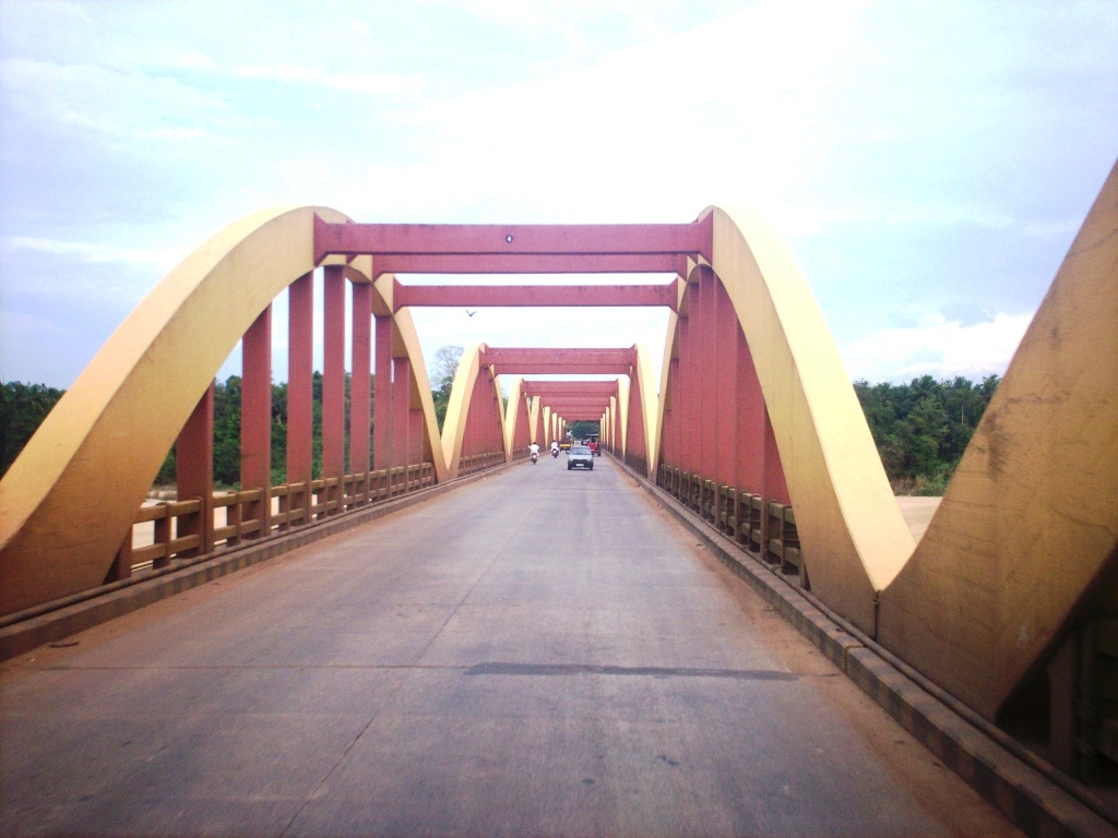
Highlights include Chamravattom Regulator-cum-Bridge and Kuttippuram bridge.
Weather in Edappāl
Forecast from MET Norway (CC BY 4.0). Full forecast
About Edappāl
Edappal is a town which lies near to the town of Ponnani in Ponnani taluk, Malappuram district, Kerala, India. Edappal at the junction of Thrissur-Kuttippuram and Palakkad-Ponnani state highways, is located 45 km (28 mi) from Malappuram. Edappal lies in two panchayaths (local body jursidcitions), Vattamkulam, and Edappal. Edappal shares borders with Thuyyam, Polpakkara, Ayilakkadu, Vattamkulam, and Annakampadu.
From the Wikipedia article Edappal (this version), under CC BY-SA 4.0.
Things to do5


Parks, trails and playgrounds6



Restaurants and cafes14




2 more on the map.
Where to stay5

Churches and places of worship40
Juma Masjid Palapra
Place of worship · Sunni · 3.1 km
Anakkara-Edappal Road, edappal
Juma Masjid Mudur
Place of worship · Sunni · 2.1 km
Anakkara-Annakkambad Road, edappal
Ayappankav Hindu Temple
Place of worship · 2.0 km
Ayilakkad Athani-Naduvattom Road, Edappal
KULANGARA BHAGAVTHI TEMPLE
Place of worship · 0.8 km
Edappal Pattambi Road, EDAPPAL
Shopping9
Gas and EV charging7
Schools, colleges and libraries62
Aided Upper Primary School Ground
School · 2.4 km
old block-parapuram road, Perumparambu
C M C Lower Primary School Thalamunda
School · 1.3 km
Thalamunda Amsakachery-Ayilakkad Road, Edappal
Darul Hidaya Higher secondary school Edappal
School
Thrissur – Kuttippuram Road, Edappal
Darul Hidaya Orphanage Higher secondary school
School · 1.4 km
pookkarathara Athani-Naduvattom Road, Edappal
Healthcare18
Ambiliy Nursing Home Edappal
Clinic and pharmacy
Thrissur – Kuttippuram Road, Edappal
Government hospital Edappal
Hospital · 0.7 km
Amsakachery-Ayilakkad Road, EDAPPAL
Homeo clinic Pulikkad
Clinic and pharmacy · 3.3 km
pookkarathara-kolalamb road, Pulikkad
Map of Edappāl
166 places. The map loads OpenStreetMap tiles when you open it.
Getting there and nearby towns
Calicut International Airport (CCJ) is the nearest airport with scheduled flights listed in OpenStreetMap, 40 km away.
- Kuttippuram 7 km north, about 7 min by car
- Ponnāni 9 km west, about 9 min by car
- Katavallūr 10 km southeast, about 10 min by car
- Kadikkād 13 km south, about 13 min by car
- Kunnamkulam 17 km southeast, about 17 min by car
- Tirur 17 km northwest, about 17 min by car
- Pattāmbi 19 km east, about 19 min by car
- Guruvāyūr 21 km south, about 21 min by car
- Kōttakkal 24 km north, about 24 min by car
- Malappuram 30 km north, about 30 min by car
Drive times are estimates from straight-line distance, not routes.
Local news
Headlines from INDB.
Reviews, tips and questions
Loading what members have shared...
Sources and licences
- GeoNames (CC BY 4.0): population, coordinates, regions and time zone
- OpenStreetMap contributors (ODbL 1.0): places, airports, map data
- Wikidata (CC0 1.0): elevation, founding date, time zone, website, landmarks and historic places
- Wikimedia Commons (see each image): photos
- Wikipedia (CC BY-SA 4.0): overview and history text
Photo credits
- Dakshinamoorthy temple - Sukapuram - Edappal, Ranji1 2000, CC BY-SA 4.0
- Bridge -bharatappuzha -kuttippuram (1), Sajetpa at Malayalam Wikipedia, CC BY-SA 3.0
Page built November 3, 2026. Spotted a mistake? Tell us or suggest a place.