


Weather in Gauriganj
Forecast from MET Norway (CC BY 4.0). Full forecast
About Gauriganj
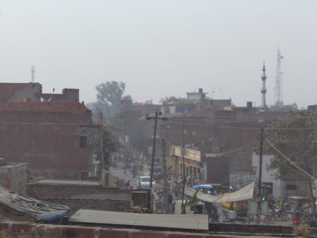
Gauriganj is a city, municipal corporation, tehsil and administrative headquarters of Amethi district in Ayodhya division, Uttar Pradesh, India. It is situated about 126 km from the state capital Lucknow. Before July 2010, it was part of Sultanpur district. After that Gauriganj, Amethi, Jais, Jagdispur and Salon formed a new district Chhatrapati Sahuji Maharaj Nagar, later named Gauriganj and now Amethi.
From the Wikipedia article Gauriganj, India (this version), under CC BY-SA 4.0.
History
At the turn of the 20th century, Gauriganj was described as "a rising town, with a station on the Oudh and Rohilkhand Railway." It then technically consisted of two villages, Katra-Lalganj and Madhopur. The bazar was founded by Raja Lal Madho Singh, the Raja of Amethi (d.1891). Gauriganj then hosted a rising grain market and had a pound, police station, and post office, as well as an upper primary school, which had many students from both Gauriganj itself and the surrounding countryside; it had a small building, though, which was not big enough to accommodate the student body adequately. The town was then surrounded by several deep hollows. West of Katra-Lalganj were low-lying fields where only jarhan rice was grown. The population of Gauriganj as of 1901 was 2,543, including a large Bania community which was larger than any other town in the district except Sultanpur. There was a Muslim minority of 194, and the rest of the town's population was a mix of Ahirs, Kurmis, and Gadariyas, as well as some Pasis.
From the History section of Gauriganj, India on Wikipedia, under CC BY-SA 4.0.
Map of Gauriganj
0 places. The map loads OpenStreetMap tiles when you open it.
Getting there and nearby towns
Maharishi Valmiki International Airport (AYJ) is the nearest airport with scheduled flights listed in OpenStreetMap, 76 km away.
- Amethī 13 km southeast, about 13 min by car
- Jais 16 km northwest, about 16 min by car
- Rāmpur Chaudhri 20 km north, about 20 min by car
- Musāfir-Khāna 22 km northeast, about 22 min by car
- Parshādepur 25 km southwest, about 25 min by car
- Antu 27 km southeast, about 27 min by car
- Dih 29 km west, about 29 min by car
- Lālganj 31 km south, about 31 min by car
- Raebareli 46 km west, about 46 min by car
- Prayagraj 86 km south, about 1 h 30 min by car
Drive times are estimates from straight-line distance, not routes.
Local news
Headlines from INDB.
Reviews, tips and questions
Loading what members have shared...
Sources and licences
- GeoNames (CC BY 4.0): population, coordinates, regions and time zone
- OpenStreetMap contributors (ODbL 1.0): places, airports, map data
- Wikidata (CC0 1.0): elevation, founding date, time zone, website
- Wikimedia Commons (see each image): photos
- Wikipedia (CC BY-SA 4.0): overview and history text
Photo credits
- Gngview, Rajatgng, CC BY-SA 3.0
- ISS053-E-448243 - View of Earth, Earth Science and Remote Sensing Unit, NASA Johnson Space Center, Public domain
- ISS053-E-434615 - View of Earth, Earth Science and Remote Sensing Unit, NASA Johnson Space Center, Public domain
- ISS053-E-448242 - View of Earth, Earth Science and Remote Sensing Unit, NASA Johnson Space Center, Public domain
- ISS053-E-434614 - View of Earth, Earth Science and Remote Sensing Unit, NASA Johnson Space Center, Public domain
- Sunrise shoot, Amit6434, CC BY-SA 4.0
- Ledyfinger focus picture, Amit6434, CC BY-SA 4.0

Page built November 2, 2026. Spotted a mistake? Tell us or suggest a place.