


Weather in Jājpur
Forecast from MET Norway (CC BY 4.0). Full forecast
About Jājpur
Jajpur (also known as Jajapur) () is a town and a municipality in Jajpur district in the Indian state of Odisha. It was the capital of the Kesari dynasty, later supplanted by Cuttack. It is the headquarter of Jajpur district.
From the Wikipedia article Jajpur (this version), under CC BY-SA 4.0.
Churches and places of worship1


Healthcare13


1 more on the map.
History
Jajpur was the capital of Keshari King Yayati Keshari in 473 CE. Accounts by Chinese travelers mention Jajpur as capital in 7th century. It has been a center of Tantrism. It was the capital of the Buddhist kingdom of Bhauma Karas in the 8th century CE. Many Buddhist structures have been unearthed in and around Jajpur including in Ratnagiri, Udayagiri and Lalitagiri that point to the Buddhist past of the town.
From the History section of Jajpur on Wikipedia, under CC BY-SA 4.0.
Map of Jājpur
14 places. The map loads OpenStreetMap tiles when you open it.
Getting there and nearby towns
Biju Patnaik International Airport (BBI) is the nearest airport with scheduled flights listed in OpenStreetMap, 86 km away.
- Dhamanagar 14 km northeast, about 14 min by car
- Sayadpur 15 km southeast, about 15 min by car
- Bramhabarada 15 km southwest, about 15 min by car
- Byasanagar 25 km northwest, about 25 min by car
- Bhadrak 29 km northeast, about 29 min by car
- Anjira 32 km west, about 32 min by car
- Kabatabandha 33 km west, about 33 min by car
- Erei 33 km northeast, about 33 min by car
- Cuttack 64 km southwest, about 1 h by car
- Bhubaneswar 83 km southwest, about 1 h 30 min by car
Drive times are estimates from straight-line distance, not routes.
Local news
Headlines from INDB.
Reviews, tips and questions
Loading what members have shared...
Sources and licences
- GeoNames (CC BY 4.0): population, coordinates, regions and time zone
- OpenStreetMap contributors (ODbL 1.0): places, airports, map data
- Wikidata (CC0 1.0): elevation, founding date, time zone, website
- Wikimedia Commons (see each image): photos
- Wikipedia (CC BY-SA 4.0): overview and history text
Photo credits
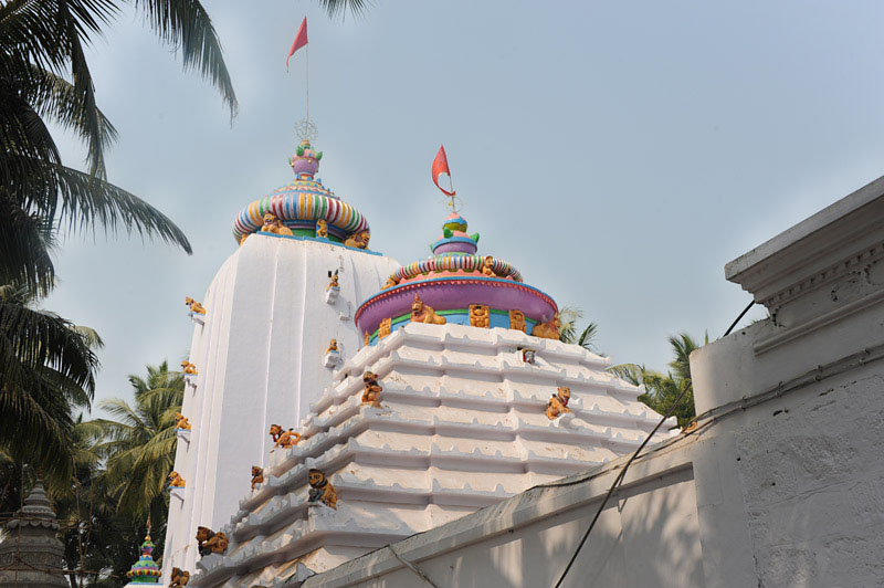
- Biraja Temple, Jajpur, Odisha, India, 13th century, Odisha1, CC BY-SA 3.0
- Front view from left side of Viraja(also named as Biraja) Temple as per list of State Protected Monuments in Odisha. Serial Number S-OR-105, Pratap555, CC BY-SA 4.0
- Jajpur, Odisha, India - panoramio (11), Deepak das, CC BY 3.0
- Rajpur, Odisha 755001, India - panoramio, Deepak das, CC BY 3.0
- Chatia bata, @jhichidu, CC BY-SA 4.0
- Dasaswamedh Ghat Jajpur - panoramio, Deepak das, CC BY 3.0
- Mudhapada, Odisha, India - panoramio, Deepak das, CC BY 3.0
- Jajpur-Bhandaripukhari Sub way connecting NH 16 - panoramio, Deepak das, CC BY 3.0
- Andola, Odisha 755007, India - panoramio (1), Deepak das, CC BY 3.0
- Kusuma garden, Saiful saikh, CC BY-SA 4.0
- Varahanath Temple, Anup525, CC BY-SA 4.0
- Jajpur-Keonagola Road - panoramio, Deepak das, CC BY 3.0
- Ankula, Odisha, India - panoramio (7), Deepak das, CC BY 3.0
- Odia Singer Kuldeep Patnaik singing on stage, Sangram Keshari Senapati, CC BY-SA 4.0
- Odia Singer Kuldeep Patnaik, Sangram Keshari Senapati, CC BY-SA 4.0
- Ratha Jatra of Maa Biraja, Jajpur in 2023 05, Parsuram Sahoo, CC BY-SA 4.0
- Ratha Jatra of Maa Biraja, Jajpur in 2023 01, Parsuram Sahoo, CC BY-SA 4.0
- Ratha Jatra of Maa Biraja, Jajpur in 2023 03, Parsuram Sahoo, CC BY-SA 4.0
- Ratha Jatra of Maa Biraja, Jajpur in 2023 02, Parsuram Sahoo, CC BY-SA 4.0
- Ratha Jatra of Maa Biraja, Jajpur in 2023 04, Parsuram Sahoo, CC BY-SA 4.0
- Ratha Jatra of Maa Biraja, Jajpur in 2023 06, Parsuram Sahoo, CC BY-SA 4.0
- Andola, Odisha 755007, India - panoramio (2), Deepak das, CC BY 3.0
- Front view from right side of Viraja(also named as Biraja) Temple as per list of State Protected Monuments in Odisha. Serial Number S-OR-105, Pratap555, CC BY-SA 4.0
- Back view of Viraja(also named as Biraja) Temple as per list of State Protected Monuments in Odisha. Serial Number S-OR-105, Pratap555, CC BY-SA 4.0
- Ankula, Odisha, India - panoramio (1), Deepak das, CC BY 3.0
- Ankula, Odisha, India - panoramio, Deepak das, CC BY 3.0
- ତ୍ରିଲୋଚନେଶ୍ଵର ମନ୍ଦିର, Anup525, CC BY-SA 4.0
- Trilochaneswar Temple, Anup525, CC BY-SA 4.0
- ତ୍ରିଲୋଚନେଶ୍ଵର ମନ୍ଦିର ମନ୍ଦିର, ଯାଜପୁର, Anup525, CC BY-SA 4.0
- Road from sinduri munha to jaipur town - panoramio, Deepak das, CC BY 3.0
- NC College Main Gate - panoramio, Deepak das, CC BY 3.0
- Sundarimuhan chowk - panoramio, Deepak das, CC BY 3.0
- NC Autonomous College Jajpur Odisha - panoramio, Deepak das, CC BY 3.0
- NC College Play Ground - panoramio, Deepak das, CC BY 3.0
- Biraja Law College Jajpur near Ankula - panoramio, Deepak das, CC BY 3.0
- Odisha State Highway 56 connecting Jajpur to Sathipur NH 16 - panoramio, Deepak das, CC BY 3.0
- Bakuli, Odisha, India - panoramio (7), Deepak das, CC BY 3.0
- Barahata, Odisha, India - panoramio, Deepak das, CC BY 3.0
- Bakuli, Odisha, India - panoramio (4), Deepak das, CC BY 3.0


Page built November 3, 2026. Spotted a mistake? Tell us or suggest a place.