

Weather in Kanīna Khās
Forecast from MET Norway (CC BY 4.0). Full forecast
About Kanīna Khās
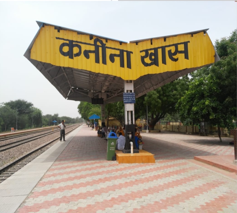
Kanina is a town and a subdivision in Mahendragarh district in the Indian state of Haryana. It is one of three administrative blocks of Mahendragarh district. It is in the Ahirwal region. It is a municipal committee of Kanina Subdivision in Mahendragarh district.
From the Wikipedia article Kanina Khas (this version), under CC BY-SA 4.0.
Healthcare9


History
Kanina is historical place which settled by Rao Kanha Ram in 13th Century. Rao Harjimal son Rao Har Sewak fought battle with Khanzadas of Mewat and defeated them. Brother of Rao Har Sewak Ghumani Ram fought famous battle of Mandan in 1770-1785 which was led by Mitra Sen Ahir . Kanina's ancient name was Kanana. Kanina Khas having very rich military tradition as many soldiers were from here, Subedar Sujjan Singh Yadav, Subedar Chajuram, Subedar Budhram, Jemadar Bharo Singh Yadav.Ganeshi lal, Gangaram, Netram, Rao Kirorimal, Bhup Singh and Ranjit Singh were soldiers of Indian National Army.
From the History section of Kanina Khas on Wikipedia, under CC BY-SA 4.0.
Map of Kanīna Khās
9 places. The map loads OpenStreetMap tiles when you open it.
Getting there and nearby towns
Indira Gandhi International Airport (DEL) is the nearest airport with scheduled flights listed in OpenStreetMap, 81 km away.
- Mahendragarh 17 km southwest, about 17 min by car
- Bhākli 19 km northeast, about 19 min by car
- Manethi 21 km south, about 21 min by car
- Charkhi Dādri 29 km north, about 29 min by car
- Rohtak 68 km northeast, about 1 h 15 min by car
- Gurugram 71 km east, about 1 h 15 min by car
- Najafgarh 72 km northeast, about 1 h 15 min by car
- Bahadurgarh 73 km northeast, about 1 h 15 min by car
- Delhi Cantonment 86 km east, about 1 h 30 min by car
- Chhatarpur 87 km east, about 1 h 30 min by car
Drive times are estimates from straight-line distance, not routes.
Local news
Headlines from INDB.
Reviews, tips and questions
Loading what members have shared...
Sources and licences
- GeoNames (CC BY 4.0): population, coordinates, regions and time zone
- OpenStreetMap contributors (ODbL 1.0): places, airports, map data
- Wikidata (CC0 1.0): elevation, founding date, time zone, website
- Wikimedia Commons (see each image): photos
- Wikipedia (CC BY-SA 4.0): overview and history text
Photo credits
- Kanina khas 2, https://nwr.indianrailways.gov.in/testnwr.jsp?DIVISION_ID=1&STATION_ID=Kiwarli, CC BY-SA 4.0
Page built November 3, 2026. Spotted a mistake? Tell us or suggest a place.