
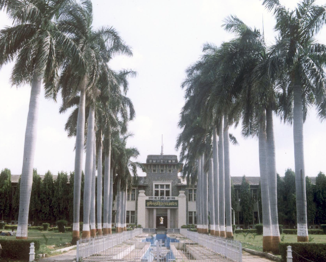


Why visit Khadki Buzurg
Townapedia lists 1 park or trail, 2 places to eat, 1 place to stay and 1 attraction in and around town.
Highlights include Dr. Panjabrao Deshmukh Krishi Vidyapeeth.
Weather in Khadki Buzurg
Forecast from MET Norway (CC BY 4.0). Full forecast
Things to do1
Dr. Panjabrao Deshmukh Krishi Vidyapeeth
School · 4.0 km
State public university in Akola, Maharashtra, India
Parks, trails and playgrounds1

Restaurants and cafes2

Anand Restaurant
Restaurant · Regional · 1.4 km
Barshitakli Rd, Kaulkhed, Akola
Mo-Su 11:30 am–10 pm
Where to stay1

Aarya Boys Hostel
Motel and hotel · 2.5 km
Bajoriya Complex, Old Hingna Road, Akola
Churches and places of worship7
Gayatri Shaktipeeth
Place of worship · Orthodox · 2.4 km
Gayatri nagar, Kaulkhed Road, Akola
Gayatri Shaktipeth
Place of worship · Orthodox · 2.4 km
Gayatri nagar, Kaulkhed Road, Akola
Hanuman Mandir
Place of worship · Orthodox · 2.3 km
Somthana, Radha Nagari,, Akola
Hanuman Mandir
Place of worship · Orthodox · 2.5 km
M2P5+GR4, Arogya Nagar, Kaulkhed Road,, Akola
Hanuman Temple
Place of worship · Orthodox · 2.3 km
Jijau Nagar, Old Hingna Road, Akola
Shopping3
G Bazar
Grocery · 1.5 km
Barshitakli Rd, near HP PETROL PUMP, Lahariya Nagar, Kaulkhed,, Akola
Gas and EV charging3
Indian Oil
Gas station · 1.7 km
Survey No 20, 2, Mangrulpir - Akola Rd, Lahariya Nagar, Kaulkhed, Akola
Schools, colleges and libraries2
Jyoti Convent , Vidhyalaya And College
School · 1.9 km
Kapil Vastu Nagar, Gorakshan Road, Behind Vijay Colony, Akola
Healthcare9
Simran Medical
Clinic and pharmacy · 1.5 km
Shop No 2, Lahariya Nagar, Kaulkhed, Akola
Sunil Thavrani Hospital
Hospital · 1.5 km
Barshitakli Rd, near HP PETROL PUMP, Lahariya Nagar, Kaulkhed,, Akola
Map of Khadki Buzurg
29 places. The map loads OpenStreetMap tiles when you open it.
Getting there and nearby towns
Akola Airport (AKD) is the nearest airport with scheduled flights listed in OpenStreetMap, 5 km away.
- Sivni 4 km northeast, about 4 min by car
- Sivar 4 km northeast, about 4 min by car
- Akola 5 km northwest, about 5 min by car
- Umbri 5 km north, about 5 min by car
- Ajani Budruk 16 km southeast, about 16 min by car
- Ajani Khurd 16 km southeast, about 16 min by car
- Nashirabad 16 km southeast, about 16 min by car
- Pātūr 25 km south, about 25 min by car
- Bālāpur 26 km west, about 26 min by car
- Amravati 81 km east, about 1 h 15 min by car
Drive times are estimates from straight-line distance, not routes.
Local news
Headlines from INDB.
Reviews, tips and questions
Loading what members have shared...
Sources and licences
- GeoNames (CC BY 4.0): population, coordinates, regions and time zone
- OpenStreetMap contributors (ODbL 1.0): places, airports, map data
- Wikidata (CC0 1.0): elevation, founding date, time zone, website, landmarks and historic places
- Wikimedia Commons (see each image): photos
Photo credits
- PDKV Akola - Agricultural University, Originally uploaded by Gkramteke (Transferred by Armbrust ), Public domain
- Sketch of IT, Vedant Bhusari, CC BY-SA 4.0
Page built November 3, 2026. Spotted a mistake? Tell us or suggest a place.