


Why visit Malkajgiri
Townapedia lists 11 museums and landmarks, 48 parks and trails, 124 places to eat, 19 places to stay and 21 attractions in and around town.
Highlights include Bhavans Vivekananda College, English and Foreign Languages University, Indira Park and Lumbini Park.
Weather in Malkajgiri
Forecast from MET Norway (CC BY 4.0). Full forecast
About Malkajgiri
Malkajgiri also known as Mallikarjuna Giri (ancient name) is a suburb of Hyderabad, Telangana, India. It is located in Medchal–Malkajgiri district and also Sub-District in Medchal District is the headquarters of Malkajgiri mandal in Malkajgiri revenue division. Erstwhile Malkajgiri Major Grampanchayat was upgraded to a municipality in 1965 and became a municipal corporation in 2007. It was merged into the Greater Hyderabad Municipal Corporation in 2007.
From the Wikipedia article Malkajgiri (this version), under CC BY-SA 4.0.
Things to do21

Bhavans Vivekananda College
School · 4.7 km
College in Telangana, India

English and Foreign Languages University
School · 2.7 km
Public Central University in Hyderabad, Telangana, India
Indian Institute of Chemical Technology
School · 3.2 km
Research institute in Hyderabad, Telangana


Osmania University
School · 4.5 km
State public university in Hyderabad, Telangana, India

9 more on the map.
Museums and landmarks11


Parks, trails and playgrounds48





The English and Foreign Languages University (EFLU)
Park · 2.7 km
Ravindra Nagar, Hyderabad
36 more on the map.
Restaurants and cafes124

Almond House
Cafe · Coffee Shop, Indian · 2.6 km
9-1-109/1B Regimental Bazaar, Shivaji Nagar, Secunderabad
Mo-Su 09:00-23:00

Baker's Den
Bakery · 2.5 km
Eat-in and take-out bakery cooking up cakes, sweets and light savoury snacks and fast food.
9-1-95/5 Sarojini Devi Road
Mo-Su 09:00-22:00

Happy Tummy Hotel
Restaurant · Indian, Chinese · 2.8 km
28-53 Malkajgiri - Neredmet Road, Secunderabad
Mo-Su 11:00-23:00
Grill 9
Restaurant · Indian · 2.1 km
Rail Nilayam Road, Secunderabad
Mo-Su 12:00-23:00
Bangalore Iyengar Bakery
Bakery · 3.4 km
Padmarao Nagar Road, Hyderabad
Mo-Su 07:00-21:00
112 more on the map.
History
Malkajgiri : Malkajgiri, Mirjalguda, Moulali, Neredmet, Yapral, Kowkoor.
After district bifurcation "or" formation Alwal Municipality became a New Mandal "Alwal mandal."
From the History section of Malkajgiri on Wikipedia, under CC BY-SA 4.0.
Where to stay19
Mahalaqa Bai Chanda Hostel
Motel and hotel · 2.7 km
Sitaphalmandi Main Road, Hyderabad
Churches and places of worship90
Basilica of Our Lady of the Assumption, Secunderabad
Church · 2.6 km
Sri Bala Anjaneya Swamy Temple
Place of worship · Vaishnavism · 2.9 km
Rambramha Nagar, Neredmet, Secunderabad
Shopping43
Bharat Military & Department Stores
Shopping center · 3.7 km
Lal Bazar, Trimulgherry, Secunderabad
Kerala Handloom and Super Store
Grocery · 3.5 km
Bank Colony All Saints Road, Secunderabad
Gas and EV charging25
Schools, colleges and libraries69
AMARAVATHI SCHOOL
School · 2.7 km
Anuradha Residency, Seethaphalmandi, Padmarao Nagar, Hyderabad, Telangana 500061
Don Bosco School, Ravindra Nagar, Sitaphalmandi
School · 2.6 km
Osmania University, Amberpet, Secunderabad, Telangana 500061
kakatiya high school
School · 3.8 km
Musheerabad,, Zamistanpur, Hyderabad, Telangana
Healthcare130
Apollo Hospitals
Hospital · 2.5 km
Pollicetty Towers, St Johns Rd, Regimental Bazaar, Shivaji Nagar, Secunderabad
Medicover Hospitals Secunderabad
Hospital · 2.4 km
9 Sarojini Devi Rd, Regimental Bazaar, Shivaji Nagar, Secunderabad
RAJUS DENTAL
Hospital · 2.4 km
25-40/63 Rajus Dental Clinic, H no 25-40/63, Opposite Andhra Bank, East anandbagh Main Road, Malkajgiri, Hyderabad, hyderabad
Map of Malkajgiri
250 places. The map loads OpenStreetMap tiles when you open it.
Getting there and nearby towns
Begumpet Airport (BPM) is the nearest airport with scheduled flights listed in OpenStreetMap, 6 km away.
- Osmania University 4 km south, about 4 min by car
- Uppal Kalan 6 km southeast, about 6 min by car
- Secunderabad 7 km north, about 7 min by car
- Bodupāl 7 km southeast, about 7 min by car
- Jawaharnagar 8 km northeast, about 8 min by car
- Hyderabad 10 km southwest, about 10 min by car
- Quthbullapur 9 km northwest, about 9 min by car
- Gaddi Annaram 9 km south, about 9 min by car
- Pīrzādagūda 9 km southeast, about 9 min by car
- Kukatpally 13 km west, about 13 min by car
Drive times are estimates from straight-line distance, not routes.
Local news
Headlines from INDB.
Reviews, tips and questions
Loading what members have shared...
Sources and licences
- GeoNames (CC BY 4.0): population, coordinates, regions and time zone
- OpenStreetMap contributors (ODbL 1.0): places, airports, map data
- Wikidata (CC0 1.0): elevation, founding date, time zone, website, landmarks and historic places
- Wikimedia Commons (see each image): photos
- Wikipedia (CC BY-SA 4.0): overview and history text
Photo credits
- Malkajgiri Skyline, Dinesh Cyanam, CC BY-SA 3.0
- Karnataka Sampark Kranthi Exp MalkajgiriRlyStn, Belur Ashok, CC BY 2.0
- Overview of a freight and Passenger trains at Malkajgiri, Adityamadhav83, CC BY-SA 3.0
- GTY based WDG-4 locos with Freight Tanker at Malkajgiri 01, Adityamadhav83, CC BY-SA 3.0
- Bhongir-Falaknuma MEMU at Malkajgiri station 01, Adityamadhav83, CC BY-SA 3.0
- Bijapur-Bolarum-HYD Passenger at Malkajgiri 06, Adityamadhav83, CC BY-SA 3.0
- WDG 3A locos of KZJ at Malkajgiri 01, Adityamadhav83, CC BY-SA 3.0
- Freight Tanker at Malkajgiri 03, Adityamadhav83, CC BY-SA 3.0
- (Visakhapatnam-Nanded) Express at Malkajgiri 03, Adityamadhav83, CC BY-SA 3.0
- Freight Tanker at Malkajgiri 02, Adityamadhav83, CC BY-SA 3.0
- GTY based WDG-4 locos with Freight Tanker at Malkajgiri 02, Adityamadhav83, CC BY-SA 3.0
- Bijapur-Bolarum-HYD Passenger at Malkajgiri 05, Adityamadhav83, CC BY-SA 3.0
- Kazipet Locc shed based WDG3A Twins spotted at Malkajgiri, Adityamadhav83, CC BY-SA 4.0
- (Kakinada-Lingampalli) Holiday Special at Malkajgiri with WDG-3A loco, Adityamadhav83, CC BY-SA 3.0
- (Visakhapatnam-Nanded) Express at Malkajgiri 01, Adityamadhav83, CC BY-SA 3.0
- Bhongir-Falaknuma MEMU at Malkajgiri station 03, Adityamadhav83, CC BY-SA 3.0
- (Manoharabad-SC) DHMU at Malkajgiri 01, Adityamadhav83, CC BY-SA 3.0
- (Visakhapatnam-Nanded) Express at Malkajgiri 02, Adityamadhav83, CC BY-SA 3.0
- WDG 3A locos of KZJ at Malkajgiri 03, Adityamadhav83, CC BY-SA 3.0
- Bhongir-Falaknuma MEMU at Malkajgiri station 02, Adityamadhav83, CC BY-SA 3.0
- Freight Tanker at Malkajgiri 01, Adityamadhav83, CC BY-SA 3.0
- Bhongir-Falaknuma MEMU at Malkajgiri station 04, Adityamadhav83, CC BY-SA 3.0
- Bijapur-Bolarum-HYD Passenger at Malkajgiri 04, Adityamadhav83, CC BY-SA 3.0
- BCNA freight train at Malkajgiri 03, Adityamadhav83, CC BY-SA 3.0
- Bijapur-Bolarum-HYD Passenger at Malkajgiri 02, Adityamadhav83, CC BY-SA 3.0
- Bijapur-Bolarum-HYD Passenger at Malkajgiri 01, Adityamadhav83, CC BY-SA 3.0
- WDG 3A locos of KZJ at Malkajgiri 02, Adityamadhav83, CC BY-SA 3.0
- BCNA freight train at Malkajgiri 02, Adityamadhav83, CC BY-SA 3.0
- Bhongir-Falaknuma MEMU Passenger at Malkajgiri, Adityamadhav83, CC BY-SA 3.0
- Bijapur-Bolarum-HYD Passenger at Malkajgiri 03, Adityamadhav83, CC BY-SA 3.0
- WDG-3A loco 13599 at Malkajgiri, Adityamadhav83, CC BY-SA 3.0
- BCNA freight train at Malkajgiri 01, Adityamadhav83, CC BY-SA 3.0
- BCNA freight train at Malkajgiri 04, Adityamadhav83, CC BY-SA 3.0
- OsmaniaUnivArtsCollege, Nbsubbaiah at English Wikipedia, Public domain
- Indira Park Hyderabad-Dr Murali Mohan Gurram (13), Dr Murali Mohan Gurram, CC BY-SA 4.0
- Lumbini Park, Hyderabad, TripodStories- AB, CC BY-SA 4.0
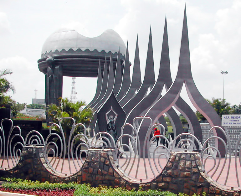
- NTR Memorial, Saikiranstuffguy, CC BY-SA 3.0
- Tabebuia aurea in Hyderabad W IMG 7091, J.M.Garg, CC BY 3.0
- CBC tower, Meher Mansion, CC BY-SA 4.0
- Stjohnschurchsecunderabad1890, Myrtleship, CC BY-SA 3.0
- Basilica of Our Lady of the Assumption, Secunderabad, Jayarathina, CC BY-SA 3.0
- Gandhimedicalcollege, Karthik akkinapalli, Public domain
- 050 The Main Shrine Hall, Anandajoti, CC BY-SA 4.0
- Jalavihar, Necklace Road , Hyderabad, Adbh266, CC BY-SA 4.0
- The English and Foreign languages university Hyderabad, adbh266, CC BY-SA 4.0
- Secunderabad Clock Tower, ప్రశాంతి, CC0


Page built November 3, 2026. Spotted a mistake? Tell us or suggest a place.