


Why visit Mangaluru
Townapedia lists 14 museums and landmarks, 32 parks and trails, 140 places to eat, 74 places to stay and 16 attractions in and around town.
Highlights include St. Aloysius University, Government First Grade College, Carstreet, Aloyseum and Srimanthi Bhai Memorial Government Museum.
Weather in Mangaluru
Forecast from MET Norway (CC BY 4.0). Full forecast
About Mangaluru
Mangaluru (Kannada: [mɐŋɡɐɭuːru]), formerly called Mangalore ( MANG-gə-lor, -LOR), is a major industrial port city in the Indian state of Karnataka and on the west coast of India. It is located between the Arabian Sea and the Western Ghats about 352 km (219 mi) west of Bengaluru, the state capital, 14 km (8+1⁄2 mi) north of the Karnataka–Kerala border and 297 km (185 mi) south of Goa. Mangaluru is the state's only city to have all four modes of transport, air, road, rail and sea. The population of the urban agglomeration was 619,664 according to the 2011 national census of India.
From the Wikipedia article Mangaluru (this version), under CC BY-SA 4.0.
Travel tips from other travellers: Mangaluru on Wikivoyage (CC BY-SA 4.0).
Things to do16

St. Aloysius University
School · 5.0 km
University in Mangalore, India

Government First Grade College, Carstreet
School · 5.5 km
College in Karnataka, India
National Institute of Technology Karnataka
School · 12.3 km
Engineering university at Surathkal, Mangalore



Yenepoya University
School · 12.0 km
Higher education institution in India


4 more on the map.
Museums and landmarks14


Srimanthi Bhai Memorial Government Museum
Museum · 3.5 km
Historic house museum in Mangaluru, Karnataka

Swami Vivekananda Planetarium
Museum · 5.7 km
3D planetarium in India

Cashew Plant - Achal Industries
Monument and historic site · 5.5 km
Largely manual production of cashew nuts. Tours offered.
206207 Industrial Area, Baikampady



2 more on the map.
Parks, trails and playgrounds32





Kavoor Lake Park
Park
Near Mahalingeshwara Temple Bajpe Main Road, Kavoor, Mangaluru

20 more on the map.
Restaurants and cafes140

Bake Studio
Cafe · Pizza, Burger, Sandwich, Cake, Pastry, Milkshake, Fresh Juice · 5.6 km
Panje Manjesh Rao Road, Mangalore
Mo-Su 09:00-22:00

Kobe Sizzlers
Restaurant · Pizza, Sizzlers, Burger, Steak House, Italian, Seafood · 4.9 km
Parin Towers,Collectors Gate Balmatta Road, Mangalore
Mo-Su 11:00-23:00
Hotel Sri Devi
Restaurant · Indian, Regional · 1.0 km
Saptagiri Complex Kavoor, Mangalore
Mo-Su 06:00-22:00
The Cafe Lounge
Cafe · 5.7 km
Includes A Party Hall
Kankanady, Valencia, Father Muller Road, Next To ICICI Bank Valencia, Upper Ground Floor, Hassan Heritage Building, Mangalore
Mo 09:00-23:00; Tu 09:00-23:00; We 09:00-23:00; Th 09:00-23:00; Fr...

The Liquid Lounge
Bar and pub · 5.3 km
WiFi & Full Bar Available
Hampankatta, Balmatta Rd, Near Don Bosco Hall, Mangalre
Mo-Su 10:00-23:30
The Sailors Bistro
Cafe · 4.5 km
Empire Mall Mahatma Gandhi Road, Mangalore
Mo-Su 10:00-21:00

PABBA'S
Ice cream · 3.9 km
Shree Krishna Prasad Building, Lalbagh, Mangaluru
Mo-Su 10:00-21:00
Shake Factory - Hangout
Cafe · 5.4 km
Hampankatta, 36, Balmatta Rd, Mangalore
Mo-Su 11:00-23:00
128 more on the map.
Where to stay74
Dr. M.V. Shetty College Hostel
Motel and hotel · 1.5 km
Kuloor Kavoor Road, Mangaluru
Churches and places of worship90
Aerebail Daivasthana
Place of worship · 6.6 km
1-83A Aerebail Road, Vamanjoor, Parari
Kordappu Sthana, Parari
Place of worship · 6.7 km
Aerebail Road, Vamanjoor, Parari
Shopping39
Silverbells Fancy & Stationery
Shop · 1.1 km
Ananth Arcade Building Airport Road, Mangalore
Gas and EV charging21
Schools, colleges and libraries89
Healthcare70
Map of Mangaluru
250 places. The map loads OpenStreetMap tiles when you open it.
Getting there and nearby towns
Mangalore International Airport (IXE) is the nearest airport with scheduled flights listed in OpenStreetMap, 5 km away.
- Mūdashedde 4 km northeast, about 4 min by car
- Kenjāru 5 km north, about 5 min by car
- Tokūru 6 km north, about 6 min by car
- Nīramārgar 7 km southeast, about 7 min by car
- Bajpe 8 km northeast, about 8 min by car
- Bondantila 8 km east, about 8 min by car
- Kolambe 8 km northeast, about 8 min by car
- Mulur 8 km east, about 8 min by car
- Udupi 48 km north, about 48 min by car
- Kanhangad 73 km south, about 1 h 15 min by car
Drive times are estimates from straight-line distance, not routes.
Local news
Headlines from INDB.
Reviews, tips and questions
Loading what members have shared...
Sources and licences
- GeoNames (CC BY 4.0): population, coordinates, regions and time zone
- OpenStreetMap contributors (ODbL 1.0): places, airports, map data
- Wikidata (CC0 1.0): elevation, founding date, time zone, website, landmarks and historic places
- Wikimedia Commons (see each image): photos
- Wikipedia (CC BY-SA 4.0): overview and history text
Photo credits
- Mangalore Skyline 0151, Premkudva, CC BY-SA 3.0
- St. Aloysius (Deemed to Be University) Administrative block, Disha Gangadhara, CC BY-SA 4.0
- NITK mangalore, Electronixid at English Wikipedia . Later version was uploaded by Kensplanet at en.wikipedia ., Public domain
- Netravathi Bridge, Roshan381, CC BY 3.0
- NMAMIT, Sathish.kabyadi, CC BY-SA 4.0
- Konkani Institute and Aloyseum, St Aloysius College campus, Mangalore, Karnataka, India (2017), Vishal nayak mcms, CC BY-SA 4.0
- Seemanthi Bai Government Museum Bejai Mangaluru - 2, BHARATHESHA ALASANDEMAJALU, CC0
- Swami Vivekananda Planetarium - Mangalore - Dome, Aviator423, CC BY-SA 4.0
- Kadripark043, Premnath Kudva, CC BY-SA 3.0
- Tagore Park in Mangalore, Aviator423, CC BY-SA 4.0
- Milagres Hampankatta, Rakshith Prasad, CC BY 3.0
- St. Aloysius Church Mangalore, Haydn Blackey, CC BY-SA 2.0
- Our Lady of Rosary of Mangalore, Peresbennet, CC BY-SA 3.0
- Front view of St. Paul's Church, Mangalore, Harshith JV, CC BY-SA 4.0
- Canara College Mangaluru 01, Pavanaja, CC BY-SA 4.0
- Father Muller Medical College, Manukrishnan80, CC BY-SA 4.0
- Fizanexus, Ullu Boy, CC BY-SA 4.0
- Clock tower Mangalore 2023, Ardo27, CC BY-SA 4.0
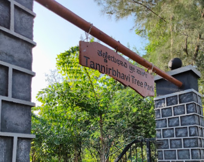
- Entrance of the Tannirbhavi Tree Park in Mangalore, Aviator423, CC BY-SA 4.0
- University College, Auditorium (Ravindra kala Bhavana), Krishna Mohan, CC BY-SA 4.0
- Gfgc carstreet, Arumobileworld, CC BY-SA 4.0
- Kori rotti(with chicken ghasi), Nishalns, CC BY-SA 4.0
- Kori sukka, Nishalns, CC BY-SA 4.0
- Bunta daiva dhoomavati, Athmi rai, CC BY-SA 4.0
- Vernara panjurli, Athmi rai, CC BY-SA 4.0
- Korathi daiva 02, Athmi rai, CC BY-SA 4.0
- Korathi daiva 01, Athmi rai, CC BY-SA 4.0
- Kuppe panjurli and sathya devathe kallurti, Athmi rai, CC BY-SA 4.0
- Panjurli o2, Athmi rai, CC BY-SA 4.0
- Daiva dhoomavati, Athmi rai, CC BY-SA 4.0
- ECHINODERMATA.MANGLORE, Dr.himshree, CC BY 4.0
- AQUATIC BIRDS, Dr.himshree, CC BY 4.0
- CLEAR WATERSOFMANGLORE, Dr.himshree, CC BY 4.0
- CRABONSAND, Dr.himshree, CC BY 4.0
- SURATHKAL, Dr.himshree, CC BY 4.0
- SUNSET2MANGLORE, Dr.himshree, CC BY 4.0
- 6MANGLOREHORIZON, Dr.himshree, CC BY 4.0
- HORIZON@BEACHMANGLORE, Dr.himshree, CC BY 4.0
- DSC 4844,KAMBALA BULL RACE, Muthutraveller, CC BY-SA 4.0
- Ornet Garden - panoramio, Glany Saldanha, CC BY 3.0
- Pilikula Regional Science Centre in Mangalore - 7, Aviator423, CC BY-SA 4.0
- Arise Awake Park - Mangalore, Aviator423, CC BY-SA 4.0


Page built November 2, 2026. Spotted a mistake? Tell us or suggest a place.