

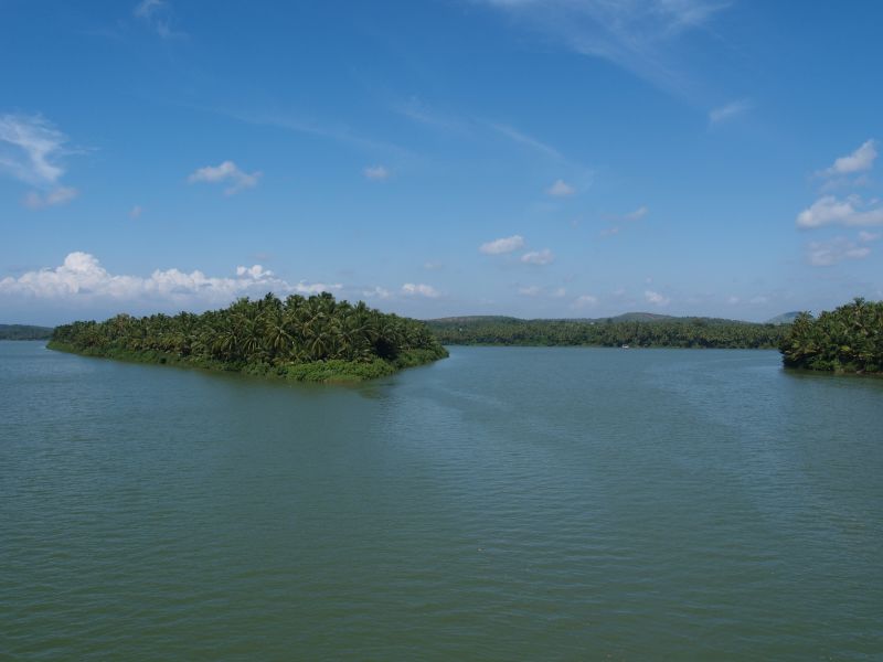


Why visit Olavanna
Townapedia lists 5 parks and trails, 14 places to eat and 1 place to stay in and around town.
Weather in Olavanna
Forecast from MET Norway (CC BY 4.0). Full forecast
Parks, trails and playgrounds5

Panchayath Stadium
Sports field and stadium · 0.8 km
palakurumba temple road, kunnathupalam



Restaurants and cafes14


2 more on the map.
Where to stay1

Churches and places of worship9

Odumbra Sri Bhagavathi Temple
Place of worship · 2.2 km
P O OLAVANNA , KOZHIKODE ( PHONE : 9072094177), Olavanna Village Panchayat
Palliyarakkal Sree Durga Bhagavati Temple
Place of worship · 2.4 km
Mankavu-Pantheerankave Road, Kozhikode
Shopping4
Gas and EV charging1
Schools, colleges and libraries51
Govenment Genapath Upper Primary School
School · 1.9 km
Mankavu-Pantheerankave Road
Grameena Vayanashala Kothanari
Library · 1.8 km
1 Mankavu-Pantheerankave Road, kothanari
Kambiliparamba Aided Mappila Upper Primary School
School · 1.3 km
CHIRAKKAL ABDHUL GAFOOR ROAD, kambiliparamba
Healthcare15
Government Homeo Dispensary
Clinic and pharmacy · 1.2 km
Panchayath office road, mathara
Map of Olavanna
100 places. The map loads OpenStreetMap tiles when you open it.
Getting there and nearby towns
Calicut International Airport (CCJ) is the nearest airport with scheduled flights listed in OpenStreetMap, 16 km away.
- Ferokh 4 km south, about 4 min by car
- Kozhikode 7 km northwest, about 7 min by car
- Beypore 6 km southwest, about 6 min by car
- Kunnamangalam 11 km northeast, about 11 min by car
- Mavoor 11 km northeast, about 11 min by car
- Kondotty 17 km southeast, about 17 min by car
- Tirūrangādi 22 km southeast, about 22 min by car
- Kōttakkal 31 km southeast, about 31 min by car
- Manjeri 33 km east, about 33 min by car
- Malappuram 34 km southeast, about 34 min by car
Drive times are estimates from straight-line distance, not routes.
Local news
Headlines from INDB.
Reviews, tips and questions
Loading what members have shared...
Sources and licences
- GeoNames (CC BY 4.0): population, coordinates, regions and time zone
- OpenStreetMap contributors (ODbL 1.0): places, airports, map data
- Wikidata (CC0 1.0): elevation, founding date, time zone, website
- Wikimedia Commons (see each image): photos
Photo credits
- Chaliyar Bypass Bridge Calicut (241659100), Dhruvaraj S from India, CC BY 2.0
- Chaliar River Kerala (226716051), Dhruvaraj S from India, CC BY 2.0
- Backwater (226716361), Dhruvaraj S from India, CC BY 2.0
- Images from malabar botanical garden Kozhikode IMG20260710170419, SijiR, CC BY-SA 4.0
- Ipomoea Cheruvannur Kozhikkode, Kishorekumar Botany, CC BY-SA 4.0
- Malabar Botanical Garden 03, Athulvis, CC BY-SA 4.0
- Malabar Botanical Garden 04, Athulvis, CC BY-SA 4.0
- Malabar Botanical Garden 01, Athulvis, CC BY-SA 4.0
- Malabar Botanical Garden 05, Athulvis, CC BY-SA 4.0
- Malabar Botanical Garden 06, Athulvis, CC BY-SA 4.0
- Malabar Botanical Garden 08, Athulvis, CC BY-SA 4.0
- Malabar Botanical Garden 07, Athulvis, CC BY-SA 4.0
- Malabar Botanical Garden 09, Athulvis, CC BY-SA 4.0
- Malabar Botanical Garden 02, Athulvis, CC BY-SA 4.0


Page built November 3, 2026. Spotted a mistake? Tell us or suggest a place.