


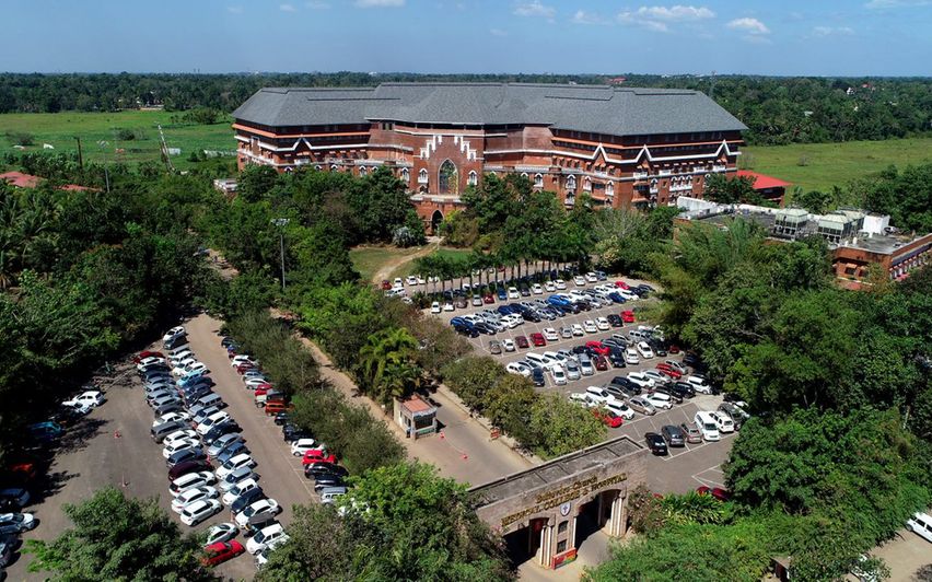


Why visit Paippad
Townapedia lists 3 museums and landmarks, 3 parks and trails, 20 places to eat, 7 places to stay and 2 attractions in and around town.
Highlights include aquactic world.
Weather in Paippad
Forecast from MET Norway (CC BY 4.0). Full forecast
Things to do2

aquactic world
Zoo and aquarium · 2.1 km
madatheruvi, Changanacherry
Mo-Fr 08:00-18:00
Museums and landmarks3

st sebastian,s church shrine
Monument and historic site · Roman Catholic · 2.3 km
Parks, trails and playgrounds3


Restaurants and cafes20



8 more on the map.
Where to stay7
Churches and places of worship27
Mar Gregorios Orthodox Church
Church · Orthodox · 2.3 km
Thiruvalla - Mallappally Road, thiruvalla
St Sebastian's church,Chanjody
Church · Roman Catholic · 2.5 km
Cnanjody, changanacherry
Chumathra Masjid
Place of worship · 2.4 km
ChumathrMasjid-Kizhakken Muthoor Road, CH59+XP Thiryvalla,kerala
Chumathra Siva Temple
Place of worship · 2.0 km
Muthoor-Chumathra-Kizhakken Muthoor-Traco Cable Factory Road, CH6C+MX Perumthuruthy,Kerala
Chumathra SNDP
Place of worship · 2.3 km
Muthoor-Chumathra-Believers Church Hospital-Kizhakken Muthoor-Traco Cable Factory Road
Shopping15
Aiswarya Beverages Co Thiruvalla
Shopping center · 2.2 km
ChumathrMasjid-Kizhakken Muthoor Road, CH5F+67 Thiruvalla,kerala
Laverne Day Fresh Vegetables
Grocery · 0.9 km
Chumathra-Believers Church Hospital-Bethelpadi Road, CH9H+4Q Kuttapuzha,kerala
Gas and EV charging1
Schools, colleges and libraries24
MST Public School And Junior College
School · Sunni · 0.6 km
Changanacherry Kaviyoor Road, paippad
Govt. Higher Secondary School, Podipara
School · 0.9 km
Changanacherry Kaviyoor Road, Kochupalli
st sebastian church ground
School · Roman Catholic · 2.4 km
chanjody, changanacherry
Government New Model L P School Aanjilithanam
School · 1.6 km
Changanacherry Kaviyoor Road, Kunnamthanam
Government Upper Primary School Chumthra
School · 1.9 km
Muthoor-Chumathra-Believers Church Hospital-Kizhakken Muthoor-Traco Cable Factory Road
Sacred Heart Public School Kilimala
School · 1.9 km
thengana naalukodi, Changanacherry
Healthcare8
Goverment Ayurveda Hospital, Paipad
Hospital · 1.2 km
Thiruvalla - Mallappally Road
Map of Paippad
110 places. The map loads OpenStreetMap tiles when you open it.
Getting there and nearby towns
Cochin International Airport (COK) is the nearest airport with scheduled flights listed in OpenStreetMap, 84 km away.
- Tiruvalla 5 km south, about 5 min by car
- Changanācheri 6 km west, about 6 min by car
- Chengannūr 13 km south, about 13 min by car
- Kottayam 19 km north, about 19 min by car
- Haripād 21 km southwest, about 21 min by car
- Aymanam 22 km northwest, about 22 min by car
- Pathanāmthitta 28 km southeast, about 28 min by car
- Kattanam 28 km south, about 28 min by car
- Alappuzha 29 km west, about 29 min by car
- Kayamkulam 29 km south, about 29 min by car
Drive times are estimates from straight-line distance, not routes.
Local news
Headlines from INDB.
Reviews, tips and questions
Loading what members have shared...
Sources and licences
- GeoNames (CC BY 4.0): population, coordinates, regions and time zone
- OpenStreetMap contributors (ODbL 1.0): places, airports, map data
- Wikidata (CC0 1.0): elevation, founding date, time zone, website, landmarks and historic places
- Wikimedia Commons (see each image): photos
Photo credits
- 33008-GHSSPaippad-gate31, 1978abilashkalathil, CC BY-SA 4.0
- St. John's Cathedral, Tiruvalla, Pradeep Thomas, CC BY 3.0
- Believers-Church-Medical-Center-Hospital, Gospel for Asia, CC BY-SA 4.0
- BCMCH, Kannureditor, CC BY-SA 4.0
- 33355-NMLPS-Pamala-school1, 1978abilashkalathil, CC BY-SA 4.0
- 33016 Govt. HSS Thrikodithanam 07, Anoopgnm, CC BY-SA 4.0
- 33016 Govt. HSS Thrikodithanam 09, Anoopgnm, CC BY-SA 4.0
- 33016 Govt. HSS Thrikodithanam 08, Anoopgnm, CC BY-SA 4.0
- 33016 Govt. HSS Thrikodithanam 15, Anoopgnm, CC BY-SA 4.0
- 33016-GHSS-Thrikkodithanam-Gate11, 1978abilashkalathil, CC BY-SA 4.0
- 33357-GLPS-Perunna-Gate1, 1978abilashkalathil, CC BY-SA 4.0
- 33016 Govt. HSS Thrikodithanam 11, Anoopgnm, CC BY-SA 4.0
- 33016 Govt. HSS Thrikodithanam 14, Anoopgnm, CC BY-SA 4.0
- 33016 Govt. HSS Thrikodithanam 13, Anoopgnm, CC BY-SA 4.0
- 33016 Govt. HSS Thrikodithanam 12, Anoopgnm, CC BY-SA 4.0
- 33016 Govt. HSS Thrikodithanam 06, Anoopgnm, CC BY-SA 4.0
- 33016 Govt. HSS Thrikodithanam 10, Anoopgnm, CC BY-SA 4.0
- 33016 Govt. HSS Thrikodithanam 03, Anoopgnm, CC BY-SA 4.0
- 33016 Govt. HSS Thrikodithanam 05, Anoopgnm, CC BY-SA 4.0
- 33016 Govt. HSS Thrikodithanam 04, Anoopgnm, CC BY-SA 4.0
- 33016 Govt. HSS Thrikodithanam 02, Anoopgnm, CC BY-SA 4.0
- 33016 Govt. HSS Thrikodithanam 01, Anoopgnm, CC BY-SA 4.0


Page built November 3, 2026. Spotted a mistake? Tell us or suggest a place.