


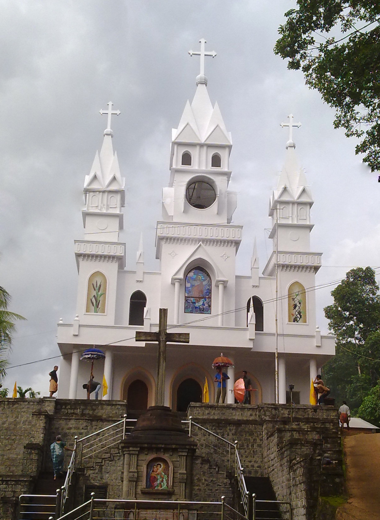


Why visit Pathanāmthitta
Townapedia lists 4 museums and landmarks, 9 parks and trails, 57 places to eat, 19 places to stay and 12 attractions in and around town.
Highlights include Kaipattoor Bridge and Sree Buddha College of Engineering, Elavumthitta.
Weather in Pathanāmthitta
Forecast from MET Norway (CC BY 4.0). Full forecast
About Pathanāmthitta
Pathanamthitta (IPA: [pɐt̪ːɐnɐn̪d̪iʈːɐ]), is a Municipal Town in southern Kerala, India, spread over an area of 23.5 km2 (9.1 sq mi). It is the administrative capital of Pathanamthitta district. The town has a population of 37,538 (as of 2011 census). The Hindu pilgrim centre Sabarimala is situated in the Pathanamthitta district; as the main transport hub to Sabarimala, the town is known as the 'Pilgrim Capital of Kerala'.
From the Wikipedia article Pathanamthitta (this version), under CC BY-SA 4.0.
Things to do12

Sree Buddha College of Engineering, Elavumthitta
School · 7.5 km
Engineering college in Kollam, India

Dhanya Remya Theatre
Cinema and theater · 0.6 km
Pathanamthitta Ring Road, pathanamthitta
Mo-Su 09:00-22:00

adithya store
Farm and orchard · 3.1 km
Adoor - Vandiperiyar Highway, pathanamthitta
sunrise-sunset

Museums and landmarks4

Parks, trails and playgrounds9

Rajiv Gandhi Indoor Stadium
Sports field and stadium · 4.2 km
kaipattor-konni road

TVR Pay&Park
Park · 0.9 km
TVR Pay&Park muthoot hospital road, aban jn, Kerala 689645, Pathanamthitta


Restaurants and cafes57

Musaliar College Canteen
Restaurant · Indian, Ice Cream, Chicken · 4.2 km
Musaliar College po malayalapuzha , pathanamthitta Kumpazha - Malayalappuzha, pathanamthitta
Mo-Su 09:00-21:00
Fil Fil Family Restaurant
Restaurant · Regional · 0.7 km
Fil Fil Family Restaurant NH 183A, Pathanamthitta, Pathanamthitta
Mo-Su 08:00-22:00
New Evergreen Continental
Restaurant · Regional
Evergreen Continental, Pathanamthitta
24/7
Thanima Hotel and Restaurant
Restaurant · Regional · 0.7 km
Thanima Hotel and Restaurant Near Bus Stand, Silver Tower, Aban Junction Ring Road, Azhoor, Pathanamthitta
Mo-Sa 08:00-20:00
Tharangam Restaurant
Restaurant · Regional · 0.6 km
THARANGAM RESTAURANT Thiruvalla - Kumbazha road, pathanamthitta
Mo-Fr 09:00-17:00
Aanandha Bawan Vegetarian Restaurant
Restaurant · 0.6 km
Aanandha Bawan Vegetarian Restaurant Pathanamthitta Ring Road, pathanamthitta
Mo-Su 09:00-21:00

Charivukalayil Bakery
Bakery
Charivukalayil Bakery, Pathanamthitta
Mo-Fr 09:00-18:00
Kudumbhasree Hotel
Restaurant
Kudumbhasree Hotel, Pathanamthitta
Mo-Sa 08:00-18:00
Aryaas omalloor
Restaurant · Indian · 3.8 km
Adoor - Vandiperiyar Highway, pathanamthitta
CLOUD CITY RESTAURANT
Restaurant · Burger, Regional, Pizza, Chicken, Coffee Shop, Indian
Pathanamthitta Ring Road, Pathanamthitta
45 more on the map.
History
The regions that form the town were formerly under the rule of Pandalam, which had connections with the Pandya kingdom. It is believed that Hindu God Lord Ayyappa was the King of this region. When Pandalam was added to the princely state of Travancore in 1820, the region came under Travancore administration.
Pathanamthitta district, along with most parts of Alappuzha district, was part of the Quilon district of the Travancore Kingdom until the formation of Pathanamthitta district in 1982.
Modern day Pathanamthitta District, the thirteenth revenue district of the State of Kerala was formed with effect from 1 November 1982, with headquarters at Pathanamthitta.
From the History section of Pathanamthitta on Wikipedia, under CC BY-SA 4.0.
Where to stay19
Hotel Hills Park
Motel and hotel · 2.2 km
Hotel Hills Park Thiruvalla - Kumbazha road, Pathanamthitta
Shanthi Hotel & Lodge
Motel and hotel
Shanthi Hotel & Lodge Bulding No: 473, Thiruvalla-Kumbazha Hwy, Central Junction, Pathanamthitta, Pathanamthitta
Shanti Hotel,Pathanamthitta
Motel and hotel
Shanti Hotel,Pathanamthitta Pathanamthitta-Kadamanitta Road, Pathanamthitta
Churches and places of worship108
Chakkulatha Kava Devi Temple
Place of worship · 3.7 km
omalloor Adoor Road, Pathanamthitta
manjinikkara mahadevar temple
Place of worship · 4.4 km
Omallur-Elavumthitta Road, pathanamthitta
Pathanamthitta Marthoma Church
Church · Catholic
Pathanamthitta Marthoma Church, Pathanamthitta
Sacred Heart Malankara Catholic Church Mylapra
Church · Catholic · 2.3 km
Mylapra,Pallipadi, Pathanamthitta
St Stephen's Orthodox Cathedral, Pathanamthitta
Church · Orthodox · 0.7 km
Adoor - Vandiperiyar Highway, Pathanamthitta
Shopping28
papaya arts and decor
Shop · 2.6 km
puthenpeedika,near auto stand Adoor - Vandiperiyar Highway, pathanamthitta
Samatha Supermarket Pathanamthitta
Grocery
Samatha Supermarket Pathanamthitta, Pathanamthitta
SHOP N SAVE SUPERMARKET
Grocery · 3.7 km
Adoor - Vandiperiyar Highway, Pathanamthitta
Chinese Super Market
Grocery
Chinese Super Market Pathanamthitta Ring Road, Pathanamthitta
Margin. Free Super Market,Managed byMariyam Traders
Grocery
Margin. Free Super Market,Managed byMariyam Traders, Pathanamthitta
Gas and EV charging9
Priyanka fuels
Gas station · 1.6 km
pathanamthitta_kumbazha road, kulashekharapathy
Schools, colleges and libraries63
Mar Philoxenos Private Industrial Training Institute, Mylapra
School · 2.9 km
Kumbazha - Malayalappuzha, Pathanamthitta
Mount Bethany E Higher Secondary School, Mylapra
School · 2.3 km
Main Eastern Highway, Mylapra
Aryabharathi High School Omalloor
School · 4.3 km
Omallur-Parakunnu Road, Omalloor
Athurasram Central School
School · 2.2 km
Adoor - Vandiperiyar Highway, pathanamthitta
Chenneerkara Grama Panchayat Samskarika Nilayam
Library · 3.4 km
Elanthoor- Santhosh Junction Road, Muttukudukka
CSM Lower Primary School Omalloor
School · 4.5 km
Omalloor-Kulanada Road, pathanamthitta
Healthcare26
Government Hospital, Pathanamthitta
Hospital
Thiruvalla - Kumbazha road, Pathanamthitta
Government Ayurveda Hospital, Omalloor
Hospital · 2.7 km
Adoor - Vandiperiyar Highway, Omalloor
Public Health Centre,Omalloor
Hospital · 4.1 km
Omallur-Elavumthitta Road, pathanamthitta
Rishi Ayurveda Hospital & Research Centre
Hospital
Rishi Ayurveda Hospital & Research Centre Pathanamthitta-Kadamanitta Road, Pathanamthitta
St Luke's Hospital
Hospital · 0.6 km
St Luke's Hospital Ring Road, Pathanamthitta
Vedagram Ayurveda Hospital
Hospital · 4.4 km
Adoor - Vandiperiyar Highway, Omalloor
Map of Pathanāmthitta
250 places. The map loads OpenStreetMap tiles when you open it.
Getting there and nearby towns
Thiruvananthapuram International Airport (TRV) is the nearest airport with scheduled flights listed in OpenStreetMap, 89 km away.
- Tiruvalla 26 km northwest, about 26 min by car
- Punalūr 31 km southeast, about 31 min by car
- Haripād 36 km west, about 36 min by car
- Kollam 48 km southwest, about 48 min by car
- Alappuzha 56 km northwest, about 56 min by car
- Varkala 60 km south, about 1 h by car
- Vettūr 61 km south, about 1 h by car
- Vaikam 68 km northwest, about 1 h 15 min by car
- Vayalār 69 km northwest, about 1 h 15 min by car
- Piravam 74 km northwest, about 1 h 15 min by car
Drive times are estimates from straight-line distance, not routes.
Local news
Headlines from INDB.
Reviews, tips and questions
Loading what members have shared...
Sources and licences
- GeoNames (CC BY 4.0): population, coordinates, regions and time zone
- OpenStreetMap contributors (ODbL 1.0): places, airports, map data
- Wikidata (CC0 1.0): elevation, founding date, time zone, website, landmarks and historic places
- Wikimedia Commons (see each image): photos
- Wikipedia (CC BY-SA 4.0): overview and history text
Photo credits
- RingRoad Pathanamthitta City Main Eastern Highway, Sujithnairv ( talk ), CC BY 3.0
- Kadammanittapally, Kadammanittapally, CC BY-SA 3.0
- Manjanikara Dayara, Eldhorajan92, CC BY-SA 4.0
- Sacred Heart church in Mylapra, Feby Varghese, CC BY 3.0
- Chandanappally Valiyapally, cyril jacob, CC BY-SA 4.0
- Crowd Aswathy, Rahuldharmaraj, Public domain
- Catholicate College, Salvador solutions, CC BY-SA 4.0
- Thrikkovil 1, gnlogic ( talk ), CC BY-SA 3.0
- Catholicate College Pathanamthitta, Dr. Chinchu C., CC BY-SA 3.0
- Divya S. Iyer, District Collector of Pathanamthitta, Alok Singh Oberoi, CC BY-SA 3.0
- Dr. Divya S. Iyer IAS - incumbent Pathanamthitta district magistrate, Alok Singh Oberoi, CC BY-SA 3.0
- Chuttippara hill street view 2, Vis M, CC BY-SA 4.0
- Pathanamthitta KSRTC Bus Station 2025, Gannu03, CC BY-SA 4.0
- Pathanamthitta KSRTC Bus Station 2025 4, Gannu03, CC BY-SA 4.0
- Pathanamthitta KSRTC Bus Station 2025 3, Gannu03, CC BY-SA 4.0
- Pathanamthitta KSRTC Bus Station 2025 2, Gannu03, CC BY-SA 4.0
- Pathanamthitta, Dr. Chinchu C., CC BY 4.0
- Buses at Pathanamthitta private bus stand 2, Vis M, CC BY-SA 4.0
- Pathanamthitta private bus stand, Vis M, CC BY-SA 4.0
- Pathanamthitta private bus stand 02, Vis M, CC BY-SA 4.0
- Chuttippara - distant view, Vis M, CC BY-SA 4.0
- Chuttippara, Vis M, CC BY-SA 4.0
- Chuttippara view from Pathanamthitta municipal bus stand, Vis M, CC BY-SA 4.0
- Pathanamthitta private bus stand panorama, Vis M, CC BY-SA 4.0
- Buses at Pathanamthitta private bus stand, Vis M, CC BY-SA 4.0
- Pathanamthitta Town, Benny Ajantha, CC BY-SA 4.0
- Churulicode, Dr. Chinchu C., CC BY-SA 3.0
- River achankovil,pattanamthitta,kerala - panoramio, rajaraman sundaram, CC BY 3.0
- Pelopidas conjuncta narooa - Sahyadri Conjoined swift 03, Adithyan A Saj, CC0
- Pelopidas conjuncta narooa - Sahyadri Conjoined swift 01, Adithyan A Saj, CC0
- Pelopidas conjuncta narooa - Sahyadri Conjoined swift 02, Adithyan A Saj, CC0
- ISS022-E-24313 - View of Earth, Earth Science and Remote Sensing Unit , Lyndon B. Johnson Space Center, Public domain
- ISS034-E-7146 - View of Earth, Earth Science and Remote Sensing Unit , Lyndon B. Johnson Space Center, Public domain
- ISS022-E-24312 - View of Earth, Earth Science and Remote Sensing Unit , Lyndon B. Johnson Space Center, Public domain
- Road 05, Arun Raj1998, CC BY-SA 4.0
- Beautirose, Arun Raj1998, CC BY-SA 4.0
- 38602-GovtLPS-Cheekanal-Gate1, 1978abilashkalathil, CC BY-SA 4.0
- Cactusammachy super, Arkhaminsanity, CC BY-SA 3.0
- National U.P.S Vazhamuttom (41706), Dr. Chinchu C., CC BY-SA 3.0
- National U.P.S Vazhamuttom, Dr. Chinchu C., CC BY-SA 3.0


Page built November 3, 2026. Spotted a mistake? Tell us or suggest a place.