


Panjim, India
Panjim is a regional capital of 70,991 people in Goa, India, founded in 1843.
Why visit Panjim
Townapedia lists 25 museums and landmarks, 29 parks and trails, 247 places to eat, 97 places to stay and 17 attractions in and around town.
Highlights include Atal Setu, Goa, Goa University, Reis Magos Fort and Sunaparanta, Goa Centre for the Arts.
Weather in Panjim
Forecast from MET Norway (CC BY 4.0). Full forecast
About Panjim
Panaji (formerly Nova Goa; ; Goan Konkani: Ponnjem, IPA: [pɵɳd͡ʑɛ̃] ; Portuguese: Pangim), also known as Panjim, is the capital of the Indian state of Goa and the headquarters of the North Goa district. It was previously the territorial capital of the former Portuguese India (Estado da Índia). It lies on the banks of the Mandovi river estuary in the Tiswadi sub-district (taluka). With a population of 114,759 in the metropolitan area, Panaji is Goa's largest urban agglomeration, ahead of Margão and Mormugão.
From the Wikipedia article Panaji (this version), under CC BY-SA 4.0.
Travel tips from other travellers: Panjim on Wikivoyage (CC BY-SA 4.0).
Things to do17

Goa University
School · 4.2 km
State public university in North Goa, Goa, India

Government Polytechnic, Panaji
School · 1.2 km
Polytechnic college in Goa, India




5 more on the map.
Museums and landmarks25


Museum of Goa
Museum · 4.7 km
Privately owned contemporary art gallery

1901 Goa Ferry Disaster Memorial
Monument and historic site · 0.6 km
Memorial to the 81 victims of the ferry 'Goa' which capsized on on December 3, 1901. Dedicated by the Goan community of Aden.



Reis Magos Fort Entry / Reception
Monument and historic site · 1.8 km
The entry and reception for reis magos fort.
13 more on the map.
Parks, trails and playgrounds29


Mermaid Garden
Park · 0.7 km
A public park and heritage site located in Goa, India

Francisco Luis Gomes Garden
Park · 0.7 km
City park with bandstands, statue and markers of trees.
Dayanand Bandodkar Marg, Panaji
24/7

Mandovi Riverfront Promenade,Miramar
Hiking and trails · 1.9 km
Promenade spanning panjim side of Mandovi river, from Mariott (West end) to Kala Academy (East end)
Can access via Youth Hostel or Miramar Beach east end
24/7

Bhagwan Mahavir Children Park
Park · 0.8 km
Children's park maintained by Forest Department.
Dayanand Bandodkar Marg, Panaji
Inspectorate of Factories and Boilers, Institute of Safety, Occupational Health and Environment
Park · 0.9 km
17 more on the map.
Restaurants and cafes247

Cream Choc
Cafe · Coffee Shop, Pizza, Burger, Ice Cream · 2.0 km
Ground floor, Chanson Apartment Dayanand Bandodkar Marg, Panjim, Goa
Mo-Su 10:00-23:00

Edu's
Restaurant · Pizza, Goan, Chinese, North Indian, Italian, Continental, Dessert · 1.9 km
Edu’s in Miramar, Panaji, is a cozy restaurant known for its pizzas, pastas, and multi-cuisine menu. Popular since the 2000s, it’s loved...
Wasab Building Nalanda Colony Main Road, Goa
Tu-Su 12:00-22:00
Riverfront / Down the Road
Restaurant · 0.8 km
Live Performances Monday-Wednesday, Karaoke Thursday; Authentic food - Goan, Baguettes, Italian, Continental etc; Beers and Cocktails;...
Mo-Su 10:00-03:00
235 more on the map.
History
Panaji was made the first neighbourhood of "Nova Goa" (New Goa) capital of Portuguese India, after a devastating epidemic decimated the population of the Cidade de Goa (Old Goa) in the mid-18th century.
Panaji was annexed by India with the rest of Goa and the former Portuguese territories after the Indian annexation of Portuguese India in 1961. It became a state-capital on Goa's elevation to statehood in 1987 and between 1961 and 1987 it was the capital of the Union Territory of Goa, Daman and Diu. A new Legislative Assembly complex was inaugurated in March 2000, across the Mandovi River, now full of casinos, in Alto Porvorim. Panaji is also the administrative headquarters of North Goa district.
From the History section of Panaji on Wikipedia, under CC BY-SA 4.0.
Where to stay97
Candolim Area Luxury 6BR Luxury Villa Cloud with private pool
Motel and hotel · 2.6 km
Churches and places of worship43
Shopping42
Gas and EV charging4
Schools, colleges and libraries31
Healthcare61
Vedayurved Bhavan
Clinic and pharmacy · 2.7 km
A3 Hilltop Apts SH-66 Highway,Near Gauri Petrol Pump, porvorim,Goa
Map of Panjim
250 places. The map loads OpenStreetMap tiles when you open it.
Getting there and nearby towns
Goa International Airport (GOI) is the nearest airport with scheduled flights listed in OpenStreetMap, 13 km away.
- Reis Magos 2 km northwest, about 2 min by car
- Taleigao 3 km south, about 3 min by car
- Penha de França 3 km north, about 3 min by car
- Murda 3 km southeast, about 3 min by car
- Serula 6 km north, about 6 min by car
- Solim 15 km northwest, about 15 min by car
- Raia 26 km southeast, about 26 min by car
- Sāvantvādi 45 km north, about 45 min by car
- Canacona 61 km southeast, about 1 h by car
- Belagavi 83 km northeast, about 1 h 30 min by car
Drive times are estimates from straight-line distance, not routes.
Local news
Headlines from INDB.
Reviews, tips and questions
Loading what members have shared...
Sources and licences
- GeoNames (CC BY 4.0): population, coordinates, regions and time zone
- OpenStreetMap contributors (ODbL 1.0): places, airports, map data
- Openverse (see each image): photos
- Wikidata (CC0 1.0): elevation, founding date, time zone, website, landmarks and historic places
- Wikimedia Commons (see each image): photos
- Wikipedia (CC BY-SA 4.0): overview and history text
Photo credits
- Atal Setu Goa, Sahil200034 at English Wikipedia, CC BY-SA 4.0
- Goa University library, Goa, India, Fredericknoronha, CC BY-SA 3.0
- Ribandar causeway, Soham Banerjee from Bangalore, india, CC BY 2.0
- Sunaparanta, Goa Centre for the Arts 09, Fredericknoronha, CC BY-SA 3.0
- Entrance to Goa State Museum, AaronC's Photos, CC BY-SA 2.0
- Museum of Goa (MOG) vrvbgoa2k24 (42), Vinayaraj, CC BY-SA 4.0
- Mermaid Statue, Mermaid Garden, Panaji, SerChevalerie, CC BY-SA 3.0
- St. Jerome Chapel, Chorão, Francome, CC BY-SA 4.0
- St-Anne-church-talaulim, Naizal Dias, CC BY-SA 3.0
- Our Lady of Grace Church (Nossa Senhora de Graça), Chorão Island, Francome, CC BY-SA 4.0
- St Bartholomew's Church (Chorão Island), Francome, CC BY-SA 4.0
- Panaji, nostra signora dell'immacolata concezione, esterno 04, Sailko, CC BY 3.0
- Entrance to Goa Science Center, Aaron C, CC BY-SA 2.0
- Reis Magos Fort - View from Mandovi River, Rajib Ghosh, CC BY-SA 4.0
- State Central Library Goa (now, the Krishnadas Shama Central Library) at Panjim, Goa, India 01, Fredericknoronha, CC BY-SA 3.0
- St. Sebastian's Chapel, Panaji, iMahesh, CC BY-SA 4.0
- Church of the Immaculate Conception, Panjim Goa, Josephdesousa, CC BY-SA 3.0
- Miramar 24022016, Nikhilb239, CC BY 3.0
- Water sports composite, Synchronized_swimming_-_Russian_team.jpg : Jesus de Blas Reverse_5391.JPG : Me KingdomGames07_02.jpg : by Knurftendans Whitewater_kayaking_Isere.jpg : by Merops 22:43, 27 December 2005 (UTC)) (1991..., CC BY-SA 3.0
- Mandovi Bridge, Donkey335, CC BY-SA 3.0
- Bambolim beach, Goa vrvbgoa2k24 (12), Vinayaraj, CC BY-SA 4.0
- Bust of Luis de Menezes Braganza at Institute Menezes Braganza, SerChevalerie, CC0
- Light House Behind Kala Academy 1-17-2008 11-59-13 AM, Amol.Gaitonde, CC BY-SA 3.0
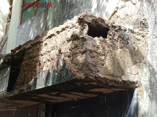
- Cine National, joegoauk73, CC BY-SA 2.0


Page built November 3, 2026. Spotted a mistake? Tell us or suggest a place.