


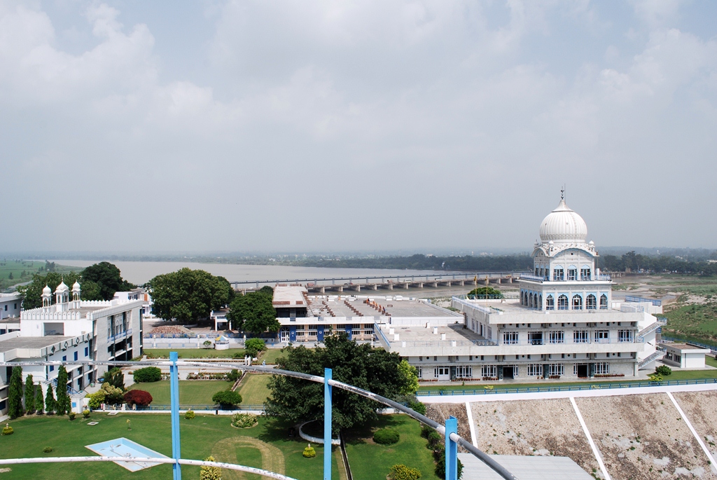
Why visit Ropar
Townapedia lists 2 museums and landmarks and 2 places to eat in and around town.
Highlights include Rupnagar.
Weather in Ropar
Forecast from MET Norway (CC BY 4.0). Full forecast
About Ropar
Rupnagar (; formerly known as Ropar or Rupar) is a city and a municipal council in Rupnagar district in the Indian state of Punjab. Rupnagar is a newly created fifth Divisional Headquarters of Punjab comprising Rupnagar, Mohali, and its adjoining districts. It is also one of the bigger sites belonging to the Indus Valley civilization. Rupnagar is nearly 47 km (29 mi) to the northwest of Chandigarh (the nearest airport and the capital of Punjab) and nearly 36 kilometres (22 mi) from Baddi- Barotiwala- Nalagarh (BBN) industrial corridor in Solan district of Himachal Pradesh.
From the Wikipedia article Rupnagar (this version), under CC BY-SA 4.0.
Travel tips from other travellers: Ropar on Wikivoyage (CC BY-SA 4.0).
Museums and landmarks2



Restaurants and cafes2


Churches and places of worship1

Shopping1

Gas and EV charging1
Schools, colleges and libraries1
Healthcare12
Map of Ropar
20 places. The map loads OpenStreetMap tiles when you open it.
Getting there and nearby towns
Chandigarh International Airport (IXC) is the nearest airport with scheduled flights listed in OpenStreetMap, 41 km away.
- Chandigarh 36 km southeast, about 36 min by car
- Mohali 37 km southeast, about 37 min by car
- Mani Mājra 41 km southeast, about 41 min by car
- Panchkula 43 km southeast, about 43 min by car
- Shimla 63 km east, about 1 h by car
- Ludhiana 65 km west, about 1 h by car
- Patiāla 72 km south, about 1 h 15 min by car
- Phagwāra 77 km west, about 1 h 15 min by car
- Māler Kotla 79 km southwest, about 1 h 15 min by car
- Naraingarh 79 km southeast, about 1 h 15 min by car
Drive times are estimates from straight-line distance, not routes.
Local news
Headlines from INDB.
Reviews, tips and questions
Loading what members have shared...
Sources and licences
- GeoNames (CC BY 4.0): population, coordinates, regions and time zone
- OpenStreetMap contributors (ODbL 1.0): places, airports, map data
- Wikidata (CC0 1.0): elevation, founding date, time zone, website
- Wikimedia Commons (see each image): photos
- Wikipedia (CC BY-SA 4.0): overview and history text
Photo credits
- IIT Ropar - Main Building of the Transit Campus, Kunal Sachdeva, CC BY-SA 3.0
- Rupnagar city, Punjab, India, Harvinder Chandigarh, CC BY-SA 4.0
- Satluj S058, Sanyam Bahga, CC BY-SA 3.0
Page built November 3, 2026. Spotted a mistake? Tell us or suggest a place.