


Indianola, Washington
Indianola is a community of 3,468 people in Kitsap County, Washington.
Why visit Indianola
Townapedia lists 2 museums and landmarks and 8 parks and trails in and around town.
Highlights include Agate Pass Bridge, Old Man House, Bloedel Reserve and Fay Bainbridge Park.
Weather in Indianola
Forecast from the National Weather Service. Full forecast
About Indianola
Indianola (Lushootseed: dəxʷsisaaʔ lit. "dizzy") is a census-designated place (CDP) in Kitsap County, Washington, United States, located on the north shore of Port Madison on the Port Madison Indian Reservation, home of the Suquamish Indian Tribe. The population was 3,664 at the 2020 census. It was originally established as a summer community and was a stop for Mosquito Fleet ferries until the 1950s.
From the Wikipedia article Indianola, Washington (this version), under CC BY-SA 4.0.
Museums and landmarks2

Agate Pass Bridge
Bridge · National Register of Historic Places · 3.9 mi
Structural steel truss cantilever bridge spanning Agate Pass, Washington state

Old Man House
Monument and historic site · National Register of Historic Places · 3.1 mi
Building in Washington, United States of America
Parks, trails and playgrounds8

Bloedel Reserve
Park · 3.7 mi
Public garden and forest preserve in Bainbridge Island, Washington State, USA


Fay Bainbridge Park
Park · 3.7 mi
Park in Washington, United States of America



Schools, colleges and libraries14

Halilts Elementary School
School · 5.4 mi
12781 Madison Ave Ne, Bainbridge Island
North Kitsap Online Academy & Parent Assisted Learning
School · 2.8 mi
25800 Siyaya Ave Ne, Kingston
2 more on the map.
History
Indianola was formed on the portion of the Port Madison Indian Reservation which had been allotted to KaKue aka "Beedee" in 1886. KaKue died in December 1886 leaving no will, and his wife Tu Tue Tue was sole heir. Tu Tue Tue died four years later in 1890 leaving a brother and a sister, Tar-de-blu, and a daughter Katie. After the death of Tar-de-blu the estate was settled in 1909 leaving Chief Jacob, the son of Tar-de-blu, as sole heir. When Katie died childless in 1896 her husband Alpheus Loughrey was sole heir. Alpheus had four sons from a previous marriage and the allotment eventually passed to his sons. Alpheus was a white man who had married Katie, the daughter of KaKue and Tu-Tue-Tue. KaKue was not related to Cyrus Beede Pickrell who was an Indian agent in Suquamish from 1906 to 1916 or to Cyrus Beede who was at the time the US Indian Inspector.
From the History section of Indianola, Washington on Wikipedia, under CC BY-SA 4.0.
Map of Indianola
24 places. The map loads OpenStreetMap tiles when you open it.
People and cost of living
American Community Survey 5-year estimates, 2020-2024, U.S. Census Bureau. Estimates have margins of error, larger for small towns.
Disaster history
Kitsap County has had 7 federal disaster declarations since 2000, most often for severe storms.
- 2020-03-22: Covid-19 Pandemic (Biological)
- 2020-03-13: Covid-19 (Biological)
- 2007-12-08: Severe Storms, Flooding, Landslides, And Mudslides (Severe Storm)
- 2006-05-17: Severe Storms, Flooding, Tidal Surge, Landslides, And Mudslides (Severe Storm)
- 2005-09-07: Hurricane Katrina Evacuation (Coastal Storm)
- 2003-11-07: Severe Storms And Flooding (Severe Storm)
OpenFEMA disaster declarations summaries.
Getting there and nearby towns
Port of Poulsbo Marina Moorage Seaplane Base (PUL) is the nearest airport with scheduled flights listed in OpenStreetMap, 6 miles away.
- Poulsbo 6 mi west, about 10 min by car
- Shoreline 8 mi east, about 12 min by car
- Bainbridge Island 8 mi south, about 13 min by car
- Edmonds 8 mi northeast, about 13 min by car
- Esperance 8 mi east, about 13 min by car
- Silverdale 10 mi southwest, about 16 min by car
- Mountlake Terrace 10 mi east, about 16 min by car
- Lake Forest Park 10 mi east, about 16 min by car
- Lynnwood 11 mi northeast, about 18 min by car
- Seattle 12 mi southeast, about 19 min by car
Drive times are estimates from straight-line distance, not routes.
Local news
Headlines from INDB, the NEMICO news database.
Reviews, tips and questions
Loading what members have shared...
Sources and licences
- NCES EDGE (Public domain): public schools
- OpenFEMA (Public domain): disaster declarations
- OpenStreetMap contributors (ODbL 1.0): places, airports, map data
- U.S. Census Bureau (Public domain): population, income, housing, education, commute
- Wikidata (CC0 1.0): elevation, founding date, time zone, website, landmarks and historic places
- Wikimedia Commons (see each image): photos
- Wikipedia (CC BY-SA 4.0): overview and history text
Photo credits
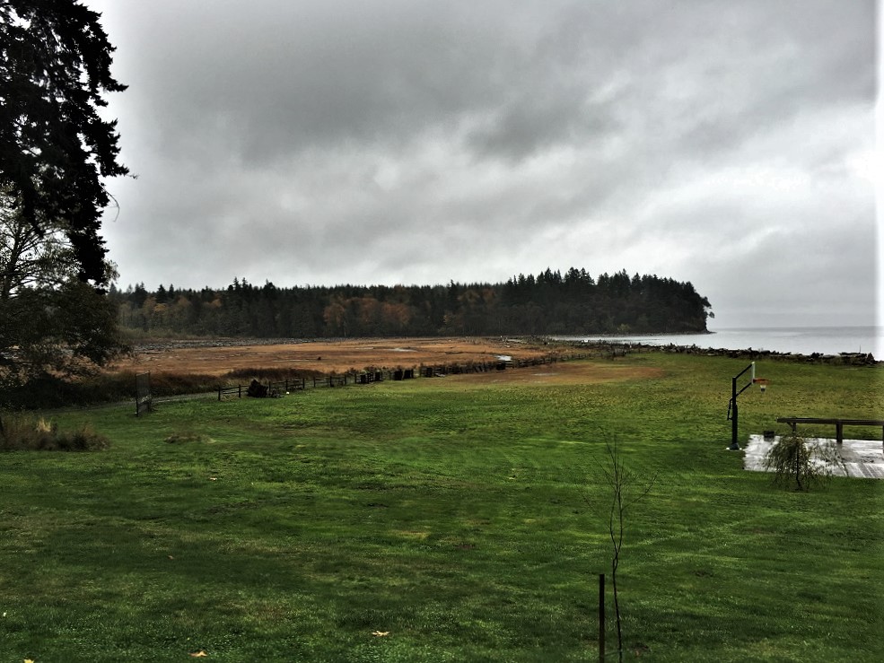
- East of Indianola, Kitsap Peninsula, brewbooks, CC BY-SA 2.0
- Old Man House 2 NRHP 89002299 Kitsap County, WA, Jon Roanhaus, CC BY-SA 3.0
- Agate pass1, User:DVD R W, CC BY-SA 3.0
- Fay Bainbridge Park, Washington, USA, Calan, CC BY-SA 3.0
- Bloedel Reserve 11, Joe Mabel, CC BY-SA 3.0
- Doe-Kag-Wats NRHP 100004076 Kitsap County, WA, Jon Roanhaus, CC BY-SA 4.0
- Doe-Kag-Wats2 NRHP 100004076 Kitsap County, WA, Jon Roanhaus, CC BY-SA 4.0
- Doe-Kag-Wats3 NRHP 100004076 Kitsap County, WA, Jon Roanhaus, CC BY-SA 4.0
- Kingston Ferry Terminal - 2708262424, brewbooks, CC BY-SA 2.0
- Kingston Ferry Terminal, brewbooks, CC BY-SA 2.0
- Phloeomana speirea 253639446, Kathleen Dobson, CC BY 4.0
- Psathyrella longistriata 184419674, Kathleen Dobson, CC BY 4.0
- Psathyrella longistriata 184419023, Kathleen Dobson, CC BY 4.0


Page built October 30, 2026. Spotted a mistake? Tell us or suggest a place.