


Why visit Āq Qāyeh
Townapedia lists 4 museums and landmarks, 5 parks and trails and 4 places to eat in and around town.
Highlights include Gonbad-e Qabus, Gonbad-e Qabus Tower and مینی پارک رنگین کمان.
Weather in Āq Qāyeh
Forecast from MET Norway (CC BY 4.0). Full forecast
About Āq Qāyeh
Aq Qayeh (Persian: آق قايه) is a village in Soltanali Rural District of the Central District in Gonbad-e Kavus County, Golestan province, Iran.
From the Wikipedia article Aq Qayeh (this version), under CC BY-SA 4.0.
Museums and landmarks4

Gonbad-e Qabus
Monument and historic site · 2.1 km
Mausoleum tower in Gonbad-e Kavus, Iranian national heritage site
Gonbad-e Qabus Tower
Monument and historic site · 2.1 km
برج گنبد قابوس بنایی تاریخی و به عنوان بلندترین برج تمام آجری جهان در میراث جهانی یونسکو ثبت شده است. این بنا در سال ۳۷۵ هجری خورشیدی و...

Parks, trails and playgrounds5

Restaurants and cafes4



آشپزخانه محمدآلق
Restaurant · Turkish · 2.1 km
2 دکتر چمران, گنبدکاووس
Mo-Su 09:00-21:00

Churches and places of worship16

4 more on the map.
Shopping4
Gas and EV charging3
Schools, colleges and libraries4
Healthcare2
Map of Āq Qāyeh
42 places. The map loads OpenStreetMap tiles when you open it.
Getting there and nearby towns
Kalaleh Airport (KLM) is the nearest airport with scheduled flights listed in OpenStreetMap, 29 km away.
- Gadamābād 2 km southwest, about 2 min by car
- Gonbad-e Kāvūs 3 km south, about 3 min by car
- Polī Ḩājjī 3 km east, about 3 min by car
- Sārlī Makhtūm 5 km east, about 5 min by car
- Tūtlī-ye Kūchak 6 km east, about 6 min by car
- Āqābād 8 km east, about 8 min by car
- Moḩammad Qolī Ākhūnd 8 km east, about 8 min by car
- Īgder-e Pā’īn 11 km east, about 11 min by car
- Ḩālī Ākhūnd 13 km southwest, about 13 min by car
- Gorgān 80 km southwest, about 1 h 15 min by car
Drive times are estimates from straight-line distance, not routes.
Local news
Headlines from INDB.
Reviews, tips and questions
Loading what members have shared...
Sources and licences
- GeoNames (CC BY 4.0): population, coordinates, regions and time zone
- Mapillary (see each image): photos
- OpenStreetMap contributors (ODbL 1.0): places, airports, map data
- Wikidata (CC0 1.0): elevation, founding date, time zone, website, landmarks and historic places
- Wikimedia Commons (see each image): photos
- Wikipedia (CC BY-SA 4.0): overview and history text
Photo credits
- Image 6962 full, Amirhosseinirf, CC BY-SA 4.0
- Gonbad-e Qabus Tower by Hadi Karimi, Hadi Karimi, CC BY-SA 4.0
- Great Wall of Gorgan 20160522 01, Amir Ali Razzaghi, CC BY 4.0
- Great Wall of Gorgan - panoramio, Lars Holmer, CC BY 3.0
- برج هزار ساله, محمد مهدی زرگریان, CC BY-SA 4.0
- گنبد گاووس - panoramio, auoob farabi, CC BY-SA 3.0
- گنبد قابوس -گنبد کاووس - panoramio, auoob farabi, CC BY-SA 3.0
- Tower of Gonbad-e Qabus, en:Robert Byron, Public domain
- گنبد سر در, Neda1982, CC BY-SA 4.0
- Gonbad Kavus, Golestan Province, Iran - panoramio, Lars Holmer, CC BY 3.0
- برج گنبد قابوس اطراف, Homan pedia, CC BY-SA 4.0
- برج گنبد قابوس نما, Homan pedia, CC BY-SA 4.0
- Gonbad Kavoos - panoramio (3), ramin shirsavar, CC BY 3.0
- Kavoos, Kaikhossrow, CC BY-SA 4.0
- گنبد3, Neda1982, CC BY-SA 4.0
- گنبد کاووس, Neda1982, CC BY-SA 4.0
- گنبد5, Neda1982, CC BY-SA 4.0
- گنبد2, Neda1982, CC BY-SA 4.0
- Gonbad Kavoos - panoramio (6), ramin shirsavar, CC BY 3.0
- گنبد-داخل, Neda1982, CC BY-SA 4.0
- Gonbad Kavoos - panoramio, ramin shirsavar, CC BY 3.0
- Gonbad Kavoos - panoramio (4), ramin shirsavar, CC BY 3.0
- Gonbad Kavoos - panoramio (2), ramin shirsavar, CC BY 3.0
- Gonbad Kavoos - panoramio (5), ramin shirsavar, CC BY 3.0
- 1گنبد, Neda1982, CC BY-SA 4.0
- Gonbad Kavoos - panoramio (1), ramin shirsavar, CC BY 3.0
- Gonbade kaavoos - panoramio, Mohammad Reza Dastaf…, CC BY 3.0
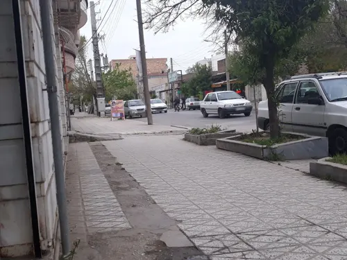
- Street-level photo, memonemat, CC BY-SA 4.0


Page built November 8, 2026. Spotted a mistake? Tell us or suggest a place.