
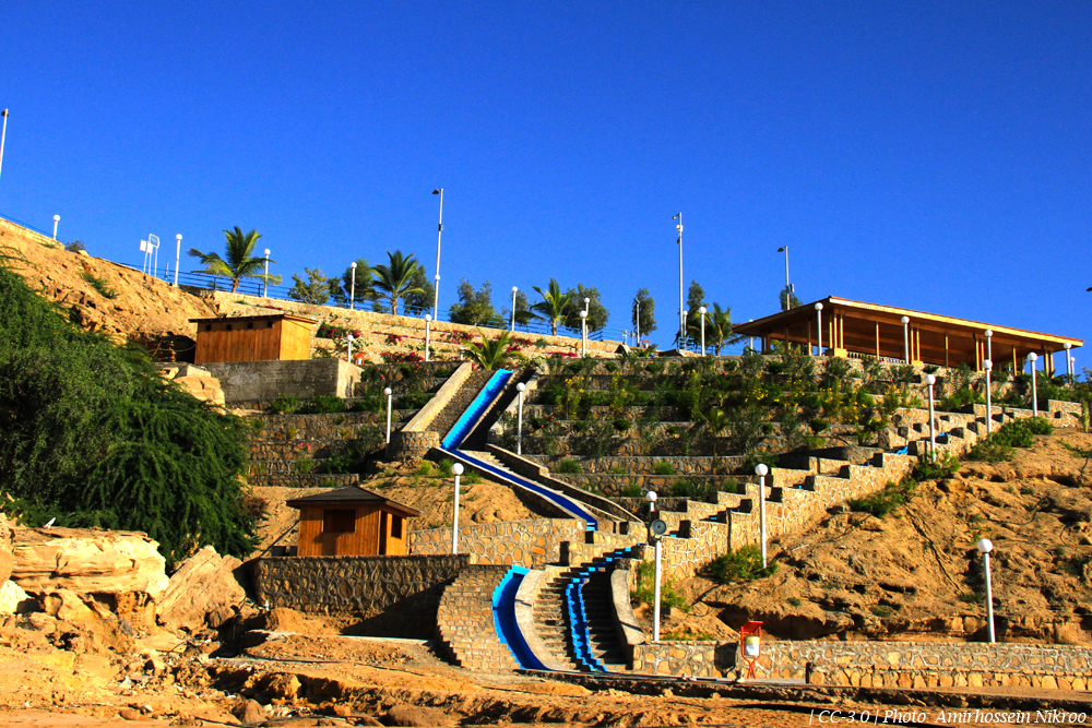


Chabahar, Iran
چابهار
Chabahar is a town of 47,287 people in Sistan and Baluchestan, Iran.
Why visit Chabahar
Townapedia lists 11 parks and trails, 19 places to eat, 8 places to stay and 2 attractions in and around town.
Weather in Chabahar
Forecast from MET Norway (CC BY 4.0). Full forecast
About Chabahar
Chabahar (Persian: چابهار (); Balochi: چھبار) is a city in the Central District of Chabahar County, Sistan and Baluchestan province, Iran, serving as capital of both the county and the district. It is a free port (free-trade zone) situated on the coast of the Gulf of Oman, and is Iran's southernmost city after Konarak. The sister port city of Gwadar in Balochistan, Pakistan, is located about 170 kilometres (110 mi) to the east of Chabahar.
From the Wikipedia article Chabahar (this version), under CC BY-SA 4.0.
Things to do2


Parks, trails and playgrounds11



Restaurants and cafes19


7 more on the map.
Where to stay8


History
There is a fishing village and former port named Tis in Chabahar's neighborhood, which dates from 2500 BC, known in Alexander the Great's conquests as Tiz, eventually renamed Tis. In addition, in his book Aqd al-Ala lel-Moghefe al Ahla, Afdhal al-Din abu Hamid Kermani wrote in 584 AH (1188 CE) about the port of Tiz and its commerce and trade.
According to the scholar and historian, Alberuni, author of an encyclopedic work on India called "Tarikh Al-Hind", the sea coast of India commences with Tiz or modern Chabahar. Tis was formerly an active commercial port, and was destroyed by the Mongols. There are still some ruins in the village.
The Portuguese were the first European colonial country to attack the Makran (Oman) Sea. The Portuguese forces under Afonso de Albuquerque gained control of Chabahar and Tis (1616 CE or 1026 AH), staying there until 1031 AH (1621 CE). The English later entered the region.
From the History section of Chabahar on Wikipedia, under CC BY-SA 4.0.
Churches and places of worship16
Shopping3
Gas and EV charging1
Schools, colleges and libraries9
Healthcare8
درمانگاه شبانه روزی چابهار
Clinic and pharmacy · 1.4 km
جمهوری ۱۳ - بهمن ۱, چابهار
Map of Chabahar
77 places. The map loads OpenStreetMap tiles when you open it.
Getting there and nearby towns
Konarak Airport (ZBR) is the nearest airport with scheduled flights listed in OpenStreetMap, 31 km away.
- Komb-e Morādābād 6 km east, about 6 min by car
- Ţīs 8 km north, about 8 min by car
- Ramīn 12 km east, about 12 min by car
- Tīskūpān 12 km east, about 12 min by car
- Konārak 26 km west, about 26 min by car
- Kambel-e Soleymān 25 km northeast, about 25 min by car
- Gabūlān 30 km northwest, about 30 min by car
- Pozm-e Tīāb 34 km west, about 34 min by car
- Jahlīār 35 km northwest, about 35 min by car
- Bānsont 43 km northwest, about 43 min by car
Drive times are estimates from straight-line distance, not routes.
Local news
Headlines from INDB.
Reviews, tips and questions
Loading what members have shared...
Sources and licences
- GeoNames (CC BY 4.0): population, coordinates, regions and time zone
- OpenStreetMap contributors (ODbL 1.0): places, airports, map data
- Wikidata (CC0 1.0): elevation, founding date, time zone, website, landmarks and historic places
- Wikimedia Commons (see each image): photos
- Wikipedia (CC BY-SA 4.0): overview and history text
Photo credits
- Chabahar Beach 1, Amirhossein Nikroo, CC BY-SA 3.0
- Seyyed Gholam Rasool Mausoleum, Chabahar (بقعه سید غلامرسول، چابهار) - panoramio, akhodadadi, CC BY 3.0
- Seyyed Gholam Rasool Mausoleum, Chabahar (بقعه سید غلام رسول، چابهار) - panoramio, akhodadadi, CC BY 3.0
- Seyyed Gholam Rasool Mausoleum, Chabahar (بقعه سید غلامرسول، چابهار) - panoramio (1), akhodadadi, CC BY 3.0
- 990804-Chabahar-IMG 6019-2, Safa.daneshvar, CC BY-SA 4.0
- 990804-Chabahar-IMG 6013-2, Safa.daneshvar, CC BY-SA 4.0
- 990804-Chabahar-IMG 6020-2, Safa.daneshvar, CC BY-SA 4.0
- 990804-Chabahar-IMG 5997-2, Safa.daneshvar, CC BY-SA 4.0
- 990804-Chabahar-IMG 6006-2, Safa.daneshvar, CC BY-SA 4.0
- 990804-Chabahar-IMG 5988-2, Safa.daneshvar, CC BY-SA 4.0
- Daryabozorg- rock coast of Chabahar دریابزرگ، ساحل صخرهای چابهار - panoramio, Hadi Karimi, CC BY 3.0
- Porota making 20210602, Safa.daneshvar, CC BY-SA 4.0
- میدان قایق دانشگاه دریانوردی و علوم دریایی چابهار - panoramio, sina ahmadzadeh, CC BY 3.0


Page built November 8, 2026. Spotted a mistake? Tell us or suggest a place.