


Why visit Karahrūd
Townapedia lists 1 museum or landmark, 14 parks and trails, 26 places to eat and 2 attractions in and around town.
Weather in Karahrūd
Forecast from MET Norway (CC BY 4.0). Full forecast
About Karahrūd
Karahrud (Persian: كرهرود) is a neighborhood in the city of Arak in the Central District of Arak County, Markazi province, Iran.
From the Wikipedia article Karahrud (this version), under CC BY-SA 4.0.
Things to do2


Museums and landmarks1

Parks, trails and playgrounds14



2 more on the map.
Restaurants and cafes26


14 more on the map.
Churches and places of worship29
Shopping6
Gas and EV charging1
Schools, colleges and libraries21
Healthcare2
Map of Karahrūd
102 places. The map loads OpenStreetMap tiles when you open it.
Getting there and nearby towns
Arak Airport (AJK) is the nearest airport with scheduled flights listed in OpenStreetMap, 21 km away.
- Senjān 2 km southwest, about 2 min by car
- Arāk 6 km northeast, about 6 min by car
- Marzījarān 9 km north, about 9 min by car
- Gāv Khāneh 12 km northeast, about 12 min by car
- Savārābād 18 km southeast, about 18 min by car
- Mahājerān 19 km west, about 19 min by car
- Kazzāz-e Bālā 20 km west, about 20 min by car
- Nāmīleh 79 km west, about 1 h 15 min by car
- Malāyer 80 km west, about 1 h 15 min by car
- Borūjerd 84 km west, about 1 h 30 min by car
Drive times are estimates from straight-line distance, not routes.
Local news
Headlines from INDB.
Reviews, tips and questions
Loading what members have shared...
Sources and licences
- GeoNames (CC BY 4.0): population, coordinates, regions and time zone
- Mapillary (see each image): photos
- OpenStreetMap contributors (ODbL 1.0): places, airports, map data
- Wikidata (CC0 1.0): elevation, founding date, time zone, website, landmarks and historic places
- Wikimedia Commons (see each image): photos
- Wikipedia (CC BY-SA 4.0): overview and history text
Photo credits
- مجتمع مسکونی واقع در کرهرود - اراک - نقطه ثبت تصویر 34.059190, 49.638998 - panoramio, Ali Sharifi, CC BY 3.0
- ساختمان نمازخانه و سالن غذاخوری دانشگاه اراک - panoramio, Ali Sharifi, CC BY 3.0
- نمای قله ی مودر - ثبت از قله ی کوه سرخه - panoramio, Ali Sharifi, CC BY 3.0
- مورچه - Ant - panoramio, Ali Sharifi, CC BY 3.0
- نمای نزدیک تکیه آقا نورالدین اراکی - panoramio, Ali Sharifi, CC BY 3.0
- نمای دیگری از خرابه های تکیه آقا نور - panoramio, Ali Sharifi, CC BY 3.0
- ساختمان اداری دانشگاه اراک - panoramio, Ali Sharifi, CC BY 3.0
- نمای بازتری از ساختمان اداری دانشگاه اراک - سردشت - panoramio, Ali Sharifi, CC BY 3.0
- ساختمان نمازخانه و سالن اجتماعات در دست ساخت دانشگاه اراک - panoramio, Ali Sharifi, CC BY 3.0
- دانشکده علوم پایه دانشگاه اراک - panoramio, Ali Sharifi, CC BY 3.0
- دانشکده فنی دانشگاه اراک - panoramio, Ali Sharifi, CC BY 3.0
- سوسمار کوهستانی - panoramio, Ali Sharifi, CC BY 3.0
- کوه سفید خانی پوشیده از برف - panoramio, Omid Jafarnezhad (om…, CC BY 3.0
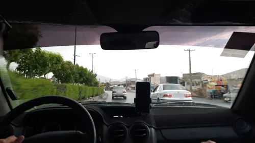
- Street-level photo, minooshaban, CC BY-SA 4.0
- Street-level photo, minooshaban, CC BY-SA 4.0
- Street-level photo, minooshaban, CC BY-SA 4.0
- Street-level photo, minooshaban, CC BY-SA 4.0


Page built November 8, 2026. Spotted a mistake? Tell us or suggest a place.