


Why visit Kāshmar
Townapedia lists 12 museums and landmarks, 10 parks and trails, 12 places to eat, 1 place to stay and 1 attraction in and around town.
Highlights include Hassan Modarres Mausoleum and Imamzadeh Hamzah.
Weather in Kāshmar
Forecast from MET Norway (CC BY 4.0). Full forecast
About Kāshmar
Kashmar (; Persian: کاشمر [kʰɒːʃˈmæɹ]) is a city in the Central District of Kashmar County, Razavi Khorasan province, Iran, serving as capital of both the county and the district. Kashmar is near the river Shesh Taraz in the western part of the province, and south of the province's capital Mashhad, in Iran, from east to Bardaskan, west to Torbat-e Heydarieh, north to Nishapur, south to Gonabad. Until two centuries ago, this city was named Torshiz (ترشیز).
From the Wikipedia article Kashmar (this version), under CC BY-SA 4.0.
Travel tips from other travellers: Kāshmar on Wikivoyage (CC BY-SA 4.0).
Things to do1

Museums and landmarks12

Hassan Modarres Mausoleum
Monument and historic site · 1.4 km
Mausoleum in Kashmar, Iranian national heritage site

Imamzadeh Hamzah
Monument and historic site · 0.7 km
Imamzadeh in Kashmar, Iranian national heritage site

Imamzadeh Morteza
Monument and historic site · 5.5 km
Imamzadeh in Kashmar, Iranian national heritage site





Parks, trails and playgrounds10



Restaurants and cafes12

Coffee Faro
Cafe · Coffee Shop · 2.0 km
253 بلوار معلم بعد از امیرکبیر, کاشمر
شنبه تا جمعه ساعت 7 صبح تا ساعت 22



Where to stay1
Churches and places of worship10
Shopping10
Gas and EV charging5
Schools, colleges and libraries17
Healthcare6
Map of Kāshmar
84 places. The map loads OpenStreetMap tiles when you open it.
Getting there and nearby towns
- Forūtaqeh 5 km southeast, about 5 min by car
- Zendeh Jān 6 km west, about 6 min by car
- Kasrīneh 6 km west, about 6 min by car
- Sar Ḩowẕak 9 km west, about 9 min by car
- Talābād 8 km southwest, about 8 min by car
- Mīrābād 14 km southwest, about 14 min by car
- Deh Now 15 km west, about 15 min by car
- Khalīlābād 16 km west, about 16 min by car
- Mazdeh 18 km west, about 18 min by car
- Torbat-e Ḩeydarīyeh 69 km east, about 1 h 15 min by car
Drive times are estimates from straight-line distance, not routes.
Local news
Headlines from INDB.
Reviews, tips and questions
Loading what members have shared...
Sources and licences
- GeoNames (CC BY 4.0): population, coordinates, regions and time zone
- Mapillary (see each image): photos
- OpenStreetMap contributors (ODbL 1.0): places, airports, map data
- Wikidata (CC0 1.0): elevation, founding date, time zone, website, landmarks and historic places
- Wikimedia Commons (see each image): photos
- Wikipedia (CC BY-SA 4.0): overview and history text
Photo credits
- Hassan Modarres Mausoleum2024-06-16 5, POS78, CC BY 4.0
- Imamzadeh Morteza2024-06-18 21, POS78, CC BY 4.0
- Hassan Modarres Mausoleum2024-06-16 22 (cropped), POS78, CC BY 4.0
- Imamzadeh Hamzah2024-06-24 57, POS78, CC BY 4.0
- Kashmar2024-06-16 20, POS78, CC BY 4.0
- Haji Jalal Mosque2023-01-01, POS78, CC BY-SA 4.0
- Ahmad Panah House2021-06-09, POS78, CC BY-SA 4.0
- Seyed Esmail Nabavi Mausoleum2021, POS78, CC BY-SA 4.0
- Haj Soltan Madrasa2023-12-16, POS78, CC BY-SA 4.0
- Amin al-Tojar Caravanserai2024-11-07, POS78, CC BY 4.0
- Eftekhar al-Tojar Mausoleum2021, POS78, CC BY-SA 4.0
- Danesh House2021-06-02, POS78, CC BY-SA 4.0
- Seyed Esmail Nabavi Mausoleum2021 12, POS78, CC BY-SA 4.0
- Haj Soltan Madrasa2021, POS78, CC BY-SA 4.0
- Jameh Mosque of Kashmar2021, POS78, CC BY-SA 4.0
- Amin al-Tojar Caravanserai2021-05-30 22, POS78, CC BY-SA 4.0
- Imamzadeh Hamzah2021-05-10 2, POS78, CC BY-SA 4.0
- انجیر و ماه, Ali hosseiny, CC BY-SA 4.0
- انجیر و ماه2, Ali hosseiny, CC BY-SA 4.0
- مسجد جامع کاشمر19, Ali hosseiny, CC BY-SA 4.0
- 21محراب مسجد جامع کاشمر, Ali hosseiny, CC BY-SA 4.0
- 27 مسجد جامع کاشمر, Ali hosseiny, CC BY-SA 4.0
- مسجد جامع کاشمر20, Ali hosseiny, CC BY-SA 4.0
- 28مسجد جامع کاشمر, Ali hosseiny, CC BY-SA 4.0
- مسجد جامع کاشمر18, Ali hosseiny, CC BY-SA 4.0
- مسجد جامع کاشمر17, Ali hosseiny, CC BY-SA 4.0
- 11 مسجد جامع کاشمر, Ali hosseiny, CC BY-SA 4.0
- مسجد جامع کاشمر12, Ali hosseiny, CC BY-SA 4.0
- 15 مسجد جامع کاشمر, Ali hosseiny, CC BY-SA 4.0
- مسجد جامع کاشمر25, Ali hosseiny, CC BY-SA 4.0
- 26 مسجد جامع کاشمر, Ali hosseiny, CC BY-SA 4.0
- مسجد جامع کاشمر24, Ali hosseiny, CC BY-SA 4.0
- 16 مسجد جامع کاشمر, Ali hosseiny, CC BY-SA 4.0
- 23مسجد جامع کاشمر, Ali hosseiny, CC BY-SA 4.0
- مسجد جامع کاشمر1, Ali hosseiny, CC BY-SA 4.0
- مسجد جامع کاشمر13, Ali hosseiny, CC BY-SA 4.0
- 14مسجد جامع کاشمر, Ali hosseiny, CC BY-SA 4.0
- مسجد جامع کاشمر10, Ali hosseiny, CC BY-SA 4.0
- Kashmar2023-12-09 3, POS78, CC BY-SA 4.0
- Kashmar2023-12-09 2, POS78, CC BY-SA 4.0
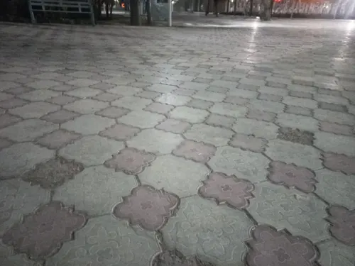
- Street-level photo, mcuteangel, CC BY-SA 4.0
- Street-level photo, mandyshmand10, CC BY-SA 4.0


Page built November 8, 2026. Spotted a mistake? Tell us or suggest a place.