


Why visit Kīsh
Townapedia lists 5 museums and landmarks, 15 parks and trails, 69 places to eat, 39 places to stay and 3 attractions in and around town.
Highlights include Zhian Gallery and Penguin Snow Park.
Weather in Kīsh
Forecast from MET Norway (CC BY 4.0). Full forecast
About Kīsh
Kish (Persian: كيش; ) is a coastal city in, and the capital of, Kish District of Bandar Lengeh County, Hormozgan province, Iran. The city is on Kish Island, a special zone of Iran. The island is served by Kish International Airport, and has a visa policy separate from the Iranian mainland, such that foreign tourists can obtain a visa on arrival.
From the Wikipedia article Kish, Iran (this version), under CC BY-SA 4.0.
Things to do3

Museums and landmarks5
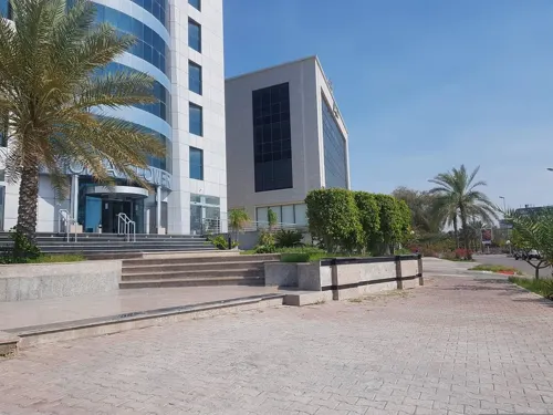


Parks, trails and playgrounds15




3 more on the map.
Restaurants and cafes69


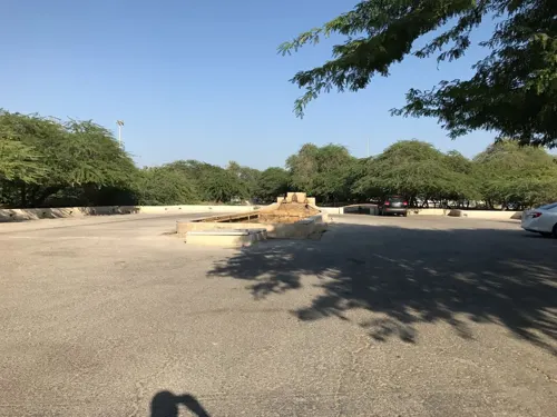


57 more on the map.
History
One of the earliest travel accounts mentioning and describing a visit to this island is that of the Greek navarch Nearchus, in the 4th century BC, during the reign of Alexander the Great. Other accounts followed, such as those by Xenophon, who referred to the island as "Mother of Kamtina".
Before the arrival of Islam, Kish was ruled by several peoples, mostly from the Persian region, such as the Elamites, Sumerians, Achaemenids, Seleucids, Arsacids, and Sassanids. Until 643, the island of Kish, along with the other islands of the Persian Gulf, was Persian in culture and language. After the Muslim expansion and the fall of the Sassanid Empire, Kish, like the rest of Iran, was governed by the Umayyad and then Abbasid caliphates.
It briefly reverted to Persian rule thanks to the victory of the Iranian Saffarid dynasty under the Abbasid Caliphate. Several dynasties succeeded one another, including finally the Pahlavi dynasty, which ruled over Iran and the island of Kish until the Iranian Revolution of 1979 and the establishment of an Islamic Republic in Iran.
From the History section of Kish, Iran on Wikipedia, under CC BY-SA 4.0.
Where to stay39
Churches and places of worship5
Shopping42
Schools, colleges and libraries11
Sharif University of Technology International Campus
School · 1.5 km
Sharif University of Technology - Kish Int'l Campus
School · 1.5 km
بلوار دانش, کیش
Healthcare8
Map of Kīsh
197 places. The map loads OpenStreetMap tiles when you open it.
Getting there and nearby towns
Kish International Airport (KIH) is the nearest airport with scheduled flights listed in OpenStreetMap, 5 km away.
- Gerzeh 21 km north, about 21 min by car
- Bandar-e Chārak 32 km northeast, about 32 min by car
- Bandar-e Chīrū’īyeh 33 km northwest, about 33 min by car
- Bandar-e Ḩoseynīyeh 36 km east, about 36 min by car
- Rostāq 40 km northwest, about 40 min by car
- Moghūyeh 49 km east, about 49 min by car
- Armak 53 km northeast, about 53 min by car
- Dīvān 56 km east, about 56 min by car
- Jenāḩ 58 km northeast, about 58 min by car
- Bastak 79 km northeast, about 1 h 15 min by car
Drive times are estimates from straight-line distance, not routes.
Local news
Headlines from INDB.
Reviews, tips and questions
Loading what members have shared...
Sources and licences
- GeoNames (CC BY 4.0): population, coordinates, regions and time zone
- Mapillary (see each image): photos
- OpenStreetMap contributors (ODbL 1.0): places, airports, map data
- Wikidata (CC0 1.0): elevation, founding date, time zone, website, landmarks and historic places
- Wikimedia Commons (see each image): photos
- Wikipedia (CC BY-SA 4.0): overview and history text
Photo credits
- 1400011322242580422511884 تصاویر هوایی روز طبیعت کیش, Hossein Tahavori, CC BY 4.0
- Sharif University Kish 2025 01, Orijentolog, CC BY 4.0
- Street-level photo, iggypl, CC BY-SA 4.0
- Street-level photo, mortezaborji, CC BY-SA 4.0
- Street-level photo, mortezaborji, CC BY-SA 4.0
- Street-level photo, mortezaborji, CC BY-SA 4.0
Page built November 8, 2026. Spotted a mistake? Tell us or suggest a place.