


Why visit Mahdishahr
Townapedia lists 4 museums and landmarks, 16 parks and trails, 2 places to eat and 2 places to stay in and around town.
Weather in Mahdishahr
Forecast from MET Norway (CC BY 4.0). Full forecast
About Mahdishahr
Mehdishahr (Persian: مهدیشهر) is a city in the Central District of Mehdishahr County, Semnan province, Iran, serving as capital of both the county and the district.
From the Wikipedia article Mehdishahr (this version), under CC BY-SA 4.0.
Museums and landmarks4


Parks, trails and playgrounds16


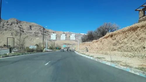
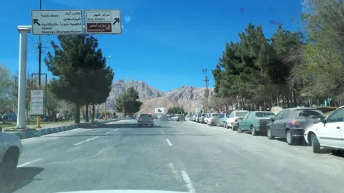


4 more on the map.
Restaurants and cafes2


Where to stay2

History
Sangesari people, who live in the city of Sangesar, speak Sangesari and live in the large geographic area of Sangesar. Sangesar has a long history dating back to the 1st millennium BC. The first inhabitants of Sangesar used to worship Indo-European deities, and for the past 4000 years, even after the arrival of Arab invaders, they remained Zoroastrians. Like the rest of Iran, they were forced to convert to Shiite Islam after the arrival of the Safavid dynasty. Although there are many theories about Sangesar's name, one of them emphasizes a Saka origin and suggests the name was Sakasar or Saksar, meaning "Saka" (Scythian) settlement, others believe the name comes from Sang (Stone) Sar (Head), literally meaning people who fight to their graves. A large number of Sangesari converted to the Bahai religion in the late 1800s and achieved prominent roles in Pahlavi Iran. After the 1979 revolution, the Islamic Republic renamed the city from Sangesar to MehdiShahr (The city of the savior) to punish the population and to assert Islamic identity.
From the History section of Mehdishahr on Wikipedia, under CC BY-SA 4.0.
Churches and places of worship15
Shopping9
Gas and EV charging2
Schools, colleges and libraries15
Healthcare6
Map of Mahdishahr
71 places. The map loads OpenStreetMap tiles when you open it.
Getting there and nearby towns
Semnan Municipal Airport (SNX) is the nearest airport with scheduled flights listed in OpenStreetMap, 18 km away.
- Semnan 15 km south, about 15 min by car
- Sorkheh 30 km southwest, about 30 min by car
- Veresk 39 km northwest, about 39 min by car
- Lāsjerd 42 km southwest, about 42 min by car
- Fīrūzkūh 53 km west, about 53 min by car
- Pol-e Sefīd 53 km northwest, about 53 min by car
- Kīāsar 61 km north, about 1 h by car
- Ālāsht 61 km northwest, about 1 h by car
- Shahrābād 61 km west, about 1 h by car
- Zīr Āb 62 km northwest, about 1 h by car
Drive times are estimates from straight-line distance, not routes.
Local news
Headlines from INDB.
Reviews, tips and questions
Loading what members have shared...
Sources and licences
- GeoNames (CC BY 4.0): population, coordinates, regions and time zone
- Mapillary (see each image): photos
- OpenStreetMap contributors (ODbL 1.0): places, airports, map data
- Wikidata (CC0 1.0): elevation, founding date, time zone, website
- Wikimedia Commons (see each image): photos
- Wikipedia (CC BY-SA 4.0): overview and history text
Photo credits
- خیابان اصلی سنگسر3 - panoramio, matin fattahi, CC BY 3.0
- خیابان اصلی سنگسر2 - panoramio, matin fattahi, CC BY 3.0
- خیابان اصلی سنگسر - panoramio (1), matin fattahi, CC BY 3.0
- شمع گل پروانه شفت و شل دیوانه - panoramio, matin fattahi, CC BY 3.0
- نمای شهر سنگسر2 - panoramio, matin fattahi, CC BY 3.0
- قهوه خانه - panoramio, matin fattahi, CC BY 3.0
- خیابان اصلی سنگسر1 - panoramio, matin fattahi, CC BY 3.0
- میدان وسط سنگسر - panoramio, matin fattahi, CC BY 3.0
- زیبایی - panoramio, matin fattahi, CC BY 3.0
- خیابان اصلی سنگسر - panoramio, matin fattahi, CC BY 3.0
- خیابان اصلی سنگسر2 - panoramio (1), matin fattahi, CC BY 3.0
- حسینیه المهدی - panoramio, Mahdishahr مهدیشهر S…, CC BY-SA 3.0
- میدان اصلی ورودی سنگسر - panoramio, matin fattahi, CC BY 3.0
- درمانگاه در سنگسر - panoramio, matin fattahi, CC BY 3.0
- Sangesar 8 - panoramio, matin fattahi, CC BY 3.0
- Sangesar 9 - panoramio, matin fattahi, CC BY 3.0
- درمانگاه در سنگسر 1 - panoramio, matin fattahi, CC BY 3.0
- بلوار ورودی سنگسر - panoramio, matin fattahi, CC BY 3.0
- Sangesar 4 - panoramio, matin fattahi, CC BY 3.0
- Sangesar 5 - panoramio, matin fattahi, CC BY 3.0
- Sangesar 7 - panoramio, matin fattahi, CC BY 3.0
- بلوار ورودی سنگسر1 - panoramio, matin fattahi, CC BY 3.0
- سنگسر 1 - panoramio, matin fattahi, CC BY 3.0
- Sangesar 6 - panoramio, matin fattahi, CC BY 3.0
- خیابان اصلی سنگسر 1 - panoramio, matin fattahi, CC BY 3.0
- دورنمایی از مهدی شهر ، ساختمان های دهکده پارسیان - panoramio, Mahdishahr مهدیشهر S…, CC BY-SA 3.0
- آرش کمانگیر در شهر زیبای سنگسر - panoramio, matin fattahi, CC BY 3.0
- پارک آبشار، مهدی شهر، استان سمنان، Iran - panoramio (1), matin fattahi, CC BY 3.0
- Uni Mahdi Shahr, Amirhosein6009, CC BY-SA 4.0
- پارک آبشار، مهدی شهر، استان سمنان، Iran - panoramio (10), matin fattahi, CC BY 3.0
- هرچه بری مسیر باریکتر می شود - panoramio, matin fattahi, CC BY 3.0
- پارک آبشار، مهدی شهر، استان سمنان، Iran - panoramio (9), matin fattahi, CC BY 3.0
- پله های تخت جمشید اما در مهدیشهر سمنان - panoramio, matin fattahi, CC BY 3.0
- پارک آبشار، مهدی شهر، استان سمنان، Iran - panoramio (7), matin fattahi, CC BY 3.0
- پارک آبشار، مهدی شهر، استان سمنان، Iran - panoramio (2), matin fattahi, CC BY 3.0
- پارک آبشار، مهدی شهر، استان سمنان، Iran - panoramio (6), matin fattahi, CC BY 3.0
- پارک آبشار، مهدی شهر، استان سمنان، Iran - panoramio (3), matin fattahi, CC BY 3.0
- Steep in road - panoramio, matin fattahi, CC BY 3.0
- پارک آبشار، مهدی شهر، استان سمنان، Iran - panoramio (8), matin fattahi, CC BY 3.0
- Street-level photo, geoaria, CC BY-SA 4.0
- Street-level photo, geoaria, CC BY-SA 4.0
- Street-level photo, geoaria, CC BY-SA 4.0
- Street-level photo, geoaria, CC BY-SA 4.0
- Street-level photo, geoaria, CC BY-SA 4.0
- Street-level photo, geoaria, CC BY-SA 4.0
- Street-level photo, geoaria, CC BY-SA 4.0
- Street-level photo, geoaria, CC BY-SA 4.0
- Street-level photo, geoaria, CC BY-SA 4.0
- Street-level photo, geoaria, CC BY-SA 4.0
- Street-level photo, geoaria, CC BY-SA 4.0


Page built November 8, 2026. Spotted a mistake? Tell us or suggest a place.