


Tehran, Iran
تهران
Tehran is a capital city of 7,153,309 people in Tehran, Iran, founded in March 20, 1794.
Why visit Tehran
Townapedia lists 73 museums and landmarks, 20 parks and trails, 144 places to eat, 65 places to stay and 18 attractions in and around town.
Highlights include Azadi Tower, City Theater of Tehran, Glassware and Ceramic Museum of Iran and Iran National Museum.
Weather in Tehran
Forecast from MET Norway (CC BY 4.0). Full forecast
About Tehran
Tehran is the capital and largest city of Iran. It is also the capital of Tehran province and the administrative center for Tehran County and its Central District. With a population of around 9 million in the city, and 16.8 million in the metropolitan area, Tehran is the most populous city in Iran and West Asia, the largest metropolitan area in the Middle East and the 24th-most-populous metropolitan area in the world. Greater Tehran includes several municipalities, including Eslamshahr, Shahriar, Qods, Malard, Golestan, Varamin, Pakdasht, Qarchak, Nasimshahr, Parand, Pardis, Andisheh, Fardis, Tajrish, and Rey.
From the Wikipedia article Tehran (this version), under CC BY-SA 4.0.
Travel tips from other travellers: Tehran on Wikivoyage (CC BY-SA 4.0).
Things to do18

Azadi Tower
Monument and historic site · 7.6 km
Tower in Tehran, Iranian national heritage site

City Theater of Tehran
Cinema and theater · 1.6 km
Theater in Tehran, Iranian national heritage site



Shahr-e Bazi
Monument and historic site · 10.8 km
Former amusement park in Tehran, Iran




nasr theater
Cinema and theater
یکی از اولین سالن های تئاتر ایران،مربوط به دوره ی قاجار است و جنب گراند هتل واقع شده است.
خیابان لاله زار، روبروی کوچه بوشهری, تهران
6 more on the map.
Museums and landmarks73


National jewellery museum
Museum
فردوسی, تهران
Sa-Tu 14:00-16:30


سوینا سینمای نابینایان
Museum · 1.1 km
سوینا (سینمای نابینایان) در سال ۱۳۹۸ و با هدف توضیحدار کردن فیلمها و سریالها به منظور فراهم آوردن امکان دسترسی افراد نابینا و کمبینا...
7 سلمان پاک, تهران
Mo-Su 08:00-22:00
Abgineh Museum of Tehran
Museum · 0.6 km
Museum in Tehran, Iranian national heritage site

Bibi Shahrbanu Shrine
Monument and historic site · 13.2 km
Shrine in Ray, Iranian national heritage site

Cheshmeh-Ali
Monument and historic site · 9.7 km
Spring in Ray, Iranian national heritage site

imam Khomeini Mausoleum
Monument and historic site · 16.9 km
Mausoleum in metropolitan Tehran, Iran

Imamzadeh Abdullah (Ray)
Monument and historic site · 11.0 km
Imamzadeh in Ray, Iranian national heritage site
61 more on the map.
Parks, trails and playgrounds20


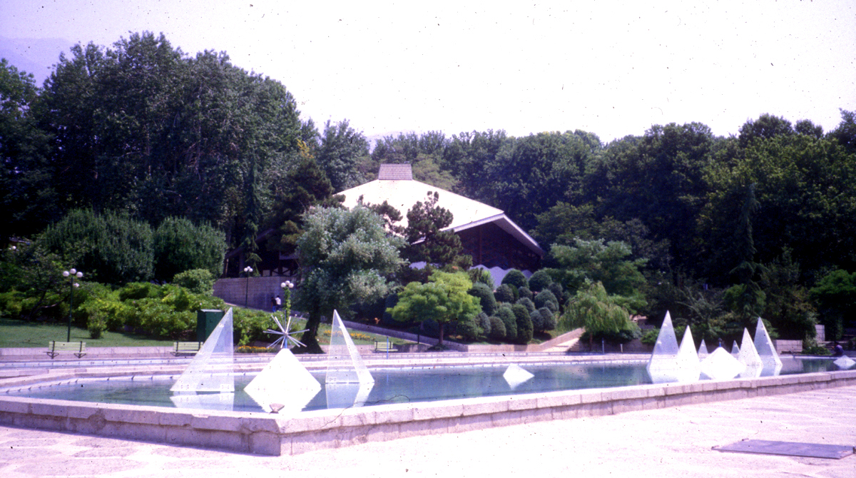




8 more on the map.
Restaurants and cafes144


Baccara
Cafe · Coffee Shop, Burger, Steak House, Salad, Pasta, Cake · 1.3 km
انقلاب اسلامی, تهران
Mo-Su 09:00-24:00
Bahrami House
Cafe · Coffee Shop, Regional, Chicken, Breakfast, Cake · 1.3 km
نوفل لوشاتو, تهران
Sa 16:00-22:30; Su-We 12:00-22:30; Th-Fr 09:00-22:30
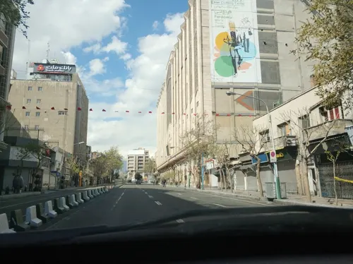


کافه پریش
Cafe · Pizza, Coffee Shop, Burger, Asian, Juice, Pasta, Cake, Salad, Chocolate, Dessert, Pancake · 1.3 km
791 انقلاب اسلامی, تهران
08:00-23:00
132 more on the map.
History
Archaeological remains from the ancient city of Ray suggest that settlement in Tehran dates back over 6,000 years.
From the History section of Tehran on Wikipedia, under CC BY-SA 4.0.
Where to stay65
hanna boutique hotel
Motel and hotel · 0.9 km
3 Neauphle-le-Château St., Hafez Ave , Lolagar Alley, Tehran
Churches and places of worship46
Daniel Synagogue (Polish)
Place of worship · Ashkenazi · 0.8 km
سیمی, Tehran
Shopping197
Gas and EV charging2
Schools, colleges and libraries70
Healthcare23
کلینیک دندانپزشکی لبخند پرنیان
Clinic and pharmacy · 1.2 km
۳۵۲ انقلاب اسلامی, تهران
Map of Tehran
250 places. The map loads OpenStreetMap tiles when you open it.
Getting there and nearby towns
Mehrabad International Airport (THR) is the nearest airport with scheduled flights listed in OpenStreetMap, 11 km away.
- Vaḩīdīyeh 5 km northeast, about 5 min by car
- Khalāzīr 11 km southwest, about 11 min by car
- Tajrīsh 12 km north, about 12 min by car
- Morteẕá Gerd 12 km southwest, about 12 min by car
- Shahrak-e ‘Alā’īn 13 km south, about 13 min by car
- Eslāmābād 13 km southwest, about 13 min by car
- Chahār Dangeh 14 km southwest, about 14 min by car
- Valīābād 15 km southwest, about 15 min by car
- Bāqershahr 18 km south, about 18 min by car
- Shahrak-e Goldasteh 17 km southwest, about 17 min by car
Drive times are estimates from straight-line distance, not routes.
Local news
Headlines from INDB.
Reviews, tips and questions
Loading what members have shared...
Sources and licences
- GeoNames (CC BY 4.0): population, coordinates, regions and time zone
- Mapillary (see each image): photos
- OpenStreetMap contributors (ODbL 1.0): places, airports, map data
- Wikidata (CC0 1.0): elevation, founding date, time zone, website, landmarks and historic places
- Wikimedia Commons (see each image): photos
- Wikipedia (CC BY-SA 4.0): overview and history text
Photo credits
- North of tehran, Amir Pashaei, CC BY-SA 4.0
- Jeanne d Arc School Iran Tehran Monastery, آرش حکیمی, CC BY-SA 4.0
- Jeanne d Arc School Iran Tehran AbandonedClassroom, آرش حکیمی, CC BY-SA 4.0
- Jeanne d Arc School Iran Tehran Abandoned Hallway, آرش حکیمی, CC BY-SA 4.0
- Jeanne d Arc School Iran Tehran MainCourtyard, آرش حکیمی, CC BY-SA 4.0
- Jeanne d Arc School Iran Tehran Plaque, آرش حکیمی, CC BY-SA 4.0
- Jeanne d Arc School Iran Tehran Backtyard, آرش حکیمی, CC BY-SA 4.0
- TEHRAN VERY NICE 2 - panoramio, matin fattahi, CC BY 3.0
- Tehran, old man (6209024104), Arian Zwegers from Brussels, Belgium, CC BY 2.0
- 1999 Ashura Tehran 6208055901, Arian Zwegers, CC BY 2.0
- TEHRAN VERY NICE 1 - panoramio, matin fattahi, CC BY 3.0
- TEHRAN VERY NICE - panoramio, matin fattahi, CC BY 3.0
- Azadi Tower, Tehran, Bernard Gagnon, CC BY-SA 4.0
- TitSh1, Behrad Moudi, CC BY-SA 4.0
- Shirpala-Twin-Falls-2024, Ahangarha, CC BY-SA 4.0
- Tabiat-Bridge-by-DIBA-group, Diba Tensile Architecture, CC BY-SA 4.0
- Roudaki Hall, Tehran Pariroz, Public domain
- Shrine-of-Shahr-Banu-AS-Tehran, Toushiro, Public domain
- Cheshmeh-Ali, Ray, Orijentolog, CC BY-SA 3.0
- Iran IMG 3429 Tehran (2864793031), Ninara from Helsinki, Finland, CC BY 2.0
- امام زاده عبدالله, Anita3283, CC BY-SA 4.0
- Park-e Shahr, http://fa.wikipedia.org/wiki/User:Iroony, CC BY-SA 3.0
- Daneshjoo Park 1, MRG90, CC BY-SA 4.0
- AmingholamaliJamshidie Tehran1, Amingholamali, CC BY-SA 3.0
- پارک جنگلی کوهسار شهران 3, Pouyan666, CC BY-SA 4.0
- Tehran view from lavizan park, Milad Mosapoor, Attribution
- منظره توچال از پارک ملت(Ms) - panoramio, Mehrdad Sarhangi, CC BY 3.0
- Park niavaran, Zereshk at English Wikipedia, CC BY-SA 3.0
- Pardisan Park - panoramio (2), ak ba, CC BY-SA 3.0
- پارک پلیس - panoramio, phareed, CC BY 3.0
- TehranCathedral, Avemundi, CC BY-SA 3.0
- Saint George church (Tehran), Լևոն Հարությունյան, CC BY-SA 4.0
- ساختمان کلیسا, [email protected], CC BY-SA 4.0
- کلیسای انجیلی՛՛, Herbert karim masihi, CC BY-SA 4.0
- Catedral de San Sarkis, Teherán, Irán, 2016-09-17, DD 69, Diego Delso, CC BY-SA 4.0
- St.Vartanas2, Serzhikt, Public domain
- کلیسای تادئوس و بارتوقیمئوس مقدس, خودم - کاربر:Zhilbert, Public domain
- دارالفنون, Neda alipour, CC BY-SA 4.0
- Kharazmi University old building 5769, GTVM92, CC BY-SA 4.0
- Baqiyatallah University of Medical Sciences 1399060511374052121048844, Vahid Ahmadi, CC BY 4.0
- Damavand College, مانفی, CC BY-SA 4.0
- Imam Hossein University Engineering Faculties, Facecite12656 ( talk ), CC BY-SA 3.0
- 1397020812401033113977764 سعادت آباد, Sajjad Naseri, CC BY 4.0
- Tehran - Glass ware and ceramics Museum, Philippe Chavin ( Simorg ), CC BY-SA 3.0
- Alborz-HighSchool, Bahram.zahir, CC BY 3.0
- The Islamic Museum Of National Museum of Iran Darafsh (03), Darafsh, CC BY-SA 3.0
- Majd al-Dawla mosque - Cropped, MRG90, CC BY-SA 4.0
- Sahktemane bimarestane najmiye 1, Azadi68, CC BY-SA 4.0
- Sina Hospital in Tehran, MRG90, CC BY-SA 3.0
- Ferdowsi-Ave-1962, Unknown author Unknown author, Public domain
- National Museum of Iran Darafsh (839), Darafsh, CC BY 3.0
- Haim Synagogue کنیسه حیم 2, Azadi68, CC BY-SA 4.0
- Armenian Catholic St. Gregory Church of Tehran, Orijentolog, CC BY-SA 3.0
- Meli Museum 2 - panoramio, A.H Mansouri, CC BY-SA 3.0
- Cinema Sara, Kasir, CC BY-SA 4.0
- Firouzeh Hotel (Tehran, Iran) (28361305582), Sasha India from Irpin, Ukraine, CC BY 2.0
- شهروند آرژانتین - panoramio (cropped), matin fattahi, CC BY 3.0
- Street-level photo, hota, CC BY-SA 4.0
- Street-level photo, hota, CC BY-SA 4.0
- Street-level photo, hota, CC BY-SA 4.0
- Street-level photo, hota, CC BY-SA 4.0
- Street-level photo, hota, CC BY-SA 4.0
- Street-level photo, hota, CC BY-SA 4.0
- Street-level photo, hota, CC BY-SA 4.0
- Street-level photo, hota, CC BY-SA 4.0
- Street-level photo, hota, CC BY-SA 4.0
- Street-level photo, hota, CC BY-SA 4.0


Page built November 8, 2026. Spotted a mistake? Tell us or suggest a place.