


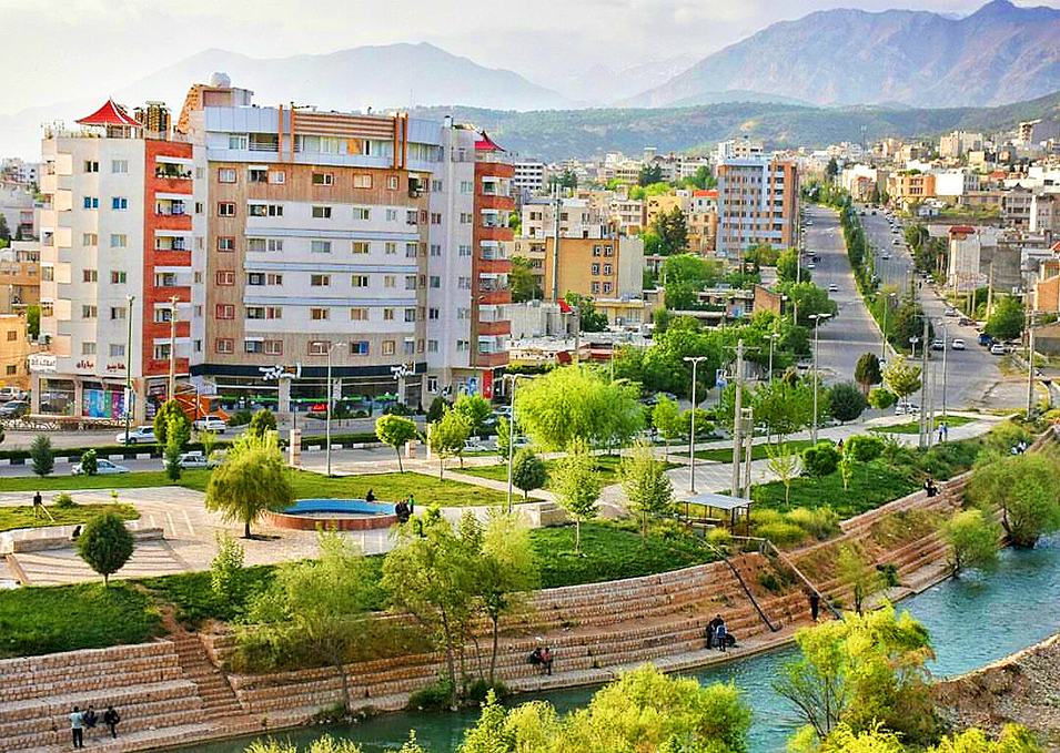

Yasuj, Iran
یاسوج
Yasuj is a regional capital of 96,786 people in Kohgiluyeh and Boyer-Ahmad, Iran.
Why visit Yasuj
Townapedia lists 1 museum or landmark, 7 parks and trails, 23 places to eat and 3 places to stay in and around town.
Weather in Yasuj
Forecast from MET Norway (CC BY 4.0). Full forecast
About Yasuj
Yasuj (Persian: ياسوج; [jɒːˈsuːdʒ] ) is a city in the Central District of Boyer-Ahmad County, Kohgiluyeh and Boyer-Ahmad province, Iran, serving as capital of the province, the county, and the district.
From the Wikipedia article Yasuj (this version), under CC BY-SA 4.0.
Travel tips from other travellers: Yasuj on Wikivoyage (CC BY-SA 4.0).
Museums and landmarks1

Parks, trails and playgrounds7


Restaurants and cafes23

VITAMIX Food Land
Restaurant · Breakfast, Burger, Cake, Chicken, Coffee Shop, Diner, Ice Cream · 0.8 km
کیمیا
Mo-Su 14:00-22:00
رستوران و بیرون بر شریف
Restaurant · 1.2 km
بلوار شهید مطهری, یاسوج
Mo-Su 10:00-22:00

11 more on the map.
Where to stay3

History
The area of Yasuj had been settled as early as the Bronze Age. Findings include the Martyrs Hills (dating from 3rd millennium BC), the Khosravi Hill from the Achaemenian period, the ancient site of Gerd, the Pataveh bridge, and the Pay-e Chol cemetery. Yasuj is the place where Alexander III of Macedon and his Macedonian forces stormed the Persian Gates (Darvazeh-ye Fars), and found a way into the Persian heartland (331 BC).
The Yasuj Museum, which opened in 2002, displays coins, statues, pottery, and bronze vessels recovered from surrounding archaeological sites.
In 2023, the city of Madavan and the villages of Balahzar, Jadval-e Ghureh-ye Mehrian, Madavan-e Sofla, Mehrian, Sarab-e Taveh, Servak, and Tall Khosrow merged with the city of Yasuj.
From the History section of Yasuj on Wikipedia, under CC BY-SA 4.0.
Churches and places of worship9
Shopping5
Gas and EV charging4
Schools, colleges and libraries26
Healthcare24
Map of Yasuj
102 places. The map loads OpenStreetMap tiles when you open it.
Getting there and nearby towns
Yasuj Airport (YES) is the nearest airport with scheduled flights listed in OpenStreetMap, 6 km away.
- Sepīdār 23 km west, about 23 min by car
- Dengezī 23 km north, about 23 min by car
- Shahīd 24 km northeast, about 24 min by car
- Sīsakht 25 km northwest, about 25 min by car
- Chītāb 29 km northwest, about 29 min by car
- Kīfteh 31 km north, about 31 min by car
- Sarbāz 32 km north, about 32 min by car
- Bārand-e Soflá 32 km north, about 32 min by car
- Tūt-e Nadeh 34 km northwest, about 34 min by car
- Dezhkord 36 km east, about 36 min by car
Drive times are estimates from straight-line distance, not routes.
Local news
Headlines from INDB.
Reviews, tips and questions
Loading what members have shared...
Sources and licences
- GeoNames (CC BY 4.0): population, coordinates, regions and time zone
- OpenStreetMap contributors (ODbL 1.0): places, airports, map data
- Wikidata (CC0 1.0): elevation, founding date, time zone, website, landmarks and historic places
- Wikimedia Commons (see each image): photos
- Wikipedia (CC BY-SA 4.0): overview and history text
Photo credits
- Panoramo de Yasuj (Jasuĝ), Ali Majdfar, CC BY-SA 2.5
- Yasujltgh3, Vah.hem, CC BY-SA 3.0
- Yasujltgh1, Vah.hem, CC BY-SA 3.0
- Yasuj Homan Baqerpour, Homan Baqerpour, CC BY-SA 4.0
Page built November 8, 2026. Spotted a mistake? Tell us or suggest a place.