
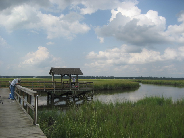


James Island, South Carolina
James Island is a town of 12,198 people in Charleston County, South Carolina.
Why visit James Island
Townapedia lists 64 museums and landmarks, 13 parks and trails, 26 places to eat and 3 attractions in and around town.
Highlights include Castle Pinckney Light, Fort Sumter, Secessionville Historic District and Andrew B. Murray Vocational School.
July is the warmest month, with average highs of 88°F; January lows average 44°F.
Weather in James Island
Forecast from the National Weather Service. Full forecast
About James Island
James Island is a town in Charleston County, South Carolina, United States. It is located in the central and southern parts of James Island. James Island is included within the Charleston, South Carolina metropolitan area and the Charleston Urbanized Area.
From the Wikipedia article James Island, South Carolina (this version), under CC BY-SA 4.0.
Things to do3

Castle Pinckney Light
Lighthouse · 3.0 mi
Lighthouse in South Carolina, United States

Fort Sumter
Monument and historic site · 3.8 mi
Fort in Charleston, South Carolina

Medical University of South Carolina
School · 3.4 mi
Medical school and six colleges for the education of health professionals
Museums and landmarks64

Secessionville Historic District
Monument and historic site · National Register of Historic Places · 2.2 mi
Historic district in South Carolina, United States

Andrew B. Murray Vocational School
Monument and historic site · National Register of Historic Places · 2.6 mi
Former school in Charleston, South Carolina, USA

Branford-Horry House
Monument and historic site · National Register of Historic Places · 2.7 mi
Historic house in South Carolina, United States

Castle Pinckney
Monument and historic site · National Register of Historic Places · 3.0 mi
Fort
Charleston Arsenal
Monument and historic site · National Register of Historic Places · 3.5 mi
Former U.S. arsenal in Charleston, South Carolina

Citizens and Southern National Bank of South Carolina
Monument and historic site · National Register of Historic Places · 2.8 mi
Building in Charleston, United States of America

City Market
Monument and historic site · National Register of Historic Places · 3.1 mi
Historic Market Hall and sheds in Charleston, South Carolina, U.S.A.
Clark Mills Studio
Monument and historic site · National Register of Historic Places · 2.8 mi
Clark Mills first sculpture studio, Charleston, SC (1837-1848)

College of Charleston
Monument and historic site · National Register of Historic Places · 3.3 mi
Liberal arts college in Charleston, South Carolina, USA

Coming Street Cemetery
Monument and historic site · National Register of Historic Places · 3.7 mi
Cemetery in Charleston, South Carolina, United States


Congregation Kahal Kadosh Beth Elohim
Monument and historic site · National Register of Historic Places · 3.2 mi
One of the oldest Jewish congregations in the US
Denmark Vesey House
Monument and historic site · National Register of Historic Places · 3.2 mi
Historic house in South Carolina, United States
52 more on the map.
Parks, trails and playgrounds13

Demetre Park
Park · 1.6 mi
Park in South Carolina, United States of America
South Carolina Aquarium
Park · 3.9 mi
Aquarium in Charleston, South Carolina
Washington Square (Charleston)
Park · 2.8 mi
Greenspace in downtown Charleston, South Carolina
Waterfront Park
Park · 3.0 mi
Park in Charleston, United States of America
James Island Recreation Complex and Park
Park
Baseball fields, Basketball court, Benches, picnic tables, playground, pool, restrooms, dog park.
1088 Quail Drive, Charleston
sunrise-sunset
Dock Street Park
Park · 1.5 mi
Park in James island with views of Charleston, a fishing pier and picnic tables
749 Sprague Street, James Island

1 more on the map.
Restaurants and cafes26

Edison
Restaurant · International · 0.4 mi
1014 Fort Johnson Road, Charleston
Mo-Sa 16:00-21:00; Su 10:00-14:00 "brunch"
Martin's Bar-B-Que Joint
Restaurant · Barbecue · 1.7 mi
1622 Highland Avenue, Charleston
Su-Th 11:00-21:00; Fr-Sa 11:00-22:00
El Pollo Guapo
Restaurant · Latin American · 1.9 mi
1130 Folly Road, Charleston
Jalisco Taqueria & Tequila
Restaurant · Mexican · 2.1 mi
1271 Folly Road, Charleston
14 more on the map.
History
On November 14, 1782, Tadeusz Kościuszko, Colonel of the Continental Army, led the last known armed action of the Revolutionary War against the British and was nearly killed on James Island. Later, The Continental Congress named Kosciuszko Brigadier General for his service in both the North, including his tremendous assistance to General Gates at The Battle of Saratoga and brilliant efforts assisting General Greene in saving the South Region Army from Cornwallis forces and ultimately severely weakening the British under command of Cornwallis.
In the American Civil War, the Battle of Secessionville was fought on James Island.
Long settled as a semi-rural area, this island has been affected by increasing urbanization and the expansion of the city of Charleston.
Island residents incorporated the Town of James Island on January 8, 1993. Joan Sooy was elected as the first Mayor in March 1993.
A lawsuit was filed by the City of Charleston claiming that the parts of the new Town were not contiguous, being separated by salt marsh that it had already incorporated. The City of Charleston prevailed at Circuit Court and the Town appealed. The South Carolina Supreme Court ruled against the Town in 1997.
From the History section of James Island, South Carolina on Wikipedia, under CC BY-SA 4.0.
Churches and places of worship13
Circular Congregational Church
Church · National Register of Historic Places · 3.0 mi
Emanuel African Methodist Episcopal Church
Church · National Register of Historic Places · 3.6 mi
Huguenot Church
Church · National Register of Historic Places · 3.1 mi
St. Michael's Episcopal Church
Church · National Register of Historic Places · 2.8 mi
St. Philip's Episcopal Church
Church · National Register of Historic Places · 3.0 mi
Unitarian Church in Charleston
Church · National Register of Historic Places · 2.5 mi
Kingdom Hall of Jehovahs Witnesses
Church · Jehovahs Witness · 1.6 mi
1309 Secessionville Road, Charleston
St. John's Protestant Episcopal Church (Charleston, South Carolina)
Church · 4.0 mi
Sisters of Charity of Our Lady of Mercy
Church · Catholic · 2.1 mi
424 Fort Johnson Road, Charleston
Shopping6
Schools, colleges and libraries30
Charleston Advancement Academy High School
School · 1.5 mi
1484 Camp Road, Charleston
Charleston Charter School For Math And Science
School · 4.7 mi
1002 King Street, Charleston
Healthcare2
Map of James Island
157 places. The map loads OpenStreetMap tiles when you open it.
Climate by month
Monthly table
| Month | High | Low | Rain |
|---|---|---|---|
| Jan | 58°F | 44°F | 2.6 in |
| Feb | 60°F | 46°F | 2.6 in |
| Mar | 66°F | 52°F | 3.0 in |
| Apr | 72°F | 60°F | 3.0 in |
| May | 79°F | 68°F | 2.6 in |
| Jun | 84°F | 74°F | 4.8 in |
| Jul | 88°F | 77°F | 5.1 in |
| Aug | 86°F | 76°F | 6.1 in |
| Sep | 83°F | 72°F | 5.2 in |
| Oct | 76°F | 63°F | 4.1 in |
| Nov | 67°F | 53°F | 2.3 in |
| Dec | 61°F | 47°F | 2.9 in |
U.S. Climate Normals 1991-2020 for Charleston City Hcn (3 mi away), NOAA NCEI.
People and cost of living
American Community Survey 5-year estimates, 2020-2024, U.S. Census Bureau. Estimates have margins of error, larger for small towns.
Disaster history
Charleston County has had 23 federal disaster declarations since 2000, most often for hurricanes.
- 2026-01-23: Severe Winter Storm (Winter Storm)
- 2024-09-26: Hurricane Helene (Tropical Storm)
- 2024-08-05: Hurricane Debby (Tropical Storm)
- 2023-08-31: Hurricane Idalia (Hurricane)
- 2022-11-21: Hurricane Ian (Hurricane)
- 2022-09-29: Hurricane Ian (Hurricane)
OpenFEMA disaster declarations summaries.
Getting there and nearby towns
Charleston International Airport (CHS) is the nearest airport with scheduled flights listed in OpenStreetMap, 13 miles away.
- Folly Beach 5 mi south, about 8 min by car
- Mount Pleasant 6 mi northeast, about 10 min by car
- Charleston 7 mi north, about 11 min by car
- Sullivan's Island 7 mi east, about 11 min by car
- Kiawah Island 11 mi southwest, about 18 min by car
- Isle of Palms 12 mi northeast, about 19 min by car
- Hanahan 14 mi north, about 22 min by car
- North Charleston 15 mi northwest, about 23 min by car
- Hollywood 15 mi west, about 25 min by car
- Beaufort 50 mi southwest, about 1 h 15 min by car
Drive times are estimates from straight-line distance, not routes.
Local news
Headlines from INDB, the NEMICO news database.
Reviews, tips and questions
Loading what members have shared...
Sources and licences
- NCES EDGE (Public domain): public schools
- NOAA NCEI U.S. Climate Normals 1991-2020 (Public domain): climate by month
- OpenFEMA (Public domain): disaster declarations
- OpenStreetMap contributors (ODbL 1.0): places, airports, map data
- U.S. Census Bureau (Public domain): population, income, housing, education, commute
- Wikidata (CC0 1.0): landmarks and historic places
- Wikimedia Commons (see each image): photos
- Wikipedia (CC BY-SA 4.0): overview and history text
Photo credits
- James Island South Carolina, Lee Keadle, CC BY 1.0
- Secessionville-obelisk-sc1, Brian Stansberry (photographer), CC BY 3.0
- 65 Cannon Street, ProfReader, CC BY-SA 4.0
- Powder-magazine-charleston-sc1, Brian Stansberry, CC BY 3.0
- Stiles-Hinson House 2021a, Antony-22, CC BY-SA 4.0
- South Carolina Historical Society, ProfReader, CC BY-SA 3.0
- Fort Johnson, Oct. 10, 1863, Conrad Wise Chapman, Public domain
- Saint Mary's Church (Charleston, SC), Charles N.Bayless, Public domain
- Heyward-Washington House, ProfReader, CC BY-SA 3.0
- Circular Church - May 2013, ProfReader, CC BY-SA 3.0
- Kahal Kadosh Beth Elohim Synagogue, John P. O'Neill, Public domain
- Another view IMG 4653, Billy Hathorn, CC BY-SA 3.0
- Old-slave-mart-facade-sc1, Brian Stansberry, CC BY 3.0
- French Huguenot church, ProfReader, CC BY-SA 3.0
- USS Clamagore;0834309, United States Navy, Public domain
- Farmers and Exchange Bank (Charleston), Louis I. Schwartz, Public domain
- Castle-pinckney-from-battery-sc1, Brian Stansberry, CC BY 3.0
- 200 East Bay Street, ProfReader, CC BY-SA 3.0
- Murray-school-building-charleston-sc1, Brian Stansberry, CC BY 3.0
- Dock Street Theatre, Charleston SC 20160704 1, DXR, CC BY-SA 4.0
- Customs House - 2013, ProfReader, CC BY-SA 3.0
- 635 East Bay, ProfReader, CC BY-SA 4.0
- USS Laffey (DD-724) underway at sea on 26 March 1964 (USN 1100870), U.S. Navy, Public domain
- 12 Bee, ProfReader, CC BY-SA 3.0
- Gov. William Aiken House, Elisa.rolle, CC BY-SA 4.0
- Pink-house-charleston-sc1, Brian Stansberry, CC BY 3.0
- FortsumterNM-welcome, Staib, CC BY-SA 3.0
- 50 Broad St - 2013, ProfReader, CC BY-SA 3.0
- 69 Barre, ProfReader, CC BY-SA 4.0
- Market-hall-charleston-sc1, Brian Stansberry, CC BY 3.0
- Federal Courthouse 2013, ProfReader, CC BY-SA 3.0
- Emanuel African Methodist Episcopal (AME) Church, Cal Sr from Newport, NC, US, CC BY 2.0
- Robert Barnwell Rhett House, ProfReader, CC BY-SA 3.0
- Randolph Hall, College of Charleston, Harleston Village, Charleston, SC (49364204051), Warren LeMay from Covington, KY, United States, CC0
- CamdenDepot HABS pic1 cropped, Louis Schwartz, Public domain
- Coming-street-cemetery-sc1, Brian Stansberry, CC BY 3.0
- 14 Legare St, ProfReader, CC BY-SA 3.0
- Branford-Horry House, ProfReader, CC BY-SA 3.0


Page built October 30, 2026. Spotted a mistake? Tell us or suggest a place.