


Why visit Jolivue
Townapedia lists 32 museums and landmarks, 8 places to eat and 2 places to stay in and around town.
Highlights include Arista Hoge House and Augusta County Courthouse.
July is the warmest month, with average highs of 84°F; January lows average 25°F, and about 22 inches of snow fall in a normal year.
Weather in Jolivue
Forecast from the National Weather Service. Full forecast
About Jolivue
Jolivue is a census-designated place (CDP) in Augusta County, Virginia, United States. As of the 2020 census, Jolivue had a population of 1,168. It is part of the Staunton–Waynesboro Micropolitan Statistical Area.
From the Wikipedia article Jolivue, Virginia (this version), under CC BY-SA 4.0.
Museums and landmarks32

Arista Hoge House
Monument and historic site · National Register of Historic Places · 2.6 mi
Historic house in Virginia, United States

Augusta County Courthouse
Monument and historic site · National Register of Historic Places · 2.6 mi
County courthouse in Staunton, United States of America

Beverley Historic District
Monument and historic site · National Register of Historic Places · 2.6 mi
Historic district in Virginia, United States

Booker T. Washington Community Center
Monument and historic site · National Register of Historic Places · 2.6 mi
Community center in Virginia, US

Breezy Hill
Monument and historic site · National Register of Historic Places · 2.6 mi
Historic house in Virginia, United States

C. W. Miller House
Monument and historic site · National Register of Historic Places · 2.8 mi
Single-family detached home in Staunton, United States of America

Catlett House
Monument and historic site · National Register of Historic Places · 2.7 mi
Historic house in Virginia, United States

Chapel Hill
Monument and historic site · National Register of Historic Places · 3.1 mi
Building in Virginia, United States
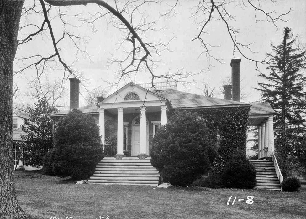
Folly
Monument and historic site · National Register of Historic Places · 2.4 mi
Historic plantation house located near Staunton, Virginia, United States

Gospel Hill Historic District
Monument and historic site · National Register of Historic Places · 2.8 mi
Historic district in Virginia, United States

Hilltop
Monument and historic site · National Register of Historic Places · 2.8 mi
Building in Virginia, United States

J. C. M. Merrillat House
Monument and historic site · National Register of Historic Places · 2.8 mi
Historic house in Virginia, United States
20 more on the map.
Restaurants and cafes8



Arby's
Fast food · Sandwich · 1.5 mi
910 Greenville Avenue, Staunton
Mo-Th 10:00-22:00; Fr-Sa 10:00-23:00; Su 10:00-22:00
Burger King
Fast food · Burger · 1.5 mi
1001 Greenville Avenue, Staunton
Mo-Th 06:00-21:00; Fr-Sa 06:00-22:00; Su 07:00-21:00
McDonald's
Fast food · Burger · 0.9 mi
130 Lee Jackson Highway, Staunton
Mo-Th 05:30-23:00; Fr 05:30-24:00; Sa 06:00-24:00; Su 06:00-23:00
Where to stay2

Holiday Inn Express
Motel and hotel · 0.4 mi
47 Rolling Thunder Lane, Staunton
Churches and places of worship7


Trinity Episcopal Church
Church · National Register of Historic Places · 2.6 mi
Church building in Staunton, United States of America

Fount of Life Church of God of Prophecy
Church · Church Of God Of Prophecy · 1.5 mi
History
Located near Jolivue is the Valley Railroad Stone Bridge, listed on the National Register of Historic Places in 1974.
From the History section of Jolivue, Virginia on Wikipedia, under CC BY-SA 4.0.
Shopping3
Gas and EV charging2
Schools, colleges and libraries24
CF Richards Seventh-day Adventist School
School · Seventh Day Adventist · 1.3 mi
Commonwealth Ctr For Children & Adolescents
School · 2.3 mi
1355 Richmond Road, Staunton
Staunton City School Preschool Programs
School · 4.5 mi
1751 Shutterlee Mill Road, Staunton
Map of Jolivue
78 places. The map loads OpenStreetMap tiles when you open it.
Climate by month
Monthly table
| Month | High | Low | Rain | Snow |
|---|---|---|---|---|
| Jan | 42°F | 25°F | 2.9 in | 5.4 in |
| Feb | 46°F | 27°F | 2.4 in | 6.8 in |
| Mar | 54°F | 33°F | 3.4 in | 4.1 in |
| Apr | 65°F | 42°F | 3.3 in | 0.1 in |
| May | 73°F | 52°F | 4.1 in | 0.0 in |
| Jun | 80°F | 60°F | 4.1 in | 0.0 in |
| Jul | 84°F | 64°F | 4.2 in | 0.0 in |
| Aug | 83°F | 62°F | 4.0 in | 0.0 in |
| Sep | 77°F | 56°F | 4.2 in | 0.0 in |
| Oct | 66°F | 44°F | 2.6 in | 0.0 in |
| Nov | 55°F | 36°F | 2.6 in | 0.4 in |
| Dec | 46°F | 28°F | 3.0 in | 4.8 in |
U.S. Climate Normals 1991-2020 for Staunton Wtp Hcn (4 mi away), NOAA NCEI.
People and cost of living
American Community Survey 5-year estimates, 2020-2024, U.S. Census Bureau. Estimates have margins of error, larger for small towns.
Disaster history
Augusta County has had 11 federal disaster declarations since 2000, most often for hurricanes.
- 2026-01-23: Severe Winter Storm (Winter Storm)
- 2020-04-02: Covid-19 Pandemic (Biological)
- 2020-03-13: Covid-19 (Biological)
- 2018-09-11: Hurricane Florence (Hurricane)
- 2012-10-29: Hurricane Sandy (Hurricane)
- 2012-07-27: Severe Storms And Straight-Line Winds (Severe Storm)
OpenFEMA disaster declarations summaries.
Getting there and nearby towns
Shenandoah Valley Regional Airport (SHD) is the nearest airport with scheduled flights listed in OpenStreetMap, 14 miles away.
- Staunton 3 mi north, about 5 min by car
- Stuarts Draft 7 mi south, about 11 min by car
- Greenville 9 mi southwest, about 14 min by car
- Waynesboro 10 mi east, about 15 min by car
- Dooms 12 mi east, about 19 min by car
- Crimora 13 mi east, about 21 min by car
- Grottoes 17 mi northeast, about 28 min by car
- Craigsville 18 mi west, about 28 min by car
- Bridgewater 20 mi north, about 32 min by car
- Harrisonburg 25 mi northeast, about 40 min by car
Drive times are estimates from straight-line distance, not routes.
Local news
Headlines from INDB, the NEMICO news database.
Reviews, tips and questions
Loading what members have shared...
Sources and licences
- NCES EDGE (Public domain): public schools
- NOAA NCEI U.S. Climate Normals 1991-2020 (Public domain): climate by month
- OpenFEMA (Public domain): disaster declarations
- OpenStreetMap contributors (ODbL 1.0): places, airports, map data
- U.S. Census Bureau (Public domain): population, income, housing, education, commute
- Wikidata (CC0 1.0): elevation, founding date, time zone, website, landmarks and historic places
- Wikimedia Commons (see each image): photos
- Wikipedia (CC BY-SA 4.0): overview and history text
Photo credits
- 2019-09-06 10 30 22 View south along Virginia State Route 262 (Woodrow Wilson Parkway) at the junction with Interstate 64 and Interstate 81 in Jolivue, Augusta County, Virginia, Famartin, CC BY-SA 4.0
- 2019-09-06 10 37 23 View north along Virginia State Route 262 (Woodrow Wilson Parkway) at the exit for U.S. Route 11 (Staunton) in Jolivue, Augusta County, Virginia, Famartin, CC BY-SA 4.0
- 2019-06-25 10 11 33 View west along Interstate 64 and south along Interstate 81 from the overpass for Virginia State Route 262 (Woodrow Wilson Parkway) in Jolivue, Augusta County, Virginia, Famartin, CC BY-SA 4.0
- 2016-05-27 18 30 03 View south along Lee Highway (U.S. Route 11) near Virginia State Secondary Route 1402 (1st Street) in Jolivue, Augusta County, Virginia, Famartin, CC BY-SA 4.0
- 2019-06-25 10 12 54 View east along Interstate 64 and north along Interstate 81 from the overpass for Virginia State Route 262 (Woodrow Wilson Parkway) in Jolivue, Augusta County, Virginia, Famartin, CC BY-SA 4.0
- 2016-05-27 07 13 15 View west along Interstate 64 and south along Interstate 81 just south of Exit 220 in Jolivue, Augusta County, Virginia, Famartin, CC BY-SA 4.0
- 2019-06-06 13 06 31 View west along Interstate 64 and south along Interstate 81 at Exit 220 (Virginia State Route 262 TO U.S. Route 11, Staunton) in Jolivue, Augusta County, Virginia, Famartin, CC BY-SA 4.0
- 2019-06-06 13 59 11 View east along Interstate 64 and north along Interstate 81 at Exit 220 (Virginia State Route 262 TO U.S. Route 11, Staunton) in Jolivue, Augusta County, Virginia, Famartin, CC BY-SA 4.0
- 2019-06-25 10 17 08 View west along Interstate 64 and south along Interstate 81 from the overpass for Virginia State Route 635 (Barterbrook Road) in Jolivue, Augusta County, Virginia, Famartin, CC BY-SA 4.0
- 2019-06-25 10 17 22 View east along Interstate 64 and north along Interstate 81 from the overpass for Virginia State Route 635 (Barterbrook Road) in Jolivue, Augusta County, Virginia, Famartin, CC BY-SA 4.0
- 2016-05-19 11 40 11 View west along Interstate 64 and south along Interstate 81 just north of Exit 220 (Virginia State Route 262, U.S. Route 11, Staunton) in Jolivue, Augusta County, Virginia, Famartin, CC BY-SA 4.0
- 2019-08-02 12 00 33 View south along U.S. Route 11 (Lee Jackson Highway) from the overpass for Virginia State Route 262 (Woodrow Wilson Parkway) in Jolivue, Augusta County, Virginia, Famartin, CC BY-SA 4.0
- 2019-08-02 12 03 20 View north along U.S. Route 11 (Lee Jackson Highway) from the overpass for Virginia State Route 262 (Woodrow Wilson Parkway) in Jolivue, Augusta County, Virginia, Famartin, CC BY-SA 4.0
- 2019-06-25 10 06 54 View east along Interstate 64 and north along Interstate 81 from the overpass for Virginia State Route 647 (Hammond Road) in Jolivue, Augusta County, Virginia, Famartin, CC BY-SA 4.0
- 2019-06-25 10 06 31 View west along Interstate 64 and south along Interstate 81 from the overpass for Virginia State Route 647 (Hammond Road) just south of Jolivue in Augusta County, Virginia, Famartin, CC BY-SA 4.0
- 2019-09-06 10 25 07 View south along Virginia State Route 262 (Woodrow Wilson Parkway) at the exits for U.S. Route 11 (Greenville, Staunton) in Jolivue, Augusta County, Virginia, Famartin, CC BY-SA 4.0
- 2016-05-19 11 42 55 View north along the Woodrow Wilson Parkway (Virginia State Route 262) near Lee Highway (U.S. Route 11) in Jolivue, Augusta County, Virginia, Famartin, CC BY-SA 4.0
- 2019-06-06 14 01 54 View east along Interstate 64 and north along Interstate 81 at Exit 221 (Interstate 64 EAST, Richmond) in Jolivue, Augusta County, Virginia, Famartin, CC BY-SA 4.0
- 2019-09-06 10 40 05 View north along Virginia State Route 262 (Woodrow Wilson Parkway) at the exit for Virginia State Route 613 (Old Greenville Road) in Jolivue, Augusta County, Virginia, Famartin, CC BY-SA 4.0
- Berkeley Place on Gospel Hill, Nyttend, Public domain
- Coffee on the Corner building, Staunton, Virginia, Weatherdude at English Wikipedia, Public domain
- Staunton, Virginia (6261997861), Doug Kerr from Albany, NY, United States, CC BY-SA 2.0
- Thomas J. Michie House, Nyttend, Public domain
- Hilltop, portico view, Mary Baldwin, Nyttend, Public domain
- Chapel Hill near Mint Spring, Nyttend, Public domain
- Augusta County Courthouse, ZeWrestler, CC BY-SA 3.0
- C.W. Miller House near Mary Baldwin, Nyttend, Public domain
- Valley Railroad, Folly Mills Creek Viaduct, Interstate 81, Staunton vicinity (Augusta County, Virginia), Jack Boucher, Public domain
- Western State Hospital, Ned Hartley, CC BY-SA 3.0
- Oakdene in Staunton, Nyttend, Public domain
- Kable House at Mary Baldwin, Nyttend, Public domain
- The Oaks on Beverley, Staunton, Nyttend, Public domain
- J.C.M. Merrillat House, Nyttend, Public domain
- Staunton, Virginia (6262002225), Doug Kerr from Albany, NY, United States, CC BY-SA 2.0
- Staunton Booker T. Washington High School, Nyttend, Public domain
- Folly Farm HABS VA1, unknown HABS photographer, Public domain
- Staunton, Virginia (6262552370), Doug Kerr from Albany, NY, United States, CC BY-SA 2.0
- Breezy Hill in Staunton, Nyttend, Public domain
- Trinity Episcopal Church Staunton VA, Strawser, CC BY-SA 3.0
- Staunton VA National Cemetery Sept 2013, Strawser, CC BY-SA 3.0


Page built October 30, 2026. Spotted a mistake? Tell us or suggest a place.