


Chikusei, Japan
筑西市
Chikusei is a town of 100,753 people in Ibaraki, Japan, founded in March 28, 2005.
Why visit Chikusei
Townapedia lists 41 museums and landmarks, 46 parks and trails, 84 places to eat, 7 places to stay and 6 attractions in and around town.
Highlights include Jichi Medical University, Niihari Gunga ruins, Teranohigashi Site and Kanakubo Athletic Park Baseball Field.
Weather in Chikusei
Forecast from MET Norway (CC BY 4.0). Full forecast
About Chikusei
Chikusei (筑西市, Chikusei-shi) is a city located in Ibaraki Prefecture, Japan. As of 1 January 2024, the city had an estimated population of 98,031 in 39,075 households and a population density of 478 persons per km2. The percentage of the population aged over 65 was 31.2%. The total area of the city is 205.30 square kilometres (79.27 sq mi).
From the Wikipedia article Chikusei (this version), under CC BY-SA 4.0.
Things to do6

Jichi Medical University
School · 14.3 km
Higher education institution in Tochigi Prefecture, Japan

Museums and landmarks41

Niihari Gunga ruins
Monument and historic site · 6.3 km
Archaeological site in Japan
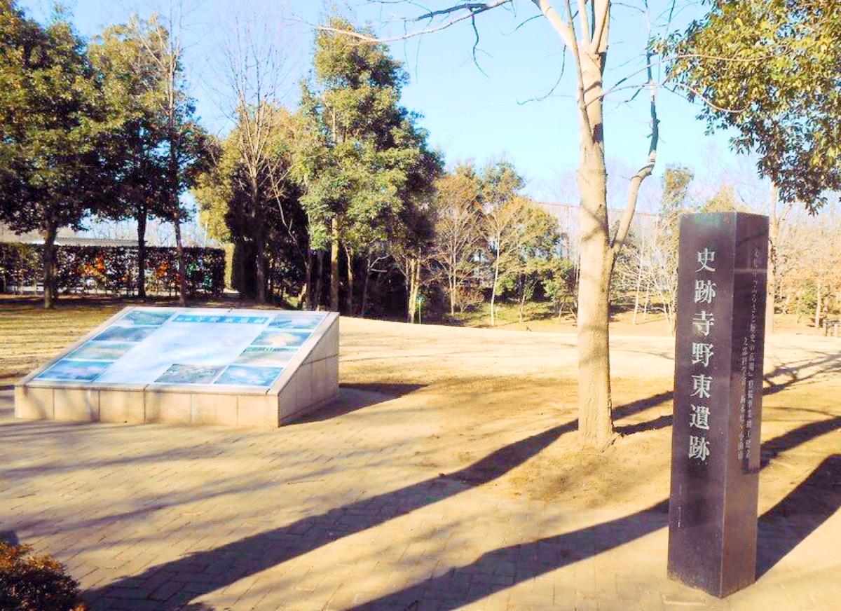
Teranohigashi Site
Monument and historic site · 9.1 km
Archaeological site in Oyama, Tochigi, Japan

Yūki temple ruins
Monument and historic site · 11.4 km
Archaeological site in Japan
NAMC YS-11 Mass-production No.1
Monument and historic site · 3.9 km
日本機械学会認定 機械遺産 第13号(1964年民航輸送機設計製造(NAMC)製、量産型としての第1号機。国立科学博物館より移設、ザ・ヒロサワ・シティ内「科博廣澤航空博物館」にて公開)

寺野東遺跡 国指定遺跡
Monument and historic site · 9.1 km
旧石器時代から近世までの複合遺跡 環状盛土遺構、水場遺構、木組み遺構
29 more on the map.
Parks, trails and playgrounds46


Kanakubo Athletic Park Baseball Field
Sports field and stadium · 10.2 km


真壁ひな祭り 流し雛 ひな壇
Park · 11.2 km
毎年2月下旬から3月初旬にかけて桜川市で繰り広げられる真壁のひなまつりにおいて、最終日にまつりのフィナーレとして同市真壁町飯塚の山口川の岸辺から手作りのひな人形を願いを込めて流す。
34 more on the map.
Restaurants and cafes84


SAPA COFFEE
Cafe · Coffee Shop · 1.2 km
Mo,We-Fr 10:00-20:30; Tu off; Sa-Su 09:00-22:00
72 more on the map.
History
During the Edo period, parts of the modern city of Chikusei were administered by Shimodate Domain, one of the feudal domains of the Tokugawa shogunate. With the creation of the modern municipalities system after the Meiji Restoration on April 1, 1889, the town of Shimodate was established within Makabe District, Ibaraki). Shimodate was raised to city status on March 15, 1954.
The city of Chikusei was established on March 28, 2005, from the merger of the city of Shimodate, and towns of Akeno, Kyōwa and Sekijō (all from Makabe District).
From the History section of Chikusei on Wikipedia, under CC BY-SA 4.0.
Where to stay7
Churches and places of worship67
Shopping34
Gas and EV charging11
Schools, colleges and libraries68
Ibaraki Prefectural Shimodate Technological High School
School · 4.4 km
Ibaraki Prefectural Yuki Special Needs Education School
School · 10.5 km
Healthcare29
Map of Chikusei
250 places. The map loads OpenStreetMap tiles when you open it.
Getting there and nearby towns
Ibaraki Airport (IBR) is the nearest airport with scheduled flights listed in OpenStreetMap, 42 km away.
- Koga 28 km southwest, about 28 min by car
- Tsukuba 29 km southeast, about 29 min by car
- Kashiwa 50 km south, about 50 min by car
- Katsuta 50 km east, about 50 min by car
- Nagareyama 52 km south, about 52 min by car
- Ōta 55 km west, about 55 min by car
- Inzai 56 km south, about 56 min by car
- Matsudo 60 km south, about 1 h by car
- Kiryū 59 km west, about 59 min by car
- Tokyo 74 km south, about 1 h 15 min by car
Drive times are estimates from straight-line distance, not routes.
Local news
Headlines from INDB.
Reviews, tips and questions
Loading what members have shared...
Sources and licences
- GeoNames (CC BY 4.0): population, coordinates, regions and time zone
- OpenStreetMap contributors (ODbL 1.0): places, airports, map data
- Wikidata (CC0 1.0): elevation, founding date, time zone, website, landmarks and historic places
- Wikimedia Commons (see each image): photos
- Wikipedia (CC BY-SA 4.0): overview and history text
Photo credits
- Chikusei City Office, ほぶ, Public domain
- Chikusei Public Library Central Branch Main 01, Miyuki Meinaka, CC BY-SA 4.0
- Chikusei Public Library Central Branch Riverside, Miyuki Meinaka, CC BY-SA 4.0
- Ibaraki prefectural road route 306 (Shimodate station-Ara line) in otsu(Ara-machi),Chikusei city, 小石川人晃, CC BY-SA 3.0
- Shimodate SPICA, Chikusei City Hall, Miyuki Meinaka, CC BY-SA 4.0
- Shimodate SPICA, Chikusei City Hall 2, Miyuki Meinaka, CC BY-SA 4.0
- Shimodate SPICA, Chikusei City Hall 3, Miyuki Meinaka, CC BY-SA 4.0
- Terahigashi Site, MChew, CC BY-SA 4.0
- Niihari Gunga marker, MChew, CC BY-SA 4.0
- Takedasuga Jinja, Abasaa, Public domain
- 大國玉神社 拝殿, Taisuke.Kasuya, CC BY-SA 4.0
- Chikusei City Hospital, Abasaa, Public domain
- Shimodate technical high school, User:Swind, CC BY-SA 3.0
- Ibaraki Prefectural Akeno High School, 小石川人晃, CC BY-SA 4.0
- Yuki 2nd High School, Abasaa, Public domain
- Kinu Commercial High School, Abasaa, Public domain
- Myoho-ji Temple (Sakuragawa City, Ibaraki Prefecture) 04, 小石川人晃, CC BY-SA 4.0
- Yahashira Shrine (Sakuragawa City, Ibaraki Prefecture) 02, 小石川人晃, CC BY-SA 4.0
- Jichi Med. Univ. Education & Research Center, Miyuki Meinaka, CC BY-SA 4.0
- Kakubo Sports Park Baseball Stadium 01, 小石川人晃, CC BY-SA 4.0
- マルフク - panoramio (56), heriheri, CC BY 3.0
- 下館 Shimodate (55137747187), nagi usano from Tokyo, Japan, CC BY 4.0
- Shimodate Haguro Shrine 1, Miyuki Meinaka, CC BY-SA 4.0
- 下館 Shimodate (55138628801), nagi usano from Tokyo, Japan, CC BY 4.0
- 国道50号 下館バイパス 茨城県筑西市 20180318 091415, Puchi-masashi This photo was taken with Canon PowerShot G9 X Mark II, CC BY-SA 4.0
- Movie theater trace of Shimodate cinema 1, 小石川人晃, CC BY-SA 4.0
- Shimodate ramen 001, Ocdp, CC0
- Shimodate station from SPICA building, Miyuki Meinaka, CC BY-SA 4.0
- Ibaraki Prefectural Road No. 305 Shimodate Station Line, 小石川人晃, CC BY-SA 4.0
- Pref. Road Repair Memorial, Shimodate, Miyuki Meinaka, CC BY-SA 4.0
- JR下館駅舎, Yukudora, CC0
- Shimodate station North Side, Miyuki Meinaka, CC BY-SA 4.0
- 道の駅グランテラス筑西 (55139023270), nagi usano from Tokyo, Japan, CC BY 4.0
- 下館駅 - panoramio (1), くろふね, CC BY 3.0
- 傘の自動販売機 (48071697907), Cheng-en Cheng from Taichung City, Taiwan, CC BY-SA 2.0
- 下館駅前 - panoramio, くろふね, CC BY 3.0
- Shimodate Hero exterior close view, Nkanplain ( talk ), CC BY-SA 3.0
- 下館駅 - panoramio (7), くろふね This photo was taken with Canon EOS 60D, CC BY 3.0
- 下館駅 - panoramio (4), くろふね This photo was taken with Canon EOS 500D, CC BY 3.0
- 下館駅 - panoramio (3), くろふね This photo was taken with Canon EOS 500D, CC BY 3.0


Page built November 4, 2026. Spotted a mistake? Tell us or suggest a place.