
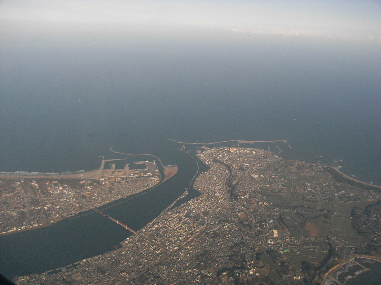


Choshi, Japan
銚子市
Choshi is a town of 58,431 people in Chiba, Japan, founded in February 11, 1933.
Why visit Choshi
Townapedia lists 87 museums and landmarks, 47 parks and trails, 119 places to eat, 16 places to stay and 8 attractions in and around town.
Highlights include Inubōsaki Lighthouse, Chiba Institute of Science, Soy Sauce Taste Experience Center and Ontake-jinja Shrine.
Weather in Choshi
Forecast from MET Norway (CC BY 4.0). Full forecast
About Choshi
Chōshi (Japanese: 銚子市, romanized: Chōshi-shi, pronounced [tɕoːɕi]) is a city located in Chiba Prefecture, Japan. As of 1 December 2020, the city had an estimated population of 59,174 in 27,160 households and a population density of 700 inhabitants per square kilometre (1,800/sq mi). The total area of the city is 84.19 km2 (32.5 sq mi).
From the Wikipedia article Chōshi (this version), under CC BY-SA 4.0.
Travel tips from other travellers: Choshi on Wikivoyage (CC BY-SA 4.0).
Things to do8

Inubōsaki Lighthouse
Lighthouse · 4.3 km
Lighthouse in Japan
08:30-16:00

Chiba Institute of Science
School · 3.4 km
Higher education institution in Chiba Prefecture, Japan

Inubōsaki Marine Park
Monument and historic site · 4.1 km
Aquarium in Chiba Prefecture, Japan



Museums and landmarks87



75 more on the map.
Parks, trails and playgrounds47




35 more on the map.
Restaurants and cafes119


大衆酒場ドリーム
Bar and pub · Fish, Soba, Ice Cream, Grill, Chicken, Seafood, Friture · 0.6 km
20, 銚子市
Mo-Sa 17:00-22:00




107 more on the map.
History
Chōshi has been noted as a fishing port since ancient times. The commercial fishing and soy sauce industries were developed in Chōshi by the Tokugawa shogunate during the Edo period (1603–1868). Their development continued in the early industrialization of Japan in the Meiji period (1868–1912). The town of Chōshi was established with the creation of the modern municipalities system on April 1, 1889. Noted soy sauce producer Yamasa was incorporated in 1928, and Higeta in 1932. Chōshi was elevated to city status on February 11, 1933.
Chōshi was a center of industrial unrest in the early 20th century; there were numerous strikes and labor disputes at the soy sauce factories, and residents attacked the government offices in 1930 over heavy taxation and unaccounted expenditures by municipal authorities.
From the History section of Chōshi on Wikipedia, under CC BY-SA 4.0.
Where to stay16
Churches and places of worship54
Shopping18
Gas and EV charging15
Schools, colleges and libraries28
Healthcare30
Map of Choshi
250 places. The map loads OpenStreetMap tiles when you open it.
Getting there and nearby towns
Narita International Airport (NRT) is the nearest airport with scheduled flights listed in OpenStreetMap, 41 km away.
- Hasaki 0 km north, about 1 min by car
- Asahi 17 km west, about 17 min by car
- Omigawa 23 km northwest, about 23 min by car
- Yōkaichiba 26 km west, about 26 min by car
- Yokoshiba 33 km west, about 33 min by car
- Sawara 34 km northwest, about 34 min by car
- Tako 33 km west, about 33 min by car
- Narutō 40 km west, about 40 min by car
- Narita 47 km west, about 47 min by car
- Tōgane 47 km southwest, about 47 min by car
Drive times are estimates from straight-line distance, not routes.
Local news
Headlines from INDB.
Reviews, tips and questions
Loading what members have shared...
Sources and licences
- GeoNames (CC BY 4.0): population, coordinates, regions and time zone
- OpenStreetMap contributors (ODbL 1.0): places, airports, map data
- Wikidata (CC0 1.0): elevation, founding date, time zone, website, landmarks and historic places
- Wikimedia Commons (see each image): photos
- Wikipedia (CC BY-SA 4.0): overview and history text
Photo credits
- Estuary of Tone river 20081229, The original uploader was BehBeh at Japanese Wikipedia ., CC BY-SA 3.0
- 250821 Neighborhood in Araoi, Choshi 07, Aspere, CC0
- 250821 Neighborhood in Araoi, Choshi 04, Aspere, CC0
- 250821 Neighborhood in Araoi, Choshi 06, Aspere, CC0
- 250821 Neighborhood in Araoi, Choshi 05, Aspere, CC0
- 250821 Neighborhood in Araoi, Choshi 03, Aspere, CC0
- 250821 Neighborhood in Araoi, Choshi 08, Aspere, CC0
- 銚子市 Choshi Japan Kodak Ektar Lomo Lc A 120, Toomore Chiang, CC BY 3.0
- 250821 Neighborhood in Araoi, Choshi 09, Aspere, CC0
- 250821 Neighborhood in Araoi, Choshi 12, Aspere, CC0
- 250821 Neighborhood in Araoi, Choshi 14, Aspere, CC0
- 250821 Neighborhood in Araoi, Choshi 11, Aspere, CC0
- 250821 Neighborhood in Araoi, Choshi 10, Aspere, CC0
- 250821 Neighborhood in Araoi, Choshi 16, Aspere, CC0
- 250821 Neighborhood in Araoi, Choshi 15, Aspere, CC0
- 250821 Neighborhood in Araoi, Choshi 13, Aspere, CC0
- 250821 Neighborhood in Araoi, Choshi 01, Aspere, CC0
- 250821 Neighborhood in Araoi, Choshi 18, Aspere, CC0
- 250821 Neighborhood in Araoi, Choshi 17, Aspere, CC0
- 250821 Neighborhood in Araoi, Choshi 02, Aspere, CC0
- 250821 Neighborhood in Baba, Choshi 02, Aspere, CC0
- 250821 Neighborhood in Baba, Choshi 03, Aspere, CC0
- InubosakiLighthouse, Ippukucho, CC BY 3.0
- Inubosaki Marine Park 2015, Miyuki Meinaka, CC BY-SA 4.0
- Chiba Institute of Science Headquarters Campus, Abasaa, Public domain
- Iinuma Kannon ac (1), Asturio Cantabrio, CC BY-SA 4.0
- Byobugaura 05, Σ64, CC BY 3.0
- AEON Mall Choshi, Abasaa, Public domain
- Kencho-hs, Unknown author, CC BY-SA 3.0
- Myofukuji, Ibaraki101c, CC BY-SA 4.0
- Kawaguchi-jinja (Chōshi) 02, 007 Tanuki, CC BY-SA 2.0
- Choshi Municipal Hospital, Abasaa, Public domain
- 銚子市立銚子中学校 - Mapillary (134635965361139), drivephotograph @ Mapillary, CC BY-SA 4.0
- Choshi bronzite andesite conservation park from south, Osumi Akari, CC BY-SA 4.0
- Pacific cycling road starting point, Higa4, CC0
- Ōuchi Kappa House 02, Higa4, CC0
- Hondōri Park (Chōshi) 01, Higa4, CC0
- Daishin Ryokan (Choshi) 01, Higa4, CC0
- Itsukushima-benzaiten (Chuo, Chōshi) 01, Higa4, CC0
- Riverside Park (Chōshi) 02, Higa4, CC0
- Ōkubo sushi (Choshi) 02, Higa4, CC0
- Daiji-ji (Chōshi) 01, Higa4, CC0
- Itsukushima-jinja (Wakamiya-cho, Chōshi) 01, Higa4, CC0
- Itoku-ji (Chōshi) 01, Higa4, CC0
- Hōman-ji (Chōshi) 03, Higa4, CC0
- Kitaogawacho Kōshindō (Chōshi) 02, Higa4, CC0
- Mine-jinja (Araoi, Chōshi) 01, Higa4, CC0
- Ōsugi-taishin (Araoi, Chōshi) 01, Higa4, CC0
- Kunikida Doppo birth place (Choshi, Chiba) 01, Higa4, CC0
- Geki Inari-daimyōjin (Chōshi) 03, Higa4, CC0
- Mitsumine-jinja (Shimizu, Chōshi) 01, Higa4, CC0
- Kōshin-dō (Shimizu, Chōshi) 01, Higa4, CC0
- Wada Fudō-dō (Chōshi) 01, Higa4, CC0
- Mitake-jinja (Uematsu, Chōshi) 01, Higa4, CC0
- Kōshin-sama (Tōri, Chōshi) 01, Higa4, CC0
- Chūō Midori Park (Chōshi) 01, Higa4, CC0
- Wiki-kanritou, Tokuyama t, CC BY-SA 3.0
- The world's smallest aquarium "Sekaiichi chicchana suizokukan" (Choshi City, Chiba Prefecture), 小石川人晃, CC BY-SA 4.0


Page built November 4, 2026. Spotted a mistake? Tell us or suggest a place.