


Daigo, Japan
大子町
Daigo is a town of 15,736 people in Ibaraki, Japan, founded in July 20, 1891.
Why visit Daigo
Townapedia lists 30 museums and landmarks, 15 parks and trails, 12 places to eat, 17 places to stay and 21 attractions in and around town.
Highlights include Fukuroda Falls, 明山, Nakagawa-machi Batō Hiroshige Museum of Art and 袋田の滝.
Weather in Daigo
Forecast from MET Norway (CC BY 4.0). Full forecast
About Daigo
Daigo (大子町, Daigo-machi) is a town located in Ibaraki Prefecture, Japan. As of 1 July 2020, the town had an estimated population of 15,771 in 6431 households and a population density of 48.4 inhabitants per square kilometre (125/sq mi). The percentage of the population aged over 65 was 46.6%. The total area of the town is 325.76 square kilometres (125.78 sq mi).
From the Wikipedia article Daigo, Ibaraki (this version), under CC BY-SA 4.0.
Things to do21

Fukuroda Falls
Waterfall · 5.1 km
Waterfall in Daigo, Kuji district, Ibaraki prefecture, Japan




9 more on the map.
Museums and landmarks30
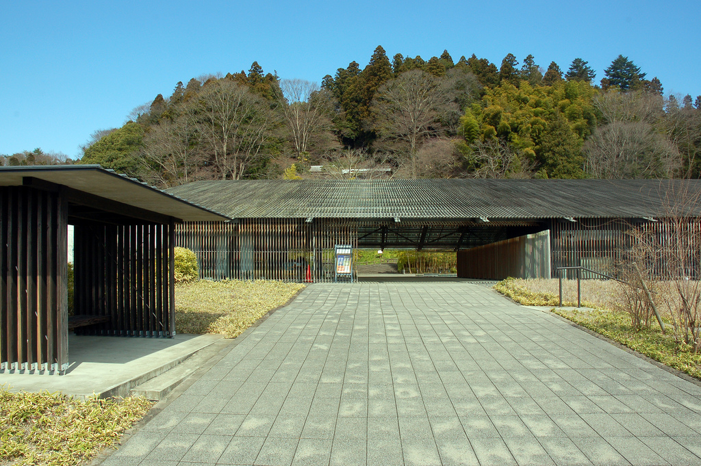
Nakagawa-machi Batō Hiroshige Museum of Art
Museum · 16.2 km
Museum of Art opened in Nakagawa, Tochigi, Japan in November 2000 and presents rotating exhibitions of Ukiyo-e from Aoki's collection...


18 more on the map.
Parks, trails and playgrounds15


3 more on the map.
Restaurants and cafes12



History
Daigo village was created with the establishment of the modern municipalities system on April 1, 1889. It was elevated to town status on July 20, 1891. On March 31, 1955, the villages of Yorigami, Fukuroda, Miyagawa, Kurosawa, Namase, Kamiogawa, Shimoogawa and Murotono merged with Daigo.
From the History section of Daigo, Ibaraki on Wikipedia, under CC BY-SA 4.0.
Where to stay17
Churches and places of worship73
Shopping10
Schools, colleges and libraries27
Healthcare3
Map of Daigo
208 places. The map loads OpenStreetMap tiles when you open it.
Getting there and nearby towns
Fukushima Airport (FKS) is the nearest airport with scheduled flights listed in OpenStreetMap, 52 km away.
- Ōmiya 25 km south, about 25 min by car
- Tanagura 29 km north, about 29 min by car
- Nasushiobara 34 km northwest, about 34 min by car
- Takahagi 33 km east, about 33 min by car
- Ishikawa 44 km north, about 44 min by car
- Katsuta 46 km south, about 46 min by car
- Tomobe 47 km south, about 47 min by car
- Yabuki 48 km north, about 48 min by car
- Iwase 51 km southwest, about 51 min by car
- Sukagawa 58 km north, about 58 min by car
Drive times are estimates from straight-line distance, not routes.
Local news
Headlines from INDB.
Reviews, tips and questions
Loading what members have shared...
Sources and licences
- GeoNames (CC BY 4.0): population, coordinates, regions and time zone
- OpenStreetMap contributors (ODbL 1.0): places, airports, map data
- Wikidata (CC0 1.0): elevation, founding date, time zone, website, landmarks and historic places
- Wikimedia Commons (see each image): photos
- Wikipedia (CC BY-SA 4.0): overview and history text
Photo credits
- Daigo town Office 2010, Miyuki Meinaka, Public domain
- Daigo ibaraki jyuunisyo jinja (15), Matsumotonaiko, CC0
- C12 187 steam locomotive (in front of Hitachi-Daigo Station, Ibaraki Prefecture) 01, 小石川人晃, CC BY-SA 4.0
- C12 187 steam locomotive (in front of Hitachi-Daigo Station, Ibaraki Prefecture) 02, 小石川人晃, CC BY-SA 4.0
- Hitachi-Daigo Station 20101106, Miyuki Meinaka, Public domain
- Daigo PostOffice2, On-chan, CC BY-SA 3.0
- Daigo ibaraki jyuunisyo jinja (17), Matsumotonaiko, CC0
- Daigo ibaraki jyuunisyo jinja (16), Matsumotonaiko, CC0
- Ibaraki prefectural route 325 (Hitachidaigo-teishajo line) in Daigo,Daigo town, 小石川人晃, CC BY-SA 3.0
- Yana, a fishry trap to capture ayu fish, along the Kuji river at Daigo - panoramio, Toshihiro Matsui, CC BY-SA 3.0
- Kuji river as seen from Yunosato bridge in Daigo town Ibaraki prefecture Japan 20091121 0902 photo by Pcs34560, pcs34560 from jawp This photo was taken with Canon PowerShot G9, Public domain
- Daigo ibaraki jyuunisyo jinja (10), Matsumotonaiko, CC0
- Daigo ibaraki jyuunisyo jinja (1), Matsumotonaiko, CC0
- Daigo ibaraki jyuunisyo jinja (9), Matsumotonaiko, CC0
- Daigo ibaraki jyuunisyo jinja (12), Matsumotonaiko, CC0
- Daigo ibaraki jyuunisyo jinja (8), Matsumotonaiko, CC0
- Daigo ibaraki jyuunisyo jinja (14), Matsumotonaiko, CC0
- Daigo ibaraki jyuunisyo jinja (2), Matsumotonaiko, CC0
- Daigo ibaraki jyuunisyo jinja (13), Matsumotonaiko, CC0
- Daigo ibaraki jyuunisyo jinja (11), Matsumotonaiko, CC0
- Daigo ibaraki jyuunisyo jinja (3), Matsumotonaiko, CC0
- Daigo ibaraki jyuunisyo jinja (4), Matsumotonaiko, CC0
- Daigo ibaraki jyuunisyo jinja (18), Matsumotonaiko, CC0
- Daigo ibaraki jyuunisyo jinja (7), Matsumotonaiko, CC0
- Bato Hiroshige Museum 2009, Photo by Woranol Sattayavinij, CC BY 2.0
- Fukuroda Falls - 袋田の滝(ふくろだのたき), TANAKA Juuyoh (田中十洋), CC BY 2.0
- Renaissance HS, Nyao148, CC BY-SA 3.0
- 生瀬富士, Koda6029, CC BY-SA 4.0
- Shimonomiya Chikatsu Jinja Keidai, Zeter114514, CC BY-SA 4.0
- Mt.Myo 07, Σ64, CC BY 4.0
- 沈下橋と盛金富士, Koda6029, CC BY-SA 4.0
- Onaka Shrine 05, Σ64, CC BY 3.0
- Mt.Chofuku 01, Σ64, CC BY 4.0
- Mt.Tsukiore 07, Σ64, CC BY 4.0
- Renaissance High School main campus (Daigo Town, Ibaraki Prefecture), 小石川人晃, CC BY-SA 4.0
- Uwaoka Elementary School, Ibaraki 20, Σ64, CC BY 4.0
- 盛金富士, Koda6029, CC BY-SA 4.0
- 常陸大子駅 - panoramio, くろふね, CC BY 3.0
- SG SL+PC, Kei365, CC BY-SA 3.0
- JRE-kiha-E130-2, LERK, CC BY 2.5
- C12187 SL, Miyuki Meinaka, Public domain
- Daigo Cafe Tempo & Shuoku 02, Suikotei, CC BY 4.0


Page built November 4, 2026. Spotted a mistake? Tell us or suggest a place.