



Why visit Den’enchōfu
Townapedia lists 48 museums and landmarks, 70 parks and trails, 255 places to eat, 2 places to stay and 9 attractions in and around town.
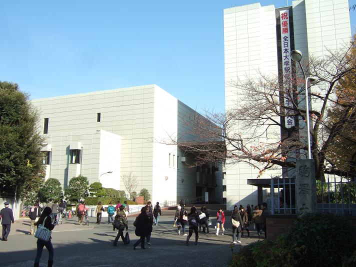
Highlights include Institute of Science Tokyo, Komazawa University, Gotoh Museum and Hasegawa Machiko Art Museum.
Weather in Den’enchōfu
Forecast from MET Norway (CC BY 4.0). Full forecast
About Den’enchōfu
Den-en-chōfu (田園調布) is a residential neighborhood located in western Ōta in southern Tokyo, Japan. It is known as one of the most exclusive neighborhoods in Tokyo.
From the Wikipedia article Den-en-chōfu (this version), under CC BY-SA 4.0.
Things to do9

Institute of Science Tokyo
School · 2.1 km
Public research university in Tokyo, Japan
Komazawa University
School · 3.8 km
University in Setagaya Ward, Tōkyō Metropolis, Japan

Senzoku Gakuen College of Music
School · 4.5 km
Higher education institution in Kanagawa Prefecture, Japan


Tokyo Institute of Technology
School · 2.0 km
National top-tier research university located in Greater Tokyo Area, Japan


Museums and landmarks48

Gotoh Museum
Museum · 3.3 km
Art museum in Kaminoge Setagaya Tokyo Japan


Kawasaki Peace Museum
Museum · 3.0 km
Museum in Kawasaki, Kanagawa, Japan

Shibokuchi Shell Mound
Monument and historic site · 4.2 km
Archaeological site in Kawasaki, Kanagawa, Japan




36 more on the map.
Parks, trails and playgrounds70


Komazawa Olympic Park
Park · 3.3 km
Park located in Setagaya-ku and Meguro-ku, Tokyo


自由が丘 Sylvanian Forest
Playground · 1.5 km
7, 目黒区
Mo-Fr 11:00-19:00; Sa,Su 10:00-20:00; Tu[2] off


Den-en-Chofu Seseragi Park
Park · 0.8 km
Apr-Sep 08:00-18:00; Oct,Feb,Mar 08:00-17:00; Nov-Jan 08:00-16:30

58 more on the map.
Restaurants and cafes255


Yakitori Restaurant Tori bar kushi Sanroku
Bar and pub · 居酒屋, 焼き鳥, Asian, Japanese · 1.7 km
自由が丘駅徒歩5分の近くにある居酒屋、 鶏バル串サンロクは日本テレビ「PON」やテレビ東京「昼めし旅」でもおすすめグルメに特集された自由が丘でも人気の居酒屋・焼鳥バルです。 【ドリンクの品質と種類にもこだわってます!】 ...
15, 目黒区
17:30-25:00

DevilCraft Jiyugoka
Restaurant · Pizza · 1.3 km
Mo off; Tu off; We-Th 17:00-22:00; Fr 17:00-22:30; Sa 12:00-22:30;...
243 more on the map.
History
Den-en-chōfu was built based on the "Garden City" idea originally developed by the British city planner Ebenezer Howard.
Den-en-chōfu was planned as a garden suburb of Tokyo. In the early 1900s, financier Eiichi Shibusawa bought, named, and developed the area by emulating the garden suburbs that were growing in metropolitan areas around the world, particularly those in Greater London. Originally, Den-en-chōfu was developed by the Garden City Company (田園都市株式会社, Den'entoshi Kabushiki-gaisha).
Although the area was developing at an adequate pace, it was the Great Kantō Earthquake of 1923 that guaranteed his success. Central Tokyo was leveled in the earthquake, but Den-en-chōfu was virtually untouched; in the aftermath, there was an exodus of people from the central city to the suburbs.
From the History section of Den-en-chōfu on Wikipedia, under CC BY-SA 4.0.
Where to stay2
Churches and places of worship34
Shopping64
Gas and EV charging7
Schools, colleges and libraries45
Healthcare45
Map of Den’enchōfu
250 places. The map loads OpenStreetMap tiles when you open it.
Getting there and nearby towns
Tokyo International Airport (HND) is the nearest airport with scheduled flights listed in OpenStreetMap, 13 km away.
- Ōta 6 km southeast, about 6 min by car
- Kawasaki 10 km southeast, about 10 min by car
- Minato City 10 km northeast, about 10 min by car
- Noborito 10 km west, about 10 min by car
- Tokyo 11 km north, about 11 min by car
- Azamino 11 km west, about 11 min by car
- Nakano 12 km north, about 12 min by car
- Chūō 13 km northeast, about 13 min by car
- Musashino 16 km northwest, about 16 min by car
- Yokohama 18 km south, about 18 min by car
Drive times are estimates from straight-line distance, not routes.
Local news
Headlines from INDB.
Reviews, tips and questions
Loading what members have shared...
Sources and licences
- GeoNames (CC BY 4.0): population, coordinates, regions and time zone
- OpenStreetMap contributors (ODbL 1.0): places, airports, map data
- Wikidata (CC0 1.0): elevation, founding date, time zone, website, landmarks and historic places
- Wikimedia Commons (see each image): photos
- Wikipedia (CC BY-SA 4.0): overview and history text
Photo credits
- Main Building - Tokyo Institute of Technology, Kakidai, CC BY-SA 4.0
- Komazawa main, Vasset at Japanese Wikipedia, CC BY-SA 3.0
- 昭和女子大学 (14885665097), Dick Thomas Johnson, CC BY 2.0
- Titech2, 03 at Japanese Wikipedia, CC BY-SA 3.0
- Gotoh Museum, Bamse, CC BY-SA 3.0
- Hasegawa Machiko Art Museum, あばさー, Public domain
- Japanese Kawasaki Peace Museum, Unknown author, CC BY-SA 3.0
- 子母口貝塚, Tsuyoshi chiba, CC BY-SA 4.0
- Tamagawadai park plaza 0075, Unknown author, CC BY-SA 3.0
- Todoroki Ryokuchi, 日陰猫Joga at Japanese Wikipedia, CC BY-SA 3.0
- 馬事公苑, Syced, CC0
- Himonya park meguro tokyo 2009, User:Kentin, CC BY-SA 3.0
- Komazawa olympic park, Unknown author, CC BY-SA 3.0
- Rinshi no mori park meguro shinagawa, Kamemaru2000, CC BY-SA 3.0
- Todoroki 15031401, Waka77, CC0
- Tamazutsumi Elementary School, Asasa198, CC BY-SA 4.0
- Joshinji hondo, Monado, CC BY-SA 2.5
- Kamenokoyama Kofun, funkyu, Saigen Jiro, CC0
- Tamagawa Sengenjinja shrine 001, 東京特許許可局, CC BY-SA 4.0
- Okusawa castle, by Monado, CC BY-SA 2.5
- NakaharaJuniorHighSchool, Asasa198, CC BY-SA 4.0
- Nippon Medical University Musasi Kosugi Hospital, WAKA77, Public domain
- Denko1, Hykw-a4 at Japanese Wikipedia, CC BY-SA 3.0
- Kumano jinja(Meguroku) torii, Tadill, CC BY-SA 3.0
- 田園調布雙葉小学校, Syced, CC0
- 雪ヶ谷八幡神社, Syced, CC0
- Shinokusawaekiato, Asasa198, CC BY-SA 3.0
- Main Hall of Okusawa Shrine in Tokyo, Doricono, CC BY-SA 4.0
- Ontake jinja ota, Kamemaru2000, CC BY-SA 3.0
- 川崎市立上丸子小学校, Syced, CC0
- Mitsuzoin temple denenchofuminami ota 2015, Kentin, CC BY-SA 4.0
- Kamenokoyama kofun 20220402 010, Op.homata, CC BY-SA 4.0
- Showauniv, The original uploader was Hykw-a4 at Japanese Wikipedia ., CC BY-SA 3.0
- Senzokugakuen, Original uploader was Hykw-a4 at ja.wikipedia, CC BY-SA 3.0
- Tokyo City University, Main Campus, Aw1805, CC BY-SA 4.0
- 本堂(龍護殿), Souka Kinmei, CC0
- Denenchofu-Futaba Elementary School, Abasaa, Public domain
- Higashichofu JunorHighschool, Asasa198, CC BY-SA 4.0
- Nippon Medical University Musasi Kosugi Hospital 20230414a, Waka77, CC0
- 雪ヶ谷八幡神社 (67467), Syced, CC0
- Den-en-chofu Seseragi Park - panoramio, AMANO Jun-ichi, CC BY 3.0


Page built November 5, 2026. Spotted a mistake? Tell us or suggest a place.