



Why visit Dōjō
Townapedia lists 10 museums and landmarks, 66 parks and trails, 90 places to eat, 1 place to stay and 8 attractions in and around town.
Highlights include Omiya Law School, Sakitama Bridge, John Lennon Museum and Konuma Museum.
Weather in Dōjō
Forecast from MET Norway (CC BY 4.0). Full forecast
Things to do8

Omiya Law School
School · 5.3 km
Higher education institution in Saitama Prefecture, Japan




Museums and landmarks10
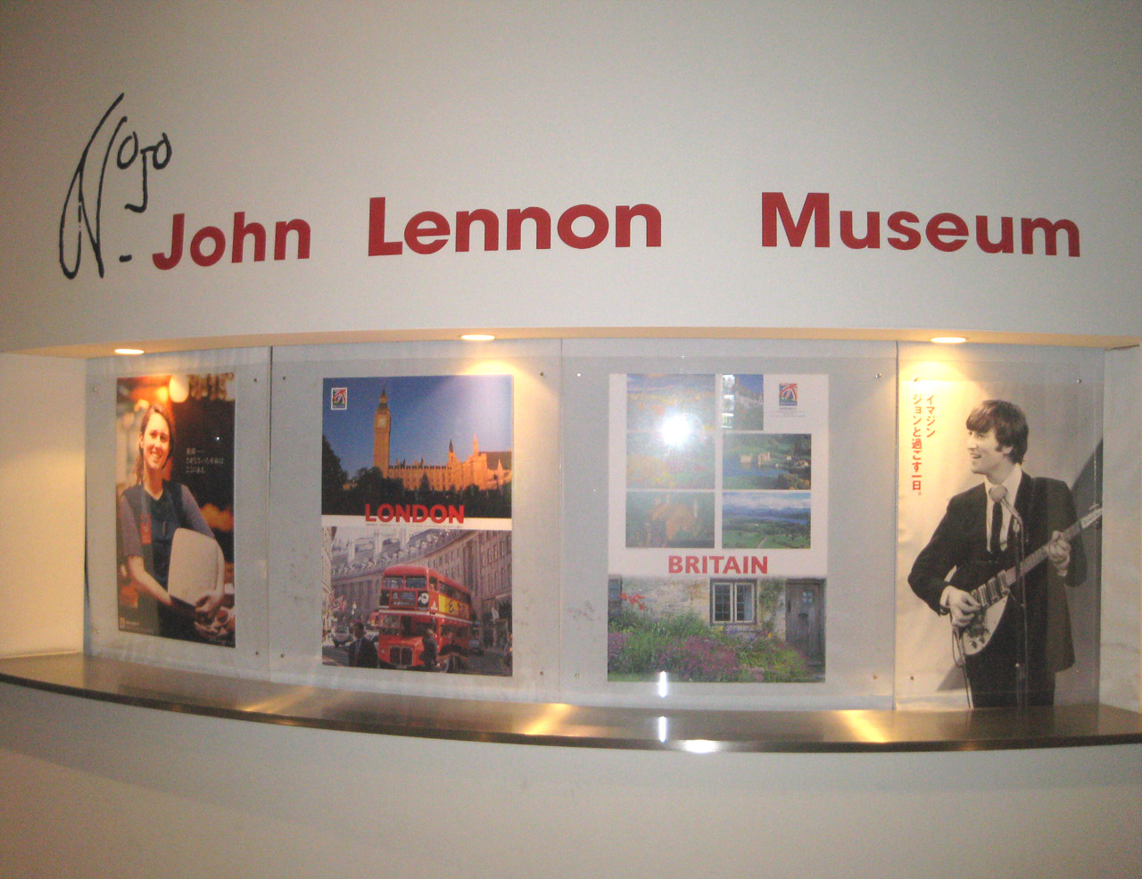
John Lennon Museum
Museum · 4.6 km
Former museum in Saitama, Saitama, Japan (2000–2010)


Mizuko Shell Mound
Monument and historic site · 4.8 km
Shell midden, settlement in Saitama, Japan

Museum of Modern Art, Saitama
Museum · 3.1 km
Art museum in Saitama, Saitama, Japan


Parks, trails and playgrounds66


Special Natural Monument: Tajimagahara Habitat of Primula Sieboldii
Hiking and trails · 2.0 km


54 more on the map.
Restaurants and cafes90

シルクロードムラト
Restaurant · Xinjiang, Uyghur · 1.4 km
Xinjiang cuisine
13, さいたま市
Tu-Su 11:30-15:00,17:00-23:30

Kitchen&Bar KANT
Bar and pub · Diner, Fish And Chips, Pasta, Sausage, Tapas · 2.5 km
さいたま市南区四谷1-2-1
Mo-Su 17:00-00:00




78 more on the map.
Where to stay1
Churches and places of worship37
Shopping30
Gas and EV charging8
Schools, colleges and libraries26
Healthcare33
Map of Dōjō
250 places. The map loads OpenStreetMap tiles when you open it.
Getting there and nearby towns
Yokota Air Base (OKO) is the nearest airport with scheduled flights listed in OpenStreetMap, 27 km away.
- Shiki 4 km southwest, about 4 min by car
- Asaka 6 km south, about 6 min by car
- Niiza 6 km southwest, about 6 min by car
- Warabi 8 km southeast, about 8 min by car
- Ōi 8 km west, about 8 min by car
- Fujimino 9 km northwest, about 9 min by car
- Kamifukuoka 9 km west, about 9 min by car
- Ōizumimachi 10 km south, about 10 min by car
- Kawaguchi 10 km southeast, about 10 min by car
- Kiyose 11 km southwest, about 11 min by car
Drive times are estimates from straight-line distance, not routes.
Local news
Headlines from INDB.
Reviews, tips and questions
Loading what members have shared...
Sources and licences
- GeoNames (CC BY 4.0): population, coordinates, regions and time zone
- OpenStreetMap contributors (ODbL 1.0): places, airports, map data
- Wikidata (CC0 1.0): elevation, founding date, time zone, website, landmarks and historic places
- Wikimedia Commons (see each image): photos
Photo credits
- Sakitama-bridge, Mayuno, CC BY-SA 3.0
- John Lennon Museum, BillyTFried at English Wikipedia, Public domain
- Fujimi Mizukokaiduka Park 3, 京浜にけ (Keihin-Nike), CC BY-SA 3.0
- Museum of Modern Art Saitama 2010, Wiiii, CC BY-SA 3.0
- Catholic Urawa Church, Abasaa, Public domain
- Saitama-Univ-Library, Unknown author, Public domain
- Saitama Akigase Park 1, 京浜にけ, CC BY-SA 3.0
- Saitama City Yono-Minami Junior High School, Suikotei, CC BY-SA 4.0
- Japanese Sai-no-Kuni Saitama Arts Theater, PRiMENON, CC BY-SA 3.0
- Saitama Tajimagahara Primula Sieboldii Primrose Habitat 3, 京浜にけ at Japanese Wikipedia, CC BY-SA 3.0
- Saitama Konuma Museum 1, 京浜にけ, CC BY-SA 3.0
- Daisen-in (Saitama), Abasaa, Public domain
- Myogyo-ji (Saitama), あばさー, Public domain
- Empuku-ji (Chuo, Saitama), Abasaa, Public domain
- Oto hikawa jinja 2, Beryllium Transistor, CC BY-SA 4.0
- Shinjo-ji (Minami, Saitama), Abasaa, Public domain
- Saitama Tajimagahara Primula Sieboldii Primrose Habitat 1, 京浜にけ, CC BY-SA 3.0
- Saizeriya Yoshikawa factory, Ebiebi2, CC BY-SA 3.0
- Saitama City Yono-Minami Elementary School, Suikotei, CC BY-SA 4.0
- Kongo-ji, Sakura-ku, Saitama 1, Beryllium Transistor, CC BY-SA 4.0
- Okubo hiesha 2, Beryllium Transistor, CC BY-SA 4.0
- Dojo tenmangu, Beryllium Transistor, CC BY-SA 4.0
- Kongo-ji, Sakura-ku, Saitama 2, Beryllium Transistor, CC BY-SA 4.0
- On the bank of Arakawa - panoramio, Nirmal Raj Joshi, CC BY-SA 3.0
- Cherry blossoms - panoramio, James.Hook, CC BY 3.0
- Playground in evening - panoramio, Nirmal Raj Joshi, CC BY-SA 3.0
- Structural material lab - panoramio (1), Nirmal Raj Joshi, CC BY-SA 3.0
- Structural material lab - panoramio, Nirmal Raj Joshi, CC BY-SA 3.0
- Structural material lab - panoramio (2), Nirmal Raj Joshi, CC BY-SA 3.0
- Under the bridge - panoramio (15), Nirmal Raj Joshi, CC BY-SA 3.0
- Saitama University - panoramio (2), Nirmal Raj Joshi, CC BY-SA 3.0
- Saitama University, Japan - Description plate of Newton's apple tree, Y gotoh, CC BY-SA 4.0
- Saitama University, Japan - Newton's apple tree2, Y gotoh, CC BY-SA 4.0
- Saitama University, Japan - Newton's apple tree1, Y gotoh, CC BY-SA 4.0
- Brass karua, Nirmaljoshi, CC BY-SA 4.0
- Notice board at Saitama University - panoramio, Nirmal Raj Joshi, CC BY-SA 3.0
- Lawson shop at Saitama University - panoramio, Nirmal Raj Joshi, CC BY-SA 3.0
- Urawa West Gym, Saitama, Miyuki Meinaka, CC BY-SA 4.0
- Clinic and cafeteria at entrance of Saitama University - panoramio, Nirmal Raj Joshi, CC BY-SA 3.0
- Saitama University - panoramio (1), Nirmal Raj Joshi, CC BY-SA 3.0
- Plaza Hotel Urawa, Abasaa, Public domain


Page built November 5, 2026. Spotted a mistake? Tell us or suggest a place.