


Fujikawaguchiko, Japan
富士河口湖町
Fujikawaguchiko is a town of 26,540 people in Yamanashi, Japan, founded in November 15, 2003.
Why visit Fujikawaguchiko
Townapedia lists 70 museums and landmarks, 15 parks and trails, 188 places to eat, 144 places to stay and 66 attractions in and around town.
Highlights include Health Science University, Yamanashi Prefectural Fuji Spring-fed Village Aquarium, Fujiten Snow Resort and Kawaguchiko Museum of Art.
Weather in Fujikawaguchiko
Forecast from MET Norway (CC BY 4.0). Full forecast
About Fujikawaguchiko
Fujikawaguchiko (富士河口湖町, Fujikawaguchiko-machi) is a town located in Yamanashi Prefecture, Japan. As of 1 June 2019, the town had an estimated population of 26,542 in 10,618 households, and a population density of 170 persons per km2. The total area of the town is 158.40 square kilometres (61.16 sq mi).
From the Wikipedia article Fujikawaguchiko (this version), under CC BY-SA 4.0.
Things to do66

Health Science University
School · 5.8 km
Higher education institution in Yamanashi Prefecture, Japan

Yamanashi Prefectural Fuji Spring-fed Village Aquarium
Zoo and aquarium · 12.8 km
Aquarium in Yamanashi Prefecture, Japan




54 more on the map.
Museums and landmarks70





Fuji Shibazakura festival
Monument and historic site · 9.4 km
Mo-Su 08:00-17:00


58 more on the map.
Parks, trails and playgrounds15







3 more on the map.
Restaurants and cafes188

富士山パンケーキ
Restaurant · Dessert, Pancake · 6.7 km
富士山溶岩窯専門 ステーキ・欧風カレー
Mo-Fr 11:00-18:00; Sa-Su,PH 10:00-20:00; Jan 01-02 off


Family Restaurant
Restaurant · Japanese · 9.6 km
2, 富士吉田市
Tu-Sa 11:30-15:00
High Spirits
Bar and pub · Japanese · 6.1 km
1, 富士河口湖町小立
Th-Fr 18:00-22:00; Sa-Su 18:00-23:00
176 more on the map.
History
The area around Lake Kawaguchi has been inhabited since at least the Jōmon period. It was on the road connecting Kai Province with Suruga Province, and is mentioned in Heian period records, which also document an eruption of Mount Fuji in 864 AD. During the Edo period, all of Kai Province was tenryō territory under direct control of the Tokugawa shogunate. During the cadastral reform of the early Meiji period on July 1, 1889, the area came under the jurisdiction of Minamitsuru District, Yamanashi Prefecture.
On 15 November 2003, the town of Kawaguchiko, and the villages of Katsuyama and Ashiwada merged to form the new town of Fujikawaguchiko. The headquarters of the infamous Aum Shinrikyo was located in the village of Kamikuishiki, most of which was absorbed into Fujikawaguchiko on 1 March 2006.
From the History section of Fujikawaguchiko on Wikipedia, under CC BY-SA 4.0.
Where to stay144
Churches and places of worship14
Shopping26
Gas and EV charging16
Schools, colleges and libraries23
Healthcare11
Map of Fujikawaguchiko
250 places. The map loads OpenStreetMap tiles when you open it.
Getting there and nearby towns
Yokota Air Base (OKO) is the nearest airport with scheduled flights listed in OpenStreetMap, 66 km away.
- Isawa 19 km north, about 19 min by car
- Kofu 23 km northwest, about 23 min by car
- Enzan 24 km north, about 24 min by car
- Ryūō 25 km northwest, about 25 min by car
- Ōtsuki 30 km northeast, about 30 min by car
- Gotemba 30 km southeast, about 30 min by car
- Fujinomiya 31 km south, about 31 min by car
- Nirasaki 32 km northwest, about 32 min by car
- Oyama 32 km southeast, about 32 min by car
- Fuji 36 km south, about 36 min by car
Drive times are estimates from straight-line distance, not routes.
Local news
Headlines from INDB.
Reviews, tips and questions
Loading what members have shared...
Sources and licences
- GeoNames (CC BY 4.0): population, coordinates, regions and time zone
- OpenStreetMap contributors (ODbL 1.0): places, airports, map data
- Wikidata (CC0 1.0): elevation, founding date, time zone, website, landmarks and historic places
- Wikimedia Commons (see each image): photos
- Wikipedia (CC BY-SA 4.0): overview and history text
Photo credits
- Mount Fuji and Laka Kawaguchi from Shindo Pass, Alpsdake, CC BY-SA 4.0
- Health Science University, Abasaa, Public domain
- Fuji Spring Water Aquarium, Sakaori ( talk ), CC BY-SA 3.0
- 170504 Kawaguchiko Museum of Art Fujikawaguchiko Yamanashi pref Japan02s3, 663highland, CC BY-SA 4.0
- 170505 Views of Fujikyu Highland from Tenjoyama Park Fujikawaguchiko Yamanashi pref Japan01s3, 663highland, CC BY-SA 4.0
- Arakurayama Sengen Park - Japan, Otto Domes, CC BY-SA 4.0
- Fuji Hokuroku Stadium, 国土地理院, CC BY 4.0
- Aokigahara Forest (10863169686), Guilhem Vellut from Annecy, France, CC BY 2.0
- Northern Fuji Sengen Shrine at the base of Mt. Fuji 26-Aug-2012, Sakaori ( talk ), CC BY-SA 3.0
- Mount Omuro from Lake Motosu, Alpsdake, CC BY-SA 4.0
- Shimo-Yoshida 2nd elem-sch, On-chan, CC0
- 富士山麓電気鉄道モ1形電車, Rsa, CC BY-SA 3.0
- Yamanashi Red Cross Hospital 20141108, Waka77, Public domain
- Kawaguchi-asama-jinja haiden and sugi (1), Saigen Jiro, CC0
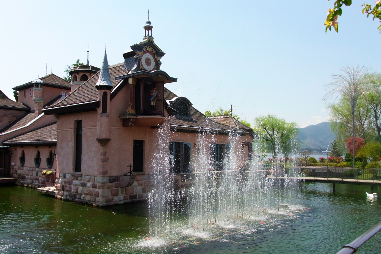
- Fountain show on the hour every hour, Kawaguchi-ko Music Forest Museum (河口湖オルゴールの森で毎正時に行われる噴水ショー), Yamaguchi Yoshiaki, CC BY-SA 2.0
- Kawaguchiko Bridge s3, Alpsdake, CC BY-SA 4.0
- Mount Kuro (Misaka Mountains), Alpsdake, CC BY-SA 4.0
- Fujiten Snow Resort (1) Dec 27, 2006, Derek Springer, CC BY-SA 2.0
- Fujisan World heritage Center, Yamanashi 1, Indiana jo, CC BY-SA 4.0
- Lockheed F-104DJ Starfighter (26-5007) at Kawaguchiko Motor Museum, Yamanashi Prefecture, Japan, Josephus37, CC BY-SA 4.0
- Mount Juni (Misaka Mountains), Alpsdake, CC BY-SA 4.0
- Itchiku Kubota Art Museum 2018c, 江戸村のとくぞう, CC BY-SA 4.0
- Showa University, Abasaa, Public domain
- 170505 Lake Kawaguchi Japan02s3, 663highland, CC BY-SA 4.0
- Kitaguchi Hongu Fuji Sengen jinja Torii, 江戸村のとくぞう, CC BY-SA 4.0
- Fujikawaguchiko High School, Abasaa, Public domain
- Fuji-Kawaguchiko town Funatsu elem-sch, Bakkai, CC BY-SA 3.0
- Mount Kurodake & Lake Kawaguchi 2013-11-13 (10863318184), Guilhem Vellut from Annecy, France, CC BY 2.0
- Aokigahara and Misaka Mountains, Alpsdake, CC BY-SA 4.0
- Mount Oni and Mount Juni, Alpsdake, CC BY-SA 4.0
- Lightbathing (22769737922), Reginald Pentinio, CC BY 2.0
- Abandoned vending machine (14575348714), Karl Baron, CC BY 2.0
- 紅葉台の展望台から富士山を見る - panoramio (1), funk bass, CC BY 3.0
- 紅葉台の展望台から富士山を見る - panoramio, funk bass, CC BY 3.0
- 紅葉台の展望台から富士吉田・山中湖方面を見る - panoramio, funk bass, CC BY 3.0
- 紅葉台の展望台屋上からの眺め - panoramio, funk bass, CC BY 3.0
- 紅葉台の展望台から富士山を見るパノラマ - panoramio, funk bass, CC BY 3.0
- 紅葉台の展望台から西湖いやしの里根場を見る - panoramio, funk bass, CC BY 3.0
- 紅葉台の展望台から西湖祖眺める - panoramio, funk bass, CC BY 3.0
- 紅葉台からすすき越しに富士山を見る - panoramio, funk bass, CC BY 3.0


Page built November 5, 2026. Spotted a mistake? Tell us or suggest a place.