


Hirosaki, Japan
弘前市
Hirosaki is a town of 168,739 people in Aomori, Japan, founded in April 1, 1889.
Why visit Hirosaki
Townapedia lists 42 museums and landmarks, 60 parks and trails, 227 places to eat, 16 places to stay and 6 attractions in and around town.
Highlights include Hirosaki Civic Hall, Hirosaki University, Hirosaki Castle and Former Ishiba Family residence.
Weather in Hirosaki
Forecast from MET Norway (CC BY 4.0). Full forecast
About Hirosaki
Hirosaki (弘前市, Hirosaki-shi) is a city located in western Aomori Prefecture, Japan. As of 1 January 2026, the city had an estimated population of 157,031 in 84,998 households, and a population density of 300 per square kilometre (780/sq mi). The total area of the city is 524.20 square kilometers (202.39 sq mi).
From the Wikipedia article Hirosaki (this version), under CC BY-SA 4.0.
Travel tips from other travellers: Hirosaki on Wikivoyage (CC BY-SA 4.0).
Things to do6


Hirosaki University
School
Higher education institution in Aomori Prefecture, Japan

Shibata Gakuen University
School · 0.6 km
Private university in Hirosaki, Japan

Heart Spot
Scenic view · 1.7 km
桜の枝が重なり合ってできたハート型のフレーム。桜の季節に写真で人気。杉の大橋近くのハートマーカーを探してください。


Museums and landmarks42


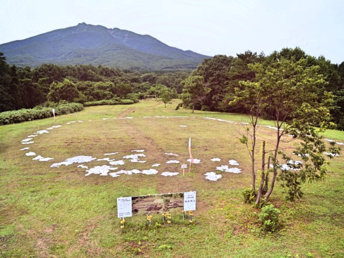
Ōmori Katsuyama Site
Monument and historic site · 15.2 km
Stone circle, settlement in Aomori, Japan

Tareyanagi Site
Monument and historic site · 9.0 km
Archaeological site in Inakadate, Japan

Nakachō Traditional Samurai House Preservation Area
Monument and historic site · 2.3 km



30 more on the map.
Parks, trails and playgrounds60




48 more on the map.
Restaurants and cafes227



215 more on the map.
History
Many human-shaped clay figures have been unearthed around the region which date as far back as 12,000 years. More of these figures date from the Jomon and Yayoi period.
The area around Hirosaki formed part of the domains of the Northern Fujiwara in the Heian period; Minamoto no Yoritomo awarded it to the Nanbu clan in the early Kamakura period after the defeat of the Northern Fujiwara (1189). During the Sengoku period a local retainer of the Nambu, Ōura Tamenobu, declared his independence (1571) and seized local castles. He pledged fealty to Toyotomi Hideyoshi at the Battle of Odawara in 1590, and was confirmed in his holdings with revenues of 45,000 koku. He also changed his name to "Tsugaru". After siding with Tokugawa Ieyasu at the Battle of Sekigahara, he was re-confirmed in his holdings with a nominal kokudaka of 47,000 koku and he began construction of a castle in Takaoka (present-day Hirosaki). This marked the start of Hirosaki Domain under the Tokugawa shogunate. His successor, Tsugaru Nobuhira, completed the castle in 1611, but its massive 5-story tenshu was lost to lightning in 1627. The domain's kokudaka increased to 100,000 koku in 1628.
From the History section of Hirosaki on Wikipedia, under CC BY-SA 4.0.
Where to stay16
Churches and places of worship77
Shopping30
Gas and EV charging12
Schools, colleges and libraries29
Healthcare82
Map of Hirosaki
250 places. The map loads OpenStreetMap tiles when you open it.
Getting there and nearby towns
Aomori Airport (AOJ) is the nearest airport with scheduled flights listed in OpenStreetMap, 24 km away.
- Fujisaki 7 km north, about 7 min by car
- Hirakawa 8 km east, about 8 min by car
- Inakadate 8 km northeast, about 8 min by car
- Kuroishi 11 km northeast, about 11 min by car
- Itayanagi 11 km north, about 11 min by car
- Ōwani 12 km southeast, about 12 min by car
- Namioka 16 km northeast, about 16 min by car
- Shirasawa 16 km west, about 16 min by car
- Tsuruta 18 km north, about 18 min by car
- Goshogawara 24 km north, about 24 min by car
Drive times are estimates from straight-line distance, not routes.
Local news
Headlines from INDB.
Reviews, tips and questions
Loading what members have shared...
Sources and licences
- GeoNames (CC BY 4.0): population, coordinates, regions and time zone
- OpenStreetMap contributors (ODbL 1.0): places, airports, map data
- Wikidata (CC0 1.0): elevation, founding date, time zone, website, landmarks and historic places
- Wikimedia Commons (see each image): photos
- Wikipedia (CC BY-SA 4.0): overview and history text
Photo credits
- The Hirosaki castle - panoramio, MAKIKO OMOKAWA, CC BY-SA 3.0
- 191208 Saishoin Hirosaki Aomori pref Japan01bs, 663highland, CC BY-SA 4.0
- Taigū-ji (Hirosaki), 掬茶, CC BY-SA 4.0
- 191208 Saishoin Hirosaki Aomori pref Japan02s3, 663highland, CC BY-SA 4.0
- Hirodai Cafe, or the former Hirosaki Higher School Foreign Lecturer Residence, 山田晴通, CC0
- Hirosaki University - panoramio (1), Feri88, CC BY 3.0
- Hirosaki University - panoramio, Feri88, CC BY 3.0
- Hirosaki Chuo Hospital, 掬茶, CC BY-SA 4.0
- Goma-dō of the Saishō-in (Hirosaki), 掬茶, CC BY-SA 4.0
- 191208 Saishoin Hirosaki Aomori pref Japan11n, 663highland, CC BY-SA 4.0
- 191208 Saishoin Hirosaki Aomori pref Japan08s3, 663highland, CC BY-SA 4.0
- 191208 Saishoin Hirosaki Aomori pref Japan04n, 663highland, CC BY-SA 4.0
- 191208 Saishoin Hirosaki Aomori pref Japan09n, 663highland, CC BY-SA 4.0
- 191208 Saishoin Hirosaki Aomori pref Japan03s3, 663highland, CC BY-SA 4.0
- 191208 Saishoin Hirosaki Aomori pref Japan06s3, 663highland, CC BY-SA 4.0
- 191208 Saishoin Hirosaki Aomori pref Japan05s3, 663highland, CC BY-SA 4.0
- 191208 Saishoin Hirosaki Aomori pref Japan10n, 663highland, CC BY-SA 4.0
- 191208 Saishoin Hirosaki Aomori pref Japan12n, 663highland, CC BY-SA 4.0
- 191208 Saishoin Hirosaki Aomori pref Japan07s3, 663highland, CC BY-SA 4.0
- Hirosaki University in winter - panoramio, Feri88, CC BY 3.0
- Main hall of the Saishō-in (Hirosaki), 掬茶, CC BY-SA 4.0
- Shin-Niō-mon of the Saishō-in (Hirosaki), 掬茶, CC BY-SA 4.0
- Hirosaki Museum of Contemporary Art, 掬茶, CC BY-SA 4.0
- Chuo-Hirosaki-Station-Background, Rsa, CC BY-SA 3.0
- Hirosaki Museum of Contemporary Art 202609, 掬茶, CC BY-SA 4.0
- Hirosaki Museum of Contemporary Art in snow, 掬茶, CC BY-SA 4.0
- Konan1271+3404 Chuohirosaki, Olegushka, CC0
- 2012-12-26 Konan Railway 7000 series at Chūō-Hirosaki Station, A_CUVE, CC BY-SA 2.0
- Konan Railway 7031F at Chuo-Hirosaki 20260912, 掬茶, CC BY-SA 4.0
- Chūōhirosaki station03, 221.20 ( talk ), Public domain
- Omori-Katsuyama Stone Circle, MChew, CC BY-SA 4.0
- Tareyanagi site, MChew, CC BY-SA 4.0
- Hirosaki univ, M1945 at ja.wikipedia, CC BY-SA 3.0
- Hirosaki Castle Keep Tower 20220508, 掬茶, CC BY-SA 4.0
- Tohoku Women's Junior College 20140830, Ryo FUKAsawa, CC BY 2.0
- Autumn in the Hirosaki Park - panoramio (1), Feri88, CC BY 3.0
- Hirosaki University school of medicine and hospital, Angaurits, CC BY-SA 3.0
- 弘前天満宮, Towacoco, CC BY-SA 4.0
- Hirosaki Gakuin University Chapel, D-Chillz, CC BY-SA 4.0
- Hirosaki City Nakacho1, At by At, CC BY-SA 3.0
- Hirosaki City Hall, 禁樹なずな, CC BY-SA 4.0
- Hirosaki City Watoku Elementary School, 禁樹なずな, CC BY-SA 4.0
- Hirosaki Tosho-gu, Abasaa, Public domain
- Hirosaki Anglican Ascension Church 20260912, 掬茶, CC BY-SA 4.0
- Fifty-Ninth Bank Head Office Main Building 20200921, Kaburamata, CC0
- Tsugaru-han Neputa Mura 20260823a, 掬茶, CC BY-SA 4.0
- Ishiba's House, 禁樹なずな, CC BY-SA 4.0
- Fujita Memorial Garden in June 2022 (2), 掬茶, CC BY-SA 4.0
- Aomori-ken Gokoku Shrine, 掬茶, CC BY-SA 4.0
- HIRORO (Hirosaki, Japan), Kaburamata, CC0
- 191207 Hirosaki City Museum Hirosaki Aomori pref Japan01s, 663highland, CC BY-SA 4.0
- Hōryū-ji (Hirosaki), 掬茶, CC BY-SA 4.0
- Hirosaki City Pubric Library, Abasaa, Public domain
- Botanical Garden - panoramio (2), Feri88, CC BY 3.0
- 国立病院機構弘前総合医療センター, Ryo FUKAsawa, CC BY 2.0
- Sakura ♡ (52087066615), Raita Futo from Tokyo, Japan, CC BY 2.0
- Hirosaki City Taisei Elementary School, こひろ ぐんた, CC BY-SA 4.0
- Hirosaki Smile Hotel, 掬茶, CC BY-SA 4.0
- Ciina Ciina Hirosaki, 掬茶, CC BY-SA 4.0


Page built November 4, 2026. Spotted a mistake? Tell us or suggest a place.