


Ichinomiya, Japan
一宮町
Ichinomiya is a town of 12,494 people in Chiba, Japan, founded in November 3, 1953.
Why visit Ichinomiya
Townapedia lists 11 museums and landmarks, 3 parks and trails, 3 places to eat and 5 places to stay in and around town.
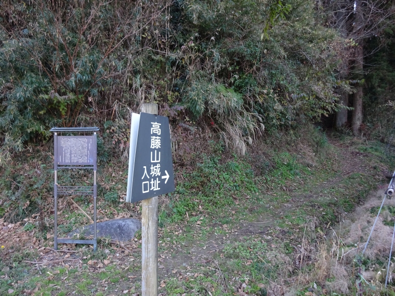
Highlights include 高藤山城址.
Weather in Ichinomiya
Forecast from MET Norway (CC BY 4.0). Full forecast
About Ichinomiya
Ichinomiya (一宮町, Ichinomiya-machi) is a town located in Chiba Prefecture, Japan. As of 31 December 2020, the town had an estimated population of 12,494 in 5643 households and a population density of 540 persons per km2. The total area of the town is 65.38 square kilometres (25.24 sq mi).
From the Wikipedia article Ichinomiya, Chiba (this version), under CC BY-SA 4.0.
Museums and landmarks11


Parks, trails and playgrounds3



Restaurants and cafes3





Where to stay5


History
The area of present-day Ichinomiya has been inhabited since prehistoric times. The area takes its name from the Tamasaki Shrine, the Ichinomiya, or first shrine of Kazusa Province. During the Sengoku period, the Satomi clan, the virtually independent rulers of the Bōsō Peninsula, established a castle at Ichinomiya. The area was devastated by the 1703 Genroku earthquake, during which a tsunami extended 1.5 kilometers inland from the coast. During the Edo period, a 13,000 koku feudal domain called Ichinomiya Domain ruled the area. After the start of the Meiji period, the area rapidly developed as a summer health resort, with many noted politicians, military figures, artists and writers establishing summer residences. Ichinomiya Town was created within Chōsei District with the establishment of the modern municipalities system on April 1, 1889. Ichinomiya merged with the neighboring village of Torami on November 3, 1953.
From the History section of Ichinomiya, Chiba on Wikipedia, under CC BY-SA 4.0.
Churches and places of worship3
Shopping2
Gas and EV charging1
Schools, colleges and libraries8
Healthcare3
Map of Ichinomiya
39 places. The map loads OpenStreetMap tiles when you open it.
Getting there and nearby towns
Narita International Airport (NRT) is the nearest airport with scheduled flights listed in OpenStreetMap, 45 km away.
- Mobara 10 km northwest, about 10 min by car
- Ōhara 14 km south, about 14 min by car
- Ōami 17 km north, about 17 min by car
- Tōgane 20 km north, about 20 min by car
- Narutō 26 km north, about 26 min by car
- Katsuura 26 km south, about 26 min by car
- Yachimata 31 km north, about 31 min by car
- Yokoshiba 32 km north, about 32 min by car
- Chiba 35 km northwest, about 35 min by car
- Yotsukaidō 36 km northwest, about 36 min by car
Drive times are estimates from straight-line distance, not routes.
Local news
Headlines from INDB.
Reviews, tips and questions
Loading what members have shared...
Sources and licences
- GeoNames (CC BY 4.0): population, coordinates, regions and time zone
- OpenStreetMap contributors (ODbL 1.0): places, airports, map data
- Wikidata (CC0 1.0): elevation, founding date, time zone, website
- Wikimedia Commons (see each image): photos
- Wikipedia (CC BY-SA 4.0): overview and history text
Photo credits
- Tamasaki-jinja Gate, ChiefHira, CC BY-SA 3.0
- Series E217 Y-2 in Kazusa-Ichinomiya Station, Wikimizuki, CC BY-SA 4.0
- Kazusa-Ichinomiya Station 20160811 150720 (31381684543), inunami, CC BY 2.0
- Chiba Prefectural Road Route 228 (Ichinomiya Station Line) in Ichinomiya, Ichinomiya Town 03, 小石川人晃, CC BY-SA 4.0
- Kazusa-Ichinomiya Station 2013 (14673317948), Izu navi, CC BY 2.0
- Chiba Prefectural Road Route 228 (Ichinomiya Station Line) in Ichinomiya, Ichinomiya Town 04, 小石川人晃, CC BY-SA 4.0
- Chiba Prefectural Road Route 228 (Ichinomiya Station Line) in Ichinomiya, Ichinomiya Town 01, 小石川人晃, CC BY-SA 4.0
- Chiba Prefectural Road Route 228 (Ichinomiya Station Line) in Ichinomiya, Ichinomiya Town 02, 小石川人晃, CC BY-SA 4.0
- Torami, Ichinomiya, Chosei District, Chiba Prefecture 299-4303, Japan - panoramio (21), 運転太郎, CC BY 3.0
- Torami, Ichinomiya, Chosei District, Chiba Prefecture 299-4303, Japan - panoramio (20), 運転太郎, CC BY 3.0
- Torami, Ichinomiya, Chosei District, Chiba Prefecture 299-4303, Japan - panoramio (24), 運転太郎, CC BY 3.0
- Torami, Ichinomiya, Chosei District, Chiba Prefecture 299-4303, Japan - panoramio (22), 運転太郎, CC BY 3.0
- Torami, Ichinomiya, Chosei District, Chiba Prefecture 299-4303, Japan - panoramio (17), 運転太郎, CC BY 3.0
- Chiba Prefectural Route 148 (Minamiso Ichinomiya Line) in Ichinomiya, Ichinomiya Town, 小石川人晃, CC BY-SA 4.0
- Torami, Ichinomiya, Chosei District, Chiba Prefecture 299-4303, Japan - panoramio (19), 運転太郎, CC BY 3.0
- Torami, Ichinomiya, Chosei District, Chiba Prefecture 299-4303, Japan - panoramio (16), 運転太郎, CC BY 3.0
- Torami, Ichinomiya, Chosei District, Chiba Prefecture 299-4303, Japan - panoramio (23), 運転太郎, CC BY 3.0
- Ichinomiya PA, アラツク, CC BY-SA 4.0
- Torami, Ichinomiya, Chosei District, Chiba Prefecture 299-4303, Japan - panoramio (14), 運転太郎, CC BY 3.0
- Torami, Ichinomiya, Chosei District, Chiba Prefecture 299-4303, Japan - panoramio (13), 運転太郎, CC BY 3.0
- Takatoyamajo, Ibaraki101c, CC BY-SA 4.0
- Tamasaki-jinja, ChiefHira, CC BY-SA 3.0
- Boso 20160811154156 (31381689373), inunami, CC BY 2.0
- Boso 20160811154216 (31381691033), inunami, CC BY 2.0
- 上総一ノ宮駅 - panoramio, くろふね, CC BY 3.0
- 上総一ノ宮駅 - panoramio(cropped), くろふね, CC BY 3.0
- 一の宮川にかかる外房線沿いの橋 - panoramio, heriheri, CC BY 3.0
- 千葉地方検察庁一宮支部 - panoramio, heriheri, CC BY 3.0
- 千葉地方裁判所一宮支部の脇の通り - panoramio, heriheri, CC BY 3.0
- Starting point of Kujukuri Toll Road, 小石川人晃, CC BY-SA 4.0
- Unnamed1 - panoramio (317), 運転太郎, CC BY 3.0
- Former Saito-ke Jutaku Misegura & Shuoku, Suikotei, CC BY 4.0
- Takahara-ke Jutaku Misegura, Suikotei, CC BY 4.0
- Sazare stone in Tamasaki shrine, Chiba, Japan, Hisi21, CC BY-SA 3.0
- Sazare-ishi at Tamasaki Shrine 2014-12-28, sunoochi, CC BY 2.0
- The Third Torii (三の鳥居) at Tamasaki Shrine (玉前神社) - panoramio, phosphor, CC BY-SA 3.0
- Tamasaki-jinja Kaguraden, ChiefHira, CC BY-SA 3.0
- Tamasaki Shrine (玉前神社) - panoramio, phosphor, CC BY-SA 3.0
- 九十九里浜パーキング - panoramio, Mamusi Taka, CC BY-SA 3.0
- Torami Station building, 西内 正, CC BY-SA 4.0


Page built November 4, 2026. Spotted a mistake? Tell us or suggest a place.