


Kainan, Japan
海南市
Kainan is a town of 48,369 people in Wakayama, Japan, founded in May 1, 1934.
Why visit Kainan
Townapedia lists 119 museums and landmarks, 45 parks and trails, 135 places to eat, 15 places to stay and 21 attractions in and around town.
Highlights include Wakayama Medical University, Mt. Kagamiishi-Yama, Wakayama Prefectural Museum of Natural History and Museum of Modern Art, Wakayama.
Weather in Kainan
Forecast from MET Norway (CC BY 4.0). Full forecast
About Kainan
Kainan (海南市, Kainan-shi) is a city located in Wakayama Prefecture, Japan. As of 31 October 2021, the city had an estimated population of 48,811 in 22,129 households and a population density of 110 persons per km². The total area of the city is 101.06 square kilometres (39.02 sq mi)
From the Wikipedia article Kainan, Wakayama (this version), under CC BY-SA 4.0.
Travel tips from other travellers: Kainan on Wikivoyage (CC BY-SA 4.0).
Things to do21
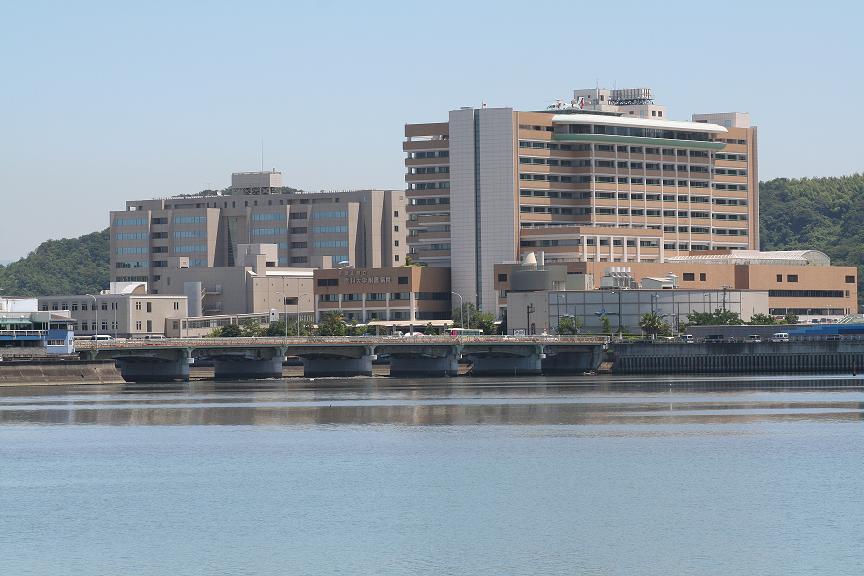
Wakayama Medical University
School · 5.2 km
Higher education institution in Wakayama Prefecture, Japan



9 more on the map.
Museums and landmarks119


Narugami Shell Mound
Monument and historic site · 8.8 km
Remains of Jōmon period settlement

Wakayama Prefecture Kii-fudoki-no-oka Museum of Archaeology and Folklore
Museum · 8.6 km
Museum in Wakayama, Wakayama, Japan



107 more on the map.
Parks, trails and playgrounds45




片男波海水浴場
Beach · 5.2 km
営業:7~8月の8~17時 和歌山駅、和歌山市駅からバスで30~40分程度で着く。 平成18年環境省選定「快水浴場百選 海の部特選」に選定された。
1740, 和歌山市和歌浦南



33 more on the map.
Restaurants and cafes135

和歌山ちゃんぽんさらしな
Restaurant · Chinese · 2.8 km
11:00-15:00, 17:30-22:30
居酒屋まさや
Restaurant · Japanese · 5.9 km
Mo-Fr 11:00-13:00,17:00-22:30
Gyoza no Ohsho
Restaurant · Chinese, Gyoza · 2.2 km
Mo-Sa 11:00-23:30; Su 11:00-22:30

123 more on the map.
History
The area of the modern city of Kainan was within ancient Kii Province, and Yayoi pottery and Kofun burial mounds indicate settlement since prehistoric times. The area is part of the Kumano Kodo and was a relay point between the capital and the onsen area of Shirahama since ancient times. During the Sengoku period, the area was a battleground between the forces of Oda Nobunaga and the local Saika ikki, one of many Ikkō-ikki movements. During the Edo period, the area prospered under the rule of Kishū Domain which gave protection to the Kuroe neighborhood as a center for the production of Kishū lacquerware. The village of Kuroe was founded with the creation of the modern municipalities system on April 1, 1889 and was raised to town status on July 7, 1896. Kuroe merged with the neighboring towns of Utsumi and Hikata and the village of Ono to form the city of Kainan on May 1, 1934. Kainan expanded by annexing the villages of Tatsumi, Kamekawa, Kitanokami, Nakanokami, and Minaminokami on April 1, 1955. On April 1, 2005, Kainan merged with the village of Shimotsu.
From the History section of Kainan, Wakayama on Wikipedia, under CC BY-SA 4.0.
Where to stay15
Churches and places of worship59
Shopping43
Gas and EV charging9
Schools, colleges and libraries65
Healthcare38
Map of Kainan
250 places. The map loads OpenStreetMap tiles when you open it.
Getting there and nearby towns
Kansai International Airport (KIX) is the nearest airport with scheduled flights listed in OpenStreetMap, 31 km away.
- Yuasa 13 km south, about 13 min by car
- Hannan 20 km north, about 20 min by car
- Sennan 22 km north, about 22 min by car
- Izumisano 31 km north, about 31 min by car
- Kishiwada 38 km north, about 38 min by car
- Sumoto 37 km northwest, about 37 min by car
- Minamiawaji 43 km west, about 43 min by car
- Minabe 44 km south, about 44 min by car
- Awaji 45 km northwest, about 45 min by car
- Kawachi-Nagano 47 km northeast, about 47 min by car
Drive times are estimates from straight-line distance, not routes.
Local news
Headlines from INDB.
Reviews, tips and questions
Loading what members have shared...
Sources and licences
- GeoNames (CC BY 4.0): population, coordinates, regions and time zone
- OpenStreetMap contributors (ODbL 1.0): places, airports, map data
- Wikidata (CC0 1.0): elevation, founding date, time zone, website, landmarks and historic places
- Wikimedia Commons (see each image): photos
- Wikipedia (CC BY-SA 4.0): overview and history text
Photo credits
- Kainan-city-panorama-2023, KainanCity CP, CC BY 4.0
- 241006 Kainan Station Kainan Wakayama pref Japan01s3, 663highland, CC BY-SA 4.0
- 241006 Kainan Station Kainan Wakayama pref Japan04s3, 663highland, CC BY-SA 4.0
- 241006 Kainan Station Kainan Wakayama pref Japan02s3, 663highland, CC BY-SA 4.0
- 241006 Kainan Station Kainan Wakayama pref Japan03s3, 663highland, CC BY-SA 4.0
- 241006 Kainan Station Kainan Wakayama pref Japan05s3, 663highland, CC BY-SA 4.0
- DomDom hamburger Kainan FC 20241014, Sakumata, CC0
- Kainan-city-streetscape, KainanCity CP, CC BY 4.0
- Kainan-city-suzuki-residence-zashiki, KainanCity CP, CC BY 4.0
- 241006 The Suzuki-homestead Kainan Wakayama pref Japan04s3, 663highland, CC BY-SA 4.0
- 241006 The Suzuki-homestead Kainan Wakayama pref Japan08s3, 663highland, CC BY-SA 4.0
- 241006 The Suzuki-homestead Kainan Wakayama pref Japan06s3, 663highland, CC BY-SA 4.0
- 241006 The Suzuki-homestead Kainan Wakayama pref Japan01s3, 663highland, CC BY-SA 4.0
- 241006 The Suzuki-homestead Kainan Wakayama pref Japan11s3, 663highland, CC BY-SA 4.0
- 241006 The Suzuki-homestead Kainan Wakayama pref Japan14s3, 663highland, CC BY-SA 4.0
- 241006 The Suzuki-homestead Kainan Wakayama pref Japan12s3, 663highland, CC BY-SA 4.0
- 241006 The Suzuki-homestead Kainan Wakayama pref Japan09s3, 663highland, CC BY-SA 4.0
- 241006 The Suzuki-homestead Kainan Wakayama pref Japan02s3, 663highland, CC BY-SA 4.0
- 241006 The Suzuki-homestead Kainan Wakayama pref Japan03s3, 663highland, CC BY-SA 4.0
- 241006 The Suzuki-homestead Kainan Wakayama pref Japan07s3, 663highland, CC BY-SA 4.0
- 241006 The Suzuki-homestead Kainan Wakayama pref Japan10s3, 663highland, CC BY-SA 4.0
- 241006 The Suzuki-homestead Kainan Wakayama pref Japan05s3, 663highland, CC BY-SA 4.0
- 241006 The Suzuki-homestead Kainan Wakayama pref Japan13s3, 663highland, CC BY-SA 4.0
- 241006 Fujishiro-jinja Kainan Wakayama pref Japan30s3, 663highland, CC BY-SA 4.0
- 241006 Fujishiro-jinja Kainan Wakayama pref Japan02s3, 663highland, CC BY-SA 4.0
- 241006 Fujishiro-jinja Kainan Wakayama pref Japan15s3, 663highland, CC BY-SA 4.0
- 241006 Fujishiro-jinja Kainan Wakayama pref Japan05s3, 663highland, CC BY-SA 4.0
- 241006 Fujishiro-jinja Kainan Wakayama pref Japan04s3, 663highland, CC BY-SA 4.0
- 241006 Fujishiro-jinja Kainan Wakayama pref Japan13s3, 663highland, CC BY-SA 4.0
- 241006 Fujishiro-jinja Kainan Wakayama pref Japan06s3, 663highland, CC BY-SA 4.0
- 241006 Fujishiro-jinja Kainan Wakayama pref Japan11s3, 663highland, CC BY-SA 4.0
- 241006 Fujishiro-jinja Kainan Wakayama pref Japan08s3, 663highland, CC BY-SA 4.0
- 241006 Fujishiro-jinja Kainan Wakayama pref Japan27s3, 663highland, CC BY-SA 4.0
- 241006 Fujishiro-jinja Kainan Wakayama pref Japan28s3, 663highland, CC BY-SA 4.0
- 241006 Fujishiro-jinja Kainan Wakayama pref Japan25s3, 663highland, CC BY-SA 4.0
- 241006 Fujishiro-jinja Kainan Wakayama pref Japan17s3, 663highland, CC BY-SA 4.0
- 241006 Fujishiro-jinja Kainan Wakayama pref Japan16s3, 663highland, CC BY-SA 4.0
- 241006 Fujishiro-jinja Kainan Wakayama pref Japan18s3, 663highland, CC BY-SA 4.0
- Wakayama Prefectural Museum of Natural History, Totti, CC BY-SA 4.0
- 121013 The museum of modern art, wakayama01s3, 663highland, CC BY-SA 4.0
- Narukami Kaizuka, setsumeiban, Saigen Jiro, CC0
- Kiifudoki-no-oka museum of history, Ozizo, Public domain
- Kimiidera Park, GSI 2008, 国土地理院 (Geospatial Information Authority of Japan), Attribution
- Chohoji03s3200, 663highland, CC BY 2.5
- Wakayama Prefectural library, KishujiRapid, CC BY-SA 4.0
- ポルトヨーロッパ, Syced, CC0
- Furobashi Wakanoura Wakayama Japan01n, 663highland, CC BY 2.5
- Itakiso-jinja, haisho, Saigen Jiro, CC0
- 和歌山市立和歌浦小学校, Syced, CC0
- 県営紀三井寺球場, NY39, CC BY-SA 4.0
- Wakayama Medical University Hospital, kouko0515, CC BY-SA 3.0
- WakayamaTechnicalHighSchool, どんどん, CC BY-SA 3.0
- Wakaura Tenmangu haiden+honden, KENPEI, CC BY-SA 3.0
- Zenpukuin shakado01s3200, 663highland, CC BY 2.5
- Kasuga-jinja, Kainan, 運動会プロテインパワー, CC BY-SA 4.0
- Kitsumoto Shrine Entrance, 聖石大戦ぶぅぶぅ, CC BY-SA 4.0
- Kainan Iryou Center(Kainan Medical Center), 聖石大戦ぶぅぶぅ, CC BY-SA 4.0
- Kaizenin tahoto, KENPEI, CC BY-SA 3.0
- Tamatsushima-jinja haiden, KENPEI, CC BY-SA 3.0
- Yanomiya jinja, Jerry fish tkc, CC BY-SA 3.0
- Kisyu Toshogu tomon, KENPEI, CC BY-SA 3.0
- Saikazaki lighthouse01n3200, 663highland, CC BY 2.5
- Wakayama-Medical-University, kinowaka, CC BY-SA 3.0
- Wakayama Saika Elementary School, hyolee2, CC BY-SA 4.0
- 250830 Mount Tengu, Wakayama, Japan07s3, 663highland, CC BY-SA 4.0


Page built November 5, 2026. Spotted a mistake? Tell us or suggest a place.