
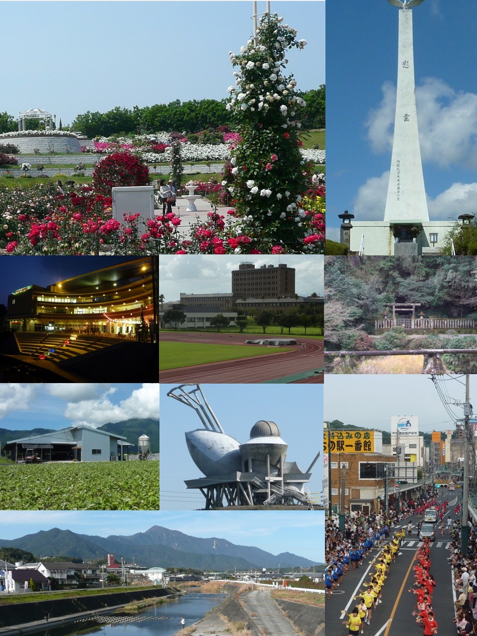


Kanoya, Japan
鹿屋市
Kanoya is a town of 101,096 people in Kagoshima, Japan, founded in May 27, 1941.
Why visit Kanoya
Townapedia lists 51 museums and landmarks, 57 parks and trails, 114 places to eat, 21 places to stay and 11 attractions in and around town.
Highlights include National Institute of Fitness and Sports in Kanoya, Mt. Ōnogara, Historical Museum of Kanoya Air Base and 塚崎のクス.
Weather in Kanoya
Forecast from MET Norway (CC BY 4.0). Full forecast
About Kanoya
Kanoya (鹿屋市, Kanoya-shi) is a city in Kagoshima Prefecture, Japan. As of 1 March 2024, the city had an estimated population of 98,367 in 46114 households, and a population density of 100 persons per km2. The total area of the city is 448.15 km2 (173.03 sq mi). Kanoya is also popularly called the "Town of Roses".
From the Wikipedia article Kanoya, Kagoshima (this version), under CC BY-SA 4.0.
Travel tips from other travellers: Kanoya on Wikivoyage (CC BY-SA 4.0).
Things to do11

National Institute of Fitness and Sports in Kanoya
School · 6.2 km
Higher education institution in Kagoshima Prefecture, Japan


Museums and landmarks51



39 more on the map.
Parks, trails and playgrounds57





45 more on the map.
Restaurants and cafes114


Osaka Ohsho
Restaurant · Japanese, Chinese · 1.7 km
Tu-Su 11:00-22:30

CoCo ICHIBANYA
Restaurant · Curry, Japanese · 2.9 km
札元2丁目3790-1, 鹿屋市

102 more on the map.
History
The area of Kanoya was part of ancient Ōsumi Province, and was part of the Shimazu-shō, a vast shōen landed manor in Ōsumi, Satsuma that was opened at the end of the Heian period, and which evolved into Satsuma Domain in the Edo period. After the Meiji restoration, the village of Kanoya was established with the creation of the modern municipalities system on April 1, 1889. Kanoya was raised to town status on December 31, 1912. On May 27, 1941, Kanoya merged with the villages of Hanaoka and Oaira to form the city of Kanoya.
In 2006, the original city of Kanoya was expanded following the merger of the two towns of Aira and Kushira in Kimotsuki District, and Kihoku in Soo District. The original Kanoya City was established as a municipality on May 27, 1941 (Navy Memorial Day).
From the History section of Kanoya, Kagoshima on Wikipedia, under CC BY-SA 4.0.
Where to stay21
Churches and places of worship23
Shopping39
Gas and EV charging11
Schools, colleges and libraries67
Healthcare32
Map of Kanoya
250 places. The map loads OpenStreetMap tiles when you open it.
Getting there and nearby towns
Kagoshima Airport (KOJ) is the nearest airport with scheduled flights listed in OpenStreetMap, 48 km away.
- Maeda 10 km southeast, about 10 min by car
- Kawahigashi 15 km east, about 15 min by car
- Shiromoto 17 km south, about 17 min by car
- Ōsaki 17 km east, about 17 min by car
- Tarumizu 18 km northwest, about 18 min by car
- Nejime-kawaminan 20 km south, about 20 min by car
- Ibusuki 25 km southwest, about 25 min by car
- Shibushi 26 km northeast, about 26 min by car
- Kagoshima 35 km northwest, about 35 min by car
- Miyakonojō 44 km northeast, about 44 min by car
Drive times are estimates from straight-line distance, not routes.
Local news
Headlines from INDB.
Reviews, tips and questions
Loading what members have shared...
Sources and licences
- GeoNames (CC BY 4.0): population, coordinates, regions and time zone
- OpenStreetMap contributors (ODbL 1.0): places, airports, map data
- Wikidata (CC0 1.0): elevation, founding date, time zone, website, landmarks and historic places
- Wikimedia Commons (see each image): photos
- Wikipedia (CC BY-SA 4.0): overview and history text
Photo credits
- Kanoya Montage Beta, Sanjo, CC BY-SA 3.0
- Kanoya Hospital 2010, ja:User:Sanjo, Public domain
- Taiyo ThankYou Kanoya, Sanjo, CC BY-SA 3.0
- Route269 Kanoya Central, ja:USer:Sanjo, Public domain
- Kimotsuki River Renacity Kanoya 2007, ja:User:Sanjo, Public domain
- Kanoya City Central 2009, ja:User:Sanjo, Public domain
- Takakuma Mountains from Kotobuki Kanoya, Sanjo, Public domain
- Kagoshima Pref Road 68 Kanoya Kotobuki, ja:User:Sanjo, Public domain
- Kanoya Naval Air Base Museum - May 5, 2024, Masahiko OHKUBO, CC BY 2.0
- Kawasaki Bell 47G-2A in the Kanoya Naval Air Base Museum - Mar 13, 2026, Sharon Hahn Darlin, CC BY 4.0
- Kimotsuki River Kanoya Utsuma, ja:User:Sanjo, Public domain
- Kagoshimaken Sinyo Kumiai Main Office - Kanoya, Japan, ja:User:Sanjo, CC BY-SA 3.0
- Kagoshima Pref Road 553 Kanoya Kotobuki 01, ja:User:Sanjo, Public domain
- NIFS in Kanoya 2010, ja:User:Sanjo, Public domain
- Senpiro Fall Yaku Island, Yosemite, CC BY-SA 3.0
- Hoshizuka Keiaien 2010, ja:User:Sanjo, Public domain
- Shijukusho jinja Kagoshima Japan, ja:user:Sanjo, Public domain
- Tukazaki b (Kimotsuki), 肝付町役場, CC BY 4.0
- Koyama jhs Kimotsuki 2010, ja:User:Sanjo, Public domain
- Kouyamajou Kagoshima Japan, Sanjo at Japanese Wikipedia, Public domain
- Udo Jinja (Aira, Kanoya, Kagoshima) 2007, ja:User:Sanjo, Public domain
- Kanoya-higashi jhs 2010, ja:User:Sanjo, Public domain
- Kanoya Air Base Museum, ja:User:Sanjo, Public domain
- Camphor tree of Tsukazaki Kagoshima, ja:User:Sanjo, Public domain
- Kanoya es 2010, ja:User:Sanjo, Public domain
- Minami es Kanoya 2010, ja:User:Sanjo, Public domain
- Kushira es Kanoya 2010, ja:User:Sanjo, Public domain
- Kamiobaru es Kanoya 2012, ja:User:Sanjo, Public domain
- Simomyo es Kanoya 2010, ja:User:Sanjo, Public domain
- Koyama es Kimotsuki 2011, ja:User:Sanjo, Public domain
- Namino es Kimotsuki 2010, ja:User:Sanjo, Public domain
- Kushira jhs Kanoya 2012, ja:User:Sanjo, Public domain
- Kamiobaru jhs Kanoya 2012, ja:User:Sanjo, Public domain
- Doryu-ji Koyama 202009 01, ja:User:Sanjo, CC BY-SA 4.0
- Kimotsuki Town Museum, ja:User:Sanjo, Public domain
- ArahiraTenjin1, Ippukucho, CC BY 3.0
- Kamikawa Falls Kagoshima, ja:User:Sanjo, Public domain
- Tsukazaki Kofun Group-51, funkyu, Saigen Jiro, CC0
- Udo-jinja (Kanoya), shaden-1, Saigen Jiro, CC0
- Tsukazaki no Kusu, zenkei-1, Saigen Jiro, CC0


Page built November 4, 2026. Spotted a mistake? Tell us or suggest a place.