


Komaki, Japan
小牧市
Komaki is a town of 148,872 people in Aichi, Japan, founded in January 1, 1955.
Why visit Komaki
Townapedia lists 30 museums and landmarks, 162 parks and trails, 131 places to eat, 5 places to stay and 10 attractions in and around town.
Highlights include Aichi Bunkyo University, Aichi Prefectural College of Nursing & Health, Asahi Site and Insulator Museum.
Weather in Komaki
Forecast from MET Norway (CC BY 4.0). Full forecast
About Komaki
Komaki (小牧市, Komaki-shi) is a city located in Aichi Prefecture, Japan. As of 1 October 2019, the city had an estimated population of 148,872 in 68,174 households, and a population density of 2,370 inhabitants per square kilometre (6,100/sq mi). The total area of the city was 62.81 square kilometres (24.25 sq mi). Komaki is commonly associated with the former Komaki Airport, which is located on the border between Komaki and neighboring Kasugai.
From the Wikipedia article Komaki (this version), under CC BY-SA 4.0.
Things to do10

Aichi Bunkyo University
School · 8.4 km
Higher education institution in Aichi Prefecture, Japan

Aichi Prefectural College of Nursing & Health
School · 1.1 km
Public university in Nagoya, Aichi, Japan

Chubu University
School · 9.1 km
Higher education institution in Aichi Prefecture, Japan

Nagoya University of Arts
School · 4.4 km
Higher education institution in Aichi Prefecture, Japan

Nagoya University of Economics
School · 5.3 km
Higher education institution in Aichi Prefecture, Japan

Nagoya Zokei University
School · 8.0 km
Higher education institution in Aichi Prefecture, Japan



Museums and landmarks30

Asahi Site
Monument and historic site · 8.9 km
Archaeological site in Kiyosu/Nagoya, Aichi, Japan

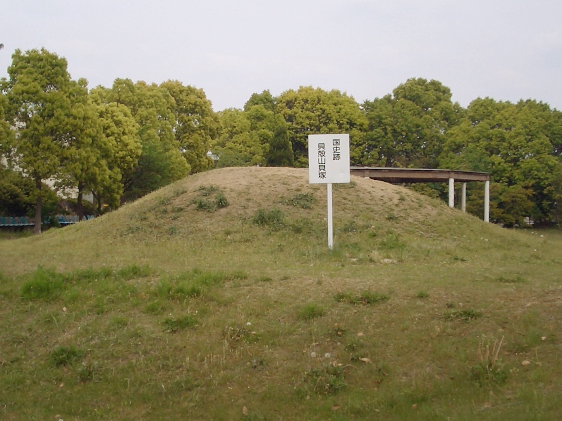
Kaigarayama Shell Mound
Monument and historic site · 9.3 km
Archaeological site in Kiyosu, Aichi, Japan
Menard Art Museum
Museum · 0.7 km
Art museum in Komaki City, Aichi, Japan


China Airlines Flight 140 Crash Memorial
Monument and historic site · 4.9 km


18 more on the map.
Parks, trails and playgrounds162




150 more on the map.
Restaurants and cafes131



119 more on the map.
Where to stay5
Churches and places of worship83
Shopping55
Gas and EV charging20
Schools, colleges and libraries57
Healthcare25
Map of Komaki
250 places. The map loads OpenStreetMap tiles when you open it.
Getting there and nearby towns
Nagoya Airfield (NKM) is the nearest airport with scheduled flights listed in OpenStreetMap, 3 km away.
- Toyoyama 4 km south, about 4 min by car
- Iwakura 5 km west, about 5 min by car
- Kitanagoya 5 km southwest, about 5 min by car
- Nagoya 11 km south, about 11 min by car
- Seto 18 km east, about 18 min by car
- Toyota 31 km southeast, about 31 min by car
- Okazaki 43 km southeast, about 43 min by car
- Nishio 48 km south, about 48 min by car
- Toyokawa 68 km southeast, about 1 h 15 min by car
- Toyohashi 71 km southeast, about 1 h 15 min by car
Drive times are estimates from straight-line distance, not routes.
Local news
Headlines from INDB.
Reviews, tips and questions
Loading what members have shared...
Sources and licences
- GeoNames (CC BY 4.0): population, coordinates, regions and time zone
- OpenStreetMap contributors (ODbL 1.0): places, airports, map data
- Wikidata (CC0 1.0): elevation, founding date, time zone, website, landmarks and historic places
- Wikimedia Commons (see each image): photos
- Wikipedia (CC BY-SA 4.0): overview and history text
Photo credits
- Komaki Castle 02, Own work, CC BY-SA 3.0
- APiTA.komaki, きのえもん, CC BY-SA 3.0
- LAMU Komaki 20170517, 円周率3パーセント (Enshuritsu 3 percent), CC BY-SA 4.0
- Apita,komaki2, きのえもん, CC BY-SA 3.0
- KomakiyamaCastle Ote street01, Nryate, CC BY-SA 4.0
- Komaki City Manhole 20161010, 円周率3パーセント, CC BY-SA 4.0
- Shimizuya Komaki 20131101, 円周率3パーセント, CC BY-SA 4.0
- Aichi Komaki c20250402 1408, 円周率3パーセント, CC BY-SA 4.0
- Komaki 20201229-35, 円周率3パーセント, CC BY-SA 4.0
- Komaki 20201229-33, 円周率3パーセント, CC BY-SA 4.0
- Komaki 20201229-36, 円周率3パーセント, CC BY-SA 4.0
- Komaki 20201229-34, 円周率3パーセント, CC BY-SA 4.0
- Komaki 20201229-28, 円周率3パーセント, CC BY-SA 4.0
- Komaki 20201229-32, 円周率3パーセント, CC BY-SA 4.0
- Komaki 20201229-31, 円周率3パーセント, CC BY-SA 4.0
- Komaki 20201229-27, 円周率3パーセント, CC BY-SA 4.0
- Komaki 20201229-30, 円周率3パーセント, CC BY-SA 4.0
- Komaki 20201229-29, 円周率3パーセント, CC BY-SA 4.0
- Parque do castelo de Komaki - panoramio, Omiya, CC BY-SA 3.0
- Aichi Bunkyo University, KKPCW, CC BY 3.0
- Chubu-daigaku University Nagoya Campus 20141018, 円周率3パーセント, CC BY-SA 4.0
- Nagoya Keizai University ac (1), Asturio Cantabrio, CC BY-SA 4.0
- Nagoya Zokei University, KKPCW, CC BY-SA 3.0
- Asahi museum2, Bariston, CC BY-SA 4.0
- Kaigarayama shell midden, MChew, CC BY-SA 4.0
- Imperial Hotel, Tokyo (1923-1968), Collin Grady, CC BY-SA 2.0
- Shonai-ryokuchi04, KAMUI, CC BY-SA 3.0
- Tagata jinja haiden 2020-12 ac (1), Asturio Cantabrio, CC BY-SA 4.0
- China Airlines Flight 140 wreckage, 航空事故調査委員会, CC BY 4.0
- Komakiyama castle1, Bariston, CC BY-SA 4.0
- Lapio in Komaki ac, Asturio Cantabrio, CC BY-SA 4.0
- Hassyosya Kumanosya Gōden, KKPCW, CC BY 3.0
- Komaki City Hospital, KKPCW, CC BY 3.0
- Komaki City Mitsubuchi Elementary School 20161010, 円周率3パーセント (Enshuritsu 3 percent), CC BY-SA 4.0
- Kaizouin (Komaki) 4, KKPCW, CC BY 3.0
- Kitanagoya City East Library, Gosei78 ( talk ), CC BY-SA 3.0
- Koto-ji temple, Komaki, 運動会プロテインパワー, CC BY-SA 4.0
- Katayamahachimansha 1, Mobnoboka, CC BY-SA 4.0
- Gyokurinji (Komaki, Komaki), KKPCW, CC BY 3.0
- Kodo-ji Temple 20160604, 円周率3パーセント, CC BY-SA 4.0
- AM boon, いたち, CC BY-SA 3.0
- Komaki Nishimachi Inarido 2021-03 ac, Asturio Cantabrio, CC BY-SA 4.0
- Kannonji (Iwazaki, Komaki), KKPCW, CC BY 3.0
- Toyoyama Town Shimizu Elementary School 20160117-02, 円周率3パーセント, CC BY-SA 4.0
- Toyoyama Town Toyoyama Junior High School 20160831, 円周率3パーセント, CC BY-SA 4.0
- Kenrin-ji temple, Komaki, 運動会プロテインパワー, CC BY-SA 4.0
- Mama Kannon ac (1), Asturio Cantabrio, CC BY-SA 4.0
- Aichi Museum of Flight, アラツク, CC BY-SA 4.0
- APITA Iwakura, Abasaa, Public domain
- 神明大一社本殿, 松乃翠, CC BY-SA 4.0
- Nagoya university of arts east, Gosei78 ( talk ), CC BY-SA 3.0
- Menard Art Museum1, Bariston, CC BY-SA 4.0
- Kasugai Elementary School, KKPCW, CC BY-SA 3.0
- Komaki City Komaki-nishi Junior High School 20161010, 円周率3パーセント, CC BY-SA 4.0
- Komakihara Elementary School, KKPCW, CC BY-SA 3.0
- Shinmei-koen Park 20131122, 円周率3パーセント, CC BY-SA 4.0
- Ichinokuta Chuo Park, KKPCW, CC BY-SA 3.0
- Toyoyama Town Toyoyama Elementary School 20160130, 円周率3パーセント, CC BY-SA 4.0
- Kitanagoya-City-Shikatsu-Kita-Elementary-School-1, Evelyn-rose, CC0
- Kitanagoya-City-Kumano-Junior-High-School-1, Evelyn-rose, CC0


Page built November 4, 2026. Spotted a mistake? Tell us or suggest a place.