


Nanao, Japan
七尾市
Nanao is a town of 50,300 people in Ishikawa, Japan, founded in July 20, 1939.
Why visit Nanao
Townapedia lists 22 museums and landmarks, 25 parks and trails, 59 places to eat, 27 places to stay and 9 attractions in and around town.
Highlights include Notojima Aquarium, Mt. Sekido, Ishikawa Nanao Art Museum and Mangyō Site.
Weather in Nanao
Forecast from MET Norway (CC BY 4.0). Full forecast
About Nanao
Nanao (七尾市, Nanao-shi) is a city located in Ishikawa Prefecture, Japan. As of 31 March 2022, the city had an estimated population of 49,660 people in 21,809 households. The total area of the city was 318.32 square kilometres (122.90 sq mi). Nanao is the fifth largest city by population in Ishikawa, behind Kanazawa, Hakusan, Komatsu, and Kaga.
From the Wikipedia article Nanao, Ishikawa (this version), under CC BY-SA 4.0.
Travel tips from other travellers: Nanao on Wikivoyage (CC BY-SA 4.0).
Things to do9

Notojima Aquarium
Zoo and aquarium · 11.2 km
Aquarium in Ishikawa, Japan
〒926-0216 Ishikawa-ken, Nanao-shi, Notojima Magarimachi, 15部40
Mo-Su 09:00-17:00



Museums and landmarks22

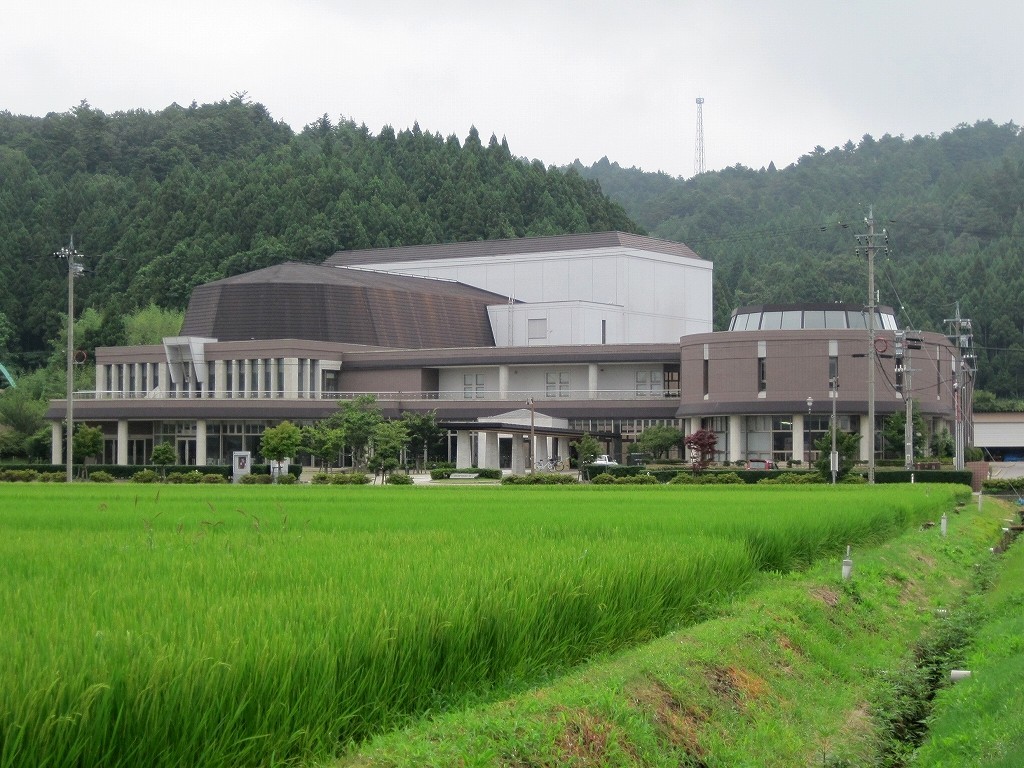
Ishikawa Nanao Art Museum
Museum · 1.3 km
Building in Nanao, Ishikawa Prefecture, Japan

Mangyō Site
Monument and historic site · 2.2 km
Archaeological site in Japan

Ōzakai Cave Dwelling Site
Monument and historic site · 15.0 km
Archaeological site in Himi, Japan


10 more on the map.
Parks, trails and playgrounds25


13 more on the map.
Restaurants and cafes59


あめや
Restaurant · Japanese, Fish, Fine Dining
桧物町27-9
Mo-Sa 11:00-14:30, 17:00-21:00
昇龍
Restaurant · Chinese · 3.5 km
細口町ろ80-1
Tu-Sa 11:00-15:00, 17:30-21:00; Su 11:00-15:00, 17:00-21:00
イタリアンジェラート チェルキオ
Ice cream
神明町ロ-22-10 国道249号線 七尾市役所そば
We-Mo 11:30-19:00



47 more on the map.
History
The area around Nanao was part of ancient Noto Province and contained the Nara period provincial capital and provincial temple. During the Sengoku Period (1467–1568), Nanao Castle was a major stronghold of the Hatakeyama clan, and was contested by the Uesugi clan and Maeda clan. The area became part Kaga Domain under the Edo period Tokugawa shogunate, with the exception of the Tsuruhama area, which was retained by the shogunate directly as tenryō territory.
Following the Meiji restoration, the area was organised into Kashima District, Ishikawa. The town of Nanao was established with the creation of the modern municipalities system on April 1, 1889. It was raised to city status on July 20, 1939.
On October 1, 2004, Nanao expanded by annexing the neighbouring municipalities of Nakajima, Notojima and Tatsuruhama (all from Kashima District).
On March 25, 2007, the 2007 Noto earthquake caused some property damage in Nanao, but no fatalities.
From the History section of Nanao, Ishikawa on Wikipedia, under CC BY-SA 4.0.
Where to stay27
Churches and places of worship19
Shopping14
Gas and EV charging4
Schools, colleges and libraries44
Healthcare12
Map of Nanao
235 places. The map loads OpenStreetMap tiles when you open it.
Getting there and nearby towns
Noto Airport (NTQ) is the nearest airport with scheduled flights listed in OpenStreetMap, 27 km away.
- Hitoto 9 km southwest, about 9 min by car
- Oshima 19 km west, about 19 min by car
- Himimachi 21 km south, about 21 min by car
- Himi 22 km south, about 22 min by car
- Wajima 40 km north, about 40 min by car
- Toyama 45 km southeast, about 45 min by car
- Tsubata 47 km southwest, about 47 min by car
- Kanazawa 59 km southwest, about 59 min by car
- Matsutō 69 km southwest, about 1 h 15 min by car
- Komatsu 85 km southwest, about 1 h 30 min by car
Drive times are estimates from straight-line distance, not routes.
Local news
Headlines from INDB.
Reviews, tips and questions
Loading what members have shared...
Sources and licences
- GeoNames (CC BY 4.0): population, coordinates, regions and time zone
- OpenStreetMap contributors (ODbL 1.0): places, airports, map data
- Wikidata (CC0 1.0): elevation, founding date, time zone, website, landmarks and historic places
- Wikimedia Commons (see each image): photos
- Wikipedia (CC BY-SA 4.0): overview and history text
Photo credits
- 七尾 能登食祭市場前の交差点Crossing in front of Fisherman's Wharf in NANAO city - panoramio, comachiangel, CC BY 3.0
- R6 noto earthquake nanao shokusai-ichiba-market 2024-02-17 2, Hurohukidaikon, CC BY 4.0
- R6 noto earthquake nanao shokusai-ichiba-market 2024-02-17 1, Hurohukidaikon, CC BY 4.0
- R6 noto earthquake nanao public-water 2024-02-17 2, Hurohukidaikon, CC BY 4.0
- 七尾港( Port of Nanao) - panoramio (13), comachiangel, CC BY 3.0
- 七尾マリンパーク(NANAO Malin parks) - panoramio, comachiangel, CC BY 3.0
- 七尾マリンパーク(Nanao-Malin park) - panoramio (3), comachiangel, CC BY 3.0
- 七尾マリンパークから望む能登島(Notojima to see from NANAO Malin parks) - panoramio (6), comachiangel, CC BY 3.0
- 七尾港( Port of Nanao) - panoramio (23), comachiangel, CC BY 3.0
- 七尾港( Port of Nanao) - panoramio (2), comachiangel, CC BY 3.0
- 七尾港( Port of Nanao) - panoramio (5), comachiangel, CC BY 3.0
- 七尾港( Port of Nanao) - panoramio (19), comachiangel, CC BY 3.0
- 七尾マリンパーク(Nanao-Malin park) - panoramio (1), comachiangel, CC BY 3.0
- 七尾マリンパーク(NANAO Malin parks) - panoramio (1), comachiangel, CC BY 3.0
- 七尾マリンパーク(Nanao-Malin park) - panoramio, comachiangel, CC BY 3.0
- 七尾マリンパーク(Nanao-Malin park) - panoramio (2), comachiangel, CC BY 3.0
- 七尾マリンパーク(NANAO Malin parks) - panoramio (2), comachiangel, CC BY 3.0
- 七尾マリンパーク(Nanao-Malin park)からの能登食祭市場 - panoramio, comachiangel, CC BY 3.0
- 七尾マリンパークから望む能登島(Notojima to see from NANAO Malin parks) - panoramio, comachiangel, CC BY 3.0
- 七尾マリンパークから望む能登島(Notojima to see from NANAO Malin parks) - panoramio (1), comachiangel, CC BY 3.0
- 七尾マリンパークから望む能登島(Notojima to see from NANAO Malin parks) - panoramio (2), comachiangel, CC BY 3.0
- 七尾港( Port of Nanao) - panoramio (12), comachiangel, CC BY 3.0
- 七尾 能登食祭市場 (Fisherman's Wharf in NANAO city) - panoramio, comachiangel, CC BY 3.0
- 七尾港( Port of Nanao) - panoramio (22), comachiangel, CC BY 3.0
- 七尾港( Port of Nanao) - panoramio (16), comachiangel, CC BY 3.0
- 七尾港( Port of Nanao) - panoramio (1), comachiangel, CC BY 3.0
- 七尾マリンパーク(NANAO Malin parks) - panoramio (4), comachiangel, CC BY 3.0
- 七尾マリンパーク(NANAO Malin parks) - panoramio (3), comachiangel, CC BY 3.0
- 七尾マリンパークから望む能登島(Notojima to see from NANAO Malin parks) - panoramio (3), comachiangel, CC BY 3.0
- Notojima Suizokukan, Fuseoyama, CC BY-SA 3.0
- Oozakai Cave, 藤谷良秀, CC BY-SA 3.0
- Kagaya 200410, Atsasebo, CC BY-SA 3.0
- 石川県七尾美術館 Nanao Art Museum, Zangix, CC BY-SA 4.0
- Patria2022, ブルーノ・プラス, CC BY-SA 4.0
- Noto Hospital, Hirorinmasa, CC BY-SA 3.0
- National Hospital Organization Nanao National Hospital, Waka77, Public domain
- Ishikawa Prefecture Notojima Glass Art Museum, 小石川人晃, CC BY-SA 4.0
- Noto-engekido, Wataridori, Public domain
- Noto Shokusai Ichiba - Nanao, Ishikawa, Japan - DSC00704, Daderot, CC0
- Michinoeki Nakajima Roman Toge, Yasu ( talk ), CC BY-SA 3.0
- Alksh20.4, ALKS, Public domain
- Nanao Municipal Nanao Junior High School, Yasu ( talk ), CC BY-SA 3.0
- Ootori gakuen high school, Nanao, 運動会プロテインパワー, CC BY-SA 4.0
- Nappy Mall - Main building, 運動会プロテインパワー, CC BY-SA 4.0
- Hondo-ji, Nakanoto - Gate, 運動会プロテインパワー, CC BY-SA 4.0


Page built November 4, 2026. Spotted a mistake? Tell us or suggest a place.