


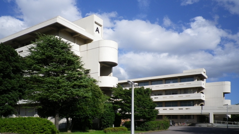


Narashino, Japan
習志野市
Narashino is a town of 176,197 people in Chiba, Japan, founded in April 1, 1889.
Why visit Narashino
Townapedia lists 20 museums and landmarks, 166 parks and trails, 188 places to eat, 8 places to stay and 5 attractions in and around town.
Highlights include Chiba Prefectural University of Health Sciences, Kanda University of International Studies, Kotehashi Shell Mound and Torikakenishi Shell Mound.
Weather in Narashino
Forecast from MET Norway (CC BY 4.0). Full forecast
About Narashino
Narashino (習志野市, Narashino-shi) is a city located in Chiba Prefecture, Japan.
From the Wikipedia article Narashino (this version), under CC BY-SA 4.0.
Travel tips from other travellers: Narashino on Wikivoyage (CC BY-SA 4.0).
Things to do5
Chiba Prefectural University of Health Sciences
School · 3.4 km
Higher education institution in Chiba Prefecture, Japan

Kanda University of International Studies
School · 2.7 km
Higher education institution in Chiba Prefecture, Japan

Open University of Japan
School · 3.3 km
Higher education institution in Chiba Prefecture, Japan


Museums and landmarks20

Kotehashi Shell Mound
Monument and historic site · 5.4 km
Archaeological site in Japan

Torikakenishi Shell Mound
Monument and historic site · 4.7 km
Archaeological site in Funabashi, Chiba, Japan

8 more on the map.
Parks, trails and playgrounds166



154 more on the map.
Restaurants and cafes188

Grazie Gardens (Buffet)
Restaurant · Italian, Italian Pizza, Pasta · 1.0 km
食べ放題あり
11, 習志野市
Mo-Su 10:00-23:30


ぼうず
Restaurant · Friture, Japanese · 2.7 km
幕張町4-544-29
Tu-Sa 11:00-14:30, 17:00-22:00; Su 11:00-14:30, 17:00-21:00
中華料理 松楽
Restaurant · Chinese, Ramen · 2.7 km
幕張町4-601-4
Fr-Tu 11:00-21:00
176 more on the map.
History
The area around Narashino has been inhabited since prehistoric times. Archaeologists have found shell middens and numerous other remains from Jōmon period, as well as burial tumuli from the Kofun period. However, for most of its history, the area was a sparsely populated wetland and swamp along the northern shore of Edo Bay.
After the Meiji Restoration, Tsudanuma (津田沼村, Tsudanuma-mura) was founded within Chiba District on April 1, 1889 on the merger of five small hamlets with a total population of 4500 people. The area only began to develop with the coming of the railway, and Tsudanuma was raised to town status on March 3, 1903, with a population of 6000.
The Narashino area of Tsudanuma was used for cavalry maneuvers by the Imperial Guard and the early Imperial Japanese Army, and was visited by the Meiji Emperor early in the Meiji period (1868 – 1912). A prisoner of war camp was built in 1904 to house POWs from the Russo-Japanese War of 1904-1905 and World War I. The Imperial Japanese Army Narashino School was the main training school for cavalry, and later for tank warfare.
On August 1, 1954, Tsudanuma merged with a portion of the neighboring city of Chiba (the former town of Makuhari) to form the new city of Narashino.
From the History section of Narashino on Wikipedia, under CC BY-SA 4.0.
Where to stay8
Churches and places of worship39
Shopping37
Gas and EV charging11
Schools, colleges and libraries50
Healthcare44
Map of Narashino
250 places. The map loads OpenStreetMap tiles when you open it.
Getting there and nearby towns
Tokyo International Airport (HND) is the nearest airport with scheduled flights listed in OpenStreetMap, 27 km away.
- Chiba 11 km southeast, about 11 min by car
- Matsudo 17 km northwest, about 17 min by car
- Sakura 18 km east, about 18 min by car
- Kashiwa 21 km north, about 21 min by car
- Nagareyama 23 km northwest, about 23 min by car
- Narita 27 km northeast, about 27 min by car
- Tokyo 32 km west, about 32 min by car
- Kawasaki 34 km southwest, about 34 min by car
- Kisarazu 35 km south, about 35 min by car
- Yokohama 45 km southwest, about 45 min by car
Drive times are estimates from straight-line distance, not routes.
Local news
Headlines from INDB.
Reviews, tips and questions
Loading what members have shared...
Sources and licences
- GeoNames (CC BY 4.0): population, coordinates, regions and time zone
- OpenStreetMap contributors (ODbL 1.0): places, airports, map data
- Wikidata (CC0 1.0): elevation, founding date, time zone, website, landmarks and historic places
- Wikimedia Commons (see each image): photos
- Wikipedia (CC BY-SA 4.0): overview and history text
Photo credits
- JR Tsudanuma sta 009, 掬茶, CC BY-SA 3.0
- Narashino Police Station (4976488845), Otota DANA from Chiba, Japan, CC BY 2.0
- Sumitomo Mitsui Banking Corporation Narashino Branch, Suikotei, CC BY 4.0
- ChibaPrefecturalUniversityOfHealthSciences20110917, 三人日, CC BY-SA 3.0
- Kanda University of International Studies, Abasaa, Public domain
- The Open University of Japan, 掬茶, CC BY-SA 3.0
- 20030927 27 September 2003 SSAWS Spring Summer Autumn Winter Snow 1 Funabashi Chiba Tokyo Japan, Morio, CC BY-SA 3.0
- KotehashiKaizuka20110809, 三人日, CC BY-SA 3.0
- CIT-Tsudanuma-RearGate01, Hasec, Public domain
- Aeon mall Tsudanuma North 20260812, にのへ, CC BY-SA 4.0
- Sandaioushrine1, Yamato-i, Public domain
- Ninomiya-jinja (Funabashi) shaden, Saigen Jiro, CC0
- Chibaken Saiseikai Narashino Hospital, Abasaa, Public domain
- IMG ôharaômiya, mikuaxe, Public domain
- Chibacity Komamorishrine, Yamato-i, Public domain
- IMG koyasu, mikuaxe, Public domain
- Mitake Jinja (Funabashi), Abasaa, Public domain
- Jingū-ji (Funabashi) 08, Higa4, CC0
- ShiritsuNarashino20121104, 三人日, CC BY-SA 3.0
- Funabashi city Ninomiya elementary school 04, Higa4, CC0
- Maehara elementary school (Funabashi, Chiba, Japan), Mixtures, CC BY 4.0
- Kikutajinnjya1, Daidouji, CC BY-SA 3.0
- 道入庵, 八津, CC BY-SA 4.0
- MimomiHongo Park01, 妖精書士, CC BY-SA 4.0
- 無量寺本尊, Ryujyo, CC BY-SA 4.0
- Chiba City Makuhari Elementary School, 掬茶, CC BY-SA 3.0
- 八坂神社(習志野市津田沼) - Yasaka Shrine (Tsudanuma, Narashino), Pat457, CC BY-SA 4.0
- 丹生神社 - Nyū Shrine, Pat457, CC BY-SA 4.0
- Yawata Park (Ōkubo, Narashino) 07, Higa4, CC0
- Jinnguuji3, Daidouji, CC BY-SA 3.0
- Chiba City Makuhari Junior High School, 掬茶, CC BY-SA 3.0
- Saizeriya Yoshikawa factory, Ebiebi2, CC BY-SA 3.0
- 千葉市無量寺本尊, Ryujyo, CC BY-SA 4.0
- Chiba City Makuhari-Higashi Elementary School, 掬茶, CC BY-SA 3.0
- 230624 藤崎堀込貝塚の杜, Kasakasa719, CC BY-SA 4.0
- 230624 藤崎森林公園, Kasakasa719, CC BY-SA 4.0
- Keisei Okubo station 2025 Feb 03 12-05PM, Nesnad, CC BY 4.0
- ゆうロード(習志野)IMG 20230129 150157 03, 経済特区, CC0
- ゆうロード(習志野)IMG 20230129 150157 04, 経済特区, CC0
- Gotcha ^ (Jumping Spider by FZ18-DCR250) - Flickr - coniferconifer, coniferconifer from japan, CC BY 2.0


Page built November 4, 2026. Spotted a mistake? Tell us or suggest a place.