


Osaka, Japan
大阪市
Osaka is a regional capital of 2,753,862 people in Osaka, Japan, founded in April 1, 1889.
Why visit Osaka
Townapedia lists 88 museums and landmarks, 18 parks and trails, 436 places to eat, 17 places to stay and 45 attractions in and around town.
Highlights include Expoland, Hannan University, Osaka City Central Public Hall and Abeno Harukas Art Museum.
Weather in Osaka
Forecast from MET Norway (CC BY 4.0). Full forecast
About Osaka
Osaka (大阪市, Ōsaka-shi; [ò̞ó̞.sä́.kä́(.ɕì), ó̞ó̞-] ) is a designated city in the Kansai region of Honshu in Japan. It is the capital of and most populous city in Osaka Prefecture, and the third-most populous city proper in Japan, following the special wards of Tokyo and Yokohama. With an estimated population of 2.8 million as of October 1, 2025 and a population density of about 12,505 people per square kilometer, it is the largest component of the Keihanshin metropolitan area, the second-largest metropolitan area in Japan and the 10th-largest urban area in the world with more than 19 million inhabitants.
From the Wikipedia article Osaka (this version), under CC BY-SA 4.0.
Travel tips from other travellers: Osaka on Wikivoyage (CC BY-SA 4.0).
Things to do45

Expoland
Monument and historic site · 12.8 km
Amusement park in Suita, Japan

Hannan University
School · 11.7 km
Higher education institution in Osaka Prefecture, Japan


Higashiosaka College
School · 7.7 km
Higher education institution in Osaka Prefecture, Japan

Hyogo Medical University
School · 11.5 km
Higher education institution in Hyōgo Prefecture, Japan

Hyogo Performing Arts Center
Cinema and theater · 14.4 km
Building in Nishinomiya, Hyogo Prefecture, Japan

Kansai Medical University
School · 6.4 km
Higher education institution in Osaka Prefecture, Japan

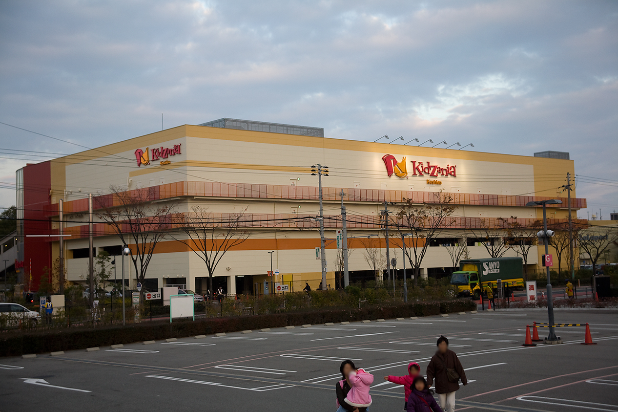
KidZania Koshien
Monument and historic site · 12.8 km
Family edutainment center amusement park
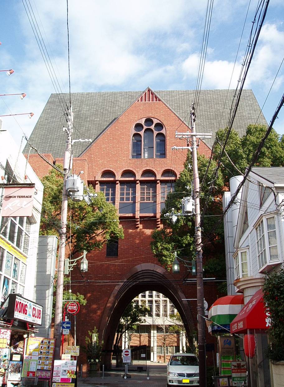
Kindai University
School · 9.1 km
Higher education institution in Osaka Prefecture, Japan


33 more on the map.
Museums and landmarks88


Abeno Harukas Art Museum
Museum · 5.5 km
Archive organization in Osaka, Japan


Itami City Museum of Insects
Museum · 14.6 km
Museum in Hyōgo Prefecture, Japan

Kawachidera temple ruins
Monument and historic site · 13.6 km
Asuka period Buddhist temple ruins

Kusaka Shell Mound
Monument and historic site · 13.5 km
Archaeological site in Japan


Liberty Osaka
Museum · 4.6 km
Human rights museum in South Osaka city


76 more on the map.
Parks, trails and playgrounds18


Hattori Ryokuchi Park
Park · 9.3 km
Park in Toyonaka, Osaka prefecture





6 more on the map.
Restaurants and cafes436

Doutor Coffee Shop
Cafe · Coffee Shop
6, 大阪市
Mo-Fr 07:00-19:00; Sa 09:00-15:00; PH off

OTTONOVE
Restaurant · Italian
■ 定休日 日曜日・祝日(貸切のご予約の場合は営業いたします)◇土曜日は不定休となっております。お問い合わせ下さい。/ Sundays and public holidays can be reserved, but are otherwise closed....
9, 大阪市
Mo Tu Th Fr 11:30-14:00; Mo Tu Th Fr 18:00-23:00; We 18:00-23:00;...


424 more on the map.
Where to stay17
Churches and places of worship5
Shopping18
Schools, colleges and libraries5
Healthcare12
Map of Osaka
250 places. The map loads OpenStreetMap tiles when you open it.
Getting there and nearby towns
Osaka Itami Airport (ITM) is the nearest airport with scheduled flights listed in OpenStreetMap, 11 km away.
- Umeda 1 km north, about 1 min by car
- Ajiharacho 4 km southeast, about 4 min by car
- Tsuruhashi 4 km southeast, about 4 min by car
- Shin’imazato 6 km southeast, about 6 min by car
- Tsumori 6 km south, about 6 min by car
- Suita 8 km north, about 8 min by car
- Moriguchi 7 km northeast, about 7 min by car
- Higashiosaka 8 km east, about 8 min by car
- Kobe 29 km west, about 29 min by car
- Kyoto 43 km northeast, about 43 min by car
Drive times are estimates from straight-line distance, not routes.
Local news
Headlines from INDB.
Reviews, tips and questions
Loading what members have shared...
Sources and licences
- GeoNames (CC BY 4.0): population, coordinates, regions and time zone
- OpenStreetMap contributors (ODbL 1.0): places, airports, map data
- Wikidata (CC0 1.0): elevation, founding date, time zone, website, landmarks and historic places
- Wikimedia Commons (see each image): photos
- Wikipedia (CC BY-SA 4.0): overview and history text
Photo credits
- Osaka Castle 02bs3200, 663highland, CC BY 2.5
- Bank of Japan Osaka Branch Yodoyabashi Osaka Jpan 1982-5-3, Mr.Naka guutarabunko, CC0
- Bank of Japan Osaka Branch Yodoyabashi Osaka Jpan 1997-autumn, Mr.Naka guutarabunko, CC0
- Bank of Japan Osaka Branch Nakanoshima Osaka Japan 1990's, Mr.Naka guutarabunko, CC0
- Osaka Dojimahama Tower, 掬茶, CC BY-SA 4.0
- Bank of Japan, Osaka Branch, West view 20190415 1, DXR, CC BY-SA 4.0
- Bank of Japan Osaka Branch 20250831, 掬茶, CC BY-SA 4.0
- Osaka - Osaka192, lumoplank, CC0
- Osaka Neon - OsakaNeon6681, lumoplank, CC0
- Osaka - Osaka194, lumoplank, CC0
- Osaka Neon - OsakaNeon6667, lumoplank, CC0
- Osaka Neon - OsakaNeon6671, lumoplank, CC0
- Osaka Neon - OsakaNeon6674, lumoplank, CC0
- Osaka Neon - OsakaNeon6655, lumoplank, CC0
- Osaka Neon - OsakaNeon6677, lumoplank, CC0
- Bank of Japan Osaka Branch ao, Sakai Yayoi, CC0
- Bank of Japan, Osaka Branch, Sakai Yayoi, CC0
- Osaka City Hall 2026 05, Sakai Yayoi, CC0
- Osaka City Hall - panoramio (1), DVMG, CC BY 3.0
- Yodoyabashi Osaka City Hall, Mr.Naka Guutarabunko, CC0
- Osaka---2025-02-15 035, RuinDig/Yuki Uchida, CC BY 4.0
- Expoland Ferris wheel wide shot, Chris Gladis from Osaka, Japan, CC BY 2.0
- Hannan University, 井上敦友, CC BY-SA 3.0
- TOHO CINEMAS Umeda in 201409, Mc681, CC BY-SA 4.0
- Hyogo Performing Arts Center night, User:Poprishchin, Public domain
- KansaiUV1, 鉄虫。the poster, CC BY-SA 3.0
- Kinki-Univ-MainCampus-WestGate01, Hasec, Public domain
- Konohana Ohashi Osaka JPN 002-edit, ignis, CC BY-SA 3.0
- Koraibashi Osaka JPN 001, ignis, CC BY-SA 3.0
- Abeno Harukas Osaka Japan01-r, Oilstreet, CC BY 2.5
- Amashin-alkaic, Kanko3131, CC BY-SA 3.0
- 260411 Fujita Museum Osaka Japan02s3, 663highland, CC BY-SA 4.0
- Itami City Museum of Insects1, KENPEI, CC BY-SA 3.0
- Kyouikutou, Osaka, Kansai explorer, CC BY 3.0
- Liberty Osaka Human Rights Museum, Kont Dracula, CC BY-SA 3.0
- Nakanoshima Museum of Art Osaka, Прикли, CC BY 4.0
- 151128 Hattori Ryokuchi Park Osaka pref Japan01s3, 663highland, CC BY 2.5
- Minami-Temma-Park-20090411-02, inoue-hiro, CC BY-SA 3.0
- Nagai Botanical Garden, Oike Pond and Bridge 001, Naokijp, CC BY-SA 4.0
- Osaka Business Park, Southwest view from Osaka Castle 20190415 1, DXR, CC BY-SA 4.0
- Osaka Castle 01bs3200, 663highland, CC BY 2.5
- Sumiyoshi-Takatourou1, KENPEI, CC BY-SA 3.0
- Tennoji park01s3200, 663highland, CC BY 2.5
- Tennoji-Zoo1, KENPEI, CC BY-SA 3.0
- UtsuboPark-RoseGarden02, inoue-hiro, CC BY-SA 3.0
- Church of Light, The original uploader was Bujatt at English Wikipedia ., CC BY-SA 2.5
- The Museum of Oriental Ceramics, Osaka 20250831, 掬茶, CC BY-SA 4.0
- Osaka Nakanosima Library, Unknown author, CC BY-SA 3.0
- Osaka Nakanoshima Public Hall, Sakai Yayoi, CC0
- Dojima Yakushido1, KENPEI, CC BY-SA 3.0
- Yodoyabashi-Mitsui-Bldg-200803, Inoue-hiro, CC BY-SA 3.0
- Tsuyu-tenjinsha haiden, KENPEI, CC BY-SA 3.0
- APA Hotel Osaka Higobashiekimae, Tokumeigakarinoaoshima, CC0
- Hoseiji (Kita, Osaka)2, KENPEI, CC BY-SA 3.0
- Conrad Osaka Japan01-r, Oilstreet, CC BY 2.5
- 至暁山 浄信寺, Edomother, CC0
- 131116 Expo Commemoration Park Suita Osaka pref Japan04s3, 663highland, CC BY 2.5
- Higashiosaka univ, The original uploader was Bakkai at Japanese Wikipedia ., CC BY-SA 3.0
- KMU Campus, Puratanasu, CC BY-SA 4.0
- Kizzania, wiki0001, CC BY 3.0
- Maishima Sports Islands, NASA World Wind, Public domain
- 日下貝塚の風景その2, Hikkun23, CC BY-SA 4.0
- こども本の森 中之島(正面), まぐろのふらい, CC BY-SA 4.0


Page built November 4, 2026. Spotted a mistake? Tell us or suggest a place.