


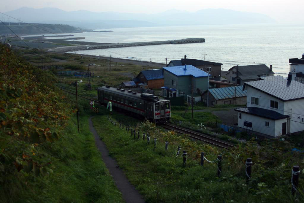


Rumoi, Japan
留萌市
Rumoi is a town of 26,454 people in Hokkaido, Japan, founded in October 1, 1947.
Why visit Rumoi
Townapedia lists 8 museums and landmarks, 32 parks and trails, 27 places to eat, 12 places to stay and 4 attractions in and around town.
Highlights include 留萌市海のふるさと館.
Weather in Rumoi
Forecast from MET Norway (CC BY 4.0). Full forecast
About Rumoi
Rumoi (留萌市, Rumoi-shi) is a city in Rumoi Subprefecture, Hokkaido, Japan. As of 31 January 2025, the city had an estimated population of 18,132 in 10519 households, and a population density of 61 people per km2. The total area of the city is 297.81 km2 (114.99 sq mi). There are several theories about the origin of the name, which comes from the Ainu word for the Rumoi River.
From the Wikipedia article Rumoi, Hokkaido (this version), under CC BY-SA 4.0.
Things to do4



Museums and landmarks8




Parks, trails and playgrounds32

20 more on the map.
Restaurants and cafes27

15 more on the map.
History
1902: The villages of Rumoi and Reuke were merged to form Rumoi Village.
1914: The capital of Mashike Subprefecture was transferred from Mashike to Rumoi and Mashike Subprefecture was renamed Rumoi Subprefecture.
1945: Rumoi was designated as the site of the proposed Soviet invasion of Hokkaido, with a plan to occupy the island from Rumoi in the west to Kushiro in the east. The plan was cancelled.
From the History section of Rumoi, Hokkaido on Wikipedia, under CC BY-SA 4.0.
Where to stay12
Churches and places of worship12
Shopping9
Gas and EV charging6
Schools, colleges and libraries7
Healthcare5
Map of Rumoi
122 places. The map loads OpenStreetMap tiles when you open it.
Getting there and nearby towns
Asahikawa Airport (AKJ) is the nearest airport with scheduled flights listed in OpenStreetMap, 71 km away.
- Obirachō 10 km north, about 10 min by car
- Mashike 13 km southwest, about 13 min by car
- Numata 28 km southeast, about 28 min by car
- Hokuryū 28 km southeast, about 28 min by car
- Chippubetsu 32 km southeast, about 32 min by car
- Moseushi 37 km southeast, about 37 min by car
- Fukagawa 41 km southeast, about 41 min by car
- Asahikawa 61 km east, about 1 h by car
- Minamishibetsuchō 63 km northeast, about 1 h by car
- Tōbetsu 80 km south, about 1 h 15 min by car
Drive times are estimates from straight-line distance, not routes.
Local news
Headlines from INDB.
Reviews, tips and questions
Loading what members have shared...
Sources and licences
- GeoNames (CC BY 4.0): population, coordinates, regions and time zone
- OpenStreetMap contributors (ODbL 1.0): places, airports, map data
- Wikidata (CC0 1.0): elevation, founding date, time zone, website
- Wikimedia Commons (see each image): photos
- Wikipedia (CC BY-SA 4.0): overview and history text
Photo credits
- 千望台(Senboudai) - panoramio (1), t-konno, CC BY-SA 3.0
- Rumoi 20201005201409 (50866878097), inunami, CC BY 2.0
- Rumoi 20201005193613 (50866778106), inunami, CC BY 2.0
- Rumoi, Hokkaidō 01, 941(旧) from Japan., CC BY-SA 2.1 jp
- Rumoi city from the sky, Bakkai, CC BY-SA 3.0
- Rumoi 20161231155131 (32085462611), inunami, CC BY 2.0
- Rumoi 20201006161142 (50866874372), inunami, CC BY 2.0
- Rumoi 20201006160903 (50866874612), inunami, CC BY 2.0
- Rumoi 20161231145856 (32165708006), inunami, CC BY 2.0
- Rumoi 20201006164156 (50866772416), inunami, CC BY 2.0
- Rumoi 20201006153122 (50866875572), inunami, CC BY 2.0
- Rumoi 20201006164139 (50866873527), inunami, CC BY 2.0
- Hokkaido Prefectural Police Rumoi Police Station, Yasu ( talk ), CC BY-SA 3.0
- Rumoi 20201006152520 (50866775266), inunami, CC BY 2.0
- JR Rumoi Station (50761399043), Kzaral, CC BY 2.0
- Rumoi 20161231142832 (32165700416), inunami, CC BY 2.0
- JR hokkaido Rumoi station, 100yen, CC BY-SA 3.0
- Rumoi 20130828 131449, Amayagan, CC0
- Rumoi Fire Department headquarters and Rumoi Fire Station, Yasu ( talk ), CC BY-SA 3.0
- Rumoi 20201006153446 (50866058478), inunami, CC BY 2.0
- JR Rumoi-Main-Line Rumoi Station building, Mister0124, CC BY-SA 4.0
- Rumoi 20161231142531 (32165699706), inunami, CC BY 2.0
- JR Rumoi-Main-Line Rumoi Station Waiting room, Mister0124, CC BY-SA 4.0
- Rumoi 20201006163247 (50866057383), inunami, CC BY 2.0
- JR Rumoi-Main-Line Rumoi Station Ticket Gates, Mister0124, CC BY-SA 4.0
- Rumoi 20201006153533 (50866774376), inunami, CC BY 2.0
- Naha29002 Rumoi 20140505, Olegushka, CC0
- Rumoi 20161231142225 (32165698556), inunami, CC BY 2.0
- JR Rumoi-Main-Line Rumoi Station Platform, Mister0124, CC BY-SA 4.0
- JR Rumoi-Main-Line Rumoi Station Bollard, Mister0124, CC BY-SA 4.0
- Rumoi 20201006163459 (50866057058), inunami, CC BY 2.0
- Across railroad bridge in Rumoi station, Toe4731, CC BY-SA 4.0
- JR Rumoi-Main-Line Rumoi Station Overpass, Mister0124, CC BY-SA 4.0
- Rumoi 20161231150442 (32165708426), inunami, CC BY 2.0
- 留萌港(Rumoi Port) - panoramio, t-konno, CC BY-SA 3.0
- Rumoi 20161231151932 (31362575344), inunami, CC BY 2.0
- Uminofurusatokan, 100yen, CC BY-SA 3.0
- Shaguma Shrine, 禁樹なずな, CC BY-SA 4.0
- Rumoi City Hospital, Mee-san, Public domain
- Mashike Town Mashike Elementary School, 禁樹なずな, CC BY-SA 4.0


Page built November 4, 2026. Spotted a mistake? Tell us or suggest a place.