
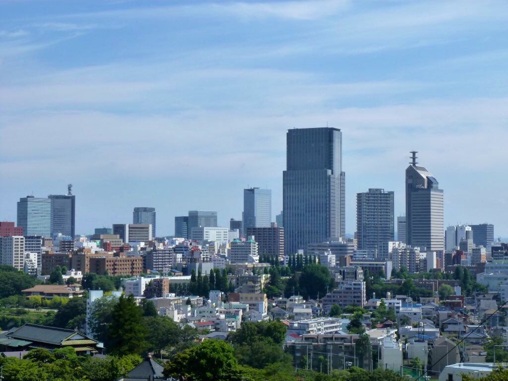


Sendai, Japan
仙台市
Sendai is a regional capital of 1,096,704 people in Miyagi, Japan, founded in April 1, 1889.
Why visit Sendai
Townapedia lists 22 museums and landmarks, 7 parks and trails, 444 places to eat, 18 places to stay and 22 attractions in and around town.
Highlights include トークネットホール仙台, 東京エレクトロンホール宮城, Daigigakoi Shell Mound and Miyagi Museum of Art.
Weather in Sendai
Forecast from MET Norway (CC BY 4.0). Full forecast
About Sendai
Sendai (仙台市, Sendai-shi; [sé̞ǹ.dä̀ì, sè̞ń.dä́ì.ɕì, sé̞ń.dä́ì-] ) is the capital city of Miyagi Prefecture and the largest city in the Tōhoku region. As of 1 August 2023, the city had a population of 1,098,335 in 539,698 households, making it the twelfth most populated city in Japan.
From the Wikipedia article Sendai (this version), under CC BY-SA 4.0.
Travel tips from other travellers: Sendai on Wikivoyage (CC BY-SA 4.0).
Things to do22


Miyagi Gakuin Women's University
School · 4.5 km
Miyagi Gakuin Women's University located in Sendai

Miyagi University
School · 9.4 km
Higher education institution in Miyagi Prefecture, Japan

Sendai Shirayuri Women's College
School · 6.9 km
Catholic women's college in Sendai, Japan

Sendai Umino-Mori Aquarium
Monument and historic site · 10.0 km
Aquarium in Miyagi, Japan

Shokei Gakuin University
School · 8.5 km
A private university in Natori, Miyagi, Japan

Tohoku Fukushi University
School · 2.2 km
Private university in Sendai, Miyagi, Japan

Tohoku Gakuin University
School · 2.1 km
Higher education institution in Miyagi Prefecture, Japan

Tohoku Medical and Pharmaceutical University
School · 2.6 km
Japanese private medical school
10 more on the map.
Museums and landmarks22

Daigigakoi Shell Mound
Monument and historic site · 16.0 km
Archaeological type site

Miyagi Museum of Art
Museum · 1.1 km
Art museum in Sendai, Miyagi Prefecture, Japan

Sendai City Museum of History and Folklore
Museum · 2.8 km
Museum in Sendai, Miyagi, Japan

Sendai City Tomizawa Site Museum
Museum · 4.9 km
Museum in Sendai, Japan

Tohoku Gakuin University Museum
Museum · 2.3 km
Museum in Sendai, Miyagi, Japan


Tohoku University Museum
Museum · 2.7 km
Museum in Sendai, Miyagi, Japan

10 more on the map.
Parks, trails and playgrounds7



Restaurants and cafes444


CHUNK BURGER STAND
Restaurant · Burger
29, 仙台市
Mo-Fr 11:00-15:00,17:00-21:00; Sa-Su,PH 11:00-21:00; Tu off

432 more on the map.
Where to stay18
Churches and places of worship6
Shopping19
Gas and EV charging2
Schools, colleges and libraries16
Healthcare45
Map of Sendai
250 places. The map loads OpenStreetMap tiles when you open it.
Getting there and nearby towns
Sendai Airport (SDJ) is the nearest airport with scheduled flights listed in OpenStreetMap, 15 km away.
- Natori-shi 11 km south, about 11 min by car
- Rifu 12 km northeast, about 12 min by car
- Tagajō-shi 12 km east, about 12 min by car
- Tomiya 14 km north, about 14 min by car
- Shiogama 16 km east, about 16 min by car
- Iwanuma 18 km south, about 18 min by car
- Shōbudahama 17 km east, about 17 min by car
- Yoshioka 19 km north, about 19 min by car
- Murata 21 km southwest, about 21 min by car
- Matsushima 21 km northeast, about 21 min by car
Drive times are estimates from straight-line distance, not routes.
Local news
Headlines from INDB.
Reviews, tips and questions
Loading what members have shared...
Sources and licences
- GeoNames (CC BY 4.0): population, coordinates, regions and time zone
- OpenStreetMap contributors (ODbL 1.0): places, airports, map data
- Wikidata (CC0 1.0): elevation, founding date, time zone, website, landmarks and historic places
- Wikimedia Commons (see each image): photos
- Wikipedia (CC BY-SA 4.0): overview and history text
Photo credits
- SendaiCity Skylines from Mukaiyama2018, Nryate, CC BY-SA 4.0
- Sendai - Sendai6192, lumoplank, CC0
- Jozenji Streetjazz Festival in SENDAI 5, neuropower, Public domain
- 定禅寺通 Jozenji-dori Avenue, Sendai City Centre - panoramio, 佐藤智史, CC BY-SA 3.0
- Sendai Third Legal Affairs Building in 2019, Kinori, CC0
- Sendai Pageant of Starlight 2025h, 掬茶, CC BY-SA 4.0
- Sendai Mediatheque 3F, yisris / Yuichi, CC BY-SA 2.0
- Interior of Sendai Mediatheque 202512, 掬茶, CC BY-SA 4.0
- Sendai Pageant of Starlight 2025g, 掬茶, CC BY-SA 4.0
- Exterior view of Sendai Mediatheque from Jozenji Street 20220910b, 掬茶, CC BY-SA 4.0
- メディアテーク Sendai Mediatheque - panoramio, Tomofumi Sato, CC BY-SA 3.0
- Sendai Mediatheque 2020 1, Ymblanter, CC BY-SA 4.0
- Sendai Pageant of Starlight 2025f, 掬茶, CC BY-SA 4.0
- Exterior view of Sendai Mediatheque from Jozenji Street 20220910a, 掬茶, CC BY-SA 4.0
- Sendai Mediatheque 2020 2, Ymblanter, CC BY-SA 4.0
- Sendai Pageant of Starlight 2025e, 掬茶, CC BY-SA 4.0
- Sendai Pageant of Starlight 2025d, 掬茶, CC BY-SA 4.0
- 仙台メディアテーク前 Sendai Mediatheque - panoramio, Tomofumi Sato, CC BY-SA 3.0
- Exterior view of Sendai Mediatheque from Jozenji Street 20220910c, 掬茶, CC BY-SA 4.0
- Sendai - Sendai6220, lumoplank, CC0
- Interior of Sendai Mediatheque - Oct 19, 2025, lumoplank, CC0
- Sendai - Sendai6182, lumoplank, CC0
- Sendai - Sendai6221, lumoplank, CC0
- Sendai - Sendai6174, lumoplank, CC0
- Sendai Nights - Sendai6171, lumoplank, CC0
- Sendai Nights - Sendai6161, lumoplank, CC0
- Sendai Nights - Sendai6164, lumoplank, CC0
- Jozenji Streetjazz Festival in SENDAI 1, neuropower, Public domain
- Sendai Pageant of Starlight 2025c, 掬茶, CC BY-SA 4.0
- Sendai Pageant of Starlight 2025b, 掬茶, CC BY-SA 4.0
- Ray Of Snow Amp Illumination In 2014 Sendai, Hilo, CC BY-SA 3.0
- Miyagi Gakuin cropped, Miyagi_Gakuin.JPG : 広瀬川 derivative work: 0607crp ( talk ), Public domain
- Myu2008, The original uploader was Maquazy at Japanese Wikipedia ., Public domain
- Sendai shirayuri auditorium, マスール, CC BY-SA 4.0
- Sendai Umino-Mori Aquarium, 広瀬川, CC BY-SA 4.0
- 東北福祉大学管理棟写真(桜), LUMIxx, CC0
- TohokugakuinDaigaku2005-4, No machine-readable author provided. Kinori assumed (based on copyright claims)., Public domain
- Tohoku Pharmaceutical University 1, Ebiebi2, CC BY-SA 4.0
- The miyagi museum of art01s3872, 663highland, CC BY 2.5
- Сендайский городской музей истории и быта 1, Kyotohippie, CC BY-SA 4.0
- Sendai City Tomizawa Site Museum1, Asenas10 at Japanese Wikipedia, CC BY 3.0
- Tohoku Rekishi Hakubutsukan 2008-11, Kinori, Public domain
- Tohoku University Museum, 2025, 石巻敎祖, CC BY 4.0
- Sendai Mediatheque 2009, scarletgreen from Japan, CC BY 2.0
- Sendai Mitsukoshi Departmentstore, Miyagi_Prefecture_office_18F_Sview2.jpg : Wkatsuhiro derivative work: Osxlib0422 ( talk ), Public domain
- Sendai city Kimachidori Elementry School, 藤谷良秀(Yoshihide Fujitani), CC BY-SA 4.0
- Sendai city Tachimachi elementary school, 藤谷良秀(Yoshihide Fujitani), CC BY-SA 4.0
- Koutoudai Park3, KENPEI, CC BY-SA 3.0
- Motokaji-chō Kōen Park, neuropower, Public domain
- TOHKnet Hall Sendai, 広瀬川, CC0
- TIC Building, 広瀬川, CC0
- Hanaza, 運動会プロテインパワー, CC BY-SA 4.0
- Tohoku Gakuin University Main Building, 石巻敎祖, CC BY-SA 4.0
- Miyagi Prefectural Auditorium viewed from a greenway in Jozenji-dori avenue, neuropower, Public domain


Page built November 4, 2026. Spotted a mistake? Tell us or suggest a place.