




Loading the weather...
Population22,745
GeoNames
RegionTokushima
Elevation4 m
13 ft
Time zoneAsia/Tokyo
Nearest airportTokushima Airport (TKS)
7 km
Why visit Takabō
Townapedia lists 4 museums and landmarks, 3 parks and trails, 22 places to eat and 1 attraction in and around town.
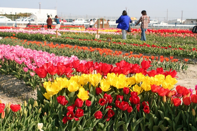
Highlights include Shikoku Saburo Bridge, 三ツ合公園 and 北島チューリップ公園.
Weather in Takabō
Forecast from MET Norway (CC BY 4.0). Full forecast
Things to do1


Museums and landmarks4


Parks, trails and playgrounds3

Advertisement
Restaurants and cafes22


10 more on the map.
Churches and places of worship10
Shopping9
Advertisement
Gas and EV charging3
Schools, colleges and libraries15
Healthcare7
Advertisement
Map of Takabō
74 places. The map loads OpenStreetMap tiles when you open it.
Getting there and nearby towns
Tokushima Airport (TKS) is the nearest airport with scheduled flights listed in OpenStreetMap, 7 km away.
- Higashikagawa 20 km northwest, about 20 min by car
- Minamiawaji 27 km northeast, about 27 min by car
- Wakimachi 36 km west, about 36 min by car
- Sumoto 40 km northeast, about 40 min by car
- Tonoshō 51 km northwest, about 51 min by car
- Awaji 53 km northeast, about 53 min by car
- Takinomiya 58 km west, about 58 min by car
- Yuasa 60 km east, about 1 h by car
- Sakaidechō 68 km west, about 1 h 15 min by car
- Akashi 73 km northeast, about 1 h 15 min by car
Drive times are estimates from straight-line distance, not routes.
Local news
Headlines from INDB.
Reviews, tips and questions
Loading what members have shared...
Sources and licences
- GeoNames (CC BY 4.0): population, coordinates, regions and time zone
- OpenStreetMap contributors (ODbL 1.0): places, airports, map data
- Wikidata (CC0 1.0): elevation, founding date, time zone, website, landmarks and historic places
- Wikimedia Commons (see each image): photos
Photo credits
- Shikoku Saburo Bridge 20210110, 新幹線, CC BY-SA 4.0
- Fuji GRAND KITAJIMA, Shugyoso, CC0
- Kitajima Tulip Park 01, タクドラの金太郎 from Tokushima, Japan., CC BY 2.1 jp
- Kitajima Town Kitajima Elementary School, Mr. Udon, CC BY-SA 3.0
- Shozuijo16, 投稿者が撮影, Public domain
- Kitajima Town Kitajima Lower Secondary School, Mr. Udon, CC BY-SA 3.0
- Tokushima City Ojin Junior High school, Sorrysorry, Public domain
- Tokushima City Ojin Elementary School, Sorrysorry, Public domain
- Kitajima Town Kitajimakita Elementary School, Mr. Udon, CC BY-SA 3.0
- Naruto City Horieminami Elementary School, Mr. Udon, CC BY-SA 3.0
- Tokushima Prefectural Fire Academy, Shugyoso, CC0
- ロックタウン北島 - panoramio, shugyoso, CC BY 3.0
- Aizumi town Aizumihigashi Junior High School, 鳴門のうずしお, CC BY-SA 3.0
- JRShikoku-Kotoku-line-T03-Shozui-station-building-20100803, LERK, CC BY 3.0
- View from train leaving Shozui Station, そらみみ (Soramimi), CC BY-SA 4.0
- JRShikoku-Kotoku-line-T03-Shozui-station-platform-20100803, LERK, CC BY 3.0
- Shinden Shōzui, Aizumi-chō, Itano-gun, Tokushima-ken 771-1270, Japan - panoramio, shugyoso, CC BY 3.0
- Kyu-Yoshinogawa River from train of Kotoku Line, そらみみ (Soramimi), CC BY-SA 4.0
- サンライフ北島と北島町立図書館・創世ホール - panoramio, shugyoso / Shugyoso at Japanese Wikipedia, Public domain
- 改修工事中の北島町総合庁舎 - panoramio, shugyoso, CC BY 3.0
- Aizumi town Aizumihigashi elem-sch, 鳴門のうずしお, CC BY-SA 3.0
- Mount Bizan from train of Kotoku Line, そらみみ (Soramimi), CC BY-SA 4.0
- 北島町民体育センター - panoramio, shugyoso / ja:利用者:Shugyoso, Public domain
- 人口密度四国第1位の自治体ですが、田畑は多いです - panoramio, shugyoso This photo was taken with KDDI Sony Ericsson re, CC BY 3.0
- Hyakujūshi Bank Tokushima-kita Branch, ラハール, CC BY-SA 4.0
- 北島北公園総合体育館 - panoramio, shugyoso / ja:利用者:Shugyoso, Public domain
- 東亞合成前の休耕田 - panoramio, shugyoso, CC BY 3.0
- Kagawa Bank Tokushima Branch, ラハール, CC BY-SA 4.0
- 自動販売機勢ぞろい - panoramio, shugyoso, CC BY 3.0


Page built November 5, 2026. Spotted a mistake? Tell us or suggest a place.