


Takasaki, Japan
高崎市
Takasaki is a town of 372,973 people in Gunma, Japan, founded in April 1, 1889.
Why visit Takasaki
Townapedia lists 27 museums and landmarks, 121 parks and trails, 160 places to eat, 18 places to stay and 18 attractions in and around town.
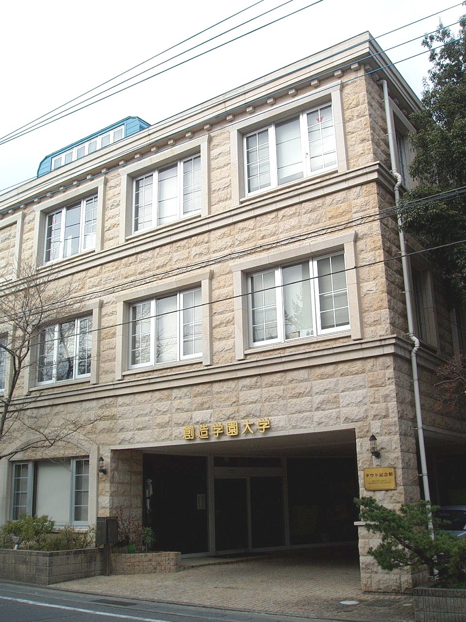
Highlights include Gumma Paz University, Gunma Prefectural College of Health Sciences, 高崎市美術館 and Gunma Prefectural Museum of History.
Weather in Takasaki
Forecast from MET Norway (CC BY 4.0). Full forecast
About Takasaki
Takasaki (高崎市, Takasaki-shi; [takasakiɕi]) is a city located in Gunma Prefecture, Japan. As of 31 August 2020, the city had an estimated population of 372,369 in 167,345 households, and a population density of 810 persons per km2. The total area of the city is 459.16 square kilometres (177.28 sq mi). Takasaki is famous as the hometown of the Daruma doll, theoretically representing the Buddhist sage Bodhidharma and in modern practice a symbol of good luck.
From the Wikipedia article Takasaki (this version), under CC BY-SA 4.0.
Travel tips from other travellers: Takasaki on Wikivoyage (CC BY-SA 4.0).
Things to do18

Gumma Paz University
School · 1.9 km
Higher education institution in Gunma Prefecture, Japan

Gunma Prefectural College of Health Sciences
School · 10.5 km
Higher education institution in Gunma Prefecture, Japan

Gunma Prefectural Women's University
School · 9.5 km
Public university in Japan

Gunma University
School · 11.1 km
Higher education institution in Gunma Prefecture, Japan

Gunma University of Social Welfare
School · 3.7 km
Higher education institution in Gunma Prefecture, Japan

Jobu University
School · 15.7 km
Higher education institution in Gunma Prefecture, Japan
Maebashi Institute of Technology
School · 6.7 km
Higher education institution in Gunma Prefecture, Japan

Takasaki City University of Economics
School · 3.7 km
Higher education institution in Gunma Prefecture, Japan



6 more on the map.
Museums and landmarks27

高崎市美術館
Museum · 1.5 km
110-27 八島町, 高崎市
Tu-Th 10:00-17:30; Fr 10:00-19:30; Sa-Su 10:00-17:30

Gunma Prefectural Museum of History
Museum · 6.8 km
Building in Gunma Prefecture, Japan

Hidaka site
Monument and historic site · 4.1 km
Ruins of a Yayoi period settlement in Takasaki, Japan
Hongō Haniwa Kiln Site
Monument and historic site · 12.8 km
Archaeological site

Kanaizawa Stele
Monument and historic site · 5.3 km
8th century Japanese stele
Kayano Site
Monument and historic site · 13.9 km
Archaeological site in Shintō, Gunma, Japan
Kitayatsu Site
Monument and historic site · 7.3 km
Ruins of a Kofun period residence in Takasaki, Japan

Sai District Shōsō ruins
Monument and historic site · 16.3 km
Archaeological site in Japan
Tago District Shōsō ruins
Monument and historic site · 8.3 km
Archaeological site in Japan

Tago Stele
Monument and historic site · 7.8 km
Stone memorial in Japan
Takasaki Byakue Daikannon
Monument and historic site · 4.1 km
Large statue in Takasaki, Japan


The Museum of Modern Art, Gunma
Museum · 6.8 km
Art museum in Gunma, Japan
15 more on the map.
Parks, trails and playgrounds121



109 more on the map.
Restaurants and cafes160


なかじゅう亭
Restaurant · Ramen, Noodle · 1.1 km
Mo-Tu,Th,Su 11:00-14:30,17:30-23:30; PH -1 day,Fr-Sa...
148 more on the map.
History
During the Edo period, the area of present-day Takasaki was the center of the Takasaki Domain, a feudal domain held by a branch of the Matsudaira clan under the Tokugawa shogunate in Kōzuke Province. The area also prospered from its location on the Nakasendō highway connecting Edo with Kyoto. Post stations located within the borders of modern Takasaki were: Shinmachi-shuku, Kuragano-shuku, and Takasaki-shuku.
Following the Meiji Restoration, Takasaki was briefly capital of Gunma Prefecture, before the capital was moved to Maebashi in 1881.
Takasaki Town was created within Gunma District, Gunma on April 1, 1889 with the creation of the modern municipalities system. It was raised to city status on April 1, 1900. On April 1, 1927, Takasaki annexed the neighboring villages of Tsukasawa and Kataoka, followed by Sano on October 1, 1937. The city largely escaped damage in World War II. Following the war, it continued to expand its borders by annexing the village of Rokugo on April 1, 1951, Shintakao and Nakamura as well as Yawata and Toyooka from Ushi District on January 20, 1955. This was followed by Orui village and Sano village from Tano District on September 30, 1956. The city celebrated its 360th anniversary in 1963 and annexed the town of Kuragano on March 31 of the same year. On September 1, 1965 the village of Gunnan was annexed.
From the History section of Takasaki on Wikipedia, under CC BY-SA 4.0.
Where to stay18
Churches and places of worship66
Shopping44
Gas and EV charging19
Schools, colleges and libraries50
Healthcare53
Map of Takasaki
250 places. The map loads OpenStreetMap tiles when you open it.
Getting there and nearby towns
Yokota Air Base (OKO) is the nearest airport with scheduled flights listed in OpenStreetMap, 72 km away.
- Kanekomachi 9 km north, about 9 min by car
- Maebashi 10 km northeast, about 10 min by car
- Tamamura 10 km east, about 10 min by car
- Yoshii 10 km south, about 10 min by car
- Fujioka 11 km southeast, about 11 min by car
- Annaka 11 km west, about 11 min by car
- Hirobaba 11 km northwest, about 11 min by car
- Tomioka 14 km southwest, about 14 min by car
- Ogura 14 km north, about 14 min by car
- Isesaki 17 km east, about 17 min by car
Drive times are estimates from straight-line distance, not routes.
Local news
Headlines from INDB.
Reviews, tips and questions
Loading what members have shared...
Sources and licences
- GeoNames (CC BY 4.0): population, coordinates, regions and time zone
- OpenStreetMap contributors (ODbL 1.0): places, airports, map data
- Wikidata (CC0 1.0): elevation, founding date, time zone, website, landmarks and historic places
- Wikimedia Commons (see each image): photos
- Wikipedia (CC BY-SA 4.0): overview and history text
Photo credits
- View from Takasaki Kannon northeast, photo: Qurren ( talk ) Taken with Canon IXY 10S (Digital IXUS 210), CC BY-SA 3.0
- Yaki manjū of Orita, Takasaki - Sep 11, 2012, yoppy, CC BY 2.0
- Yaki manjū shop Orita, Takasaki - Sep 11, 2012, yoppy, CC BY 2.0
- 251130 Takasaki Station 02, Aspere, CC0
- Takasaki train station, Ravi Dwivedi, CC BY 4.0
- Takasaki Chuo Ginza 03, 妖精書士, CC BY-SA 4.0
- Takasaki Chuo Ginza 02, 妖精書士, CC BY-SA 4.0
- Takasaki Chuo Ginza 01, 妖精書士, CC BY-SA 4.0
- Takasaki Chuo Ginza 04, 妖精書士, CC BY-SA 4.0
- 251130 Takasaki Station 01, Aspere, CC0
- Takasaki - panoramio, kcomiida, CC BY-SA 3.0
- 251130 Takasaki Station 15, Aspere, CC0
- 251130 Takasaki Station 03, Aspere, CC0
- 251130 Takasaki Station 05, Aspere, CC0
- 251130 Takasaki Station 06, Aspere, CC0
- 251130 Takasaki Station 07, Aspere, CC0
- 251130 Takasaki Station 08, Aspere, CC0
- 251130 Takasaki Station 09, Aspere, CC0
- 251128 Takasaki Station 29, Aspere, CC0
- 251128 Takasaki Station 02, Aspere, CC0
- 251128 Takasaki Station 01, Aspere, CC0
- 251130 Takasaki Station 11, Aspere, CC0
- 251130 Takasaki Station 13, Aspere, CC0
- Sakaecho, Takasaki, Gunma Prefecture 370-0841, Japan - panoramio, Nagono, CC BY-SA 3.0
- A local train at theTakasaki station, Ravi Dwivedi, CC BY-SA 4.0
- Takasaki Station east exit aug 5 2021 various 17 15 41 435000, Nesnad, CC BY 4.0
- Takasaki Sta. - panoramio, Nagono, CC BY-SA 3.0
- Sakaecho, Takasaki, Gunma Prefecture 370-0841, Japan - panoramio - Nagono, Nagono, CC BY-SA 3.0
- Gunma-Pref-College-of-Health-Sciences01, Hasec, CC0
- Gunma-Pref-Women's-Univ04, Hasec, CC0
- Gunma University Hospital, Waka77, CC0
- Gunma University of Health and Welfare, Abasaa, Public domain
- Jobu University Isesaki Campus, WAKA77, CC0
- TCUE-Bldg5, Hasec, CC0
- Takasaki University of Commerce, WAKA77, CC0
- SouzouGakuen-Univ-Yachiyo01, Hasec, CC0
- 261010 Gunma Prefectural Museum of History Takasaki Japan01s3, 663highland, CC BY-SA 4.0
- Monument of Kanaizawa, 文屋将監, CC BY 3.0
- Monument of Tago (Tagohi), 文屋将監, CC BY 3.0
- 261010 The Museum of Modern Art, Gunma Takasaki Japan04s3, 663highland, CC BY-SA 4.0
- Takasaki-station west, User:Bashizo, Public domain
- Gakugeikan High School, Abasaa, Public domain
- National Hospital Organization Takasaki General Medical Center 2, Waka77, Public domain
- TakasakiCommerceHighSchool, Happiness626, CC0
- Takasaki Girls High School, Abasaa, Public domain
- Takasakiseikyoukai, tsubasabbs, CC BY-SA 3.0
- 校舎2019, 高崎商科大学附属高等学校, CC BY-SA 4.0
- Takasaki Museum of Art, Wiiii, CC BY-SA 3.0
- RZ Cinematheque Takasaki (2), Razgrad, CC BY-SA 4.0
- Takasaki City Theatre 201911 01, 京葉快速26, CC BY-SA 4.0
- Kozen-ji, Takasaki, 運動会プロテインパワー, CC BY-SA 4.0
- Daishin-ji (Takasaki), Abasaa, Public domain
- Takasaki University of Health and Welfare, Abasaa, Public domain
- Sai Gunga Site, shoso, Saigen Jiro, CC0


Page built November 4, 2026. Spotted a mistake? Tell us or suggest a place.