


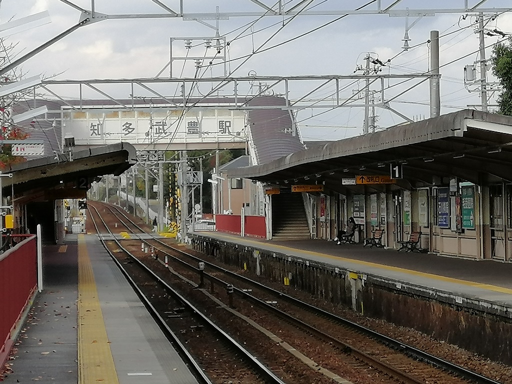

Taketoyo, Japan
武豊町
Taketoyo is a town of 43,535 people in Aichi, Japan, founded in October 5, 1954.
Why visit Taketoyo
Townapedia lists 10 museums and landmarks, 79 parks and trails, 125 places to eat and 4 places to stay in and around town.
Highlights include Handa Red Brick Building, Sugimoto Art Museum and はさま公園.
Weather in Taketoyo
Forecast from MET Norway (CC BY 4.0). Full forecast
About Taketoyo
Taketoyo (武豊町, Taketoyo-chō) is a town located in Chita District, Aichi Prefecture, Japan. As of 1 October 2019, the town had an estimated population of 43,147 in 18,392 households, and a population density of 1,636 persons per km2. The total area of the town was 26.38 square kilometres (10.19 sq mi).
From the Wikipedia article Taketoyo (this version), under CC BY-SA 4.0.
Museums and landmarks10

Handa Red Brick Building
Museum · 5.8 km
Building in Handa City, Aichi Prefecture

Sugimoto Art Museum
Museum · 7.1 km
Art museum in Aichi, Japan (1987-2021)



Parks, trails and playgrounds79

67 more on the map.
Restaurants and cafes125




113 more on the map.
Where to stay4




History
The village of Taketoyo was established within Chita District, Aichi by the early Meiji period establishment of the modern municipalities system on October 1, 1889. Taketoyo was raised to town status on February 15, 1891.
An Imperial decree in July 1899 established Taketoyo as an open port for trading with the United States and the United Kingdom.
On October 5, 1954, Taketoyo annexed the neighboring village of Fuki, also from Chita District.
From the History section of Taketoyo on Wikipedia, under CC BY-SA 4.0.
Churches and places of worship20
Shopping20
Gas and EV charging3
Schools, colleges and libraries19
Healthcare19
Map of Taketoyo
250 places. The map loads OpenStreetMap tiles when you open it.
Getting there and nearby towns
Chūbu Centrair International Airport (NGO) is the nearest airport with scheduled flights listed in OpenStreetMap, 10 km away.
- Handa 4 km north, about 4 min by car
- Tokoname 7 km northwest, about 7 min by car
- Nishio 12 km east, about 12 min by car
- Kariya 16 km north, about 16 min by car
- Anjō 19 km northeast, about 19 min by car
- Okazaki 25 km northeast, about 25 min by car
- Yokkaichi 30 km northwest, about 30 min by car
- Suzuka 31 km west, about 31 min by car
- Kuwana 32 km northwest, about 32 min by car
- Toyota 34 km northeast, about 34 min by car
Drive times are estimates from straight-line distance, not routes.
Local news
Headlines from INDB.
Reviews, tips and questions
Loading what members have shared...
Sources and licences
- GeoNames (CC BY 4.0): population, coordinates, regions and time zone
- OpenStreetMap contributors (ODbL 1.0): places, airports, map data
- Wikidata (CC0 1.0): elevation, founding date, time zone, website, landmarks and historic places
- Wikimedia Commons (see each image): photos
- Wikipedia (CC BY-SA 4.0): overview and history text
Photo credits
- Taketoyo town-office, ja:user:Bakkai, CC BY 3.0
- Taketoyo Town Taketoyo Middle School, Psjk2106, CC BY-SA 4.0
- Taketoyo Town Taketoyo Elementary School, Psjk2106, CC BY-SA 4.0
- MT-Chita-Taketoyo-station-platform-002, HQA02330, CC BY-SA 4.0
- MT-Chita-Taketoyo-station-platform, HQA02330, CC BY-SA 4.0
- Handa Police Station Taketoyo Koban, Suikotei, CC BY 4.0
- MT-Chita-taketoyo-building-East-001, HQA02330, CC BY-SA 4.0
- MT-Chita-Taketoyo-station-platform-toilet, HQA02330, CC BY-SA 4.0
- MT-Chita-Taketoyo-station-name-board, HQA02330, CC BY-SA 4.0
- MT-Chita-taketoyo-building-East-002, HQA02330, CC BY-SA 4.0
- MT-Chita-taketoyo-Nihon-Yushi-Overpass-003, HQA02330, CC BY-SA 4.0
- MT-Chita-taketoyo-Nihon-Yushi-Overpass-001, HQA02330, CC BY-SA 4.0
- MT-Chita-taketoyo-Nihon-Yushi-Overpass-002, HQA02330, CC BY-SA 4.0
- JR-Taketoyo-station-name-board, HQA02330, CC BY-SA 4.0
- JR Taketoyo Sta. - panoramio, Nagono, CC BY-SA 3.0
- Taketoyo Station platform 2016, Yasu ( talk ), CC BY-SA 3.0
- JR-Taketoyo-station-platform-ticket, HQA02330, CC BY-SA 4.0
- JR-Taketoyo-station-ticket-gate, HQA02330, CC BY-SA 4.0
- JR-Taketoyo-station-platform-toilet, HQA02330, CC BY-SA 4.0
- Taketoyo Town Kinuura Elementary School, Psjk2106, CC BY-SA 4.0
- Handaakarenga, Bariston, CC BY-SA 4.0
- Sugimmoto Museum 130416, Umako, CC0
- Center One Hotel Handa, Abasaa, Public domain
- Handa City Library1, At by At, CC BY-SA 3.0
- Handa City Gymnasium, At by At, CC BY-SA 3.0
- Aichi Prefectural Handa Commercial High School ac (1), Asturio Cantabrio, CC BY-SA 4.0
- Taketoyo Town Library 2019-08 ac (2), Asturio Cantabrio, CC BY-SA 4.0
- Taketoyo Town History and Folklore Museum ac (1), Asturio Cantabrio, CC BY-SA 4.0
- Handa AEON, 運動会プロテインパワー, CC BY-SA 4.0
- Narawa jhs gate, sou16, Public domain
- Handa city museum, Bariston, CC BY-SA 4.0
- Taketoyo Town Library 2019-08 ac (3), Asturio Cantabrio, CC BY-SA 4.0
- Taketoyo Town Folk Historical Museum 2019-08 ac, Asturio Cantabrio, CC BY-SA 4.0
- 武豊町役場庁舎 - panoramio, 博柳, CC BY 3.0
- 武豊町役場駐車場 - panoramio, 博柳, CC BY 3.0
- 武豊町川尻付近(衣浦小学校前) - panoramio, 博柳, CC BY 3.0
- 転車台ポケットパーク (愛知県知多郡武豊町里中) - panoramio (1), gundam2345, CC BY 3.0
- 転車台ポケットパーク - panoramio, 博柳, CC BY 3.0
- 転車台ポケットパーク (愛知県知多郡武豊町里中) - panoramio (10), gundam2345, CC BY 3.0
- 転車台ポケットパーク (愛知県知多郡武豊町里中) - panoramio, gundam2345, CC BY 3.0


Page built November 4, 2026. Spotted a mistake? Tell us or suggest a place.